2022 ANNUAL REPORT

NOAA Ocean Exploration 2022:
A Year in Review

A Word From Our Director

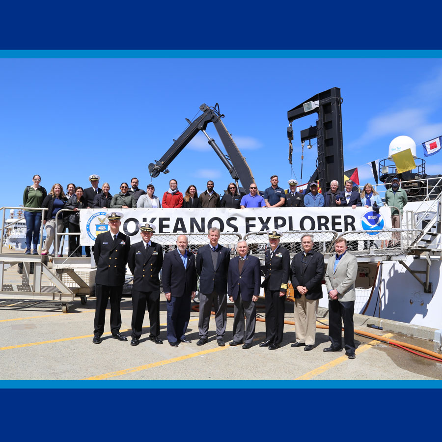
On March 14, 2022, NOAA Ocean Exploration welcomed Jeremy Weirich back as the new office director. Here, Jeremy reflects on his first year at the helm and provides a preview of 2023.

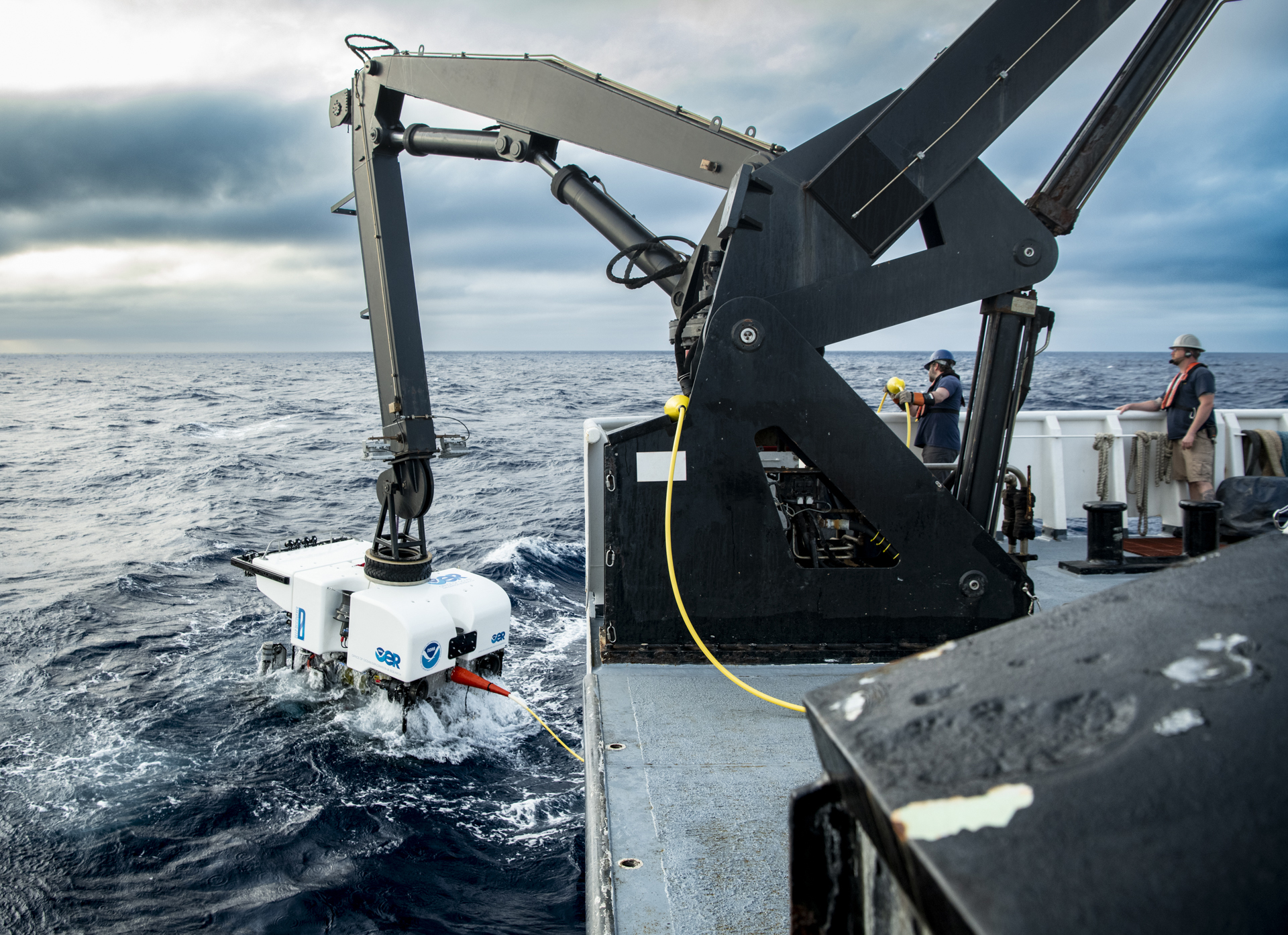
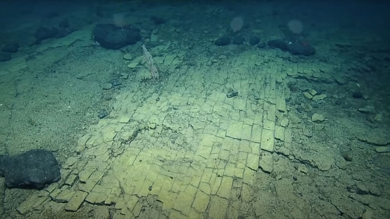
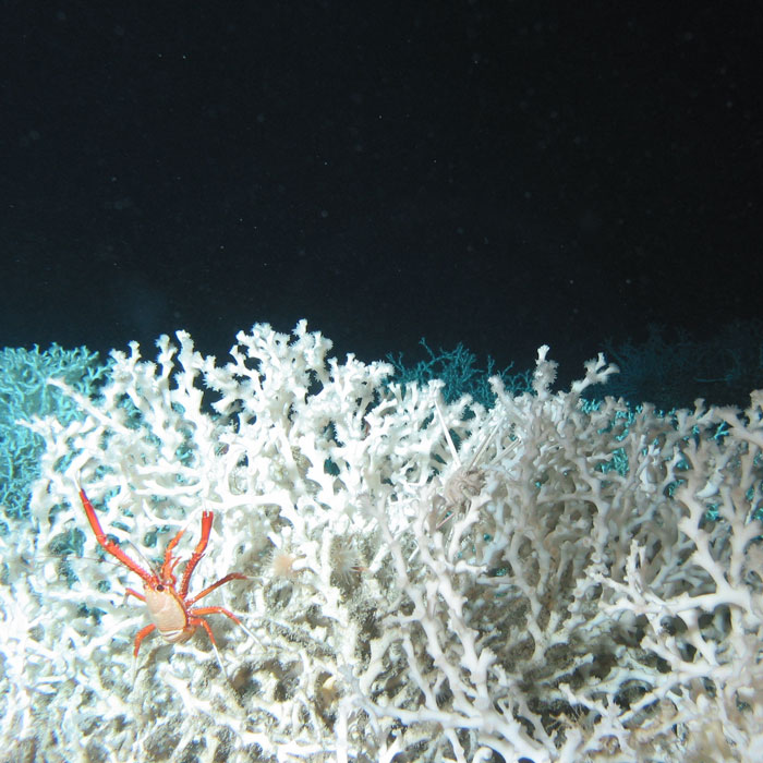
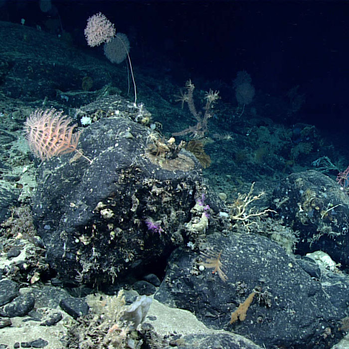
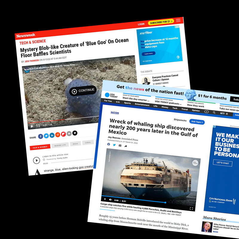
Shortly before I returned to NOAA Ocean Exploration, our team aboard NOAA Ship Okeanos Explorer, working with onshore partners, discovered a shipwreck that’s likely Industry, a historically important 19th century whaler. The media interest was significant, and this discovery served as a perfect example of the types of stories our program tells. These stories resonate with people. They introduce us to wondrous life forms and extraordinary landscapes, and they help us better understand our past and foretell our possible future. It’s through these shared experiences that we connect people to the ocean, where there’s always something happening, new stories to tell. This annual report provides a look back at some of our stories from 2022.
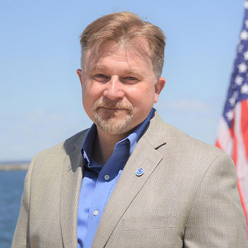

Jeremy Weirich
Director, NOAA Ocean Exploration

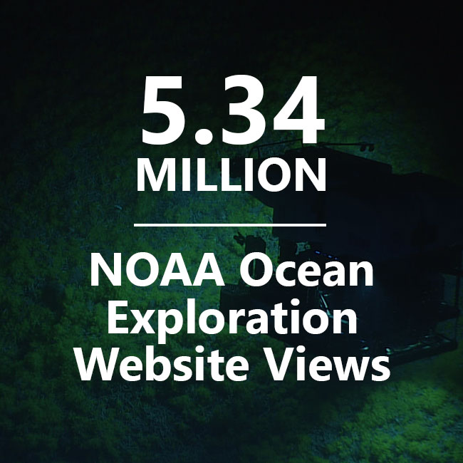
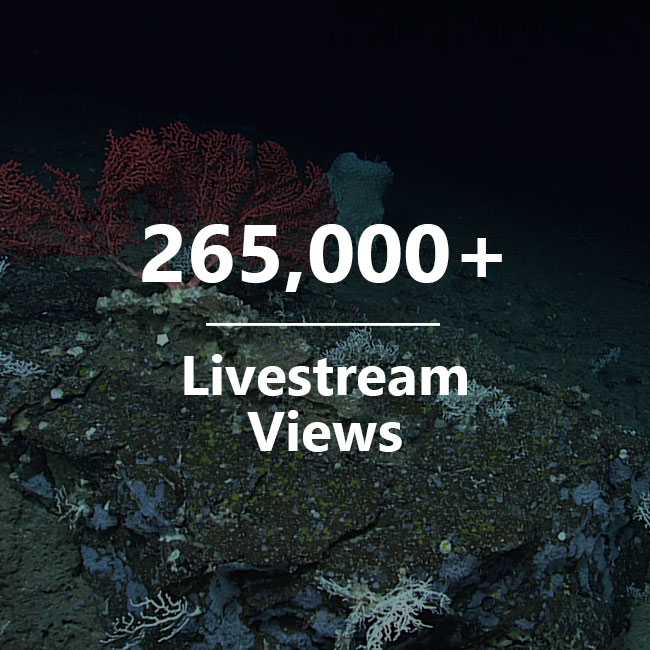
NOAA Ocean Exploration’s mission is to explore the ocean for national benefit. We do this by leading expeditions, supporting the work of the NOAA Ocean Exploration Cooperative Institute (OECI) as well as other members of the ocean exploration community (e.g., through our competitive grant program), and collaborating with partners, both inside and outside of government — and internationally. We promote this work by educating and informing the public about why we explore, how we explore, what we find, and why it matters.

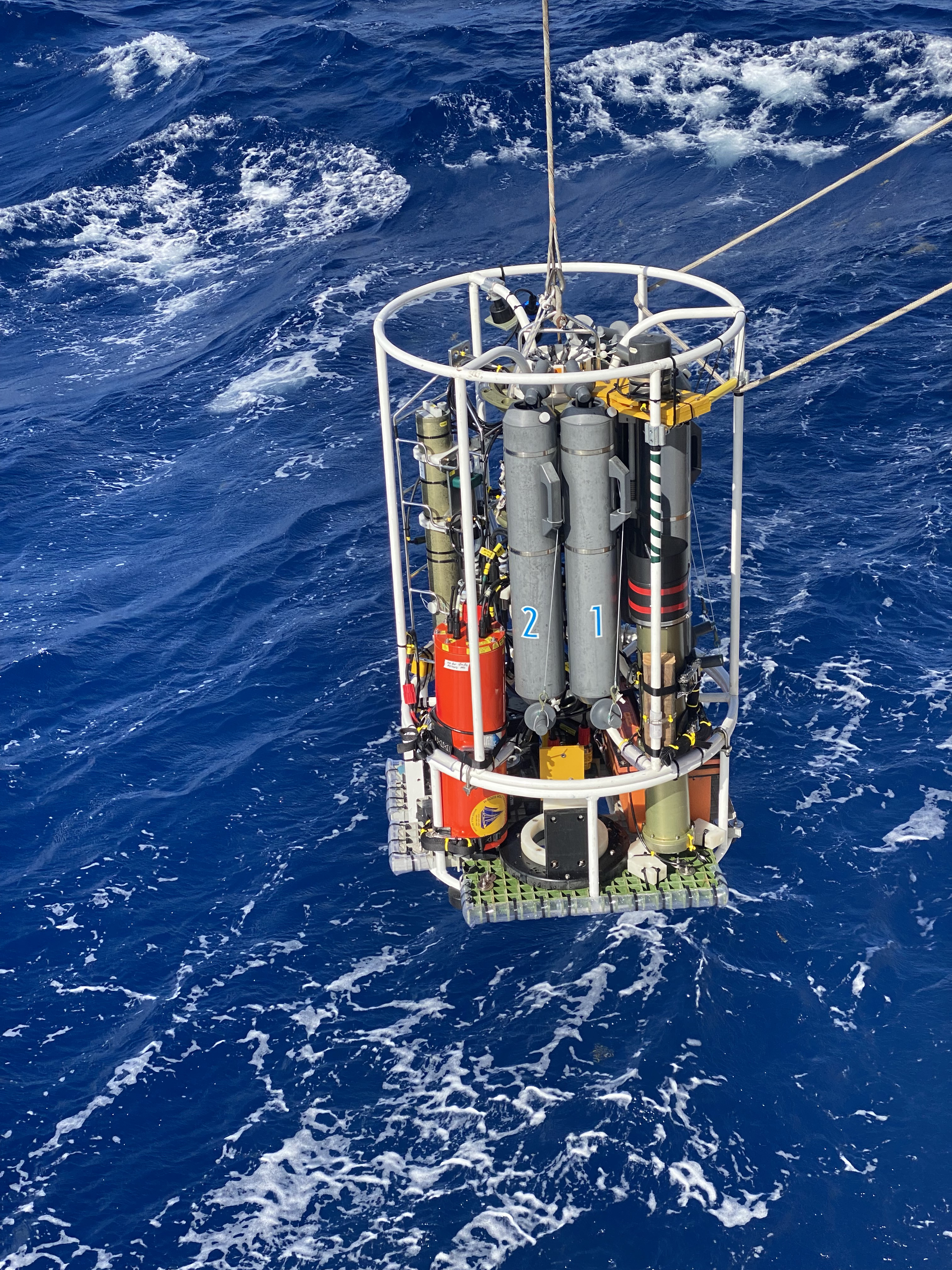
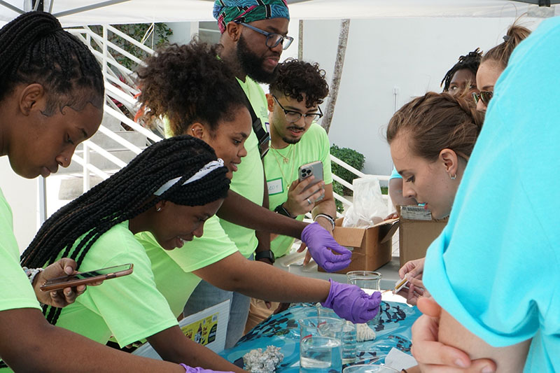
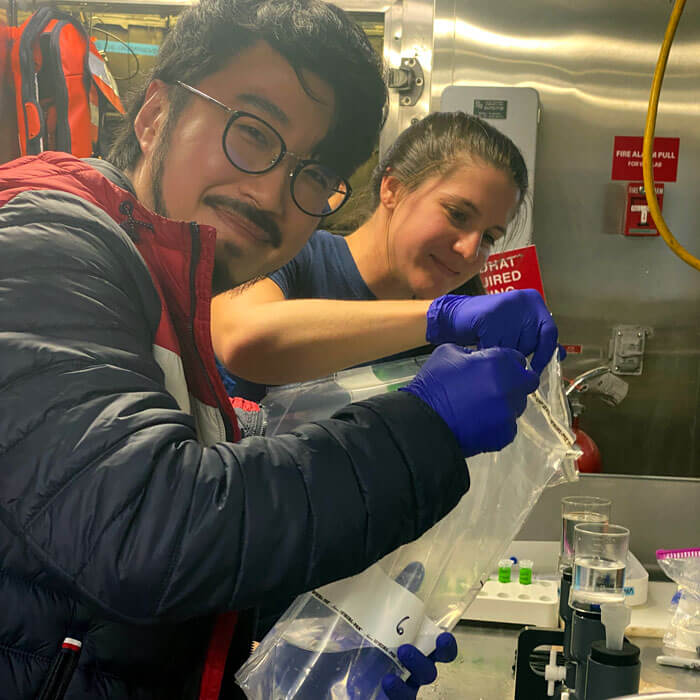
In 2022, our partners helped us advance our mission in a variety of ways called for in the National Strategy for Mapping, Exploring, and Characterizing the United States Exclusive Economic Zone and associated documents. Through the OECI, recipients of our competitive grants, and others, we extended our reach, enabling additional efforts to explore and map the deep ocean, develop and test new ocean exploration technologies, search for and study maritime heritage resources, educate the next generation of ocean explorers, and engage the public in ocean exploration.

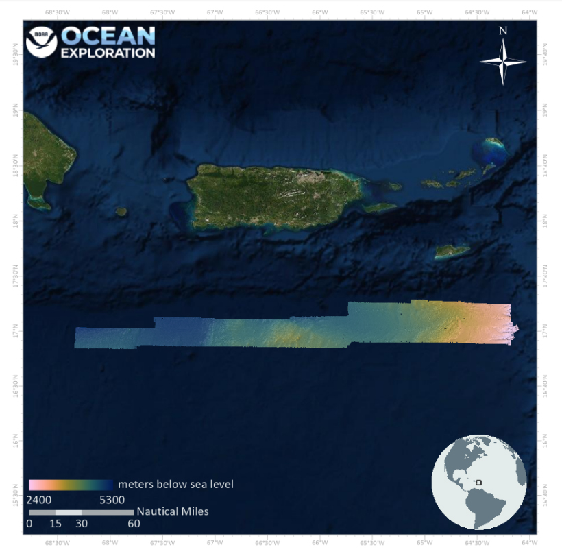
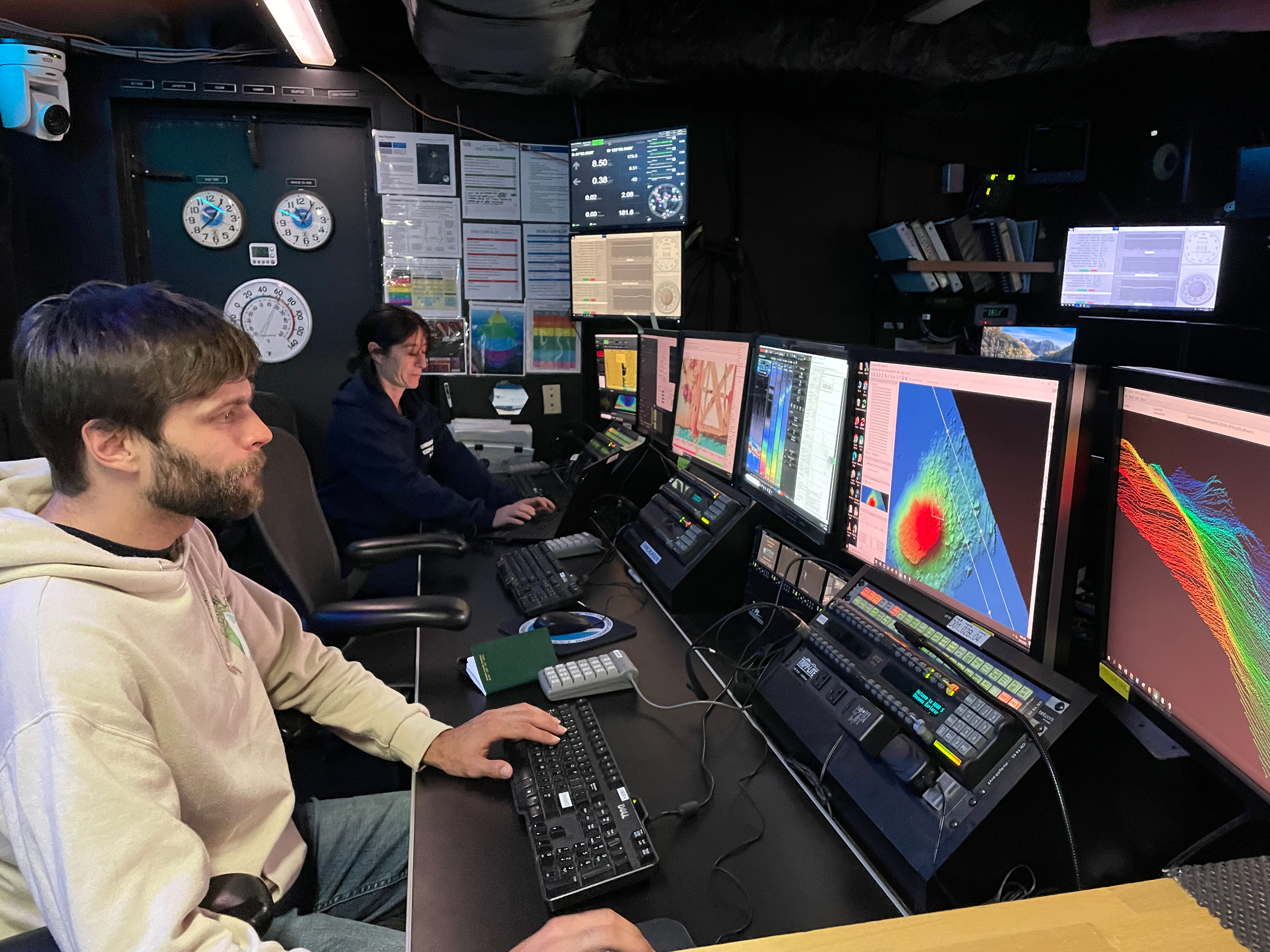
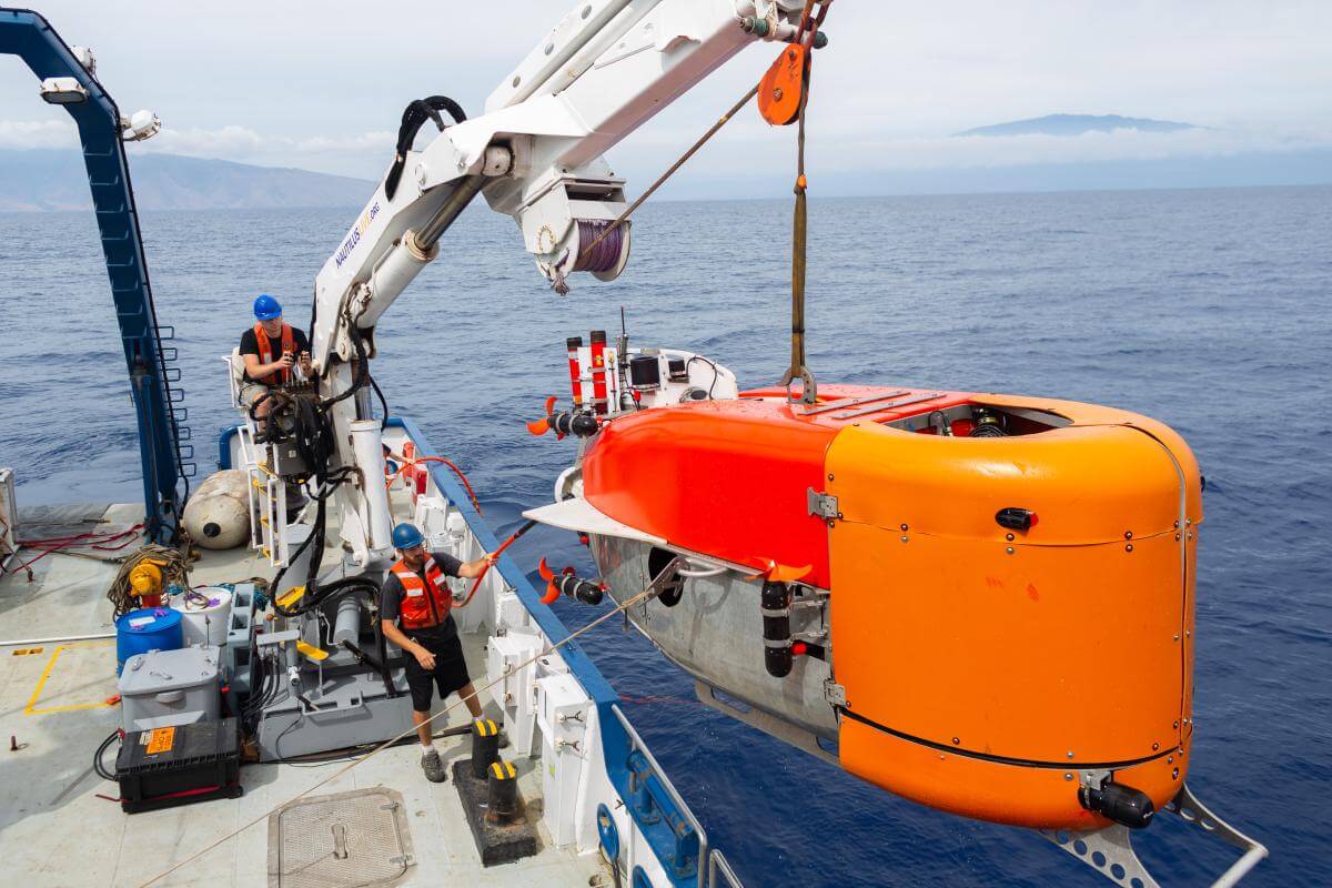
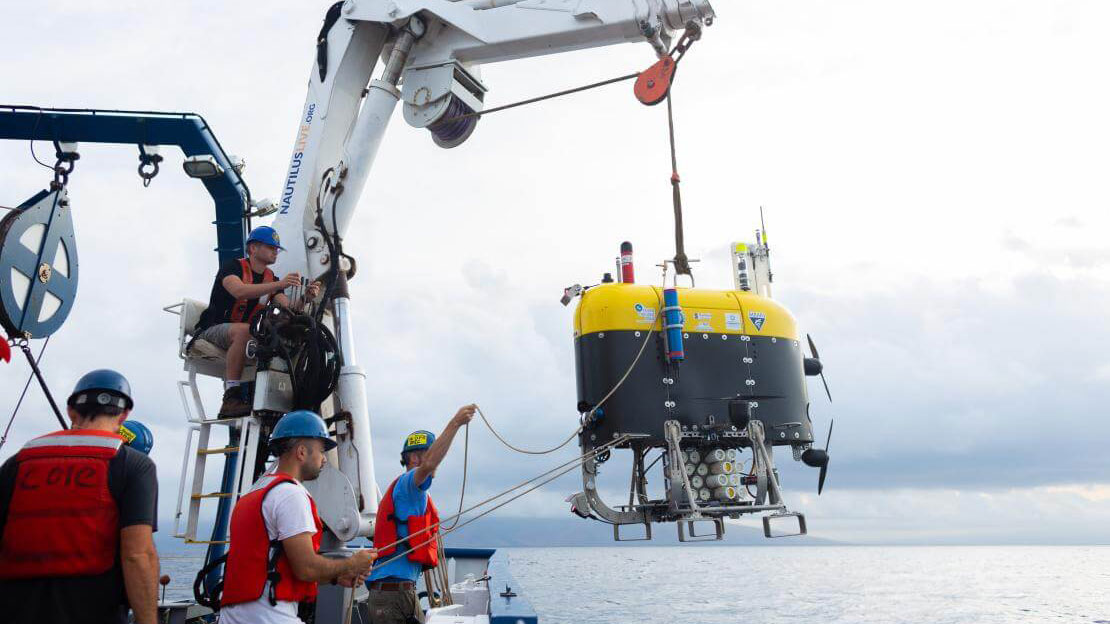
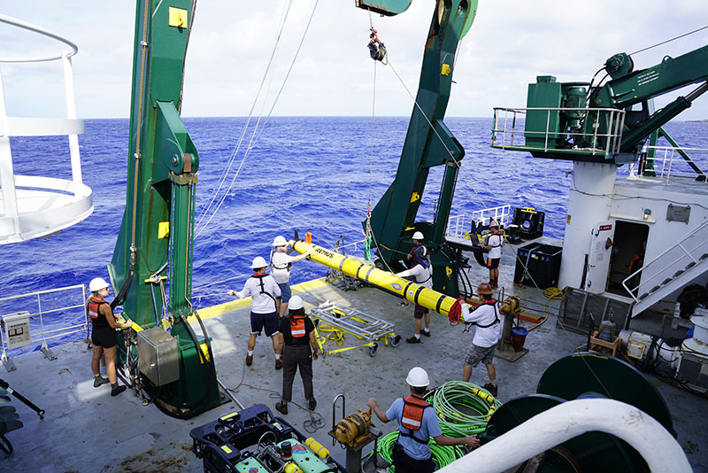
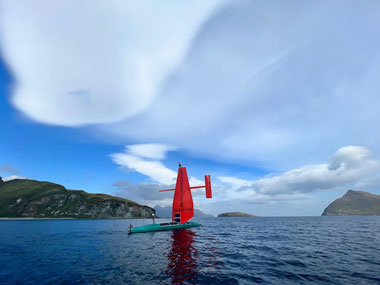
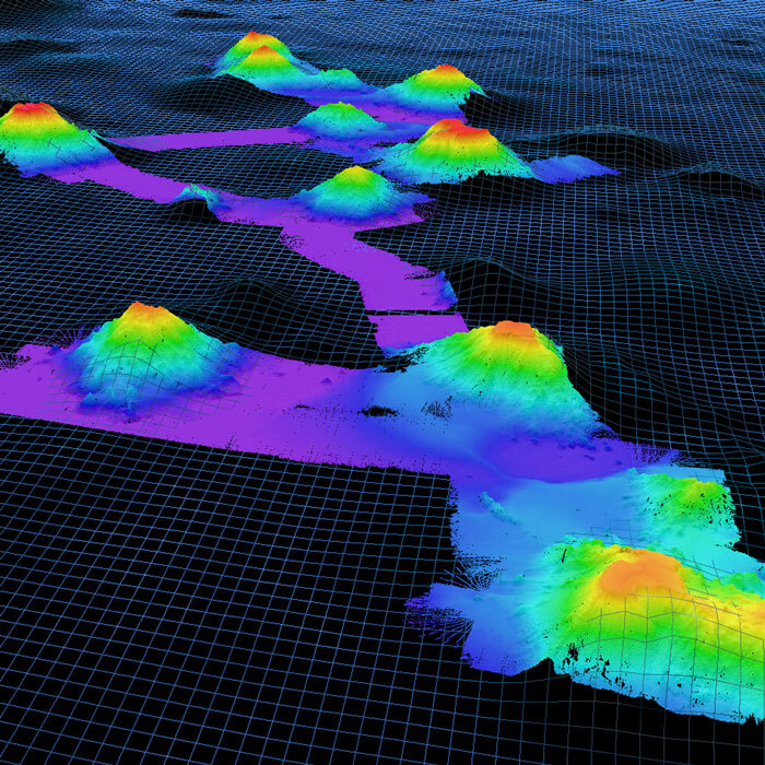
I firmly believe that to boost the pace and efficiency of these activities and to augment our NOAA-led expeditions, we will need to increase use of public-private partnerships and uncrewed systems. This past year, we made progress in both areas. We sponsored a very successful interagency public-private partnership, which included Saildrone and their new Saildrone Surveyor, to map the seafloor (16,254 square kilometers/6,276 square miles) and collect environmental data in unexplored waters around the Aleutian Islands. In addition, our OECI partners demonstrated that by deploying multiple uncrewed systems that are able to communicate and work together, while freeing ships for conventional exploration tasks, we can maximize exploration potential.

Recognizing that our ocean is a global ocean, we welcomed the June signing of the memorandum of understanding between NOAA and Seabed 2030 to formalize our contributions to the definitive map of the world ocean floor. NOAA also signed a memorandum of understanding with Australia’s two leading ocean science agencies (Geoscience Australia and the Commonwealth Scientific and Industrial Research Organisation (CSIRO)) to collaborate on ocean exploration, mapping, and characterization efforts in the Pacific; met with representatives of the Korean Institute of Ocean Sciences and Technology (KIOST) to discuss partnership opportunities; and participated in the international Map the Gaps Symposium and the All-Atlantic Ocean Research Forum 2022 scientific and ministerial events.

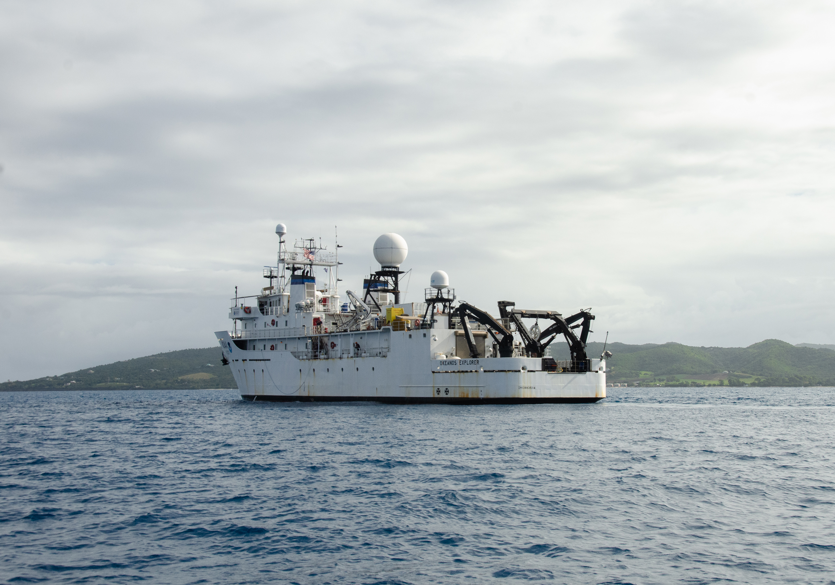
2022 also marked the conclusion of the Atlantic Seafloor Partnership for Integrated Research and Exploration (ASPIRE), our multinational, collaborative ocean exploration field program focused on raising collective knowledge and understanding of the North Atlantic Ocean. After many years of planning, working closely with academic and government partners in Portugal, and others, we made it to the Mid-Atlantic Ridge, conducting a series of three expeditions in the region on Okeanos Explorer. Voyage to the Ridge was the centerpiece of our 2022 field season on Okeanos Explorer, which culminated with a return to the Pacific in the fall.

Remotely operated vehicle Deep Discoverer images corals growing on a rocky outcrop during exploration of a seamount informally named "Zenith" on Dive 05 of the second Voyage to the Ridge 2022 expedition.
A variety of colorful fish and anemones seen at a rocky outcrop during Dive 05 of the third Voyage to the Ridge 2022 expedition.

The opportunities to advance ocean exploration science, technology, education, and outreach, and the partnerships needed to do so, are endless. And, with December’s passage of the National Ocean Exploration Act as part of the National Defense Authorization Act and our leadership roles associated with the national strategy and the National Oceanographic Partnership Program, NOAA Ocean Exploration is truly in a position to guide priorities for the ocean exploration community as a whole. As I look ahead to 2023, I see an emphasis on increasing the use and capabilities of uncrewed systems, planning for the next generation of an exploration-capable NOAA vessel, developing artificial intelligence tools to maximize data collection and use, testing new tools and methods to increase the efficiency of at-sea operations, and continuing to create new ways to increase equity in the ocean community through our expedition planning, funding opportunities, and outreach activities.

NOAA Ocean Exploration will be in the Pacific for the foreseeable future with Okeanos Explorer, and we are excited to visit Alaska with the ship in spring/summer 2023 for the first time. With this shift in ocean basins comes new priorities, new projects, new partners, and, of course, the possibility of new discoveries.

The ocean is our greatest resource, and there’s so much of it still to explore. I can’t wait to see what new discoveries lie ahead and what new stories unfold!


Jeremy Weirich
Director, NOAA Ocean Exploration

Director of NOAA Ocean Exploration, Jeremy Weirich

By the Numbers

NOAA Ocean Exploration

NOAA Ship Okeanos Explorer

0
Expeditions
0
Days at Sea
0
Remotely Operated Vehicle Dives
0

square kilometers
(95,385 square miles)

Seafloor Mapped
0

square kilometers
(35,799 square miles)

Seafloor Mapped in U.S. Exclusive Economic Zone
0
Primary Biological Samples Collected
0
Primary Geological Samples Collected
0
Water Samples Collected (eDNA)
0
Participating Scientists
0
+
Livestream Views

Grants

0
Competitive Grants Awarded
0
Days of Uncrewed Maritime Systems Deployment by Grant Recipients
0
Ocean Education Mini-Grants Awarded

Outreach & Education

0
~
Educators Trained
0
5.

MILLION

NOAA Ocean Exploration Website Views
0
~

Facebook, Twitter, Instagram, & YouTube

NOAA Ocean Exploration Social Media Followers
0
~

Facebook

NOAA Ocean Exploration Education Social Media Followers
0
+
Media/Web Stories
0
Interns
0
Knauss Fellows

Exploring the
Deep Ocean

NOAA Ocean Exploration leads expeditions on NOAA Ship Okeanos Explorer and is a primary sponsor of expeditions on Ocean Exploration Trust’s Exploration Vessel Nautilus through the NOAA Ocean Exploration Cooperative Institute. The two ships are operated in a similar manner, using telepresence to enable scientists, students, educators, and the public to follow operations and participate remotely from shore. In 2022, the work on these two ships furthered our progress on advancing marine technologies and reducing uncertainties in critical parts of our two largest ocean basins, the Atlantic and the Pacific.

NOAA Ship Okeanos Explorer

In 2022, NOAA Ocean Exploration spent 168 days at sea on NOAA Ship Okeanos Explorer, mapping and exploring in two ocean basins. We wrapped up our work in the Atlantic and the Atlantic Seafloor Partnership for Integrated Research and Exploration (ASPIRE) campaign with Voyage to the Ridge 2022 and headed to the Pacific via the Panama Canal to kick-off a new era of NOAA Ocean Exploration operations, starting with a mapping expedition in support of the Expanding Pacific Research and Exploration of Submerged Systems (EXPRESS) campaign.

A photo of the NOAA Ship Okeanos Explorer

Deck crew and engineers on NOAA Ship Okeanos Explorer recover remotely operated vehicle Deep Discoverer from the depths of the Gulf of Mexico after Dive 03 of the 2022 ROV and Mapping Shakedown.

February 23 - March 3, 2022 / Pascagoula, Mississippi — Key West, Florida

During the “shakedown” expedition in the Gulf of Mexico and the western Straits of Florida, the team ensured that our systems for exploration were in working order for the 2022 field season. Other activities included the successful testing of shoreside remotely operated vehicle (ROV) piloting and a maritime heritage dive that resulted in the discovery of what’s likely the 19th century whaler Industry.

Learn More About This Expedition

New bathymetric coverage in U.S. waters south of Puerto Rico collected during the 2022 Caribbean Mapping expedition.

March 10 - 28, 2022 / Key West, Florida — San Juan, Puerto Rico

This mapping expedition focused on U.S. waters south of Puerto Rico. The expedition team filled high-resolution mapping data gaps in the region, mapping an area approximately twice the size of Puerto Rico itself, and revealed never-before seen morphological features, including small seamounts.

Learn More About This Expedition

The conductivity, temperature, and depth (CTD) rosette is lowered into the ocean for the second deep-sea camera engineering test of the 2022 Puerto Rico Mapping and Deep-Sea Camera Demonstration.

April 4 - 28, 2022 / San Juan, Puerto Rico — Newport, Rhode Island

Continuing the work of its predecessor, during this expedition, we collected additional mapping data in the deep waters of Puerto Rico as well as in other deepwater areas of the U.S. Exclusive Economic Zone along the U.S. east coast. Discoveries of note included seamounts and other interesting geological features south of Puerto Rico. We also tested two deep-sea camera systems from the NOAA Ocean Exploration Cooperative Institute as potential additions to standard operations on NOAA Ship Okeanos Explorer.

Learn More About This Expedition

The suction sampler of remotely operated vehicle (ROV) Deep Discoverer reaches to collect a ctenophore in the genus Aulacoctena at a depth of 900 meters (2,953 feet) during Dive 03 of the second Voyage to the Ridge 2022 expedition. The suction sampler is an underwater vacuum for collecting biological samples that are too small, too delicate, or too quick to pick up using the jaws of the ROV’s hydraulic manipulator. The view throughout much of the first dive of the second Voyage to the Ridge 2022 expedition was brightly colored yellow coral in the genus Eguchipsammia living on top of dead coral rubble, with sponges, black corals, and carrier crabs sprinkled throughout. Small Black Smoker Hydrothermal Vent

May - September 2022
Newport, Rhode Island — St. Johns, Newfoundland (Canada)
Norfolk, Virginia — Horta, Faial, Azores (Portugal)
Horta, Faial, Azores (Portugal) — San Juan, Puerto Rico

Voyage to the Ridge 2022 was a series of three mapping and remotely operated vehicle (ROV) expeditions focused on collecting baseline information about unexplored and poorly understood deepwater areas of the Charlie-Gibbs Fracture Zone, Mid-Atlantic Ridge, and Azores Plateau. In addition, operations in and around Puerto Rico and the U.S. Virgin Islands built on previous work in the region’s deep waters and concluded our multiyear campaign in the Atlantic. ROV dive highlights included sets of mysterious holes on the seafloor; an unidentified blue organism; a gathering of sea urchins with debris “hats;” a massive bright yellow coral reef; a number of potential new species, range extensions, and records; landslide deposits; and the Moytirra vent field. Collectively, over the course of the three expeditions, we mapped more than 152,430 square kilometers (58,854 square miles) of seafloor — an area larger than the state of Florida — which included the largest continuous mapping effort to date over the Charlie-Gibbs Fracture Zone and the discovery of several new mound features in the North Atlantic and sonar anomalies that could indicate the presence of hydrothermal vents.

Learn More About This Expedition

Two explorers-in-training working on computers in the control room of NOAA Ship Okeanos Explorer. One works on the map of a seamount in the Pacific Ocean another supervises data collection.

October 16 - November 3, 2022 / San Diego, California — Newport, Oregon

After transiting through the Panama Canal, we conducted our first expedition back in the Pacific and our final expedition for the season. During this mapping expedition, we collected 26,945 square kilometers (10,404 square miles) of high-resolution seafloor mapping data, which included two previously unexplored seamounts, increasing mapping coverage in unexplored deep waters off the coasts of California and Oregon, including around the Channel Islands.

Learn More About This Expedition

Exploration Vessel Nautilus

E/V Nautilus: 2022 Field Season

March - October 2022

In 2022, NOAA Ocean Exploration supported eight expeditions on Ocean Exploration Trust’s (OET) Exploration Vessel (E/V) Nautilus in the central Pacific through the NOAA Ocean Exploration Cooperative Institute. These expeditions focused on mapping and remotely operated vehicle operations in and around the unexplored waters of the Pacific Remote Islands Marine National Monument (Kingman Reef, Palmyra Atoll, and Johnston Unit) and Papahānaumokuākea Marine National Monument and the successful testing and integration of multivehicle operations in the deep waters off Hawai‘i.

Learn about the highlights shown here and more in OET’s Top 10 WOW Moments of 2022 and Exploring the Central Pacific: 2022 Field Season Summary.

Images courtesy of Ocean Exploration Trust.
A photo of the Ocean Exploration Trust’s Exploration Vessel Nautilus An image of what looks like a yellow brick road while diving on the Liliʻuokalani Ridge within Papahānaumokuakea Marine National Monument An image of a deck chief and ROV pilot in the middle of a NUI launch

Advancing Ocean Exploration
Through Support to Others

Our partnerships leverage complementary expertise and produce innovations in exploration tools and capabilities. By working with institutions with a wide range of experience, expertise, and creativity, NOAA Ocean Exploration is able to enhance the potential for significant new advances in discovery, understanding, action, and inspiration.

NOAA Ocean Exploration Cooperative Institute

The NOAA Ocean Exploration Cooperative Institute (OECI) furthers NOAA Ocean Exploration’s mission by leveraging the capabilities of its partner institutions: University of Rhode Island, Ocean Exploration Trust (OET), University of New Hampshire, University of Southern Mississippi (USM), and Woods Hole Oceanographic Institution. These metrics are based on OECI-supported expeditions on OET’s Exploration Vessel Nautilus (see above), USM’s Research Vessel Point Sur, and the .

Learn more about the OECI’s activities in the OECI Year 3 Annual Report: Executive Summary.

0
Expeditions
0
Days at Sea
0
Uncrewed Maritime Systems Dives
0

square kilometers
(70,985 square miles)

Seafloor Mapped
0

square kilometers
(61,714 square miles)

Seafloor Mapped in U.S. Exclusive Economic Zone
0
Primary Biological Samples Collected
0
Primary Geological Samples Collected
0
Water Samples Collected (eDNA)
0
Participating Scientists
0
~1.

MILLION

Livestream Views
Autonomous underwater vehicle Mesobot being deployed from the deck of Exploration Vessel Nautilus.
Images courtesy of Ocean Exploration Trust.

Annual Competitive Grant Program

NOAA Ocean Exploration conducts an annual ocean exploration competitive grant program to catalyze the ocean exploration community and advance ocean knowledge. In Fiscal Year 2022, we awarded funds to eight projects, totaling approximately $4 million, across three categories: ocean exploration, technology, and maritime heritage. Funding awarded in previous years supported projects in 2022, including the following:

A REMUS 600 vehicle is launched from the A-frame of Research Vessel Kilo Moana during the Deepwater Surveys of World War II U.S. Cultural Assets in the Saipan Channel expedition. Crew and staff wear hard hats, work vests, and steel-toed boots during deck operations for safety. The A-frame lifts the vehicle using a strap attached to a brailer, which releases the vehicle once in the water. A red line is attached to the nose of the vehicle and is released remotely when the vehicle is ready to dive.
Image courtesy of Deepwater Surveys of World War II U.S. Cultural Assets in the Saipan Channel.

February 24 - March 11, 2022

Using sonar systems, autonomous underwater vehicles, and a remotely operated vehicle, researchers searched the waters of the Northern Mariana Islands for U.S. warplanes lost during World War II to contribute to site management and preservation, advance and promote deepwater maritime heritage, and honor U.S. service members who lost their lives there. While analyses of collected data are ongoing, initial discoveries included two aircraft crash sites and a field of dispersed unexploded ordnance.

Learn More About This Expedition

Callogorgia sp. coral seen creating habitat for numerous other species, including brittle stars, fish, snails, a flytrap anemone, and chyrostylid crabs during a dive as part of the Illuminating Biodiversity in Deep Waters of Puerto Rico 2022 expedition.
Image courtesy of Illuminating Biodiversity in Deep Waters of Puerto Rico 2022.

April 6 - 19, 2022

Researchers collected baseline data about the deepwater habitats off the coast of Puerto Rico to inform management of the region’s vulnerable marine ecosystems and fisheries. Highlights included collection of several potentially new species of black corals, sponges, and a colonial tunicate and observations of a new type of symbiosis and a predatory tunicate not previously documented in the Caribbean. New technologies for environmental DNA (eDNA) collection and low-light imaging were used to get a more holistic (and less intrusive) view of the region’s biodiversity.

Learn More About This Expedition

Though they may not appear frightening, many sea stars are predators on the ocean floor, consuming coral polyps and other invertebrates. This sea star (Evoplosoma sp.) was observed predating on a whip coral during a Luʻuaeaahikiikekumu - Ancient Seamounts of Liliʻuokalani Ridge expedition dive.
Image courtesy of Ocean Exploration Trust.

April 7 - May 1, 2022

As part of the Luʻuaeaahikiikekumu — Ancient Seamounts of Liliʻuokalani Ridge expedition on Exploration Vessel Nautilus, researchers explored seamounts of Papahānaumokuākea Marine National Monument to better understand their mineral resource potential and the animals and microbes that live on them for management and conservation purposes. Observations of note included highly diverse communities of deep-sea life, unusual volcanic sediment resembling a “yellow brick road,” new sea star feeding behaviors, and very high densities of corals and sponges on an unnamed seamount outside the monument’s boundary.

Learn More About This Expedition

This 1.5-meter (5-foot) sponge, Xestospongia sp. was spotted at McGrail Bank during the Exploring the Blue Economy Biotechnology Potential of Deepwater Habitats expedition.
Image courtesy of Exploring the Blue Economy Biotechnology Potential of Deepwater Habitats.

May 1 - 14, 2022

During this expedition in and around the Flower Garden Banks National Marine Sanctuary in the Gulf of Mexico, researchers explored coral and sponge habitats in search of marine organisms rich in natural products that show promise for helping fight off human illnesses and diseases. They discovered new species and a great variety of habitats with a diversity of corals, sponges, and other organisms. As part of the sample preparation process, DNA from each of the organisms collected, and cells from the sponges, was preserved for future analysis.

Learn More About This Expedition

Caves on the shoreline of Divers Island off the west coast of Dall Island, seen during the first year of fieldwork for the Our Submerged Past expedition.
Image courtesy of Our Submerged Past.

May 15 - June 4, 2022

During year one of this project, a team of Indigenous Alaskans, local community members, and scientists used side-scan sonar and a remotely operated vehicle to search the continental shelf off Prince of Wales Island in southeast Alaska for submerged cave and rock shelter entrances that would have been accessible to early inhabitants of the region. They gained valuable understanding about the seafloor and submerged landscapes, which will guide further exploration with an autonomous underwater vehicle in 2023 to learn about the area’s paleolandscape, its changes over time, and late Pleistocene human migration. In addition, the team discovered what may be the oldest stone fish trap ever found.

Learn More About This Expedition

The team from Louisiana State University launches the remotely operated vehicle during the Machine Learning for Automated Detection of Shipwreck Sites from Large Area Robotic Surveys expedition.
Image courtesy of Guy Meadows.

May 23 - June 3, 2022

The goal of this technology project is to use artificial intelligence to increase the efficiency and decrease costs associated with exploring shipwrecks. In 2022, the researchers used autonomous underwater and remotely operated vehicles to collect acoustic data associated with known shipwrecks in Lake Huron’s Thunder Bay National Marine Sanctuary to create datasets for training and validating machine learning models for shipwreck detection using sonar imagery. In 2023, they’ll return to the field to test and validate their capability to search for and survey shipwreck sites autonomously.

Learn More About This Expedition

An outcrop of hydrothermal rocks that presents colorful red and yellow tones from the iron sulfide under the outer layer of organic and sedimentary debris. Imaged during an Escanaba Trough: Exploring the Seafloor and Oceanic Footprints expedition dive with remotely operated vehicle Jason.
Image courtesy of Escanaba Trough: Exploring the Seafloor and Oceanic Footprints.

May 26 - June 14, 2022

During this expedition, researchers explored Escanaba Trough (off northern California) with an autonomous underwater vehicle (AUV) and a remotely operated vehicle, collecting data that will enhance our understanding of the trough’s hydrothermal sulfide system, and the organisms that live within it, and testing new AUV seafloor mapping techniques. Extensive sampling operations included the collection of rocks, push cores, vent fluid samples, water samples, and biological samples. Initial findings included hydrothermal activity in a region believed inactive and the discovery of unexpected volcanic features and pockmarks, inactive sulfide minerals, and hydrothermal minerals in unexpected places.

Learn More About This Expedition

In 2022, we launched a series of NOAA Science Seminars that offer principal investigators the opportunity to share the results of their grant-funded projects with NOAA and other interested parties. These seminars are hosted by the NOAA Central Library, and recordings of 2022’s six seminars are available on the library’s YouTube channel.

The Power of Partnerships

NOAA Ocean Exploration also supports other projects through the National Oceanographic Partnership Program and other agreements, like the one signed by NOAA and the Bureau of Ocean Energy Management (BOEM) in 2022 to facilitate more efficient resource sharing and support at-sea fieldwork in areas of common mission interest. Two notable projects in 2022 involved our key partners from BOEM and the U.S. Geological Survey, among others.

Seen during 2022’s Investigation of a Historic Seabed Mining Equipment Test Site on the Blake Plateau, along with a skate (look closely), manganese nodules like these were the subject of an experimental deep-sea mining pilot project in the 1970s.

July 31 - August 12, 2022

Continuing a long tradition of collaboration, the Bureau of Ocean Energy Management (BOEM), the U.S. Geological Survey, and NOAA Ocean Exploration explored a site on the Blake Plateau off Georgia’s coast that was subject to seabed mining equipment testing in the 1970s. Building on data collected during a 2019 expedition on NOAA Ship Okeanos Explorer, the research team on Ocean Infinity’s ship Deep Helder used a HUGIN 6000 autonomous underwater vehicle to collect more detailed geophysical data and imagery. BOEM will use these results to improve its understanding of the potential long-term environmental impacts of deep-sea mining-related disturbances and help guide future decision-making.

Learn More About This Expedition

The Saildrone Surveyor departing Dutch Harbor, Alaska, after the mid-project pit stop.
Image courtesy of Saildrone.

August 11 - October 3, 2022

Sponsored primarily by NOAA Ocean Exploration and the Bureau of Ocean Energy Management (BOEM), this project used the Saildrone Surveyor to collect mapping and environmental data in remote, unexplored waters near Alaska’s Aleutian Islands identified as high priority by NOAA, BOEM, the U.S. Geological Survey, and other federal agencies. Led by the NOAA Ocean Exploration Cooperative Institute, this project showed how data can be collected to better understand ocean processes in areas inaccessible by ship. Notably, the Surveyor mapped 16,254 square kilometers (6,276 square miles) of seafloor and collected 98 eDNA samples using revolutionary technology from MBARI (Monterey Bay Aquarium Research Institute) in waters around Alaska.

Learn More About This Expedition

Making Discoveries of
Societal Importance

NOAA Ocean Exploration is all about discovery. Discoveries that help us better understand the marine environment, the life that inhabits it, and the role it plays in supporting our planet’s past, present, and future. It’s not unusual for scientists involved with our expeditions and those of our partners to find new species, observe new behaviors, document unknown geological features and phenomena, and locate remnants of our past. This year was no exception.

Contributions to History

NOAA, Partners Discover Wreck of 207-year-old Whaling Ship in Gulf of Mexico

NOAA Ocean Exploration and partners discovered the wreck of what is likely the 207-year-old whaling ship Industry more than a mile below the surface of the Gulf of Mexico while testing systems during the 2022 shakedown expedition. The remains of the 64-foot long, two-masted wooden ship opens a window into a little known chapter of American history when descendants of enslaved Africans and Native Americans joined whaling vessels as essential crew in one of the nation’s oldest industries.

Scientists Discover Ancient Underwater Fish Weir in Southeast Alaska

Scientists supported by NOAA Ocean Exploration discovered what may be the oldest stone fish trap ever found while exploring Shakan Bay in southeast Alaska. Based on sea-level reconstruction, scientists believe the trap, found at a depth of 52 meters (171 feet), dates to at least 11,100 years ago. This finding pushes back confirmed Native occupation of the region by more than 1,000 years and supports the hypothesis that people migrated to the Americas along the coast instead of a land bridge across the Bering Strait.

Contributions to Taxonomy and Biodiversity

Seeing Stars: New Sea Stars Brought to Light During NOAA Ocean Exploration’s Pacific Campaign

Using samples and video of sea stars collected during NOAA Ocean Exploration’s Campaign to Address Pacific monument Science, Technology, and Ocean NEeds (CAPSTONE), a scientist described, in a 2022 article, 12 species and 3 genera of sea stars that are new to science. Among them are sea stars named after NOAA Ship Okeanos Explorer (Okeanosaster hohonui), our CAPSTONE campaign (Hippasteria capstonei), and our partners in ocean exploration, the Global Foundation for Ocean Exploration, or GFOE (Litonotaster gfoei). These sea stars represent only a fraction of new sea star species discovered as a result of CAPSTONE.

Okeanosaster hohonui represents a new genus and a new species and has a different structure than other sea stars in the family Goniasteridae seen at similar depths. It was named to honor NOAA Ship Okeanos Explorer. “Hohonu,” the Hawaiian word for deep, refers to the great depth at which the sea star was seen. The new sea star, seen here in the Musicians Seamounts in Papahānaumokuākea Marine National Monument Monument, was documented at depths ranging from 1,743 to 3,304 meters (1.1 to 2.1 miles).

Contributions to Imagination and Curiosity

The Case of the Mysterious Holes on the Seafloor

Several mysterious, almost linear, sets of holes were seen in the seafloor sediment during multiple remotely operated vehicle dives on the Mid-Atlantic Ridge and Azores Plateau during Voyage to the Ridge 2022. These holes were observed at depths between 1,400 and 2,540 meters (0.9 and 1.6 miles). A sample of the sediment from one of the sites failed to reveal clues as to what formed the holes, but scientists are hoping that analysis of eDNA from a water sample will reveal a biological source of the holes.

Unknown Organism

An unfamiliar blue organism (“blue goo”) was seen several times while exploring the seafloor southwest of St. Croix, U.S. Virgin Islands, during Voyage to the Ridge 2022. Scientists think it may be a soft coral, sponge, or tunicate, but we were unable to collect a sample, and it remains a mystery.

A Rarely Seen Sea Urchin Aggregation

A large gathering of sea urchins (Conolampas sigsbei) was seen at a depth of 411 meters (1,348 feet) while exploring the seafloor southwest of St. Croix, U.S. Virgin Islands, during Voyage to the Ridge 2022. Each urchin was adorned with a debris “hat,” possibly a demonstration of an unusual urchin behavior of gathering and collecting debris and bringing them up to a specific place on the surface of its body. This rarely seen event, featuring more than 35 individuals spread out over several meters, was most likely a mating aggregation.

Easing Access
to Ocean Data

Data collected during expeditions led or supported by NOAA Ocean Exploration are publicly and freely available through national archives. Digital data from these expeditions are quality controlled and made available through a suite of data access tools, including the NOAA Ocean Exploration Data Atlas, which was launched by NOAA’s National Centers for Environmental Information (NCEI) in partnership with NOAA Ocean Exploration in fall 2022. The data atlas is a map-based tool for searching, viewing, and accessing data, information, and products collected during our expeditions from our inception in 2001 to the present. It replaces the Ocean Exploration Digital Atlas and offers numerous enhancements, such as improved performance and more intuitive visualizations.

A screenshot of the NOAA Ocean Exploration Data Atlas.

Inspiring the Public and the
Next Generation of Ocean Explorers

In 2022, NOAA Ocean Exploration’s outreach and education activities continued to evolve in response to the changing needs of our varied audiences. These activities emphasized providing educators with the information and tools they need to generate interest in the ocean among their students, training the next generation of ocean explorers, improving access to information about our work, ocean exploration, and the ocean in general, and doing all of this with attention to diversity, equity, inclusion, and accessibility.

Support for Educators

Ocean Education Mini-Grants

Diversity, equity, inclusion, and accessibility (DEIA) remains central to all we do in NOAA Ocean Exploration, and in 2022 we made a clear commitment to DEIA with the launch of the Ocean Exploration Education Mini-Grants project in partnership with the National Marine Sanctuary Foundation. In the first year of this successful project (which will continue in 2023), we awarded nine grants totaling almost $210,000 to educational institutions and organizations to open ocean exploration career pathways for students in underserved and/or underrepresented communities and help science, technology, engineering, art, and math (STEAM) educators bring ocean science and exploration to life in the classroom and beyond.

Image courtesy of Mystic Aquarium.
Black in Marine Science Immersion Program Week undergraduate participants assist University of Miami Shark Research and Conservation Program staff in shark tagging efforts on board a research boat. The satellite tags allow scientists to track the migratory routes of different shark species.
Image courtesy of Nola Schoder at the University of Miami Shark Research and Conservation Program.
At "The Ripple Effect" station, Ocean Explorers investigated the impact of ocean pH on animals with calcium carbonate skeletons, like corals. Students saw first hand the potential impacts ocean acidification can have on local coral reefs!
Image courtesy of Shannon McDonnell.
Image courtesy of Yannick Peterhans/USC Wrigley Institute.

Student Opportunities

Through student opportunities that provide real-world training, NOAA Ocean Exploration helps prepare the next generation of ocean explorers, scientists, engineers, and communicators for careers in ocean exploration. In 2022, we hosted 3 John A. Knauss Marine Policy fellows and 15 interns representing our Explorer-in-Training (EiT) program, the William M. Lapenta NOAA Student Internship Program, the Ernest F. Hollings Undergraduate Scholarship, and, for the first time, the DOD (Department of Defense) Skillbridge program. This year’s interns participated in mapping, communications, education, grants, policy, and data analysis activities — contributing to all of our major mission areas. With the return of at-sea mapping opportunities, the volume of applications for the EiT program was unprecedented.

In addition, our partners at the NOAA Ocean Exploration Cooperative Institute also provided internships through the ongoing program with Tuskegee University, a historically Black university, and a successful new program with the New England Institute of Technology.

There's so much life in the deep ocean that we don't know anything about. And, since it's too large to explore it all with cameras, and some creatures are too small to see, scientists have found another way to ID occupants of the water column and the seafloor: environmental DNA (eDNA). In this photo, explorers on the 2022 Puerto Rico Mapping and Deep-Sea Camera Demonstration are processing water samples. Genetic material is captured on filters and sent to shore for analysis. Who knows what they'll find.

Public Communication

Outreach Events

Two events in 2022 marked the return of in-person events for NOAA Ocean Exploration:
1

The first, in partnership with the NOAA Ocean Exploration Cooperative Institute (OECI) and the NOAA Office of Marine and Aviation Operations, was a celebration of successful partnerships in ocean exploration, featuring VIP tours of NOAA Ship Okeanos Explorer at its homeport at Naval Station Newport followed by an OECI showcase at the University of Rhode Island at its Bay Campus in Narragansett. Attendees included U.S. Senator Reed of Rhode Island and congressional staff.

Group photo of the VIP tours of NOAA Ship Okeanos Explorer at its homeport at Naval Station Newport followed by an OECI showcase at the University of Rhode Island at its Bay Campus in Narragansett. Attendees included U.S. Senator Reed of Rhode Island and congressional staff.
We worked with the Global Foundation for Ocean Exploration and NOAA Corps Officers to welcome local stakeholders aboard NOAA Ship Okeanos Explorer while the ship was in port in Horta in the Azores archipelago (Portugal).

During the second, we worked with the Global Foundation for Ocean Exploration and NOAA Corps Officers to welcome local stakeholders aboard NOAA Ship Okeanos Explorer while the ship was in port in Horta in the Azores archipelago (Portugal). Among the visitors were several prominent local government representatives and Portuguese scientists, many who were involved in the Voyage to the Ridge 2022 expeditions.

2

Other outreach events in 2022 included a public virtual interaction to promote Voyage to the Ridge 2022; small virtual interactions (including one with educators in American Samoa and two with elementary school students in the Azores, Portugal); and in-person interactions of varying size, from middle-school classrooms to Puerto Rico’s EcoExploratorio (also broadcast online) and the New York Aquarium.

In addition, NOAA Ocean Exploration supported two student remotely operated vehicle (ROV) competitions: the Marine Advanced Technology and Education (MATE) ROV Competition and the 2022 International SeaPerch Challenge. In addition to sponsoring the MATE competition, NOAA Ocean Exploration also collaborated with organizers to design and execute an Ocean Exploration Video Challenge that tasked teams with creating a program using artificial intelligence/machine learning to efficiently analyze ROV video data.