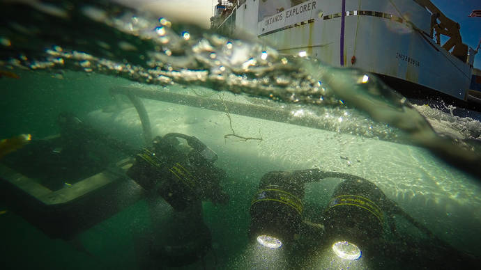
Below, you will find lessons and learning tools relevant to the expedition and the exploration strategy of the Okeanos Explorer.
Grade Level: 5-12
Focus: How students can become active ocean explorers while viewing live video feeds during Okeanos Explorer expeditions (Physical Science/Earth Science)
Students learn how to access the Ocean Explorer website and access a live video feed of an Okeanos Explorer expedition; explore along with the ocean science community via live feeds during Okeanos Explorer expeditions.
Grade Level: 5-12
Focus: ¿Cómo pueden los estudiantes convertirse en activos exploradores del océano mientras ven las transmisiones de video en directo, durante las expediciones del Okeanos Explorer?
Grade Level: 6-12
Focus: Data and information products from remotely operated vehicle operations during missions of the NOAA Ship Okeanos Explorer (Physical Science)
Students learn to access information products collected through remotely operated vehicle dives during NOAA Ship Okeanos Explorer missions.
Grade Level: 5-12
Focus: Telepresence and communications for ocean exploration (Physical Science)
Students understand how telepresence technologies increase the pace, efficiency and scope of ocean exploration; and how the basic properties of simple waves contribute to processes of obtaining, evaluating, and communicating information in ocean exploration.
Grade Level: 5-6
Focus: Bathymetric mapping (Physical Science)
From the Okeanos Explorer Education Materials Collection, V2: How Do We Explore?
Students analyze and interpret data to explain how multibeam sonar is used to identify patterns of ocean floor structures; construct three-dimensional maps; and understand how multibeam sonar technology extends the measurement and exploration capacity of modern ocean exploration.
Addendum: Blank Wet Maps Graph
Grade Level: 7-8
Focus: Ocean chemistry and hydrothermal vents
From the Okeanos Explorer Education Materials Collection, V2: How Do We Explore?
Students analyze and interpret data from the Okeanos Explorer to make inferences about the possible presence of hydrothermal vents; and explain how interaction with hydrothermal vents affects chemical and physical properties of seawater.
Grade Level: 9-12
Focus: Image analysis
From the Okeanos Explorer Education Materials Collection, V2: How Do We Explore?
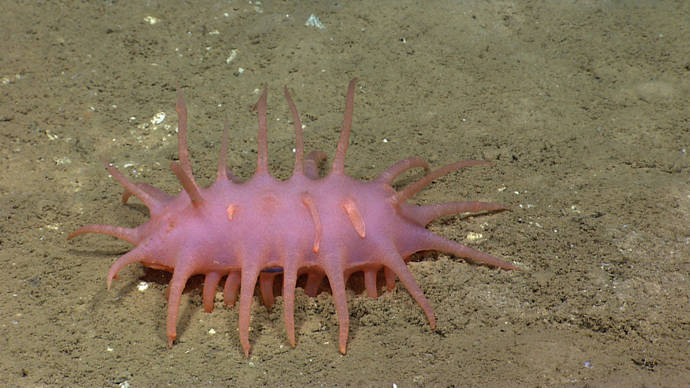
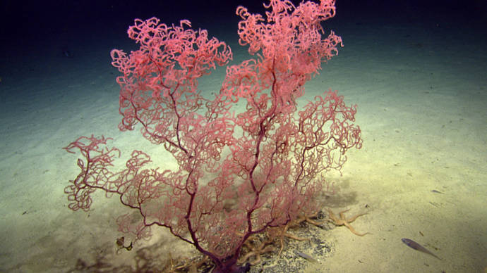
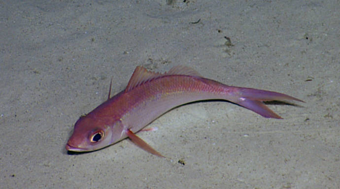
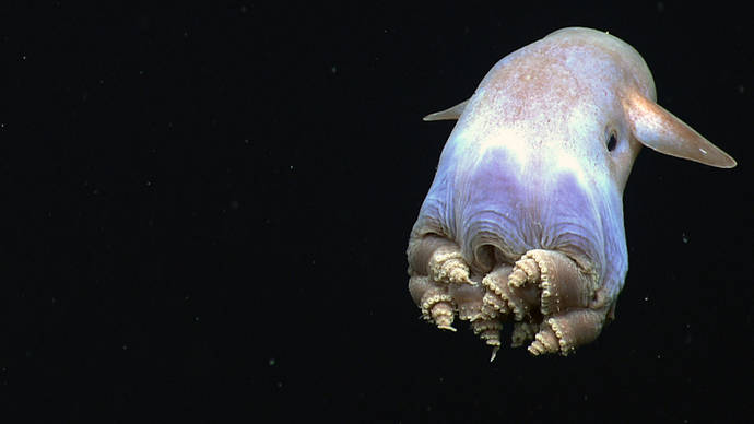
Students explain how robotic vehicle technology is used to extend the exploration capacity of scientific investigations aboard the Okeanos Explorer; use mathematics and computational thinking to show how lasers may be used in scientific investigations to calibrate images for size and distance measurements; and analyze and interpret video data from the Okeanos Explorer’s underwater robot to make inferences about environmental interactions of organisms in deep-sea ecosystems.
Grade Level: 9-12
Focus: Multibeam sonar
From the Okeanos Explorer Education Materials Collection, V2: How Do We Explore?
Students explain how multibeam sonar uses the properties of sound waves in water for scientific research about topography of the ocean floor; and analyze and interpret multibeam sonar data using free iview4D software to identify patterns in the distribution of seafloor features that contribute to scientific research about large-scale interactions in Earth’s systems.
To further explore the exploration strategy of the Okeanos Explorer and the technologies of bathymetric mapping, water column exploration, and remotely operated vehicle imagery, view the lessons below.
Grade Level: 5-12
Focus: Multibeam sonar data and exploration activities during the NOAA Ship Okeanos Explorer Gulf of Mexico 2012 Expedition missions (Earth Science)
Students describe multibeam sonar, explain why the velocity of sound in water must be measured before maps can be created with the Okeanos Explorer’s multibeam sonar system, discuss the advantages of multibeam sonar bathymetry compared to two-dimensional topographic bathymetry, and interpret three-dimensional multibeam data of underwater features mapped by the Okeanos Explorer. This activity is followed up with Okeanos Explorer Multibeam Sonar Supplemental Datasheet #1 for Cruise 12.02 (pdf, 924 KB) in which students interpret three-dimensional multibeam data of underwater features mapped by the Okeanos Explorer during the Gulf of Mexico 2012 Expedition.
Grade Level: 5-12
Focus: CTD data and exploration activities during the NOAA Ship Okeanos Explorer Gulf of Mexico 2012 Expedition (Physical Science/Earth Science)
Students define "CTD" and explain how this instrument is used aboard the Okeanos Explorer; explain how relationships between temperature, salinity, pressure, and density in seawater are useful to ocean explorers; and use data from the Okeanos Explorer to create and interpret graphs of temperature, salinity, and depth. This activity is followed up with Okeanos Explorer CTD Supplemental Datasheet #1 for Cruise 12.02 (pdf, 956 kb) in which students interpret CTD data collected by the Okeanos Explorer during the Gulf of Mexico 2012 Expedition.
Grade Level: 5-12
Focus: ROV imagery and exploration activities during the NOAA Ship Okeanos Explorer Gulf of Mexico 2012 Expedition (Earth Science)
From the NOAA Ship Okeanos Explorer Gulf of Mexico 2012 Expedition
Students will describe typical applications and limitations of imagery obtained with ROVs, demonstrate how lasers may be used to calibrate images for size and distance measurements, and analyze ROV imagery from the Okeanos Explorer to make inferences about deep-ocean habitats and organisms. This activity is followed up with Okeanos Explorer ROV Imagery Supplemental Datasheet #1 for Cruise 12.02 (pdf, 837 kb) in which students interpret ROV imagery collected by the Okeanos Explorer during the Gulf of Mexico 2012 Expedition.