


2026 American Samoa ROV + Mapping Exploration
Media Resources
This page provides members of the media with information, resources, and multimedia developed in association with the 2026 American Samoa ROV and Mapping Exploration expedition.
Importance | Goals | Partners | Explorers | Videos & Images | Background Information | Contacts
In August and September, NOAA Ocean Exploration and partners will conduct a 29-day remotely operated vehicle (ROV) and mapping expedition on NOAA Ship Okeanos Explorer to explore deep waters in and around American Samoa. This expedition will include ROV dives to explore the seafloor and water column, overnight mapping operations, and continuous shore-side participation via telepresence technology.
During the expedition, video will be streamed online in real time from approximately 8 a.m. to 8 p.m. SST / 3 p.m. to 3 a.m. EDT, August 23-September 12 (subject to change). During dives, we expect to explore abyssal seafloor features, deep-sea coral and sponge habitats, seamounts, marine critical minerals, and the water column of American Samoa.
Anyone with an internet connection will be able to follow expedition operations live, tuning in as discoveries are made in real time.
Expedition Importance
The 2026 American Samoa ROV and Mapping Exploration expedition is focused on scientific exploration and seafloor mapping to support understanding of deep ocean waters of American Samoa, helping to build baseline knowledge in regions that remain difficult to access and not well understood.
Located approximately 3,500 kilometers (2,200 miles) southwest of Hawaiʻi, American Samoa is the only U.S. territory south of the equator. This unique region, comprising five volcanic islands and two coral atolls, covers over 300,000 square kilometers (115,830 square miles) of ocean, representing a vital strategic and cultural link for the United States in the South Pacific. These waters are a cornerstone of American Samoa’s cultural heritage and a critical driver of regional economic security. From thriving shallow coral reefs to deepwater coral and sponge communities and hydrothermal vents, the marine ecosystems here are among the most biodiverse on the planet. These waters also hold vast marine resources, including fishery habitats and potentially marine critical minerals.
Gaps in data and information filled during the 2026 American Samoa ROV and Mapping Exploration expedition will increase our understanding of the current ocean environment, increase understanding of resources to inform responsible management decisions, identify further knowledge gaps, and increase public connection to and awareness of ocean issues.
Four Things to Know About the Expedition
- During the expedition, we will use the advanced systems on NOAA Ship Okeanos Explorer to map deepwater areas of American Samoa. The work of this expedition will build on a NOAA-funded contract project completed in 2026 to map and characterize over 30,000 square nautical miles of federal waters off American Samoa. Collected expedition data will help to fill remaining gaps in seafloor mapping data in the region, including in Rose Atoll Marine National Monument and National Marine Sanctuary of American Samoa. Data collected during this expedition will help further inform expedition dive targets and guide future exploration efforts; help to establish a baseline assessment of the ocean environment; and increase understanding of marine life, habitats, and resources to inform management decisions.
- As part of the expedition, we will map and explore abyssal plain environments, with a focus on gathering baseline information about regions with marine critical minerals, specifically polymetallic nodules, in deep waters of American Samoa. We will collect seafloor mapping data in deep waters using ship-mounted multibeam sonar and conduct visual surveys and physical sample collection using our remotely operated vehicle system, providing the data needed to build a foundation for understanding the geological and biological context of the area, allowing scientists to better characterize the abyssal plain ecosystems of American Samoa. On some abyssal plains, polymetallic nodules containing critical minerals may be found on or near the top of soft sediment. During this expedition, we are collecting scientific data to better understand where, why, and how these nodules occur. Providing the best-available science to decision-makers can support responsible use of ocean resources like marine critical minerals. While data collected by NOAA Ocean Exploration on this and other expeditions are used to inform resource managers and ensure sound decision-making, NOAA Ocean Exploration is not responsible for making decisions related to seabed mineral resource management or regulation.
- Seamounts, deep-sea coral and sponge communities, and fish habitats are important natural resources in American Samoa. We will explore these habitats to better understand the diversity, distribution, extent, abundance, and relative importance of animals that live there. American Samoa has 48 known seamounts in its waters. These submerged mountains form critical marine ecosystems by providing structure for animals to settle and live on and currents to supply food and nutrients, meaning that seamounts can be biodiversity hotspots—oases of life. While American Samoa is well known for its vibrant shallow-water coral reefs, these waters are also home to deepwater corals that live below the depths of sunlight. These corals create structures that provide shelter, food, and nursery habitat to other invertebrates and fish, including some that are commercially important and that may in turn provide us with food, medicines, and other resources. While recent research has significantly contributed to our understanding and appreciation of deepwater coral and sponge communities, there is still a great deal to learn about their distribution, diversity, reproduction, and resilience, particularly in the unexplored and poorly understood deepwater areas where we will be exploring. Data collected about these habitats during the expedition can help scientists assess connections between biological productivity on the seafloor and productivity in the overlying water column to develop a better understanding of whole ecosystem functioning and the overall role of unique seafloor habitats.
- NOAA is committed to working with local communities in American Samoa, decision-makers, members of the scientific community, and others to ensure full access to and knowledge of what is found and learned during and after the expedition. Real-time ROV operations will be streamed online, providing the public and shore-based scientists a unique window into the deep-sea environment. Collected data will be filed in the public domain, meaning it will be freely available to anyone through the NOAA data archives. This data-driven approach is designed to provide authoritative science for decision-makers at federal and local levels, with data gathered during the expedition being made publicly available to support the responsible management of marine resources, including critical minerals, in the region.
Goals of the Expedition
The 2026 American Samoa ROV and Mapping Exploration expedition will address science themes and priority areas put forward by scientists and managers from the Cook Islands, NOAA, and the ocean science community. Priorities for the expedition include a combination of science, education, outreach, and open data objectives that will support management decisions at multiple levels. Specific goals include:
- Acquiring data on deepwater habitats of American Samoa to support priority science and management needs;
- Identifying, mapping, and exploring the diversity and distribution of seafloor habitats, including fish habitats, deep-sea coral and sponge communities, potential polymetallic nodule fields, and abyssal plains;
- Mapping, surveying, and sampling geological features to better understand the geological context of the region;
- Collecting high-resolution mapping data in areas with no (or low-quality) data;
- Acquiring a foundation of ROV, sonar, and oceanographic data to better understand the characteristics of the water column and the organisms that live there;
- Engaging a broad spectrum of the scientific community and public in telepresence-based exploration; and
- Providing a foundation of publicly accessible data and information products to spur further exploration, research, and management activities.
Expedition Partners
This cruise is being led by NOAA Ocean Exploration and partners, including National Marine Sanctuary of American Samoa, the U.S. Geological Survey, the NOAA Ocean Exploration Cooperative Institute, NOAA Marine and Aviation Operations, and NOAA National Centers for Environmental Management.
Explorers
The individuals listed below are the primary leads for the 2026 American Samoa ROV and Mapping Exploration expedition. They coordinate input from multiple scientists and managers participating from shore, are several of the voices you hear on the live video feeds, and are active participants in outreach events.

Katlin Adamczyk
Expedition Co-Science Lead – Marine Geochemist and Oceanographer, U.S. Geological Survey
Katlin Bowman Adamczyk, Ph.D., is a marine geochemist and oceanographer with the Global Seabed Mineral Resources group at the U.S. Geological Survey’s Pacific Coastal and Marine Science Center in Santa Cruz, California. She has a bachelor of science and doctoral degree in environmental sciences from Wright State University and completed postdoctoral training at the University of California Santa Cruz. She has participated in over 20 expeditions across the globe including a 65-day voyage to the North Pole, thousands of miles of hydrographic transects in the Atlantic and Pacific Oceans, and seafloor exploration via human occupied and remotely operated deep-sea vehicles. In 2024, she was named to the Explorers Club 50 list and has been a National Geographic Explorer since 2018.
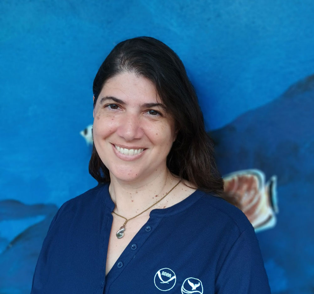
Valerie Brown
Expedition Co-Science Lead – Research Coordinator, National Marine Sanctuary of American Samoa
Val Brown is the research coordinator for the National Marine Sanctuary of American Samoa. Val holds a Master’s of Public Affairs with a focus on environmental policy and natural resource management and a Master of Science in Environmental Science with a focus on applied ecology from Indiana University. She has over two decades of experience in the Pacific Islands region focused on the application of scientific data to enhance the management and conservation of marine resources. Val also has a passion for science communications and engagement activities and is excited to assist with ship-to-shore interactions. She has conducted ship-based expeditions in both the Mariana and Samoan Archipelagos, exploring a wide range of marine ecosystems from the intertidal to the deep sea.

Nikki Morgan
Expedition Coordinator, NOAA Ocean Exploration
Nikki Morgan, Ph.D., started with NOAA Ocean Exploration in 2026 as a full-time expedition coordinator. She previously coordinated nearly a dozen deep-sea expeditions from 2012-2021 in the North Pacific and off the Gulf coast of Florida, using numerous technologies including autonomous underwater vehicle Sentry, human occupied underwater vehicles Pisces IV and Pisces V, and remotely operated vehicle Lu’ukai. Nikki studied connectivity of deep-sea communities using video surveys and population genetic structure of the precious red coral Hemicorallium laauense, and she has an unabiding love for deep-sea octocorals. She also has a not-so-secret passion for mapping and digital map making, which can be seen in a number of her publications. She holds doctoral and master’s degrees in oceanography from Florida State University and a bachelor’s degree in marine biology from the University of Texas at Austin.

Kasey Cantwell
Expedition Coordinator, Operations Chief, NOAA Ocean Exploration
Kasey Cantwell is the operations chief for the Expeditions and Exploration Division of NOAA Ocean Exploration. Kasey has a master’s degree in marine affairs and policy and marine geology and geophysics and a bachelor’s degree in marine science and biology, both from the University of Miami Rosenstiel School of Marine and Atmospheric Science. Kasey joined NOAA Ocean Exploration in 2012 and is responsible for overseeing the office’s operational portfolio, including telepresence-enabled expeditions aboard NOAA Ship Okeanos Explorer. In her role as an expedition coordinator for remotely operated vehicle expeditions, she has coordinated over two dozen expeditions and projects, including multidisciplinary expeditions throughout the U.S. Exclusive Economic Zone. Beyond deep-sea exploration, Kasey’s background includes imagery-based mapping of coral reefs throughout the Caribbean, long-term ecosystem monitoring, and evaluating resource management strategies to improve efficiency and data quality.
Videos and Images
Dive highlight videos, short video clips, and images will be posted online in the cruise multimedia gallery on a rolling basis, as they become available.
Images and video collected during the cruise are in the public domain, meaning they are free to use without restrictions or additional permissions, provided that the credit information listed in the caption associated with each image or video is included. If space is limited, please credit NOAA Ocean Exploration (preferred) or NOAA.
Please contact Emily Crum for high-resolution footage, b-roll, and other materials posted on the NOAA Ocean Exploration website.
For additional information, please view our online media kit.
NOAA Ocean Exploration Background Information
- NOAA Ocean Exploration is the only federal organization dedicated to exploring the unknown ocean, unlocking its potential through scientific discovery, technological advancements, data delivery, and public engagement. With priority placed on exploration of deep waters and the waters of the U.S. Exclusive Economic Zone, NOAA Ocean Exploration executes its mission to explore the ocean for national benefit by using the latest tools and technology to explore unknown or poorly known areas of our ocean, making discoveries of scientific and economic value.
- NOAA Ocean Exploration owns the mission equipment being used during the cruise and is coordinating the mission on NOAA Ship Okeanos Explorer. The ship is operated by the NOAA Commissioned Officer Corps and civilians as part of NOAA’s fleet managed by NOAA Marine and Aviation Operations. The remotely operated vehicles and network systems are operated in partnership with the NOAA Ocean Exploration Cooperative Institute.
- Unlike many other ocean expeditions supported by NOAA, most of the scientists participating in expeditions on Okeanos Explorer remain on shore, thanks to telepresence technology. This technology includes a high-bandwidth satellite connection that enables the transmission of data and video to shore in real time, allowing scientists to participate in the expedition from anywhere in the world.
- Anyone with an internet connection can follow dives — LIVE. The same technology that allows scientists around the world to participate in the expedition from shore also allows interested members of the public to experience deep-sea exploration, the wonder of discovery, and the fascination of science in real time through the internet.
- Data collected during expeditions on Okeanos Explorer are quality assured and then made available to scientists and the public via the NOAA archives. This data collection serves as a unique and centralized national resource of critical ocean information for scientists and resource managers to plan future research, make management decisions, detect natural hazards, improve nautical charts, and more.
Media Contact Information
Emily Crum
Communications Specialist
Email Address: ocean-explore-comms@noaa.gov
Keeley Belva
Public Affairs Officer
Email Address: keeley.belva@noaa.gov
Nerrelle Que Moffit
Communications and Outreach Coordinator
nerelle.que@noaa.gov