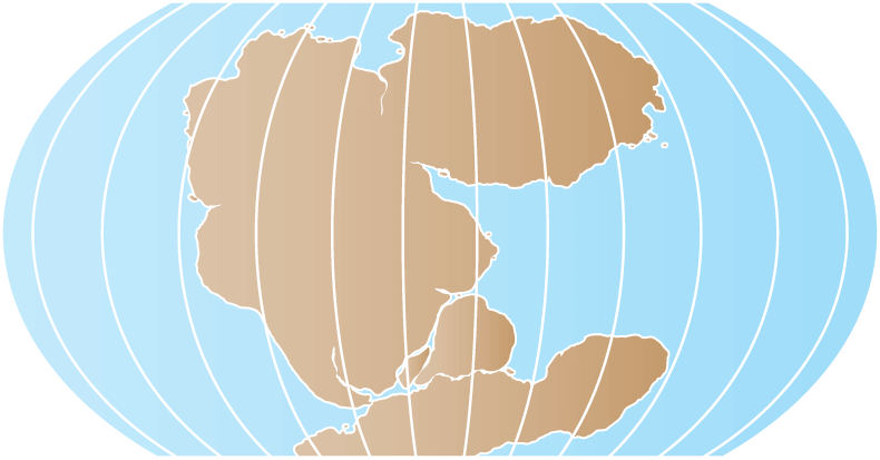
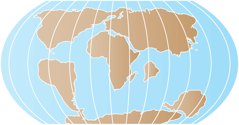
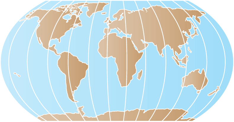
Our Blue Frontier: Exploring Our Ocean World

The ocean is a defining and life-giving feature of our planet. But despite its significance to all life on Earth, it is still largely unexplored.

OYLA #18, May 2022
By Aurora Elmore, Ph.D., and Rachel Gulbraa

The site for Dive 06 of the second Voyage to the Ridge 2022 expedition, provided ideal conditions needed to support beautiful, diverse, and dense coral and sponge communities. View full video.

Earth’s First Ocean

When Earth first formed over 4.5 billion years ago, it was a hot, dusty, and gassy wasteland, without an ocean in sight. As the planet cooled, a toxic atmosphere formed from volcanic gasses. Little by little, early volcanic eruptions released the elements hydrogen and oxygen, with more of each arriving from icy comets as they crashed into the young planet. These hydrogen and oxygen molecules joined together to create dihydrogen monoxide—better known as water.

By 3.8 billion years ago, Earth had cooled enough that the atmospheric temperature fell below the boiling point of water (212°F/100°C), allowing the planet’s first rain to form from atmospheric water vapor. This first rainshower lasted for thousands of years. Due to gravity, the rainwater settled in lower geographic areas on the planet’s surface, creating Earth’s first ocean. This liquid water is what makes Earth so uniquely suited to supporting life.

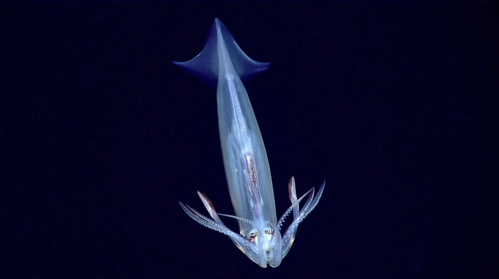
Earth’s earliest ocean was probably similar in volume to today’s, but otherwise looked very different—completely devoid of life. It was also hot, acidic, and heavily enriched with iron. The earliest ocean was not even salty since the salinity of today’s ocean is the result of the weathering of continental rocks over long periods of time. It was under these extreme conditions that life on Earth arose around 3.8 billion years ago. Scientists hypothesize that this first occurred near the ocean’s hydrothermal vents.

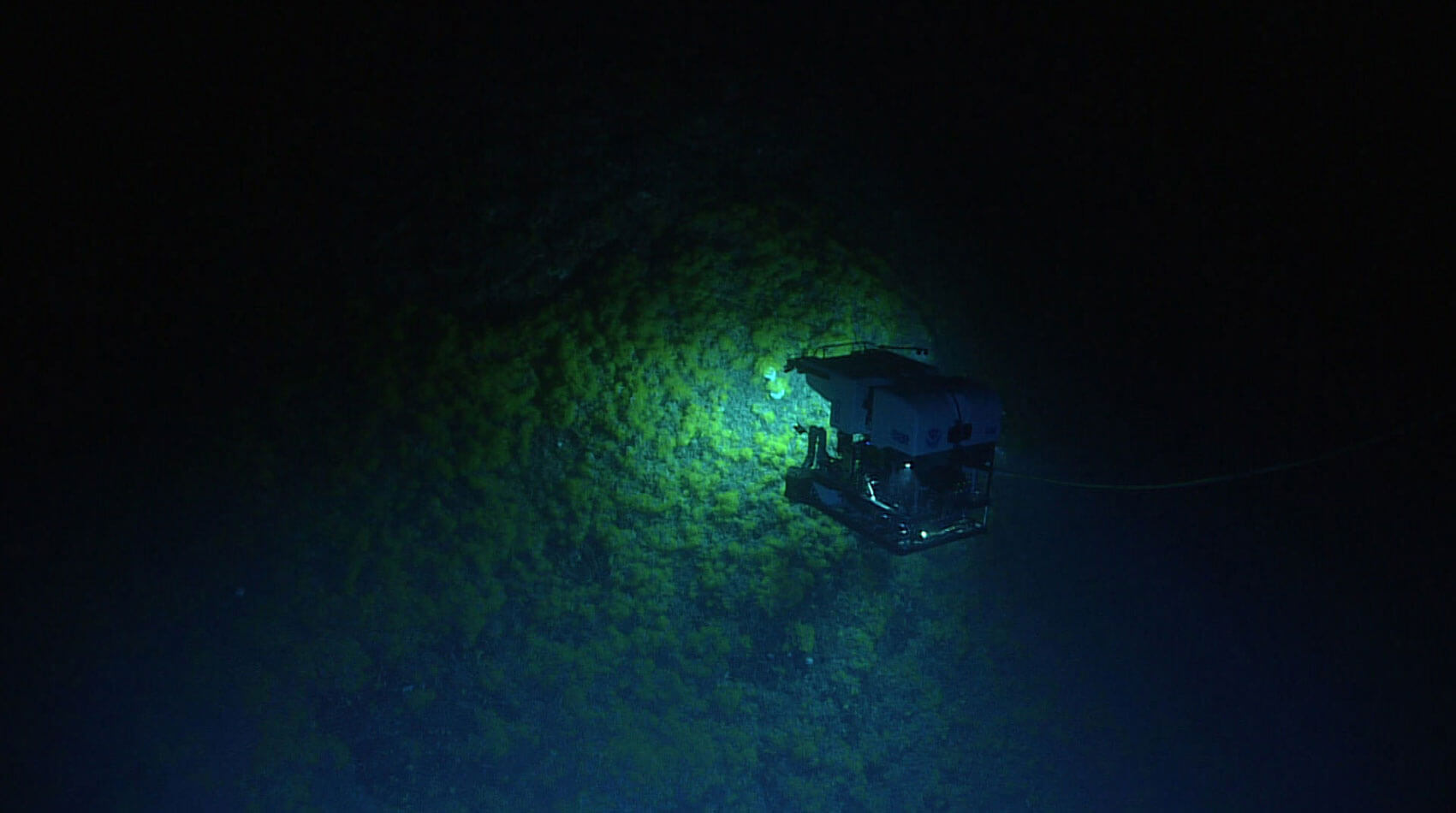
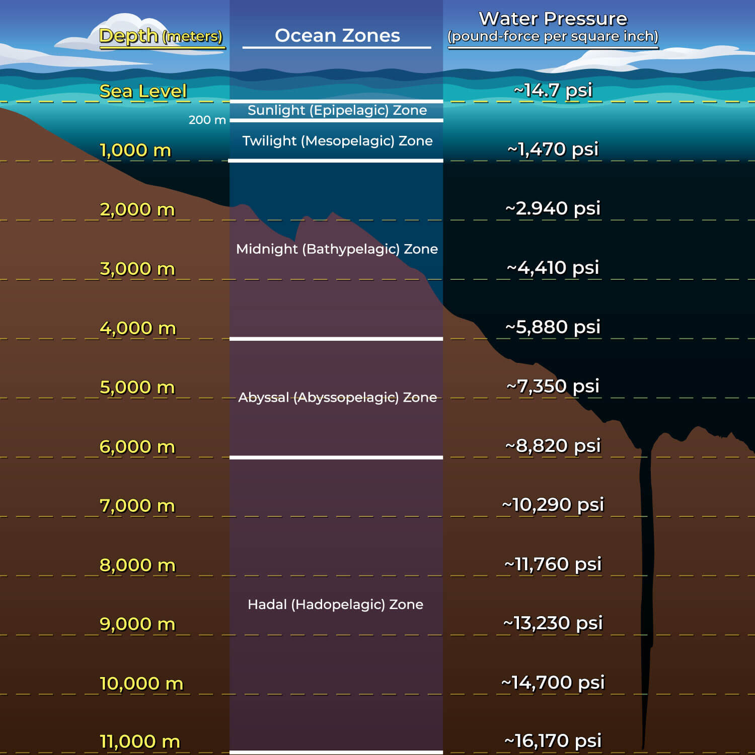
WHAT ARE HYDROTHERMAL VENTS?

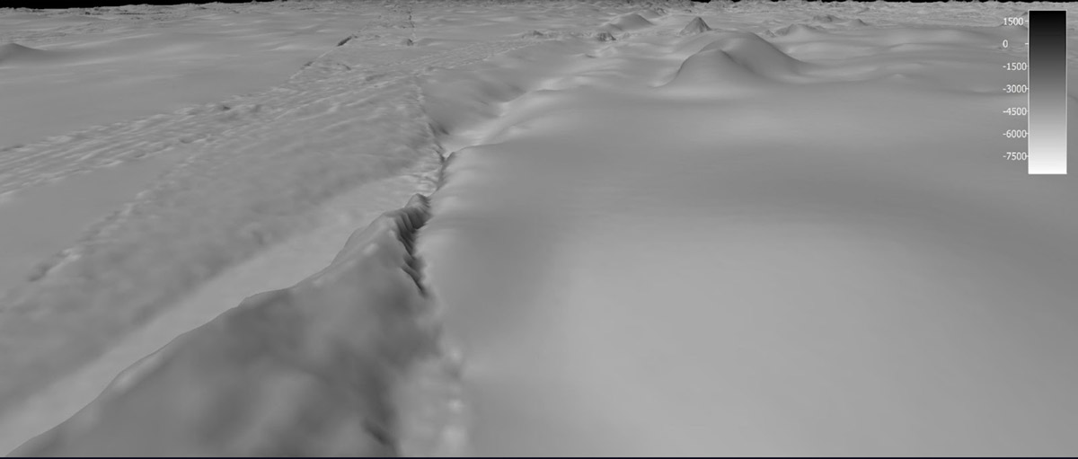
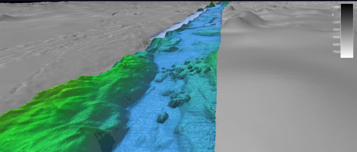
Hydrothermal vents are openings on the ocean floor from which super-heated, mineral-rich water gushes. Like hot springs on the ocean floor, hydrothermal vents are produced by submarine volcanism, which often occurs at plate tectonic boundaries. These important features were first discovered in the deep sea by ocean explorers in 1977. Scientists were shocked to discover chemosynthetic organisms (organisms that depend on energy released from chemical reactions) being supported by the vents in the absence of light. Until this relatively recent discovery, it was thought that sunlight was a requirement for life.

This incredible active hydrothermal vent was imaged for the first time during the Marianas expedition. Video courtesy of NOAA Ocean Exploration, 2016 Deepwater Exploration of the Marianas. Download largest version (mp4, 75.6 MB).
Video courtesy of NASA.

The Changing Shape of the Ocean

By about 2 billion years ago, the ocean probably had characteristics similar to our modern ocean, but the slow and steady geologic processes of plate tectonics continued to shift the locations of the continents and ocean basins, reconfiguring the shape of the ocean through time. This movement continues to this day.

Today’s continental arrangement is responsible for global ocean circulation patterns, which in turn impact our planet’s climate. Ocean currents act like a complicated conveyor belt, moving surface water around the globe and linking surface and deep currents. The overall result of global circulation is the transportation of warm surface water from the equator toward the poles and cold deep water from the poles back to the tropics. The formation of deep currents can sink carbon dioxide, removing a potent greenhouse gas from the atmosphere in a process called carbon sequestration. Thus, the speed, temperature, and location of ocean currents regulate the global climate, helping to counteract the uneven distribution of solar radiation at Earth’s surface. Without currents in the ocean, regional temperatures would be more extreme—super hot at the equator and frigid toward the poles—and much less of the planet would be habitable.

Locations of the Continents Through Geologic Time

An image of the continents 250 million years ago

250 Million Years Ago

An image of the continents 50 million years ago

50 Million Years Ago

An image of the continents today

Today

250 Million Years Ago

The continents were massed together as Pangea

50 Million Years Ago

The northern and southern continents were separated by the equatorial Tethys

Today

Modern-day continental configuration is responsible for our global ocean circulation patterns

The Importance Of The Ocean

The ocean supports and impacts life as we know it in many ways. More than half of the oxygen produced on Earth originates from the ocean. Photosynthetic organisms like phytoplankton, cyanobacteria, and algae produce this oxygen—if you pause and take two breaths right now, you can thank the ocean for one of them! By better understanding the ocean,we can more accurately predict and respond to geohazards like earthquakes and tsunamis, tap into new sources of food, medicines, and energy, and more wisely and sustainably manage the sea and its resources. The key to wise use is understanding, which requires exploration to study and solve the problems of today and tomorrow.

The Ocean Provides


The Air We Breathe
The ocean produces over half of the world's oxygen and stores 50 times more carbon dioxide than our atmosphere.

Climate Modulation
Covering over 70% of the Earth’s surface, the ocean transports heat from the equator to the poles, regulating our climate and weather patterns.

Transportation
76% of all U.S. trade involves some form of marine transportation.

Economy
The U.S. ocean economy produces $282 billion in goods and services, while ocean-dependent businesses employ almost 3 million people.

Medicine
Many medicinal products come from the ocean, including ingredients that help fight cancer, arthritis, Alzheimer’s disease, and heart disease.

Food
The ocean provides much more than just seafood. Ingredients from the sea can be found in surprising foods such as peanut butter and soymilk.

The Challenge of Exploration

The sheer size of the ocean is difficult to comprehend. It covers over 70% of our planet’s surface, and has an average depth of 3.7 km (2.3 mi), making it the largest livable space on the planet. Throughout these depths, from the surface of the ocean to the seafloor and everywhere in between, there is life. In fact, this space is home to 4/5ths of the world’s biodiversity, the majority of which has yet to be described.

Many of us might picture the ocean from a more familiar perspective: perhaps from the shores of a sandy coast, the shallow waters of a beach, the waves seen from shore or ship, or even from satellite imagery of the ocean’s surface. But the vast majority of ocean waters are beneath the surface.

Remotely operated vehicle Deep Discoverer traverses over a field of live, yellow coral in the genus Eguchipsammia growing over the top of dead coral rubble seen during much of Dive 01 of the second Voyage to the Ridge 2022 expedition.
Remotely operated vehicle Deep Discoverer traverses over a field of live, yellow coral in the genus Eguchipsammia growing over the top of dead coral rubble seen during much of Dive 01 of the second Voyage to the Ridge 2022 expedition. Download largest version (jpg, 537 KB).
Northern shortfin squid (Illex illecebrosus) seen while diving in Uchupi Canyon during the 2021 ROV Shakedown.
Northern shortfin squid (Illex illecebrosus) seen while diving in Uchupi Canyon during the 2021 ROV Shakedown. Download largest version (jpg, 206 KB).

Sunlight only penetrates the top 200 m (656 ft) of the ocean; below this is considered “the deep sea.” This remote realm is dark, cold, and under high pressure. These conditions make the deep sea very challenging to explore and study. Because of this, we know much more about shallow, coastal waters than we do about the rest of the ocean. In order to explore and study the full water column and the seafloor, we need new and specialized technologies.

The water column of the open ocean is divided into five zones from the surface to the seafloor. Each zone varies in pressure, light, temperature, oxygen concentration, nutrients, and biological diversity.
The water column of the open ocean is divided into five zones from the surface to the seafloor. Each zone varies in pressure, light, temperature, oxygen concentration, nutrients, and biological diversity. Download largest version (jpg, 971 KB).

Ocean Exploration Begins With Mapping

The first step in ocean exploration is mapping. Seafloor mapping provides a detailed guide and a sense of the features of an area. This information helps scientists make informed decisions about where to explore in greater detail. While the entire seafloor has been coarsely mapped using satellites, these maps provide only a general picture of what’s there. That’s because the resolution of these maps is 1.5 km (about one mile), meaning that only a seafloor feature 1.5 km or larger will be big enough to appear on a map of this resolution. Because detail is limited, features like seamounts, volcanic craters, coral mounds, or shipwrecks can remain hidden.

As of 2022, slightly less than 25% of the global seafloor has been mapped with modern, high-resolution sonar systems that can reveal the seafloor in much greater detail. Ocean mapping can also be used to detect features within the water column such as gas plumes that reveal the location of seeps, or even the ascent and descent of groups of marine organisms as they move through the water column. Many other forms of data are also collected at this initial stage using a wide range of technologies. Sub-bottom profilers penetrate through the seafloor surface and reflect off different layers of sediment, and conductivity, temperature, and depth sensors (known as CTDs) provide important information about the physical, chemical, and even biological properties of the water column.

before
After
In May, during the first Voyage to the Ridge 2022 expedition, NOAA Ocean Exploration completed the largest continuous mapping survey effort to date over the Charlie-Gibbs Fracture Zone, collecting bathymetric data along this geologically fascinating and ecologically exceptional region. Slide the arrow back and forth to compare satellite-derived bathymetry data (gray) to the high-resolution bathymetry data (color) collected during Voyage to the Ridge 2022 using the multibeam system on NOAA Ship Okeanos Explorer.

Ocean Exploration: Onwards and Downwards

Once a detailed map of an area has been created, it can be used as a framework to guide the next steps in exploration. This often means exploring a small area of interest at a high level of detail with technologies such as human-occupied vehicles, remotely operated vehicles (ROVs), or autonomous (self-guided) underwater vehicles, all of which are essentially underwater robots. Scientists use high-resolution maps to carefully plan a path for the vehicle, which can be equipped with a range of sensors, lights, and cameras.

For example, an exploratory dive conducted by NOAA Ocean Exploration will usually use an ROV, which is controlled by pilots aboard a ship above, and might begin on the seafloor and proceed upslope towards a feature of interest, such as a seamount. Along the way, pilots maneuver the ROV and direct its lights and cameras to objects and organisms of interest, like rocks, coral groves, sponge communities, or any of the abundant animal life that may be found on the seafloor. Some ROVs can bring a limited number of physical samples and specimens back to the surface for further study. While space and time on ships is often limited and costly for scientists, some ships are equipped with telepresence technology, which allows for dives to be live streamed anywhere with an Internet connection—meaning that scientists around the globe can participate in the exploration in real time. This technology allows for a greater breadth of expertise to guide the mission and makes ocean exploration accessible to the public in real time.

Remotely operated vehicle Deep Discoverer traverses over a field of live, yellow coral in the genus Eguchipsammia growing over the top of dead coral rubble seen during much of Dive 01 of the second Voyage to the Ridge 2022 expedition.

Northern shortfin squid (Illex illecebrosus) seen while diving in Uchupi Canyon during the 2021 ROV Shakedown.

Remotely operated vehicle Deep Discoverer traverses over a field of live, yellow coral in the genus Eguchipsammia growing over the top of dead coral rubble seen during much of Dive 01 of the second Voyage to the Ridge 2022 expedition.

Alvin, which is operated by Woods Hole Oceanographic Institution (WHOI), has been in operation since 1964. The human occupied vehicle can carry two scientists and one pilot for each dive.

Michigan Technological University's autonomous underwater vehicle Iver 3 aboard Research Vessel Storm during the Machine Learning for Automated Detection of Shipwreck Sites from Large Area Robotic Surveys expedition. Image courtesy of Guy Meadows. Download largest version (jpg, 3.15 MB). During the second year of the Our Submerged Past expedition, the team will use the SUNFISH® autonomous underwater vehicle to explore submerged caves and rock shelters discovered during the first year of the project. Image courtesy of Jill Heinerth, Stone Aerospace. Download largest version (jpg, 3.15 MB). The sun rises over remotely operated vehicle Seirios on the back deck of NOAA Ship Okeanos Explorer, marking the dawn of a new day of exploration and discovery. Download largest version (jpg, 20.7 MB). Alvin, which is operated by Woods Hole Oceanographic Institution (WHOI), has been in operation since 1964. The human occupied vehicle can carry two scientists and one pilot for each dive. Image courtesy courtesy of Woods Hole Oceanographic Institution. Download largest version (jpg, 473 KB).

Many ocean exploration organizations are committed to sharing the data they collect, which allows for new species to be described using video footage, genetic analysis to be conducted on biological specimens, and baseline data to be established as a reference to detect future changes, among many other applications. The rigorous observations and documentation of the biological, chemical, physical, geological, and archaeological aspects of our ocean that take place during ocean exploration set the stage for future research and decision-making.

The ocean is vital to us all, and NOAA Ocean Exploration and the Global Foundation for Ocean Exploration are working to unlock its mysteries because...we are EXPLORERS. Download largest version (mp4, 104.1 MB).

The technology used to explore the full extent of our ocean has come a long way over the last century, and is improving rapidly. Meanwhile, the field of ocean exploration is constantly being broadened as more people from various disciplines bring their expertise to the table. An ocean explorer may be anyone, from a mechanical engineer to an oceanographer, a maritime archaeologist to a science communicator, a biologist, a geologist, a pilot, a filmmaker, and many others. Together, ocean explorers work to build a better understanding of the ocean and its importance, its current properties, and how it is changing—ensuring that decision-makers have the information they need to make sound policies for this life-sustaining asset: our ocean.