Media Resources
This page provides members of the media with information, resources, and multimedia developed in association with the 2023 Seascape Alaska series of expeditions.
Importance | Goals | Partners | Explorers | Background Information | Contacts
May through September 2023, NOAA and partners will conduct a series of telepresence-enabled ocean exploration expeditions on NOAA Ship Okeanos Explorer to improve knowledge about unexplored and poorly understood deepwater areas offshore Alaska, with a particular focus on the Aleutian Islands and Gulf of Alaska.
The expeditions will include mapping operations, remotely operated vehicle (ROV) dives, and autonomous underwater vehicle (AUV) operations, depending on the expedition:
- AUV and mapping: May 5 - 26
Seascape Alaska 1: Aleutians Deepwater Mapping (Seattle, Washington to Dutch Harbor, Alaska) - Mapping: June 5 - 20
Seascape Alaska 2: Aleutians Deepwater Mapping (Dutch Harbor, Alaska to Kodiak, Alaska) - ROV and mapping: July 14 - 25
Seascape Alaska 3: Aleutians Remotely Operated Vehicle Exploration and Mapping (Kodiak, Alaska to Dutch Harbor, Alaska) - Mapping: August 1 - 17
Seascape Alaska 4: Gulf of Alaska Deepwater Mapping (Dutch Harbor, Alaska to Kodiak, Alaska) - ROV and mapping: August 23 - September 16
Seascape Alaska 5: Gulf of Alaska Remotely Operated Vehicle Exploration and Mapping (Kodiak, Alaska to Seward, Alaska) - Transit mapping: September 23 - October 14
Seascape Alaska 6: Gulf of Alaska Transit Mapping (Seward, Alaska to San Francisco, California)
During expeditions with ROV operations, video of dives will be streamed online in real time from approximately 8 a.m. to 5 p.m. AKDT (12 p.m. to 9 p.m. ET), June-July and August-September (subject to change). During dives, we expect to explore deep-sea coral and sponge habitats, hydrothermal vent communities, deep-sea canyons and seamounts, fracture and rift zones, and the water column.
Expedition Importance
Despite contributing the largest area to the U.S. Exclusive Economic Zone (EEZ), Alaska waters remain one of the least explored areas in the United States. Current mapping data for the waters around Alaska address only 34% of the seafloor, much of which is sparse and predates modern mapping technologies. Additionally, much of the deepwater habitats of the Gulf of Alaska, Aleutian Islands, and the Aleutian Trench remain predominantly unexplored. Through mapping and exploration of Alaska’s deep waters, we can establish baseline information needed to sustainably manage and protect these areas.
Filling data gaps and increasing our understanding of this region has far-reaching benefits, including safer navigation and community access, better hazard mitigation, preservation of marine habitats and heritage, a deeper comprehension of and connection to natural resources, and improved fisheries management.
Four Key Things to Know About the Expedition
- Data collected during the expeditions will close significant gaps in one of the least explored but incredibly economically and culturally important areas in the United States: Alaska, our nation’s "last frontier." Much of Alaska is built on the Blue Economy: The state supports the largest commercial fishery in the United States, is home to one of the busiest cargo hubs in the world, boasts resources that provide jobs and a stable food supply for the nation while supporting a traditional way of life for Alaska Natives and local fishing communities, and supports a tourism industry that annually welcomes more visitors than the state’s total population to enjoy outdoor adventures. Despite their critical role in our nation’s economy and national security, the deep waters of Alaska remain one of the least explored areas in the United States. The data collected during the 2023 Seascape Alaska expeditions will close gaps in one of the least-explored, but most-productive areas of our nation’s EEZ.
- Throughout the 2023 Seascape Alaska expeditions, we will use the advanced sonar systems on NOAA Ship Okeanos Explorer to fill critical gaps in mapping data within deepwater areas of the Gulf of Alaska, Aleutian Islands, and the Aleutian Trench. Alaskan waters cover just over 1 million square nautical miles, yet are the least mapped relative to the waters of any other U.S. state, with 66% of waters around Alaska currently unmapped. And, existing data are sparse and predate modern mapping technologies, which yield a more complete picture of the seafloor. Data collected during these expeditions will increase the area of seafloor within Alaskan waters that are mapped at high resolution and will contribute to Seascape Alaska, a regional campaign supporting the National Strategy for Mapping, Exploring, and Characterizing the United States Exclusive Economic Zone. These data will also help further inform expedition dive targets and guide future exploration efforts, be used to establish a baseline assessment of the ocean environment, increase understanding of marine life and habitats to inform management decisions, and increase public awareness of ocean issues.
- While thoughts of the waters of Alaska may not conjure up images of thriving corals, coral and sponge communities are actually quite diverse and abundant in Alaska’s marine waters. During the 2023 Seascape Alaska expeditions, we will work to characterize the diversity and extent of these ecologically important communities. In particular, research suggests that the waters along the Aleutian Islands, an area we will be exploring, are home to the highest diversity of corals in Alaska and possibly throughout the North Pacific and may rank among the most abundant deep-sea coral and sponge communities in the world. These deep-sea corals and sponges create structures that provide shelter, food, and nursery habitat to other invertebrates and fish, including some that are commercially important, such as flatfish and rockfish. Because corals and sponges are fixed in place and generally long-lived and slow growing, they are particularly vulnerable to human activities and associated environmental change, including climate change, making increased understanding of these animals and the communities they support in these largely unexplored areas all the more important for their management and protection.
- The 2023 Seascape Alaska expeditions are being planned and conducted from a place of respect for and recognition of the Indigenous peoples of Alaska and their connection to and knowledge of the ocean, fish, birds, and other wildlife that sustain their livelihood, traditions, and communities. Over many generations, Alaska Natives have evolved a holistic, cultural way of life, which includes indigenous traditional knowledge that can inform and enrich what is learned through expedition science operations, allowing us to better understand, manage, and protect our ocean. And, since coastal Alaska Natives have a strong connection to the ocean, sharing our expeditions, including the communication of data and research results and education and outreach efforts, with these communities can further enrich understanding and connection to the deep ocean. By communicating and engaging with tribal communities, NOAA hopes to learn more about Alaska Native traditions and cultures and gain insights into how NOAA can better partner with these communities, incorporate indigenous knowledge, and ensure continued practical use and conservation of the state’s marine resources.
Goals of the Expeditions
The 2023 Seascape Alaska series of expeditions will address science themes and priority areas put forward by scientists and managers from NOAA, management agencies in the region, and the ocean science community. NOAA priorities for each expedition include a combination of science, education, outreach, and open data objectives that will support management decisions at multiple levels. Specific goals include:
- Improving knowledge of unexplored deepwater areas offshore Alaska to inform management needs for sensitive habitats, geological features, and potential resources.
- Locating and characterizing deep-sea coral, sponge, and hydrothermal communities.
- Collecting high-resolution bathymetry in areas with no or low-quality sonar data to extend bathymetric mapping coverage in support of the National Strategy for Mapping, Exploring, and Characterizing the United States Exclusive Economic Zone and Seabed 2030.
- Ground truthing existing bathymetric data, habitat suitability models, seafloor composition models, and inferred vent sites.
- Characterizing water column habitats using acoustics, visual observations, and emerging technologies.
- Collecting data to enhance predictive capabilities for vulnerable marine habitats, seafloor composition, seamount formation, plate tectonics, hydrothermal vents, critical minerals, and submarine geohazards.
- Investigating biogeographic patterns of deep-sea ecosystems and connectivity for use in broader comparisons of deepwater habitats throughout the Pacific basin.
- Mapping, surveying, and sampling geological features, including convergent plate boundaries, hydrothermal vents, extinct polymetallic sulfide systems, and fracture and fault zones to better understand the geological context of the region and improve knowledge of past and potential future geohazards.
- Engaging a broad spectrum of the scientific community and public in telepresence-based exploration and providing publicly accessible data and information products to spur further exploration, research, and management activities.
Expedition Partners
Led by NOAA Research's NOAA Ocean Exploration, the 2023 Seascape Alaska expeditions on Okeanos Explorer involve a number of partners including the NOAA Office of Marine and Aviation Operations, NOAA Satellite’s National Centers for Environmental Information, NOAA’s National Ocean Service, NOAA Fisheries, and the Global Foundation for Ocean Exploration. The Seascape Alaska campaign also includes a variety of federal, academic, and private sector partners.
Explorers
The individuals listed below are the primary leads for the 2023 Seascape Alaska expeditions that involve ROV operations. They coordinate input from multiple scientists and managers participating from shore to plan dives, are several of the voices you hear on the live video feeds, and are some of the primary participants in outreach events.

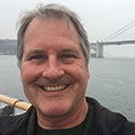
Merlin Best
Seascape Alaska 5, Science Co-Lead (Biology), Fisheries and Oceans Canada
Merlin Best is a biologist with Fisheries and Oceans Canada based out of the Institute of Ocean Sciences (IOS) in Sidney, British Columbia, in the territory of the W̱SÁNEĆ Peoples including the MÁLEXEȽ (Malahat), BOḰEĆEN (Pauquachin), W̱JOȽEȽP (Tsartlip), SȾÁUTW̱ (Tsawout), and W̱SĺḴEM (Tseycum) Nations.
Merlin studied biology at Dalhousie University in Halifax, Nova Scotia and started their career at the Bedford Institute of Oceanography (BIO) as a technician in 2007. At BIO, they focused on the annotation of underwater imagery and study of sponge and coral taxonomy. Since 2019, they have built on and continued this work in their current role as an aquatic science biologist with the Integrated Conservation Monitoring Program in the Marine Spatial Ecology and Analysis Section at IOS. Their work now focuses on vulnerable marine ecosystems in the offshore region of British Columbia, contributing to the establishment and monitoring of the Tang.ɢwan – ḥačxwiqak – Tsig̱is Marine Protected Area. They coordinate a team of annotators that collect data from video and photos of deep-sea study sites, which include seamounts, cold seeps, hydrothermal vents, and mud volcanoes, each with their own unique biological communities and dynamics. Their taxonomic research has taken the form of published identification guides for sponges and corals, as well as a series of guides for species in situ on iNaturalist. They are currently working with colleagues at the University of Victoria and the Royal BC Museum on the taxonomy of the bubblegum corals found in the Northeast Pacific (genus Paragorgia). Over the years they’ve worked with various remotely operated vehicle (ROV) platforms, camera systems, trawls, and drones, and they are incredibly excited to explore the Gulf of Alaska with ROV Deep Discoverer and the NOAA Ocean Exploration team.
Jamie Conrad
Seascape Alaska 5, Science Co-Lead (Geology), U.S. Geological Survey
Jamie Conrad is a research geologist with the U.S. Geological Survey’s (USGS) Pacific Coastal and Marine Science Center in Santa Cruz, California. He received his bachelor’s degree in earth science from U.C. Berkeley and a master’s degree in geology from San Jose State University. He began his career with the USGS working on mineral and ore deposit studies in the western U.S. and dating ore deposits and related igneous rocks using Argon geochronology. From 2006-2008 he did similar studies in Madagascar as part of a cooperative USGS-British Geological Survey project funded by the World Bank. His current research is focused on the seafloor geology of the U.S. west coast, and aims to help understand the hazards posed to coastal communities and infrastructure by offshore active faults and submarine landslides. Jamie has participated in numerous research expeditions in California, Oregon, and Alaska mapping the seafloor, collecting subbottom seismic profile data, and recovering sediment core samples from the seafloor.
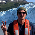
Sam Candio
Seascape Alaska 5, Expedition Coordinator, NOAA Ocean Exploration
Sam Candio is a physical scientist with NOAA Ocean Exploration. He splits his time between conducting field operations aboard NOAA Ship Okeanos Explorer as an expedition coordinator/mapping lead and conducting shoreside responsibilities at the University of New Hampshire Center for Coastal and Ocean Mapping/Joint Hydrographic Center, including mission planning, data quality control, and data archiving. Sam received a bachelor’s degree in marine biology from the University of North Carolina, Wilmington (UNCW), with minors in environmental science and oceanography, and an associate degree in marine technology from Cape Fear Community College. Following graduation, he worked as an instructor for UNCW's MarineQuest, leading a suite of marine science experiential learning programs ranging from the generation of biodiesel from algae to the operation of side-scan sonars and remotely operated vehicles. Prior to signing on with NOAA Ocean Exploration, Sam spent four years aboard NOAA Ship Fairweather, serving as the chief hydrographic survey technician leading coastal bathymetric surveys in areas ranging from the Alaskan Arctic to California’s Channel Islands.

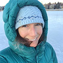
Shannon Hoy
Seascape Alaska 3, Expedition Coordinator, NOAA Ocean Exploration
Shannon Hoy is the Expedition Coordinator Team Lead with NOAA Ocean Exploration. She has always had a love of the ocean and started going to sea as an undergraduate on numerous seafloor mapping missions. On two of these expeditions, she was a NOAA Ocean Exploration explorer-in-training on NOAA Ship Okeanos Explorer! Now she leads field expeditions aboard Okeanos Explorer using a variety of tools such as multibeam sonars and remotely operated vehicles to map and explore remote and/or poorly understood areas of our ocean. When not in the field, she focuses on improving NOAA Ocean Exploration's operational efficiency and effectiveness and works to improve the pace and quality of ocean mapping as an active participant in the global mapping community. Her specialty is in deepwater ocean mapping and she received a master’s degree in Earth Sciences: Ocean Mapping from the University of New Hampshire.
Jennifer Aschoff
Seascape Alaska 3, Science Co-Lead (Geology), University of Alaska, Anchorage
Jennifer Aschoff is an Associate Professor in Geological Sciences at the University of Alaska, Anchorage, where she currently serves as the department chair. She has lived in the Anchorage area for nearly 10 years and is passionate about the complex geology and landscape of Alaska. Jennifer holds a Ph.D. in geology from the University of Texas at Austin, an M.S. in geological sciences from New Mexico State University, and a B.S. in Earth sciences from Montana State University. Her research interests are broadly focused in the areas of sedimentology, stratigraphy, and the interaction of tectonics and sedimentation. She has several current research projects that include Alaska’s North Slope and Rocky Mountains, aimed at interpreting the geologic evolution of these areas. Through her research, Jennifer has spent the last approximately 20 years interpreting ancient landscapes recorded in sedimentary rocks, including marine environments. She is excited to deepen her perspective of marine sedimentary processes and collaborate with a broad range of scientists during the Seascape Alaska expedition. In her free time, she enjoys climbing, skiing and exploring the coastlines of Alaska.
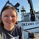
Rhian Waller
Seascape Alaska 3, Science Co-Lead (Biology), University of Gothenburg, Sweden
Rhian Waller is a senior lecturer (associate professor) of marine sciences at the Tjärnö Marine Laboratory, which is part of the University of Gothenburg in Sweden. She received her bachelor’s degree in marine biology at the University of Wales, Aberystwyth (Great Britain), completed her Ph.D. at the Southampton Oceanography Centre in Southampton (UK), and then moved to the United States for a postdoc at the Woods Hole Oceanographic Institution. After spending 20 years in the United States (a good part of that on research expeditions around the world!), Rhian and her family moved to Sweden in early 2022. Her research is mainly focused on the reproductive ecology of deep-sea organisms, primarily cold-water corals, and how this important process is affected by environmental change (natural and human caused). A large part of her research program looks at where cold-water corals live around the globe (biogeography), so that her research group can start to hypothesize larval transport linkages and what is possible given a species’ reproductive potential. Rhian has worked all over the globe and currently has projects in Alaska, Patagonia, Antarctica, Sweden, and the North Atlantic basin. In her spare time, Rhian spends most of her time outside with her two boys, husband, and corgi Atlas, biking, hiking and camping, as well as learning Swedish. Jag är glad över att gå med på denna forskningskryssning och upptäcka nya organismer i Alaska!
NOAA Ocean Exploration Background Information
- NOAA Ocean Exploration is dedicated to exploring the unknown ocean, unlocking its potential through scientific discovery, technological advancements, and data delivery. We are leading national efforts to fill gaps in our basic understanding of the marine environment, providing critical ocean data, information, and awareness needed to strengthen the economy, health, and security of the United States and the world. In 2021, we celebrated our 20th anniversary of deep-ocean exploration.
- NOAA Ocean Exploration’s work supports the National Strategy for Mapping, Exploring, and Characterizing the United States Exclusive Economic Zone, which calls for coordinating interagency mapping and exploration activities for the U.S. Exclusive Economic Zone (EEZ), developing new and emerging science and mapping technologies, building public and private partnerships, and completing mapping of the deep water of the U.S. EEZ by 2030 and the near shore by 2040.
- NOAA Ocean Exploration owns the mission equipment being used during the expedition and is coordinating the mission on NOAA Ship Okeanos Explorer. The ship is operated by the NOAA Commissioned Officer Corps and civilians as part of NOAA's fleet managed by the NOAA Office of Marine and Aviation Operations and the remotely operated vehicles are operated in partnership with the Global Foundation for Ocean Exploration.
- Unlike many other ocean expeditions supported by NOAA, most of the scientists participating in expeditions on Okeanos Explorer remain on shore, thanks to telepresence technology. This technology includes a high-bandwidth satellite connection that enables the transmission of data and video to shore in real time, allowing scientists to participate in the expedition from anywhere in the world.
- Anyone with an internet connection can follow the expedition — LIVE. The same technology that allows scientists around the world to participate in the expedition from shore also enables interested members of the public to experience deep-sea exploration, the wonder of discovery, and the fascination of science in real time through the internet.
- Data collected during expeditions on Okeanos Explorer are quality assured and then made quickly available to scientists and the public. This data collection serves as a unique and centralized national resource of critical ocean information for scientists and resource managers to plan future research, make management decisions, detect natural hazards, improve nautical charts, and more.
Media Contact Information
Emily Crum
Communications Specialist
Email Address: ocean-explore-comms@noaa.gov
Keeley Belva
Public Affairs Officer
Email Address: keeley.belva@noaa.gov