Seascape Alaska 1: Aleutians Deepwater Mapping
(EX2302)
Live From the Field: Updates from Logan
Join Logan Kline, 2023 John A. Knauss marine policy and science communication fellow with NOAA Ocean Exploration, on her adventures at sea during the Seascape Alaska 1: Aleutians Deepwater Mapping expedition. You can follow her chronicles below or on Facebook, Twitter, and Instagram.
Explorers-in-Training

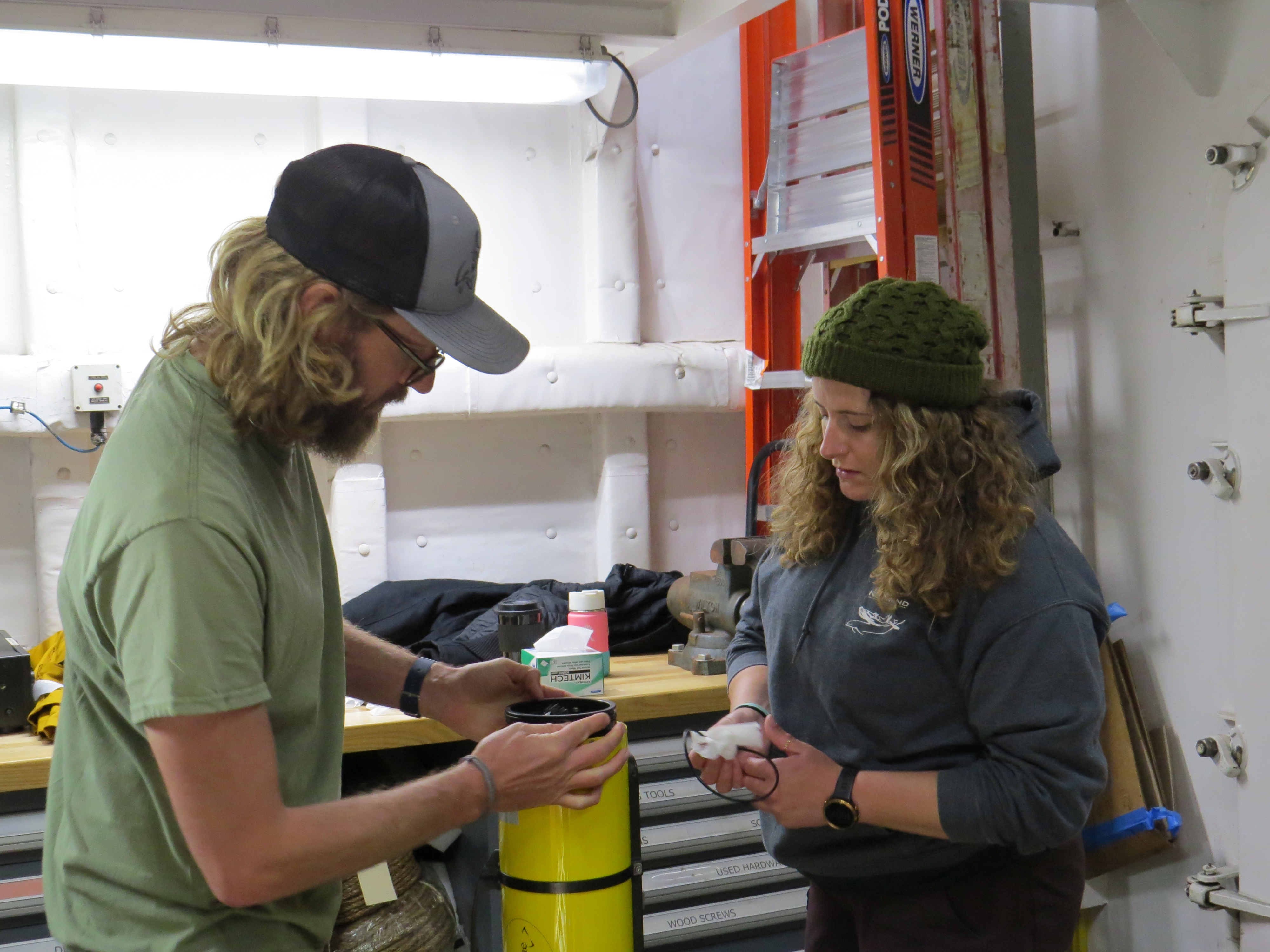
One of the exciting aspects of taking part in a NOAA Ocean Exploration expedition is the spectrum of experience across the team onboard NOAA Ship Okeanos Explorer. We range from seasoned mariners and scientists on their twentieth expedition to first-time flyers – er, sailers – like myself, some of whom have never slept on a ship. I love to hear the stories about previous expeditions from folks who have been out before, but equally as fun is talking to our explorers-in-training (EiTs).
Through the EiT program, a collaboration between NOAA Ocean Exploration and Cooperative Programs for the Advancement of Earth System Science at the University Corporation of Atmospheric Research, we host the next generation of ocean explorers in paid onshore and offshore internship opportunities. For this Seascape Alaska 1: Aleutians Deepwater Mapping expedition, three EiTs – Cameron Kuhle, Dana Carris, and Brett Woodworth – joined the mapping watch team. The three vary in their backgrounds (they have interests in remote sensing, underwater archaeology, and fish metabolics), but all three wanted to learn about deep-ocean exploration. As mapping watchstanders on this expedition, they’ve learned about and collected data on underwater volcanoes, gas seeps, and the Aleutian Trench.
When I asked them what their favorite aspect of the expedition has been so far, they mentioned the autonomous underwater vehicle survey and beautiful landscapes. I’m a little offended that they didn’t mention either the awesome seabirds or the cool Knauss fellow that they’ve gotten to know, but I suppose I’ll let it slide!
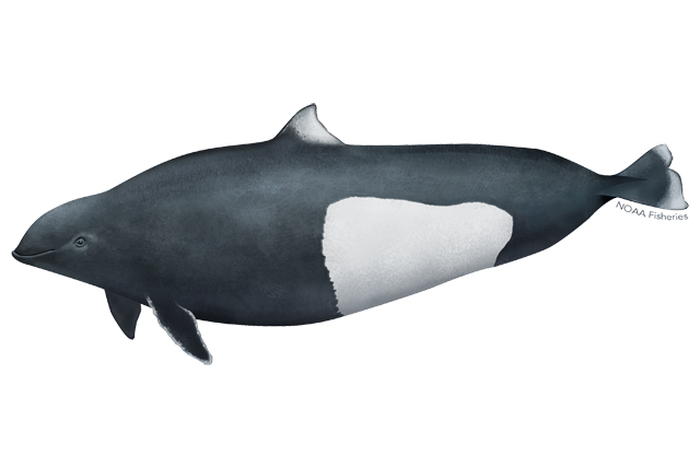
Visited by a Pod of Dall’s Porpoises
As an animal lover (and the expedition’s verified bird nerd), I can often be found staring over the side of NOAA Ship Okeanos Explorer as I try to convince myself that a floating blob of kelp is a humpback whale or that a tinier blob is a cool bird. Sometimes, after gazing into the waves long enough, the moment comes where a blob finally moves, or splashes, or flaps its wings, and a fun new critter materializes out of nowhere.
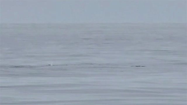
My first sighting of Dall’s porpoises during this expedition came about in a similar way. Absent-mindedly looking out of the mess deck’s porthole, I slowly realized that the whitecaps I thought I was watching were small, black, and doing a whole lot of splashing. I definitely (embarrassingly) yelled "Minke whales!" before taking off to the boat deck to get a better look (minke whales are the smallest baleen whales, but they are nowhere near as tiny as Dall’s porpoises, and they don’t create "rooster tail"-shaped spray when they surface). Once I reached the boat deck, my mistake became very apparent, but I was too excited to care – here was a species I’d never seen before, splashing about 200 meters (656 feet) from the ship!
That brief sighting made my day, and we were visited again during the evening by a smaller pod of porpoises surfacing further out. Seeing marine mammals and seabirds, and sharing my excitement with the rest of the team, has been one of my favorite aspects of this expedition.
Crossing the Antimeridian
Prior to joining this expedition, I had little to no knowledge of ships or their storied traditions. When our expedition coordinator, Sam Cuellar, excitedly told me that we were going to cross the antimeridian and receive certificates for the Domain of the Golden Dragon, my very professional response was, "Huh?" In my defense, I’d just risen from one of many excellent naps on NOAA Ship Okeanos Explorer, and I was still groggy when he shared this tidbit.
After waking myself up with a hearty dinner courtesy of our amazing stewards, I was ready to learn more about this mysterious Domain of the Golden Dragon. It turns out that the unofficial award was adopted from the United States Navy, who bestowed the honor upon crew members of ships that had crossed the International Date Line (IDL), which mostly follows the antimeridian.
This is one of several unofficial awards that crews can earn on their travels. My personal favorite, which the Okeanos Explorer crew received in 2017, is the Royal Order of Purple Porpoises, awarded to personnel who cross the junction of the equator and the IDL during the vernal equinox.
As of 20:54 UTC on May 21, 2023, we crossed the antimeridian and hopped into the future and the Domain of the Golden Dragon! I’m eagerly awaiting my certificate in the mail.
Bathymetry Data
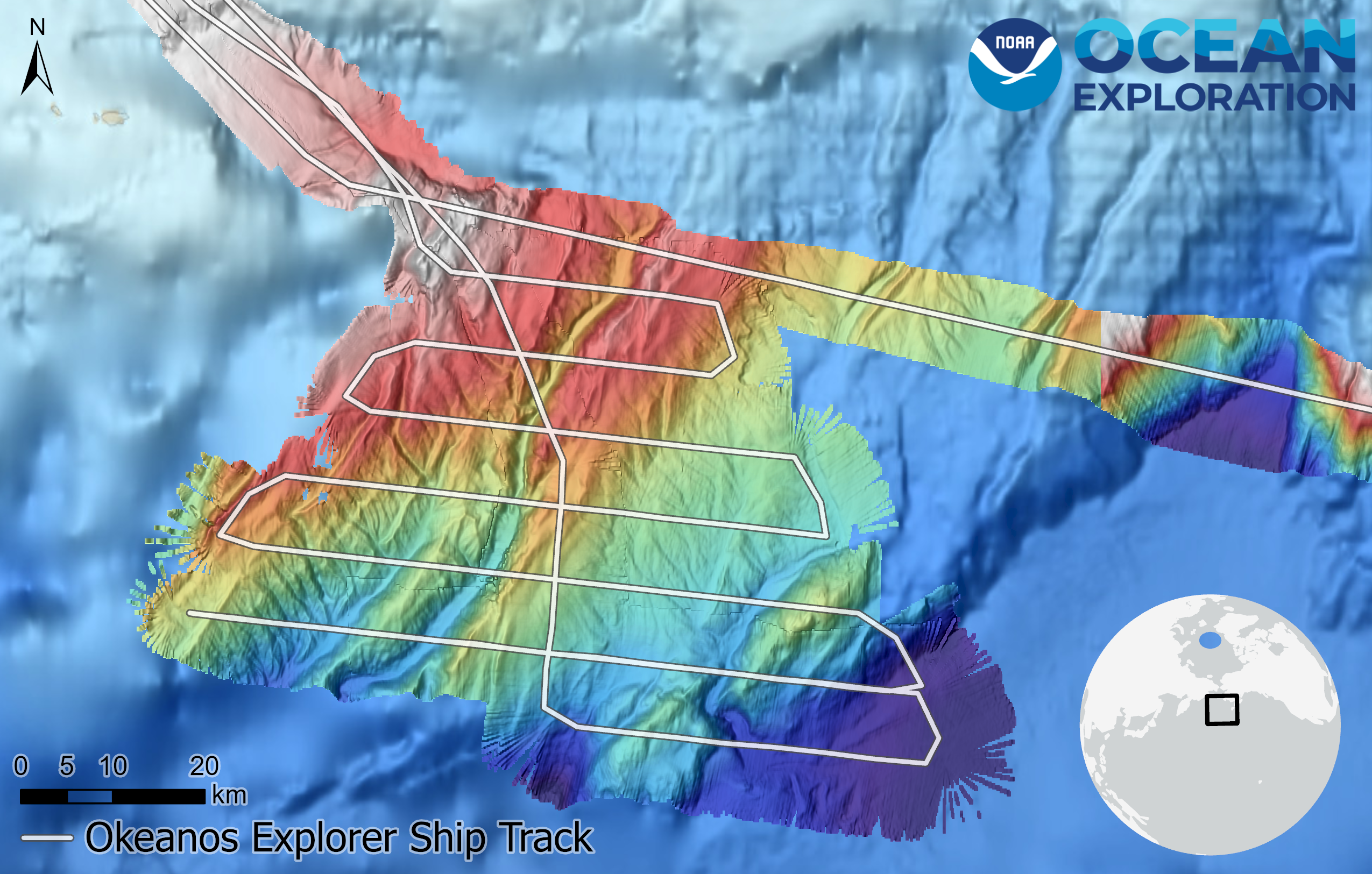
On my last update, I wrote about lawnmower transects and how we were collecting new bathymetry data in an unmapped subsection of the Aleutian Trench. In this map, you can see the new bathymetric data with the lawnmower transects overlaid.
While NOAA Ship Okeanos Explorer went back and forth through the ocean, our multibeam sonar sent sound energy to the seafloor. We can calculate the depth of the ocean bottom based on how long it takes for those pulses to return to the ship, then use those calculations to generate high-resolution maps of the seafloor. High-resolution data is imperative in ocean mapping as it improves our ability to recognize navigational hazards, such as seamounts, and unique geological characteristics. Now that we’ve collected data on this subsection of the Aleutian Trench, who knows what scientists could discover?!
Tracks Showing a Lawnmower Pattern
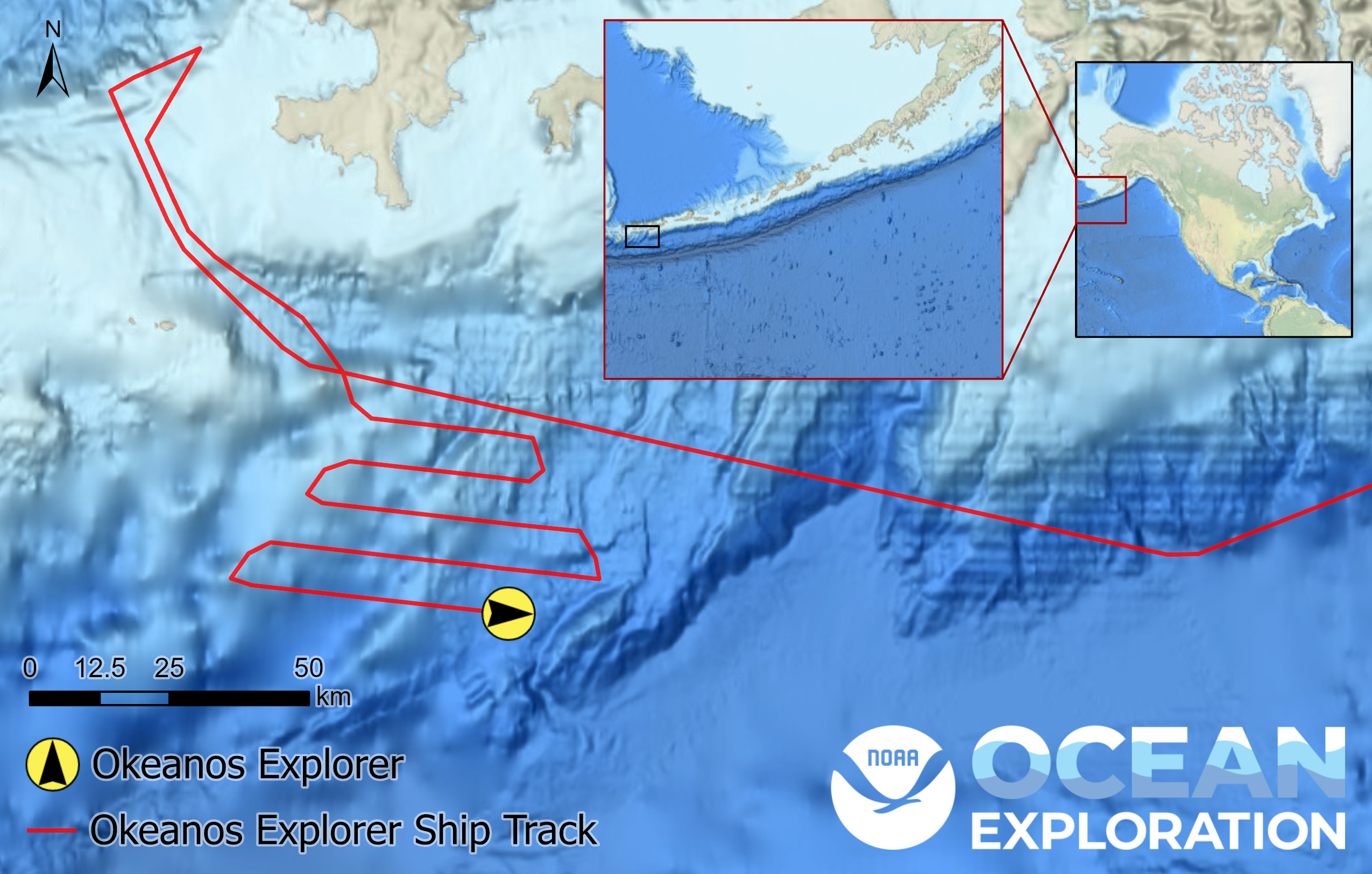
If you’ve been following NOAA Ship Okeanos Explorer on our live operations map (and if you haven’t been, start now!), you may have noticed a peculiar change in the ship’s tracklines over the past day. Whereas our transit up to the Aleutian Islands was mostly in straight lines, we’ve begun mapping back and forth over a previously unmapped subsection of the Aleutian Trench. This back-and-forth pattern is known as a lawnmower transect, and it’s a common mapping technique for collecting high-resolution data.
To prepare for a lawnmower transect, mapping watchstanders set the multibeam sonar to pulse sound energy across a specified swath, or the area acoustically imaged by the sonar. In the case of this subsection, the multibeam swath was set to cover 5 kilometers and a 30% overlap between tracklines ensured full coverage of the seafloor. Okeanos Explorer then conducted the lawnmower transects, during which we onboard clung to railings whenever we turned and waves hit us perpendicularly!
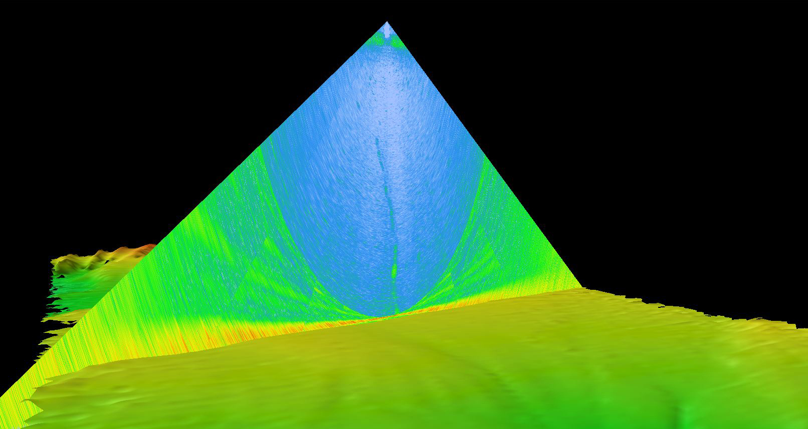
A Noodly Line
Not long after we traversed over the Aleutian Trench, I heard whispers about an exciting find in the multibeam sonar data that our mapping team is continuously collecting and monitoring. While processing data, our mapping watchstanders noticed a noodly line emerging from the seafloor about 2,300 meters (7,545 feet) under the surface and extending upwards through the water column. We know from previous expeditions that ground-truthed mapping data with remotely operated vehicle dives that the noodly line was actually created by our multibeam sonar sound pulses bouncing off bubbles close to the seafloor. Bubbles are indicative of gasses seeping up through the seafloor, and indeed, we had found ourselves a gas seep! As of this writing, we’ve found at least three gas seeps that were previously unmapped. Go science!
World Migratory Bird Day
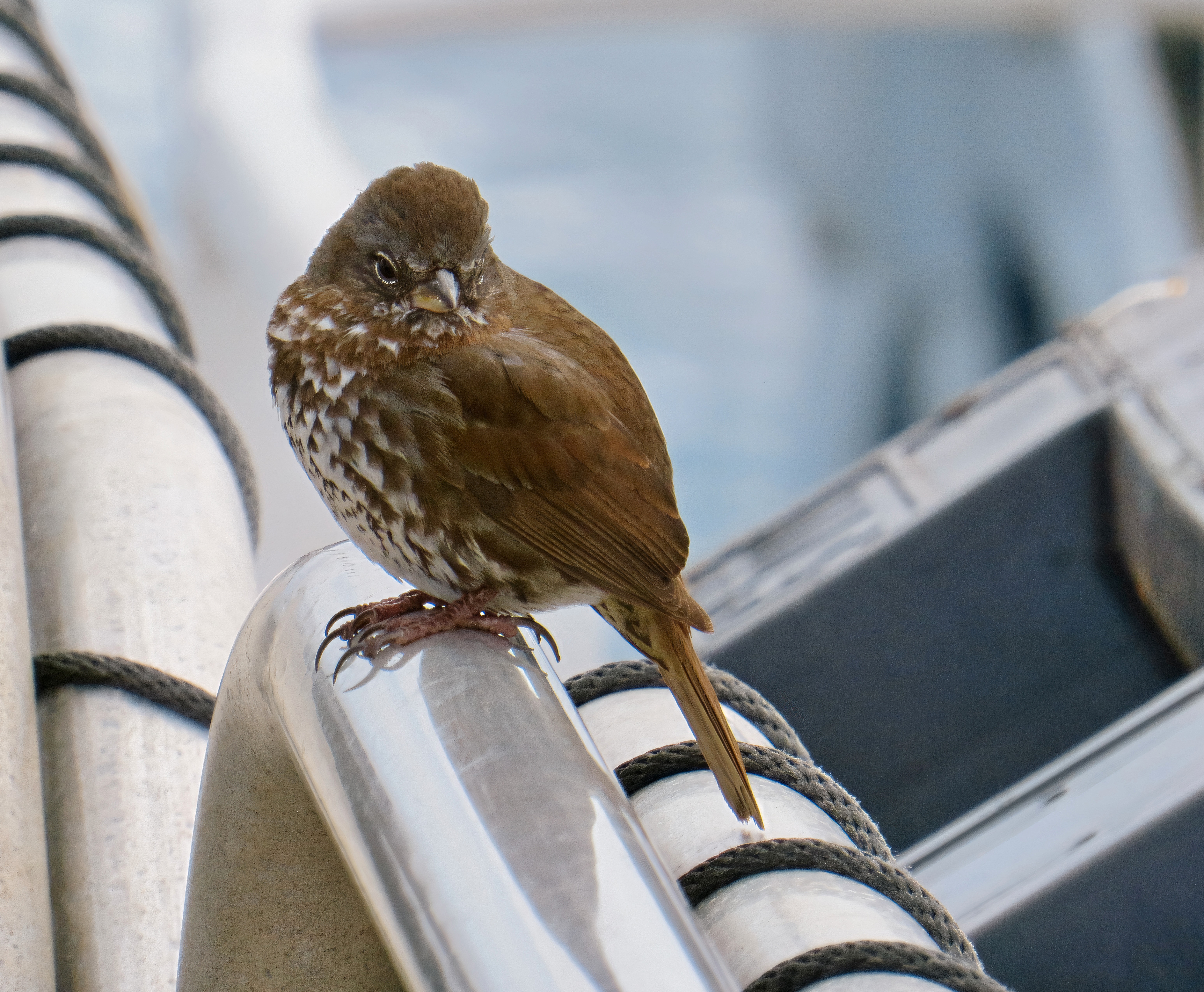
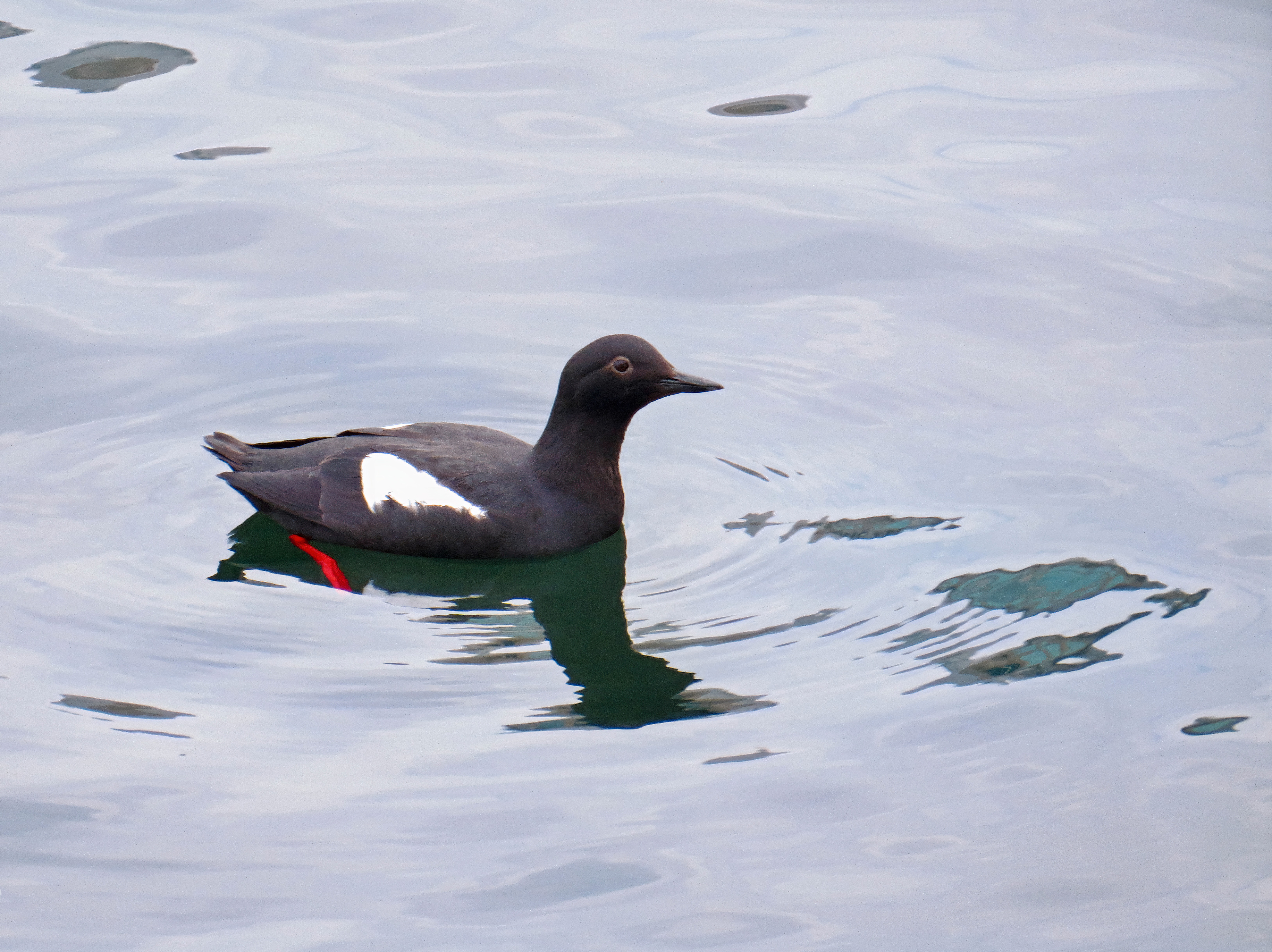
Today is World Migratory Bird Day! On this day, people across the globe celebrate migratory birds and shine a spotlight on their conservation needs. As a self-proclaimed bird nerd, any cause for celebrating tiny winged dinosaurs is a great one. I’ve spent time out on the deck of Okeanos Explorer photographing amazing seabirds like guillemots and shearwaters (I finally got a picture of a Laysan albatross!), but the bird that surprised me the most was a quietly chirping fox sparrow that hitched a ride on the ship.
Migratory birds that have traveled a long distance or have been blown off course by strong winds will occasionally perch on ships in the ocean to regain energy. Forest-dwelling birds like fox sparrows can’t stay for too long without a source of freshwater or a healthy supply of insects and seeds, so it was bittersweet when our passenger took off for greener lands. Hopefully, our bird friend has made it to the forests of British Columbia, where it might mate up, build a nest, and raise a whole new generation of migratory fox sparrows who can visit scientists on ships.
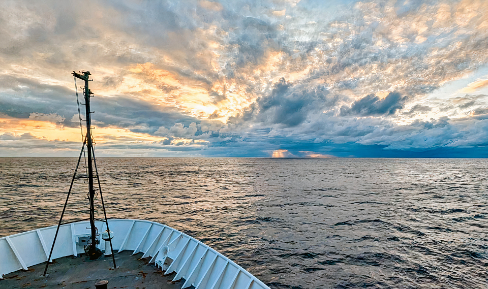
Aleutian Trench

Woohoo, we’ve reached the Aleutian Trench! All morning in the mapping room we’ve watched depth readings slowly increase as we neared the point where we’d be officially traversing over the trench. Personally, I’m excited to try and spot the breadth of wildlife that can be spotted in these waters: beaked whales, albatross, humpback whales, shearwaters… When I’m not seasick or hanging out with the mapping team, you can probably spot me on one of our livestream cameras as I dash back and forth to see new critters!
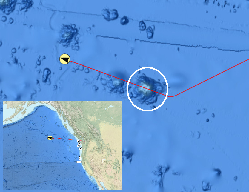
Collaboration in Action
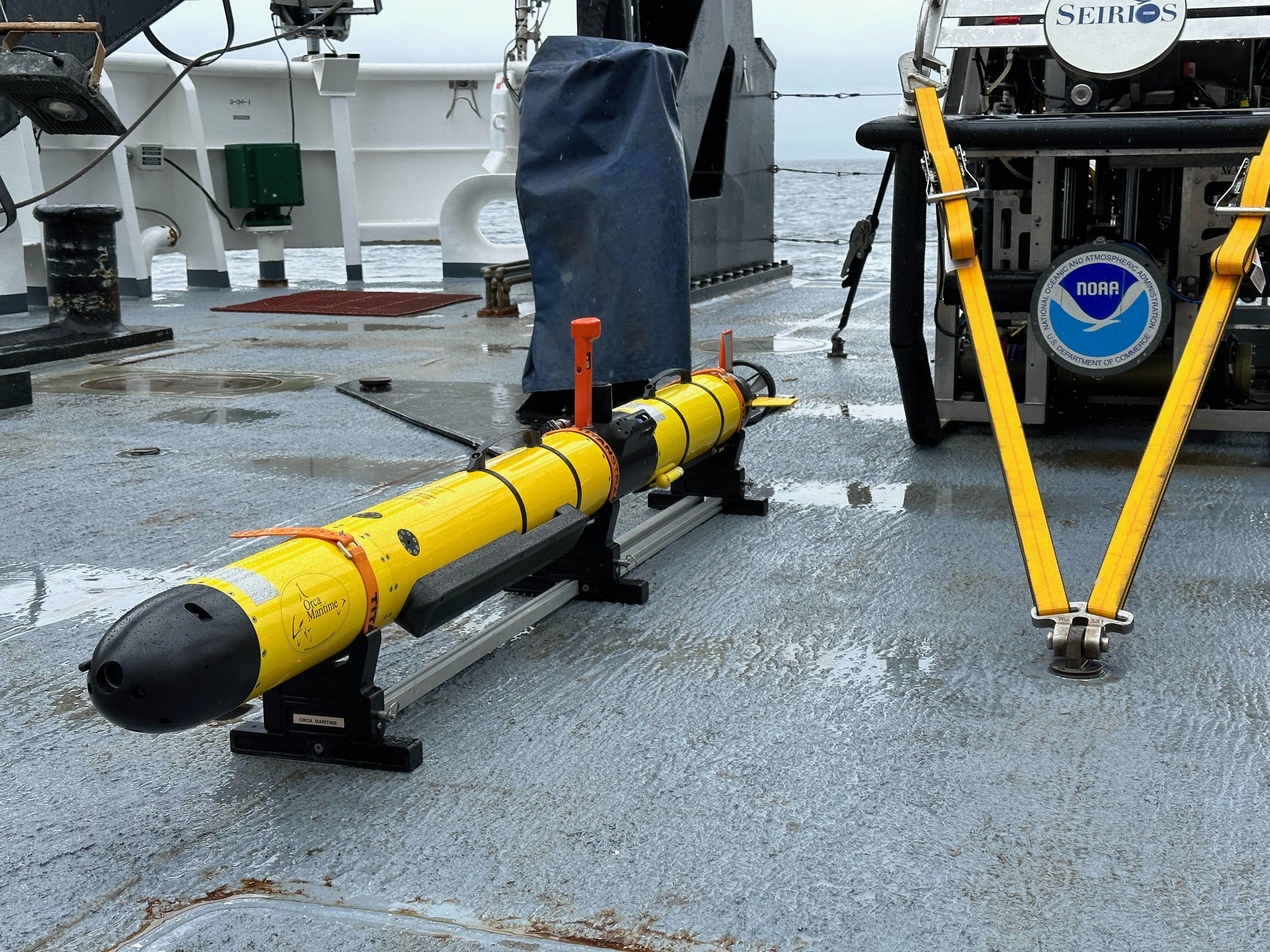
The Seascape Alaska 1: Aleutians Deepwater Mapping expedition will be unique in part due to a collaboration between NOAA and the Defense POW/MIA Accounting Agency (DPAA), whose mission includes "[providing] the fullest possible accounting for [United States] missing personnel to their families and the nation." Collaborative and interdisciplinary work has always been a top priority of mine, and I’m excited to see NOAA and DPAA partnering to locate a World War II-era B-25 bomber aircraft that was lost in 1944. Whether or not the plane is located, I’m looking forward to seeing this collaboration in action and learning from the data collected using the Iver3 autonomous underwater vehicle.
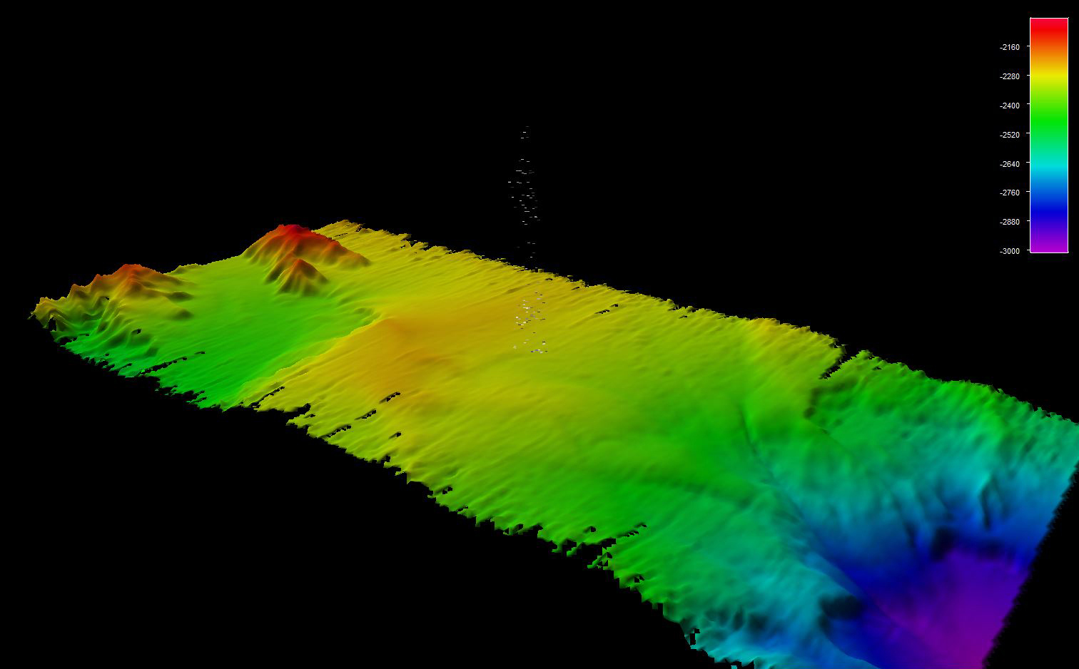
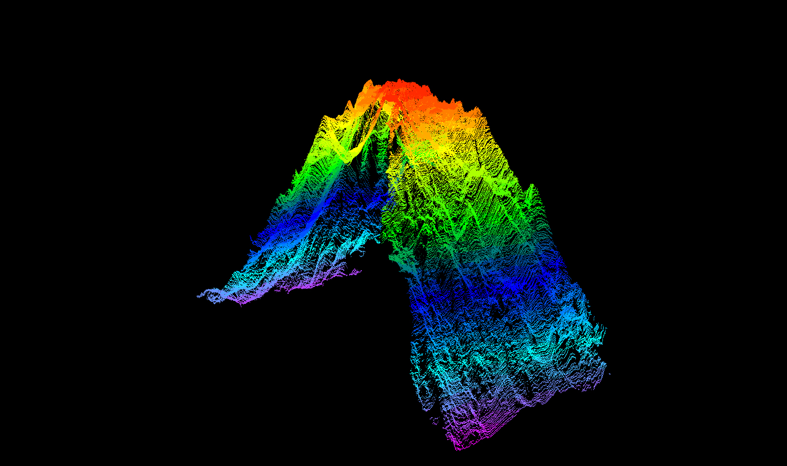
Sea-legs and a Massive Seamount
I’ve emerged from two days battling seasickness as we roll through the northeastern Pacific Ocean! My sea-legs manifested just in time to learn about the massive seamount we spent the morning of May 8 mapping. Before our multibeam sonars pinged the seafloor here, the peak of the seamount was recorded at around 1,592 meters (5,223 feet) under the surface on older NOAA nautical charts. Now that we’ve collected more data, we know that the peak on this seamount exists at around 895 meters (2,936 feet) below the surface. This suggests that the seamount is nearly double the height of what is recorded on the nautical chart. Part of the fun of mapping the seafloor is learning new information that changes or improves our understanding of the ocean and its vast habitats!

Published May 11, 2023
Updated May 25, 2023