Windows to the Deep 2021: Southeast U.S. ROV and Mapping
October 26 - November 15, 2021
Media Resources
This page provides members of the media with information, resources, and multimedia developed in association with the Windows to the Deep 2021: Southeast U.S. ROV and Mapping expedition.
Importance | Goals | Partners | Explorers | Videos & Images | Background Information | Contacts
From October 26 to November 15, 2021, NOAA Ocean Exploration and partners will conduct a telepresence-enabled ocean exploration expedition on NOAA Ship Okeanos Explorer to collect critical baseline information in deep water on and around the Blake Plateau off the Southeast United States. The expedition will expand on previous NOAA Ocean Exploration expeditions to explore this region conducted in 2018, summer 2019, and fall 2019. The expedition will begin in Charleston, South Carolina, and end in Port Canaveral, Florida.
Windows to the Deep 2021 will include both mapping and remotely operated vehicle (ROV) operations, with video from ROV dives streamed online in real time from approximately 8:30 a.m. to 4:00 p.m. ET each day between October 27 and November 14. Dive sites are expected to include deep-sea coral and sponge habitats, midwater habitats, biogenic mounds, unique geologic features, and other poorly understood deepwater habitats.
Expedition Importance
The U.S. East Coast is home to millions of Americans and is experiencing some of the highest population growth rates in the United States, yet what lies in offshore waters, particularly deep waters, off the coasts of Florida, Georgia, and South Carolina remains largely unknown.
Prior seafloor mapping and exploration suggests that portions of the Blake Plateau are covered with mound features. How extensive are these features? How were they formed? Are they important habitats for marine life? If so, which organisms? Moving upward, what lives in the water column in this region? Is there a connection between animals on different parts of the seafloor? Are they connected to animals in the water column? Scientists hope to begin to reveal answers to some of these questions over the course of the expedition, thereby helping us to identify, understand, protect, and manage sensitive marine life and habitats, geological features, and potential resources.
Four Key Things to Know About the Expedition
- Throughout this expedition, we will use the advanced sonar systems on NOAA Ship Okeanos Explorer to fill critical gaps in mapping data on and around the Blake Plateau off the Southeast United States. As a whole, the ocean covers 70% of our planet’s surface, yet only 20% of the global seafloor has been mapped with modern high-resolution technology. The collection of high-resolution mapping data, including seafloor, sub-bottom, and water column data, is the first step in exploring and thus understanding our ocean. Data collected during this expedition will help further inform expedition dive targets and guide future exploration efforts; help to establish a baseline assessment of the ocean environment; increase understanding of marine life and habitats to inform management decisions; and increase public awareness of ocean issues. Collected data will also support the national goal of mapping all waters within the U.S. Exclusive Economic Zone (EEZ) deeper than 40 meters (131 feet) by 2030 and fill mapping data gaps in support of Seabed 2030 efforts to generate a complete world seafloor map by 2030.
- This expedition will yield data to help scientists understand the diversity and extent of deep-sea coral and sponge communities off the Southeast U.S. coast, which represent some of the most valuable marine ecosystems on the planet, creating structures that provide shelter, food, and nursery habitat to other invertebrates and fish. A better understanding of how populations of coral, sponge, fish, and other deep-sea species are related across geographically separated locales (a concept known as connectivity) can offer insight into the resiliency of those populations. This is important for predicting the impacts of human activities on coral communities and for developing solid plans for their protection.
- During this expedition, we will conduct exploration of the water column, increasing our understanding of the animals living in this large and underexplored habitat that plays a key role in making our planet hospitable. The water column, which includes all of the water in the ocean between the surface and the seafloor, supports a huge biomass that plays an important role in global carbon and other biogeochemical cycles. By cycling carbon in the ocean and preventing its immediate return to the atmosphere, animals within the water column contribute to the storage of large volumes of carbon in the ocean annually, which in turn helps to regulate our climate. Yet despite the fact that it makes up over 95% of the total livable volume on the planet and plays a critical role in making our planet livable, the water column remains one of the most poorly explored environments on Earth.
- Through this expedition, we will acquire data to inform priority science and management needs. Deep-sea coral and sponge communities like those we will explore during this expedition create vital habitats that rival those of their shallow water counterparts in diversity. Not only are these communities beautiful and diverse, they also provide nursery habitat for several commercially important fish species, like alfonsino and wreckfish, as well as other invertebrates. Understanding the dynamics and distributions of these valuable habitats is key to sustainable resource management and maintaining their biodiversity, but we can’t adequately manage or protect resources that we don’t know exist or that we don’t understand. Deep-sea exploration is the first step towards increasing our understanding about these wonderful and diverse habitats.
Expedition Goals
The Windows to the Deep 2021: Southeast U.S. ROV and Mapping expedition will address science themes and priority areas put forward by scientists and managers from NOAA, management agencies in the region, and the ocean science community. NOAA priorities for the expedition include a combination of science, education, outreach, and open data objectives that will support management decisions at multiple levels. Specific expedition goals include:
- Mapping and exploring marine habitats, including deep-sea coral and sponge communities, fish habitats, and biological communities that colonized or aggregate around shipwrecks.
- Investigating the geology of the Southeast U.S. continental margin.
- Acquiring a foundation of ROV, sonar, and oceanographic data to better understand the characteristics of the water column and animals that live there.
- Extending seafloor mapping coverage in the U.S. EEZ in support of Seabed 2030 and the National Strategy for Mapping, Exploring, and Characterizing the United States Exclusive Economic Zone.
- Engaging a broad spectrum of the scientific community and public in telepresence-based exploration.
- Providing publicly accessible data and information products to spur further exploration, research, and resource management activities.
Additionally, Windows to the Deep 2021 will contribute to NOAA’s Atlantic Seafloor Partnership for Integrated Research and Exploration (ASPIRE), a major multiyear, multinational collaborative field program focused on raising collective knowledge and understanding of the North Atlantic.
Expedition Partners
The expedition involves a number of NOAA partners including the Office of Marine and Aviation Operations; NOAA Fisheries’ Office of Habitat Conservation, Deep Sea Coral and Research and Technology Program, and Southeast Fisheries Science Center; NOAA Satellite’s National Centers for Environmental Information; and NOAA Research's NOAA Ocean Exploration. Other partners include the South Atlantic Fisheries Management Council, Bureau of Ocean Energy Management, U.S. Geological Survey, and Smithsonian National Museum of Natural History.
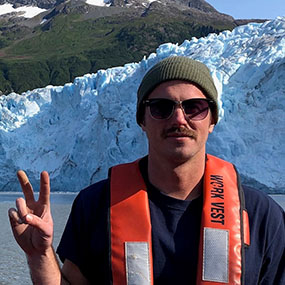
Explorers
The individuals listed below are the primary leads for the expedition. They coordinate input from multiple scientists and managers participating from shore to plan dives, are several of the voices you hear on the live video feeds, and are the primary participants in outreach events. For a full list of members of the team, visit the Exploration Team page.
Allen Collins
Science Co-Lead (Biology), NOAA Fisheries National Systematics Laboratory and Smithsonian National Museum of Natural History
With an undergraduate degree in mathematics and economics (Amherst College), Allen Collins began studying biology in earnest after a five-year career in economic consulting. A night course on the history of earth broadened his horizons and set him on a path toward pursuit of a doctorate studying the early evolution of animals. After receiving his doctorate from the University of California Berkeley, he held a few postdoctoral positions before joining NOAA as a research zoologist and the Smithsonian National Museum of Natural History as a curator in late 2004. An expert on jellyfish and other relatively simple animals, he has published about 130 collaborative papers, focusing on evolution and systematics. He supports museum-based marine science by hosting interns, mentoring students, participating in outreach, and providing tours of collections to as many individuals as possible. Allen has worked with samples collected by NOAA Ocean Exploration in the past, describing two species new to science based on these collections. This is his first opportunity to sail on NOAA Ship Okeanos Explorer.
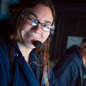
Stephanie Farrington
Science Co-Lead (Biology), Harbor Branch Oceanographic Institute at Florida Atlantic University
Stephanie Farrington is a biological research specialist at Harbor Branch Oceanographic Institute, Florida Atlantic University (HBOI-FAU). She has a bachelor’s degree in marine science and biology from the University of Tampa and a master’s in marine biology from what is now Nova Southeastern University’s Halmos College of Natural Sciences and Oceanography (NSU-HCAS). While at NSU-HCAS, she studied the biogeography of the Straits of Florida to complete a comprehensive study of the deep-sea animals of the region. At HBOI-FAU, she manages and analyzes deep-sea data using her self-created Microsoft Access database. Stephanie has participated in more than 25 expeditions using remotely operated vehicles and human-occupied vehicles. She has almost 18 years of experience identifying and studying deep-sea and mesophotic invertebrates in the western Atlantic, Straits of Florida, Gulf of Mexico, and Cuba. Stephanie sailed with NOAA Ship Okeanos Explorer in 2012, assisting with nighttime multibeam mapping, and as the biology science lead during 2014’s Exploration of the Gulf of Mexico 2014 expedition and the 2019 Southeastern U.S. Deep-Sea Exploration. She has co-authored over 94 reports, publications, presentations, posters, and marine protected area and habitat area of particular concern creations or extensions for the South Atlantic and Gulf of Mexico fishery management councils.
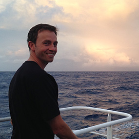
Matt Dornback
Expedition Coordinator, NOAA Ocean Exploration
Matt Dornback has worked for NOAA since 2011, applying his background in marine science and data science on projects related to deep-sea coral, harmful algal blooms, and oceanography. Matt sailed on NOAA Ship Okeanos Explorer as a sample data manager in 2015, 2016, and 2017 and as expedition coordinator in training for the 2021 ROV Technology Demonstration. He is always interested in adapting new technologies to aid in ocean exploration and is currently working on projects for cloud-based annotation of the biology and geology seen during dives and to harness artificial intelligence for work at sea. He holds a master’s degree in biological oceanography from the University of Southern Mississippi and a bachelor’s degree in marine biology from the University of North Carolina Wilmington.
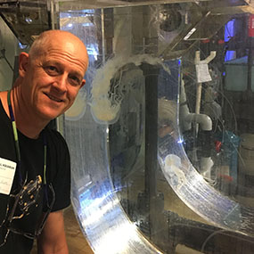
Derek Sowers
Mapping Lead, NOAA Ocean Exploration
Derek Sowers has worked as an expedition coordinator and mapping lead for NOAA Ocean Exploration for the past eight years. He completed a bachelor’s degree in environmental science from the University of New Hampshire, a master’s in marine resource management from Oregon State University, and a doctorate in oceanography from the University of New Hampshire. He has 16 years of previous experience working for NOAA's National Estuarine Research Reserve network and the Environmental Protection Agency’s National Estuary Program in both Oregon and New Hampshire. Derek has participated in oceanographic expeditions spanning remote areas of the Arctic, Pacific, and Atlantic oceans. When not at sea, Derek works at the Center for Coastal and Ocean Mapping/Joint Hydrographic Center at the University of New Hampshire.
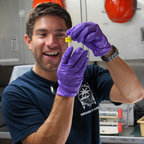
Sam Candio
Mapping Lead, NOAA Ocean Exploration
Sam Candio is a physical scientist with NOAA Ocean Exploration. He splits his time between conducting field operations aboard NOAA Ship Okeanos Explorer as an expedition coordinator/mapping lead and conducting shoreside responsibilities at the University of New Hampshire Center for Coastal and Ocean Mapping/Joint Hydrographic Center, including mission planning, data quality control, and data archiving. Sam received a bachelor’s degree in marine biology from the University of North Carolina, Wilmington (UNCW), with minors in environmental science and oceanography, and an associate degree in marine technology from Cape Fear Community College. Following graduation, he worked as an instructor for UNCW's MarineQuest, leading a suite of marine science experiential learning programs ranging from the generation of biodiesel from algae to the operation of side-scan sonars and remotely operated vehicles. Prior to signing on with NOAA Ocean Exploration, Sam spent four years aboard NOAA Ship Fairweather, serving as the chief hydrographic survey technician leading coastal bathymetric surveys in areas ranging from the Alaskan Arctic to California’s Channel Islands.
Videos and Images
Dive highlight videos, short video clips, and photos will be posted online in the expedition gallery as they become available.
Images and video collected during Windows to the Deep 2021 are in the public domain, meaning they are free to use without restrictions or additional permissions, provided that the credit information listed in the caption associated with each image or video is included. If space is limited, please credit NOAA Ocean Exploration (preferred) or NOAA.
Bigfin Squid: Genus Magnapinna
On November 9, 2021, during Dive 10 of Windows to the Deep 2021, NOAA Ocean Exploration captured remarkable footage of an adult bigfin squid, genus Magnapinna.
Please contact Emily Crum for high-resolution footage, b-roll, and other materials posted on the NOAA Ocean Exploration website.
For additional information, please view our online media kit.
NOAA Ocean Exploration Background Information
- NOAA Ocean Exploration is the only federal program dedicated to ocean exploration, making the office uniquely situated to lead partners in delivering critical deep-ocean information to managers, decision makers, scientists, and the public, leveraging federal investments to meet national priorities. In 2021, we are celebrating our 20th anniversary of deep-ocean exploration.
- NOAA Ocean Exploration’s work supports the National Strategy for Mapping, Exploring, and Characterizing the United States Exclusive Economic Zone, which calls for coordinating interagency mapping and exploration activities for the U.S. EEZ, developing new and emerging science and mapping technologies, building public and private partnerships, and completing mapping of the deep water of the U.S. EEZ by 2030 and the near shore by 2040.
- NOAA Ocean Exploration owns the mission equipment being used during the expedition and is coordinating the mission on NOAA Ship Okeanos Explorer. The ship is operated by the NOAA Commissioned Officer Corps and civilians as part of NOAA's fleet managed by the NOAA Office of Marine and Aviation Operations.
- Unlike many other ocean expeditions supported by NOAA, most of the scientists participating in expeditions on Okeanos Explorer remain on shore, thanks to telepresence technology. This technology includes a high-bandwidth satellite connection that enables the transmission of data and video to shore in real time, allowing scientists to participate in the expedition from anywhere in the world.
- Anyone with an internet connection can follow the expedition — LIVE. The same technology that allows scientists around the world to participate in the expedition from shore also enables interested members of the public to experience deep-sea exploration, the wonder of discovery, and the fascination of science in real time through the internet. Multimedia elements and other updates will be added to the website throughout the expedition to keep everyone informed.
- Data collected during expeditions on Okeanos Explorer are quality assured and then made quickly available to scientists and the public. This data collection serves as a unique and centralized national resource of critical ocean information for scientists and resource managers to plan future research, make management decisions, detect natural hazards, improve nautical charts, and more.
Media Contact Information
David Hall
Public Affairs Officer
Email Address: david.l.hall@noaa.gov