- Home
- Expeditions
- 2021 Technology Demonstration
- Media Resources
This page provides members of the media with information, resources, and imagery developed in association with the 2021 Technology Demonstration.
From May 14-27, 2021, NOAA Ocean Exploration will lead an ocean exploration expedition on NOAA Ship Okeanos Explorer to complete field engineering trials for two of Woods Hole Oceanographic Institution’s autonomous underwater vehicles. These vehicles are equipped with a vision-based navigation software system from NASA’s Jet Propulsion Laboratory, similar to the Terrain Relative Navigation used on the Mars Perseverance rover. The expedition will also provide an opportunity to pilot environmental DNA field sampling protocols on Okeanos Explorer. Night operations will focus on mapping previously unmapped priority areas between Port Canaveral, Florida, and Norfolk, Virginia, including the Blake Plateau. This marks the first expedition on a NOAA vessel for the NOAA Ocean Exploration Cooperative Institute.
To learn more about the team participating in the expedition, visit the Meet the Explorers page.
On this page:
Importance | Partners | Videos & Images | Background Info | Contact Info
Expedition Importance
Despite the fact that the ocean covers approximately 70% of Earth’s surface and plays a critical role in supporting life on our planet, from the air we breathe and the food we eat to weather and climate patterns, only a small fraction of our ocean has been explored, and much of that exploration has occurred in shallower waters. Deep reaches of the ocean are places with almost freezing temperatures, corrosive saltwater, limited or no light, and extreme pressures, making them incredibly challenging to reach and explore without the right technology.
The 2021 Technology Demonstration provides an opportunity to test several emerging technologies that will potentially allow us to explore deeper, farther, and faster than previously possible. Data collected with these technologies, when combined with more traditional work happening via sonars and remotely operated vehicles deployed directly from research vessels, will help us fill gaps in our understanding of the deep ocean and enhance our ability to identify, understand, protect, and manage ocean resources for present and future generations.
Five Key Things to Know About the Expedition
- Orpheus and Eurydice autonomous underwater vehicles (AUVs) will provide access to the some of the deepest parts of our world ocean: Orpheus and Eurydice were designed by Woods Hole Oceanographic Institution in collaboration with NASA's Jet Propulsion Laboratory to withstand the pressure in the ocean down to 10,000 meters (6.2 miles) depth, providing access to some of the deepest parts of our ocean, including the hadal zone. These AUVs are small, lightweight, low-cost, deployable from research vessels and ships of opportunity of all sizes, and require minimal specialized technical support. Integration of a vision-based system for estimating relative position developed by NASA’s Jet Propulsion Laboratory, similar to the Terrain Relative Navigation system used on the Mars Perseverance rover, will allow the AUVs to quickly and autonomously sense their locations relative to the seafloor to avoid hazards and recognize seafloor features that may be of scientific interest. Equipped with cameras to survey the seafloor and the potential for customization to meet varying mission objectives, Orpheus and Eurydice can help to answer fundamental questions about what is living in the deepest parts of our ocean.
- The hadal zone is largely unexplored, but could hold clues to understanding our own planet as well other ocean worlds: The hadal zone, which includes everything deeper than 6,000 meters (3.7 miles), is one of the most poorly investigated and mysterious habitats on Earth, meaning there is a lot left there to discover and understand. Now known to support a vast array of life, exploring the hadal zone will help us understand the composition and distribution of animal species in this part of the ocean and how they have evolved to survive under immense cold, pressure, and darkness. While Orpheus and Eurydice will not reach hadal depths during the 2021 Technology Demonstration, this deployment, which is supported by the NOAA Ocean Exploration Cooperative Institute, is an important step in getting the AUVs operational.
- What we learn from ocean exploration could advance space exploration, and vice versa: The extreme environments of Earth’s deep ocean can mimic extreme conditions in space, making our own ocean a good place to test new technologies for space exploration (and vice versa). By examining parallels in ocean and space exploration, we can develop better tools and technologies to study life both on Earth and in space. Pressures at the hadal depths that Orpheus and Eurydice can explore are roughly that which engineers expect to encounter when and if a probe is ever able to penetrate the ice shell of Europa to explore the seafloor of that ocean world.
- eDNA can allow us to identify biodiversity and species composition from a single sample of seawater or sediment: The genetic material shed by organisms into the environment, known as environmental DNA, or eDNA, can be analyzed to establish a baseline of community structure and biodiversity in the marine ecosystem and to detect invasive species, harmful algal blooms, pathogens and parasites, migratory species, cryptic species, endangered species, and more. eDNA techniques are nondestructive and noninvasive and can improve access to hard-to-reach ecosystems like the deep ocean. In addition, they can provide comprehensive and accurate biological data with increased efficiency, resulting in timely public access to information. During the 2021 Technology Demonstration, NOAA Ocean Exploration is partnering with NOAA Fisheries’ Northwest Fisheries Science Center to pilot eDNA field sampling protocols on Okeanos Explorer.
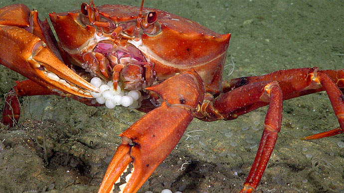
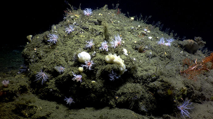
- Mapping operations will extend bathymetric mapping coverage of U.S. waters: Seafloor mapping is the first step in exploring our ocean. Yet despite the fact that the ocean covers 70% of our planet’s surface, less than 20% of the global seafloor has been mapped with modern high-resolution technology. Data collected during this expedition, with an advanced multibeam sonar system on NOAA Ship Okeanos Explorer and the AUVs, will help fill the mapping gaps on the Blake Plateau, which lies offshore of the southeast United States. New mapping data collected in this region in recent years by NOAA Ocean Exploration and partners are transforming scientific understanding of this area and have led to the recent discovery of some of the nation’s most extensive contiguous formations of deep-sea coral reefs.
Expedition Partners
While led by NOAA Ocean Exploration, the expedition involves a number of partners including the NOAA Northwest Fisheries Science Center, Woods Hole Oceanographic Institution , the Ocean Exploration Cooperative Institute, and NASA Jet Propulsion Laboratory.
NOAA Ocean Exploration Background Information
- NOAA Ocean Exploration is the only federal program dedicated to ocean exploration, making the office uniquely situated to lead partners in delivering critical deep-ocean information to managers, decision makers, scientists, and the public, leveraging federal investments to meet national priorities. In 2021, we are celebrating our 20th anniversary of deep-ocean exploration.
- NOAA Ocean Exploration’s work supports the National Strategy for Mapping, Exploring, and Characterizing the United States Exclusive Economic Zone, which calls for coordinating interagency mapping and exploration activities for the U.S. Exclusive Economic Zone (EEZ), developing new and emerging science and mapping technologies, building public and private partnerships, and completing mapping of the deep water of the U.S. EEZ by 2030 and the near shore by 2040.
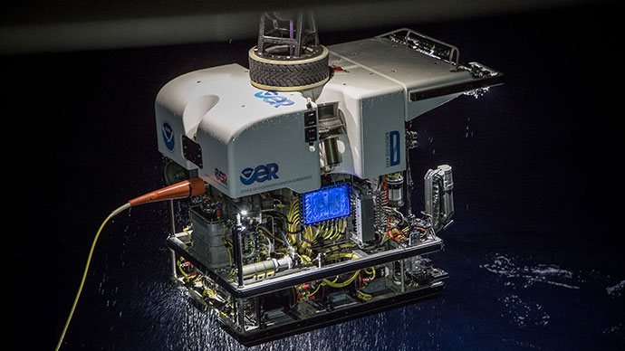
- NOAA Ocean Exploration owns the mission equipment that will be used during the 2021 Technology Demonstration, including a new Kongsberg EM 304 multibeam sonar (one of the first complete EM 304 systems in operation worldwide), Simrad EK60 and EK80 split-beam fisheries sonars, Knudsen 3260 Chirp sub-bottom profiler sonar, and Teledyne acoustic Doppler current profiler for mapping and water column characterization.
- NOAA Ship Okeanos Explorer is operated by the NOAA Commissioned Officer Corps and civilians as part of NOAA's fleet managed by NOAA's Office of Marine and Aviation Operations.
- This marks the first expedition on a NOAA vessel for the NOAA Ocean Exploration Cooperative Institute (OECI). Established in 2019, OECI is a unique consortium of top oceanographic institutions, including the University of Rhode Island, Ocean Exploration Trust, University of New Hampshire, University of Southern Mississippi, and Woods Hole Oceanographic Institution, working together to advance NOAA’s ocean exploration priorities.
- By using telepresence technology, which includes a high-bandwidth satellite connection, NOAA Ocean Exploration enables the transmission of data and video to shore in real time, which lets scientists participate in the expedition from anywhere in the world.
- Data collected during expeditions on NOAA Ship Okeanos Explorer are quality assured and then made quickly available to the scientists and the public. This data collection serves as a unique and centralized national resource of critical ocean information for scientists and resource managers to plan future research, make management decisions, detect natural hazards, improve nautical charts, and more.
Contact Information
NOAA Ocean Exploration
Emily Crum
Communications Specialist
Email Address: emily.crum@noaa.gov
NOAA Office of Marine and Aviation Operations
David Hall
Public Affairs Officer
Email Address: david.l.hall@noaa.gov
Woods Hole Oceanographic Institution
Ken Kostel
Director of Research Communications
Email Address: kkostel@whoi.edu
Suzanne Pelisson
Media Relations
Email Address:
spelisson@whoi.edu
NASA’s Jet Propulsion Laboratory
Ian O’Neill
Media Relations Specialist for Robotics
Office: (978) 281-9175
Email: ian.j.oneill@jpl.nasa.gov