by Mike Brennan, Maritime Archaeologist, SEARCH
June 29, 2019
 1049A. Here a crew member watches one of the lifeboats. Image courtesy of National Archives and Records Administration.")
All of the survivors from the attack on the Bloody Marsh were rescued later in the morning by the Submarine Chaser (SC) 1049A. Here a crew member watches one of the lifeboats. Image courtesy of National Archives and Records Administration. Download larger version (jpg, 269 KB).
Between 1942 and 1943, Germany sent a fleet of U-boats to the shores of the United States to target merchant shipping vessels resupplying Europe. During this time, numerous oil tankers and freighters were sunk, many in deep water, that today have still yet to be located. One of these was SS Bloody Marsh, sunk on July 2, 1943 by U-66.
Bloody Marsh was a T2-SE-A1 oil tanker built in 1943 in Chester, Pennsylvania, by Sun Shipbuilding and Dry Dock Company. It was on its maiden voyage from Houston to New York with a cargo of 106,496 barrels (4,472,832 gallons) of oil. While steaming off the coast of South Carolina, a torpedo from U-66 struck the aft port side, destroying the engine room and killing three of the crew. The rest of the crew and armed guards on the vessel boarded life rafts and escaped. A second torpedo struck the port side amidships and broke the tanker in two, sinking it quickly. U-66 surfaced to view the sinking ship and struck one of the lifeboats, knocking the sailors into the sea before leaving the scene.
Ships like the Bloody Marsh, particularly the oil tankers, pose a potential pollution threat, as 75 years of corrosion in the deep marine environment could cause seams to split and release the oil cargo. NOAA has identified 87 wrecks that pose a potential pollution threat due to the violent nature in which some ships sank and the structural reduction and demolition of those that were navigational hazards [Bloody Marsh is one of the 87].

An archived image of an empty lifeboat from the sinking of the Bloody Marsh in 1943. Image courtesy of National Archives and Records Administration. Download larger version (jpg, 294 KB).
As the first step toward assessing the pollution risk of these shipwrecks is locating them in deep water, I suggested the target for a survey by NOAA Ship Okeanos Explorer last year. Sonar specialist Gary Fabian looked through the mapping data and found a target that was similar in dimensions to the ship (about 500 feet). This year, the target was added to the dive list for the 2019 iteration of the Windows to the Deep expedition. While the target was the right length, the historical accounts of the sinking said Bloody Marsh broke in two from the second torpedo strike as it sank, so we were hesitant to jump to conclusions, as this target appeared to show the ship intact.
Finding shipwrecks in the deep ocean is challenging. Hull-mounted sonars, such as the one on Okeanos Explorer, are far from the seabed, which limits the achievable resolution as depth increases. In 2013, when I was working on Exploration Vessel Nautilus, we tested the ability of the hull-mounted multibeam sonar to detect oil tanker-sized shipwrecks by mapping over the wrecks of Gulfoil and Gulfpenn in the Gulf of Mexico. These 500-foot ships rest at about 500 meters (1,640 feet) of depth and were visible as small bumps on the seabed, so I knew that the size of Bloody Marsh at a similar depth range would be visible, but that smaller shipwrecks or greater depths would pass out of the range of this sonar. Other survey methods for deepwater shipwreck detection include deep tow sonar, as well as Autonomous Underwater Vehicles (AUVs), which can conduct surveys closer to the seabed for higher-resolution mapping.
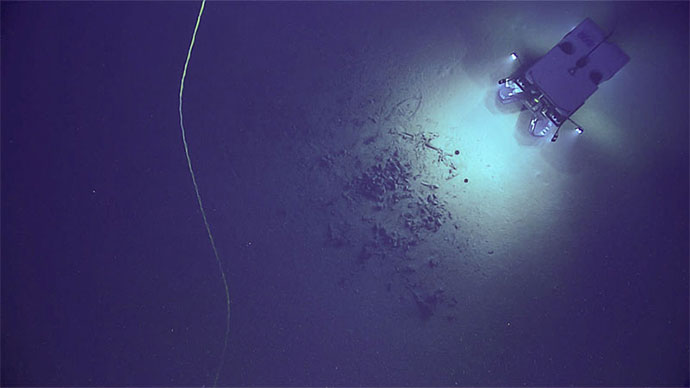
During yesterday's dive, we approached the possible Bloody Marsh target from the south. The seafloor sloped gently upward toward what we discovered was a natural rise of rocky outcrop and carbonate shelves. It was not the site of the Bloody Marsh shipwreck.
While the geologists and biologists on board the Okeanos Explorer and scientists watching the live feed from shore began to characterize and document the features of this mound, the archaeologists on the call began to discuss the next steps for finding Bloody Marsh. This will begin with reviewing more of the backscatter data from the area around the ship’s reported sinking. The wreck of this tanker, as well as others sunk by U-boats in World War II, is important to find and document so we can assess the potential pollution threat from it and make a determination about what oil may remain in the hull and how best to mitigate a potential oil spill.