Date: June 21, 2019
Location: Lat: 28.25046493°, Lon: -79.59834115°
Dive Depth Range: 714 - 805 meters (2,342 - 2,641 feet)
Access Dive Summary and ROV Data
We encountered these chimaeras, originally identified as belonging to the genus Hydrolgaus but later determined to be in the genus Chimaera, during the first dive of Windows to the Deep 2019. Chimaeras also have the perhaps unfortunate common name of "ratfish," as their long, thin tails were thought to resemble that of a rat's; but at least they have beautiful coloration. These fascinating fish almost always steal the show. Video courtesy of the NOAA Office of Ocean Exploration and Research, Windows to the Deep 2019. Download larger version (mp4, 60.4 MB).
Today, the Windows to Deep 2019 expedition marked the first dive Celebrating 100 Exploration Missions Aboard NOAA Ship Okeanos Explorer. This exciting milestone dive began about 60 miles off of Cape Canaveral, Florida, at a site called Canaveral Deep. This site exists at the southern extent of the “Million Mounds” region, within the Stetson Miami Terrace Deep Water Coral Habitat Area of Particular Concern (HAPC).
Canaveral Deep was only recently mapped during the first leg of the Windows to the Deep 2019 expedition, and this dive was the first ever remotely operated vehicle (ROV) dive in the newly mapped area. We chose to explore one of the many mounds with a high probability of hosting deep-sea coral and sponges based on the high-resolution mapping data. In honor of World Hydrography Day today, we'd like to acknowledge the importance of data collected by our mapping team in planning this mission, as hydrographic data is the critical first step to characterizing any site.

The mapping team celebrating World Hydrography Day on board NOAA Ship Okeanos Explorer during the Windows to the Deep 2019 expedition. Image courtesy of the NOAA Office of Ocean Exploration and Research, Windows to the Deep 2019. Download image (jpg, 4.4 MB).
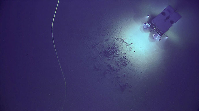
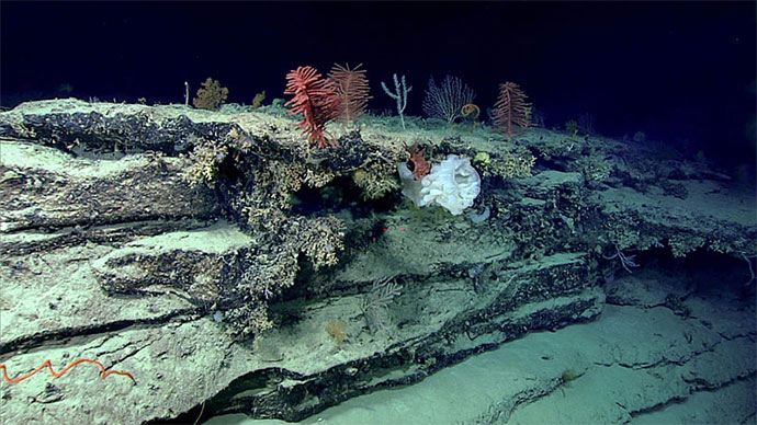
The ROV first touched down to the soft substrate of the seafloor around 805 meters (2,641 feet) and made its way up to the top of the mound at about 714 meters (2,342 feet), seeing a marked change in coral abundance and diversity along the way. The first stretch of the ROV track identified a great deal of dead Lophelia and bamboo coral skeletons, with a significant increase in living coral species as the dive progressed up the lateral mound. These skeletons build up over time, creating the structure of the mounding feature. As we worked our way up, we began to see a greater abundance and diversity of hard corals, octocorals, hydroids, sponges, cutthroat eel, coral hake, and chimera.

Close-up view of Enallopsammia profunda with polyps extended for feeding. Image courtesy of the NOAA Office of Ocean Exploration and Research, Windows to the Deep 2019. Download image (jpg, 967 KB).

This squat lobster was collected using the suction sampler during the first dive of the Windows to the Deep 2019 expedition. Image courtesy of the NOAA Office of Ocean Exploration and Research, Windows to the Deep 2019. Download image (jpg, 3.3 MB).
We collected three coral samples including Lophelia pertusa, a Nephtheid octocoral, and an Isididae octocoral – all with associated fauna. A highlight of the dive was using the new suction sampler on a small squat lobster, potentially an undescribed species. The richness of coral seen on the dive highlighted the relevance of this location as a HAPC.
Scientists were also interested in looking for effects given the site's location within the Gulf Stream and noted several interesting features consistent with high-current environments. Overnight, we will continue collecting important high-resolution mapping data as we move north to the next dive site at the southern portion of the Stetson Mesa.

Location of Dive 01 on June 21, 2019. Download larger version (jpg, 2.2 MB).

The remotely operated vehicle track for Dive 01, shown as an orange line with a white curtain. Scale is water depth in meters. Download larger version (jpg, 1.3 MB).