By Dr. Eric Mittelstaedt - University of Idaho

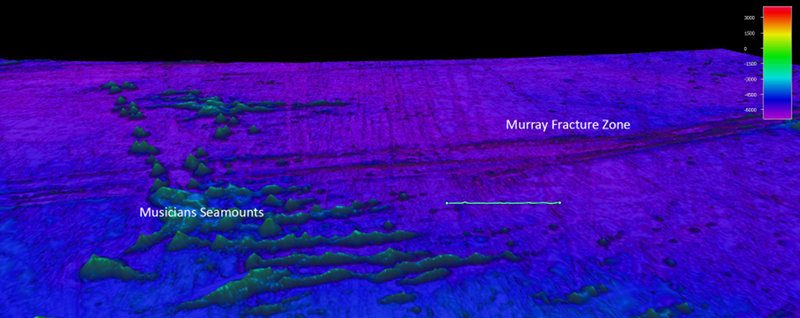
Oblique view of Murray Fracture Zone with 100 nautical mile line drawn for scale. Depths in meters, data from Sandwell and Smith. Vertical exaggeration x6. Image courtesy of the NOAA Office of Ocean Exploration and Research. Download larger version (jpg, 817 KB).
Locations in the Earth’s ocean basins where the tectonic plates spread apart are known as mid-ocean ridges. The shape of mid-ocean ridges is complicated; often two approximately straight sections of the ridge axis are offset from each other by a zone where the plates slide past each other. These zones are known as transform faults and are regions of intense deformation.
This deformation leaves large scars, or fracture zones, on the seafloor that stretch for hundreds to thousands of kilometers across the surface of the tectonic plates. Fracture zones provide a record written in the seafloor of the history of deformation and evolution of transform faults, which in some cases can be quite dramatic. For example, the Murray Fracture Zone splits from one to multiple strands and back again, indicating that the former Murray Transform Fault likely experienced large changes in plate motion that pulled it apart sometime in the past.
The mapping to be undertaken during the Musicians Seamounts Telepresence Mapping expedition will yield a previously unavailable look into part of the evolution of the Murray Transform and its complex history.
In some parts of the oceans, the seafloor is shallower than expected and hosts chains of volcanoes oriented parallel to plate motion at the time of their eruption. These regions, known as hotspots, are commonly thought to be caused by upwelling and partial melting of a column of anomalously warm rock in the Earth’s mantle called a mantle plume.
Plumes that upwell near mid-ocean ridges commonly cause excess volcanism both above the plume upwelling and along the ridge axis. In some locations, however, volcanism is also observed on the seafloor between the plume center and the ridge axis. Typically, this volcanism takes the form of linear ridges or aligned seamounts known as lineaments. The processes controlling formation of such lineaments are unclear; however, the processes are likely closely tied to the dynamics of mantle plumes.
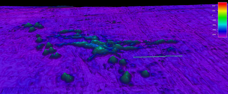
The Musicians Seamounts is one location where such lineaments are known to exist, yet almost no high-resolution mapping or sampling has been performed here. The mapping to be performed during this cruise will reveal important information about the structure of one set of lineaments that extend away from the main line of the Musicians Seamount chain, likely toward a formerly nearby mid-ocean ridge.
The structure and shape of these seamounts will provide clues to the tectonic environment in which they formed and their relationship to the nearby mid-ocean ridge.

Oblique view of focused mapping area of Musicians Seamounts with 100 nautical mile line drawn for scale. Depths in meters, data from Sandwell and Smith. Vertical exaggeration x6. Image courtesy of the NOAA Office of Ocean Exploration and Research. Download larger version (jpg, 89 KB).