By Jonathan Tree, University of Hawaiʻi at Mānoa
March 3, 2016

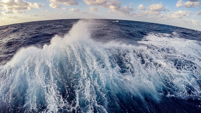
Deep Discoverer slowly working its way up a canyon wall. Image courtesy of the NOAA Office of Ocean Exploration and Research, Hohonu Moana 2016. Download larger version (518 KB).
The Hohonu Moana Expedition of NOAA Ship Okeanos Explorer was scheduled to leave Honolulu on February 23, 2016, en route to Kwajalein, Marshall Islands, via a transit through the Papahānaumokuākea Marine National Monument. Due to some technical difficulties and concerning weather, which delivered the best surf to the island of Oahu since 2009, we were delayed two days. On February 25, around 3:00 PM Hawaii Standard Time, we left Honolulu and headed northwest to begin exploring the deep waters on the flanks of old submerged extinct Hawaiian volcanos.
Many are very familiar with the main Hawaiian Islands, but few know about the northwestern extension of the greater Hawaiian Archipelago. Located to the northwest of Kaʻula, Niʻihau, and KauaʻI, and stretching about 2,800 kilometers (about 1,740 miles) in length, are the Northwest Hawaiian Islands. These submerged and extinct seamounts (i.e., underwater mountains) are older volcanoes that were formed by the Hawaiian hotspot between five and 45 million years ago. More than 90 percent of these volcanoes lie beneath the ocean. The exploration of this vastly unexplored region is the primary mission of this expedition.

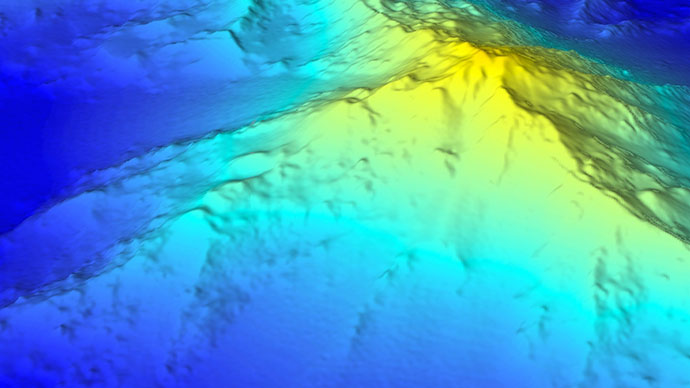
Bathymetric chart of French Frigate Shoals. Image courtesy of the NOAA Office of Ocean Exploration and Research, Hohonu Moana 2016. Download larger version (797 KB).
Since leaving Pearl Harbor in Honolulu on February 25 and February 28, we had completed two successful dives using the remotely operated vehicles (ROVs) Deep Discoverer and Seirios.
The first target was the second deepest dive that has ever been attempted by the Okeanos Explorer ROV team within the Monument, with its deepest dive completed in August 2015. This dive was located on the northeastern flank of an island called Mokumanamana (Necker Island) at a depth of approximately 4,300 meters (about 2.5 miles) beneath the ocean. The goal of the dive was to investigate Necker Ridge, an extensive ridge that extends 400 miles southwest on the other side of the island. Our goal was to determine if this ridge was also present on the northeastern flank of this old Hawaiian volcano.

Jonathan Tree, hard at work in the control, preparing for Dive 2. Image courtesy of the NOAA Office of Ocean Exploration and Research, Hohonu Moana 2016. Download larger version (1.0 MB).
In addition to visual observations made during the dive, ROV Deep Discoverer was also able to collect various rock samples. The etiology of these volcanic rocks remains a secret. Did they erupt from the Hawaiian volcano Mokumanamana, or did they erupt with the same lava flows that make up Necker Ridge? The answer to their origin will be revealed after laboratory analysis, indicating rock age and composition, following the conclusion of this expedition.
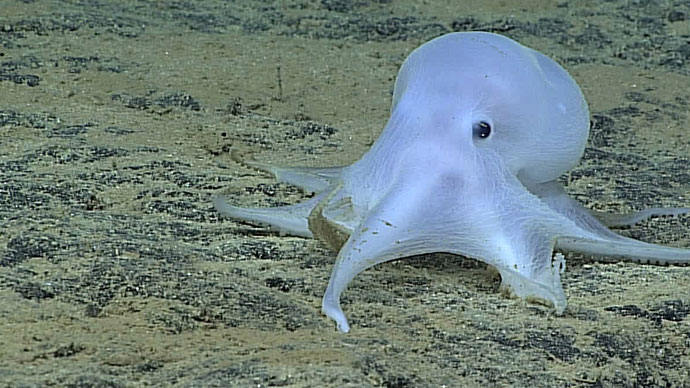
The octopod imaged in detail on this first dive was a member of the second group, the incirrates. A distinctive characteristic was that the suckers were in one, rather than two, series on each arm. This animal was particularly unusual because it lacked the pigment cells, called chromatophores, typical of most cephalopods, and it did not seem very muscular. This resulted in a ghostlike appearance, leading to a comment on social media that it should be called Casper, like the friendly cartoon ghost. It is almost certainly an undescribed species and may not belong to any described genus.
Our second dive targeted a submarine canyon on the northern side of the largest island atoll in the Papahānaumokuākea Marine National Monument, French Frigate Shoals. This was the very first attempt by the Okeanos crew to dive this type of landscape and habitat, a moment of true exploration. These features are known to be a rich habitat for marine life, and our findings supported this fact. Once we reached our target depth of approximately 1,400 meters, we observed a heavily sedimented surface and vast fish species in the area. We even found a deepwater shark!

Deepwater shark moving to "attack" position. Image courtesy of the NOAA Office of Ocean Exploration and Research, Hohonu Moana 2016. Download larger version (1.1 MB).
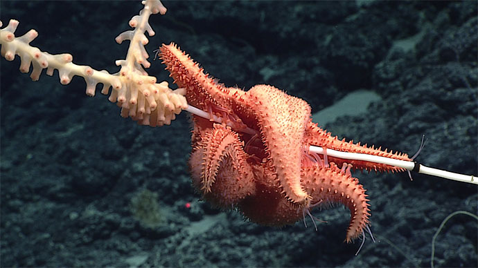
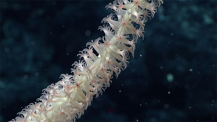
As we began our ascent up the canyon wall, the ocean floor terrain transformed from mostly a sediment surface to rocky cliffs and ledges. These harder substrates are ideal for sessile animals such as corals, sponges, and anemones. As we traveled along the cliffs, the team observed a treasure trove of these organisms, highlighting how certain groups of animals prefer specific types of biomes, or habitats.
After the second dive, we had to transit west around a storm and head to the most northwestern portion of the monument to resume our deep diving explorations. Stay tuned for more exciting news of discovery and exploration.