
By Jonathan Tree - Geologist, University of Hawaii Moana
August 13, 2015
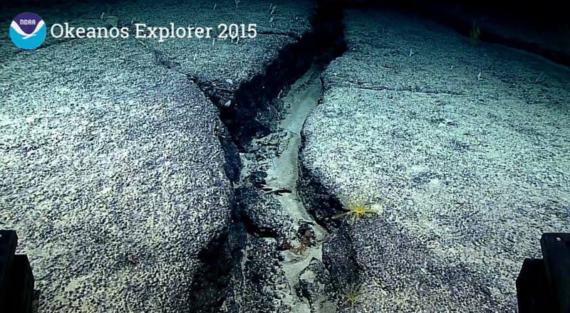
Sheet flow from our cruise on a ridge northwest of Maro Reef. Image courtesy of the NOAA Office of Ocean Exploration and Research, 2015 Hohonu Moana. Download larger version (jpg, 524 KB).
NOAA's remotely operated vehicle, Deep Discoverer, has been exploring the volcanic rift zone ridges in the Papahānaumokuākea Marine National Monument during the Hohonu Moana: Exploring Deep Waters off Hawaiʻi expedition.
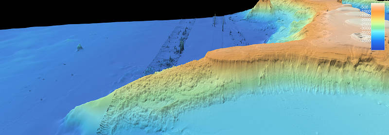
Volcanic rift zone ridge of St. Rogatien, one of our previous dives and a very dramatic example of the types of locations we are targeting on this mission. Image courtesy of the NOAA Office of Ocean Exploration and Research, 2015 Hohonu Moana. Download larger version (jpg, 451 KB).
Volcanoes erupting between 5-30 million years ago, and a few volcanoes up to 80 million years ago, formed these ridge features that are the primary surveying objective of the Hohonu Moana. Understanding a little bit about how these rocks formed allows you to use your imagination to think about what was happening when these eruptions were taking place. As the Pacific tectonic plate moves over the Hawaiian hotspot, magma that melted deep under the volcanoes moves along a complex pipeline to the shallow surface. Once the pressure is great enough from magma accumulating, it breaks through the volcano by pushing its way through big cracks along these ridges.
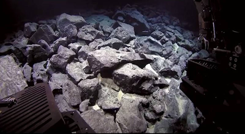
This photo shows a video still taken while we were traversing over a field of broke up dike rocks. These rocks are typically very angular when they are broken apart, as the ones pictured in this image. Image courtesy of the NOAA Office of Ocean Exploration and Research, 2015 Hohonu Moana. Download image (jpg, 54 KB).
Sometimes the magma doesn’t make it to the surface to cause an eruption and stays trapped underground where it can cool slowly, forming a slab of rock that geologist call a "dike." We have seen some of these dike rocks when we were diving in the crater at Maro Reef. These kind of tabular rocks formations are common along these ridges. They are now visible because the volcano is no longer active and begins to erode, away exposing what used to be under the surface.
Sometimes the magma breaks the surface and starts erupting on the volcanic flanks. This means most if not all of the landscapes we are looking at on these dives are lava flow fields. There are a multitude of factors that influence what kind of shape that the lava takes on once it has started erupting. A couple of these factors include the eruption effusion rate, the slope of the surface, temperature and viscosity of the lava flow, chemical and crystal contents, and the cooling rate.
If the effusion rate is low, rounded or tubular flow structures, called pillow lavas, are produced. These pillow lavas form as the very cold water that these flows erupt in freezes a crust on the outside of the lava. As more lava makes its way in to the pillow, the pillows crack and expand to accommodate the new lava into a new pillow. Different eruption rates and slopes of the surface form different sizes and shapes. These factors work together to make the scenery we have been observing. They’re typically solid in their interiors, but sometimes a thick enough crust forms and the lava moving through it drains away, leaving behind a hollow pillow. Eventually, this fragile feature will break open exposing the hollow interior.
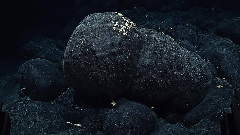
Photo of an intact bulbous pillow lava from a lava flow that was surveyed by the Deep Discoverer on August 13 along a ridge of the Pearl and Hermes Atoll. Image courtesy of the NOAA Office of Ocean Exploration and Research, 2015 Hohonu Moana Download larger version (jpg, 210 KB).
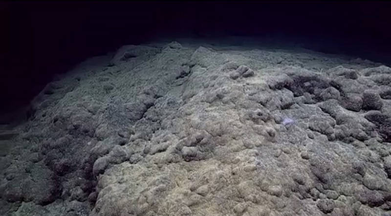
Photo showing the rounded, toothpaste tubular look of pillow lavas on a mound that was constructed completely from the pillows not traveling very far horizontally and building on top of each other. Image courtesy of the NOAA Office of Ocean Exploration and Research, 2015 Hohonu Moana. Download image (jpg, 52 KB).
If the effusion rate is high, the lava ends up forming sheet flows. These are not as bulbous and are more planar, flat features. The lava cools a hard flat surface on top while molten lava flows in the interior. Often times, there are textures on the top of the sheet flow called lineations that help geologists determine which direction lava flowed and where to go to try to find the eruption vent it came from. These types of lava flows have been rarer on these dives and we have not seen any good examples of these lava flows.
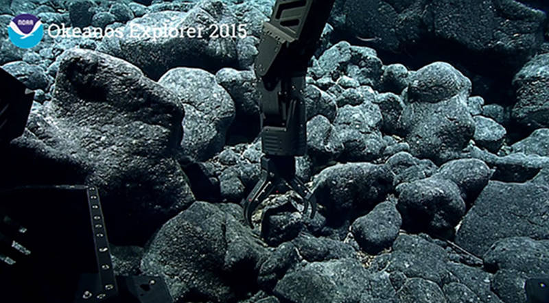
This is a photo of the Deep Discoverer's manipulator arm grabbing a sample from pillow lavas on the seafloor. Image courtesy of the NOAA Office of Ocean Exploration and Research, 2015 Hohonu Moana. Download image (jpg, 86 KB).