by Dave Lovalvo, Expedition Leader
July 22, 2010
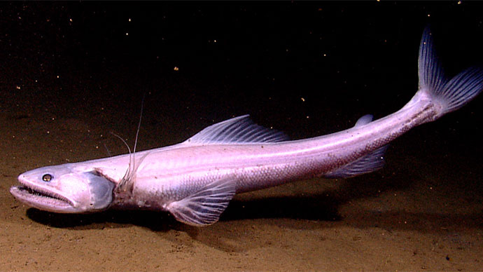
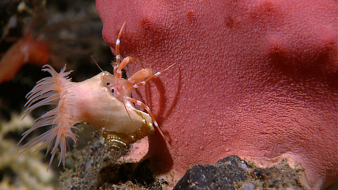
, streamed live to the ship and shore-side Exploration Command Centers, are viewed by scientists with the expertise to identify seafloor life and habitats. The ROV has captured many never-before-seen areas of the seafloor, including images of previously unknown species. This is one of several photos revealing the dense community of life at “Site K.” It is possible new species were imaged at this site.")
Images from the remotely operated vehicle (ROV), streamed live to the ship and shore-side Exploration Command Centers, are viewed by scientists with the expertise to identify seafloor life and habitats. The ROV has captured many never-before-seen areas of the seafloor, including images of previously unknown species. This is one of several photos revealing the dense community of life at “Site K.” It is possible new species were imaged at this site. Image courtesy of the NOAA Office of Ocean Exploration and Research, INDEX-SATAL 2010. Download larger version (jpg, 1.4 MB).
NOAA Ship Okeanos Explorer departed the port of Bitung today and set to sea, initiating the second leg of an expedition involving joint operations with the Indonesian Research Vessel Baruna Jaya IV. Each ship will focus on mapping and characterizing the unknown depths of the Sangihe-Talaud region, utilizing a variety of tools and technology.
As we continue on our first mission of ocean exploration, collectively we must strive to answer what still today remains one of our most controversial questions: Where does exploration stop and research science begin? Serious thought should be given as to how we stay true to the mission that defines us.

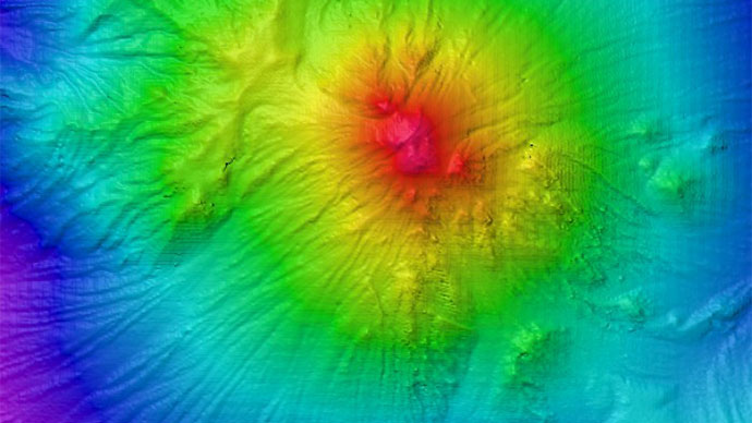
Multibeam image of one of the volcanoes mapped during the INDEX-SATAL 2010 expedition. After imaging an interesting feature such as a submarine volcano with the multibeam sonar, the team will deploy the Little Hercules remotely operated vehicle to the seafloor to collect imagery so that scientists examining the footage can “characterize” the site. Enough information about the site is collected to ask interesting questions, but exploration entails moving on to explore another site instead of lingering on to answer those questions. Image courtesy of the NOAA Office of Ocean Exploration and Research, INDEX-SATAL 2010. Download larger version (jpg, 354 KB).
As a program, we are not mandated to do research science; we are mandated to “explore.” To characterize areas of interest that are yet to be defined and yet not linger indefinitely in the business of thorough understanding. The privilege that has been cast before us is now the challenge we must define. Will we embrace the difference implied or simply seek to mold it to the comfort level so many of us well know?
I ask that we all think long and hard about this as we venture forth and make our way. We have been given the tools and the encouragement to use them. On what path are we destined to proceed? And to what end?

Okeanos Explorer mapped an area larger than the State of Delaware during Leg 2 operations, imaging some never-before-seen seafloor structures. Image courtesy of the NOAA Office of Ocean Exploration and Research, INDEX-SATAL 2010. Download larger version (jpg, 461 KB).