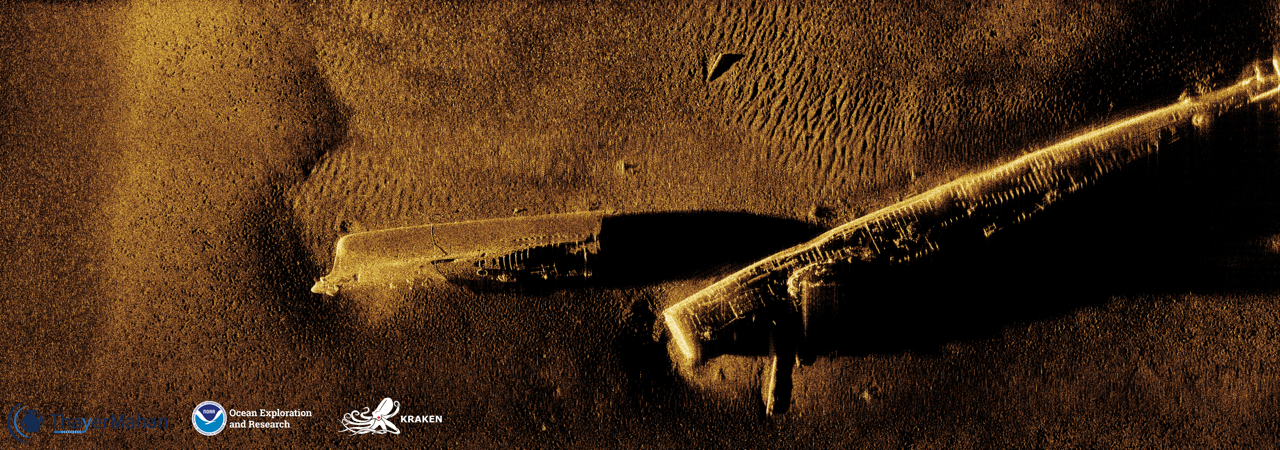
November 7, 2021: USS Bass

Image courtesy of ThayerMahan, Inc., Kraken Robotics, and NOAA Ocean Exploration. Download larger version (jpg, 11.1 MB).
During the 2019 Technology Demonstration, USS Bass, a U.S. Navy submarine that was intentionally sunk off Long Island in 1945, was mapped for the first time using synthetic aperture sonar, revealing that the submarine is split into two parts.
In 2018, NOAA Ocean Exploration and Kraken Underwater Systems began a partnership to jointly advance ocean exploration imaging technology. The 2019 Technology Demonstration provided the opportunity to test the Kraken towed KATFISH™ with Synthetic Aperture Sonar (SAS) on NOAA Ship Okeanos Explorer. The KATFISH™ system collects 3D bathymetry and ultra-high-resolution seabed imagery, providing detailed images of the seafloor and objects on it with 30 times more detail than a conventional side scan sonar.
New SAS imaging of shipwrecks such as USS Bass in the waters off the New England coast are helping archaeologists assess the condition of these subs and potential for further study.
From: USS Bass.