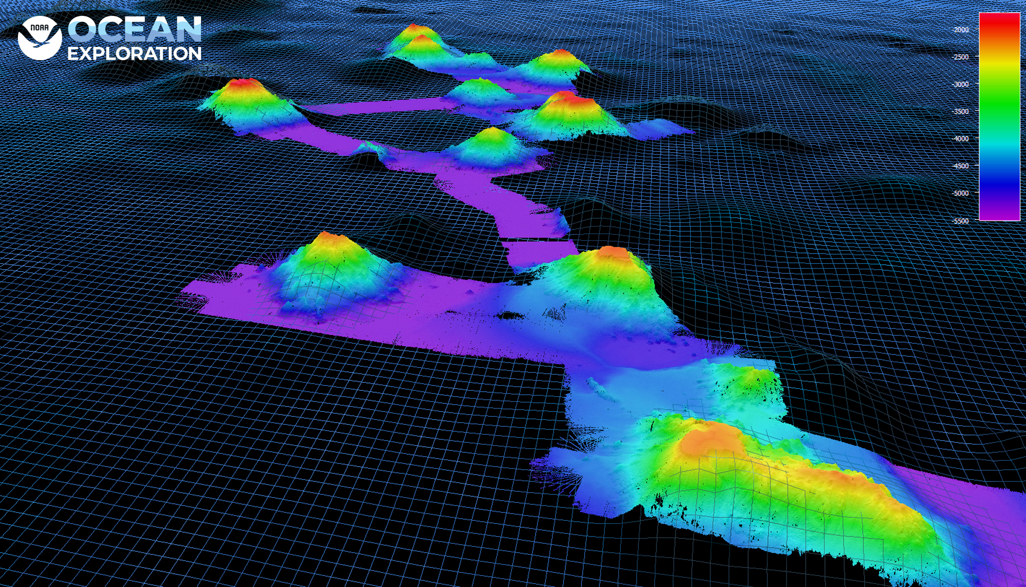
October 18, 2021: Seafloor Bathymetry

Image courtesy of NOAA Ocean Exploration, 2021 North Atlantic Stepping Stones: New England and Corner Rise Seamounts. Download larger version (jpg, 3.5 MB).
During the 2021 North Atlantic Stepping Stones expedition, the NOAA Ocean Exploration mapping team mapped (to varying degrees) about 40 seamounts, 20 of which had little to no preexisting data, and performed 14 “map and dives,” whereby mapping operations that occurred overnight or in the early morning were designed to map an area of interest for the following dive. In addition to creating maps to determine the optimal location for remotely operated vehicle dives, the mapping data collected during this expedition fill gaps in our collective understanding of the North Atlantic seamount chains.
This image shows new bathymetry data of the New England Seamounts collected with the EM 304 MK II variant on NOAA Ship Okeanos Explorer during the expedition, overlaid on the Global Multi-Resolution Topography Data Synthesis grid.
From: Mapping and Diving Go Together Like Peanut Butter and Jelly.