2022 Puerto Rico Mapping and Deep-Sea Camera Demonstration
April 4 - 28, 2022
Expedition Overview
April 4 - 28, NOAA Ocean Exploration will lead an expedition on NOAA Ship Okeanos Explorer. The two-fold purpose of this expedition is to fill mapping gaps in the Atlantic’s U.S. Exclusive Economic Zone and test deep-sea camera operations.

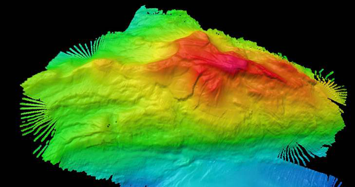
We will focus the expedition’s 24-hour-a-day mapping operations on areas deeper than 200 meters (656 feet) offshore Puerto Rico, in U.S. waters off the U.S. East Coast, and in the high seas. Building on data collected during expeditions on Okeanos Explorer in 2015, 2018, 2022, and other work supported by NOAA Ocean Exploration and partners, we aim to complete the mapping of deepwater areas in the U.S. Exclusive Economic Zone north of Puerto Rico.
Using our deepwater mapping systems and telepresence, we will share mapping data about the seafloor and water column in real time. These data will increase our knowledge about the deep ocean, help inform ocean managers tasked with the protection and wise use of ocean resources, and encourage future exploration and research.
During our transit across the Puerto Rico Trench, we will test the depth limits of our new EM 304 multibeam sonar system. At more than 8,000 meters (5 miles) deep at its deepest point, the Puerto Rico Trench is the deepest trench in the Atlantic and the eighth deepest in the world.
Two explorers-in-training will participate in this expedition as part of our effort to train future ocean explorers. This unique opportunity will provide them hands-on experience collecting, processing, and managing mapping data in a real-world setting.
In partnership with the NOAA Ocean Exploration Cooperative Institute, we will also test two deep-sea camera systems (one real-time remotely controlled and the other automated) to enable us to collect a wider variety of data types during mapping expeditions. The versatile and relatively low-cost cameras were designed and provided by the Multidisciplinary Instrumentation in Support of Oceanography (MISO) facility at Woods Hole Oceanographic Institution. They will be deployed on a conductivity, temperature, and depth (CTD) rosette.
Additional science objectives include collecting and processing water samples for environmental DNA (eDNA) analysis.

Published March 30, 2022
Relevant Expedition: 2022 Puerto Rico Mapping and Deep-Sea Camera Demonstration