This media resources page provides members of the media with information, resources, and broadcast-, print-, and web-quality imagery developed during the 2019 Southeastern U.S. Deep-sea Exploration – Remotely Operated Vehicle and Mapping Operations expedition.
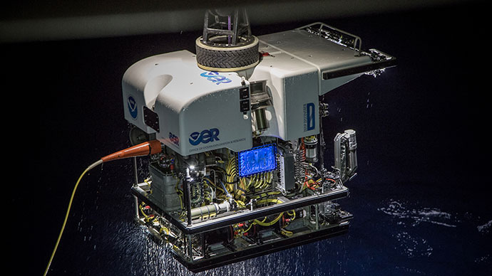
From October 31 through November 20, 2019, NOAA and partners will conduct mapping and remotely operated vehicle (ROV) operations from NOAA Ship Okeanos Explorer to collect critical baseline information about unknown and poorly understood deepwater areas of the Southeastern U.S. continental margin, along the coasts of Florida, Georgia, and South Carolina. The expedition will start in Miami, Florida, and end in Key West, Florida.
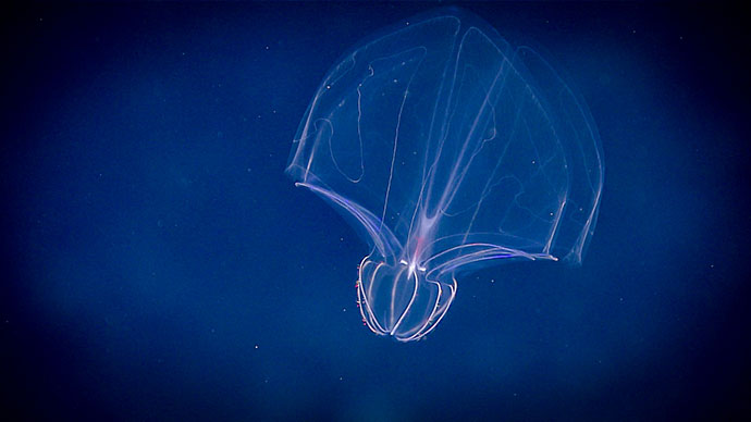
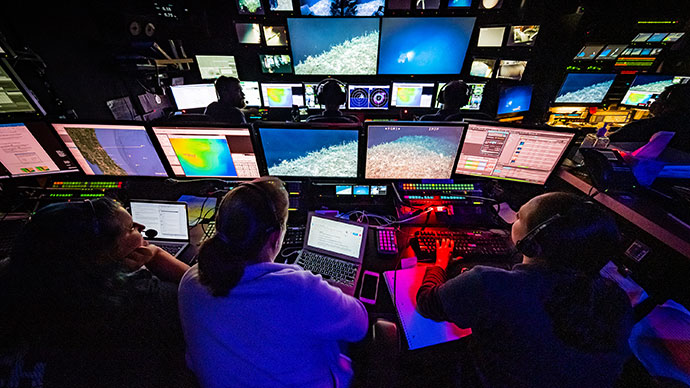
Video from ROV dives will be streamed online daily in real time from November 1 to November 19, from approximately 8:30 am to 4:00 pm ET. Dive sites are expected to include deep-sea coral and sponge habitats, midwater habitats, biogenic mounds, unique geologic features, and other poorly known deepwater habitats.
On this page:
Importance | Objectives | Partners | Who? | Videos & Images | Background Info | Contact Info
Though the U.S. East Coast is home to millions of Americans and is experiencing some of the highest population growth rates in the United States, the Southeastern U.S. continental margin has some of the largest gaps in high-resolution ocean mapping data on this coast and limited observations via submersibles. In fact, these deepwater areas are some of the least explored deepwater areas along the U.S. East Coast.
This expedition to explore deepwater areas of the Southeastern U.S. continental margin will fill gaps in our understanding of the region, providing information needed by decision makers to sustain and accelerate the economy, health, and security of our nation. Data collected during the mission will also contribute to NOAA’s Atlantic Seafloor Partnership for Integrated Research and Exploration (ASPIRE), a major multiyear, multinational collaborative ocean exploration field program focused on raising collective knowledge and understanding of the North Atlantic Ocean.
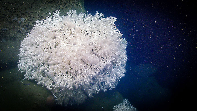
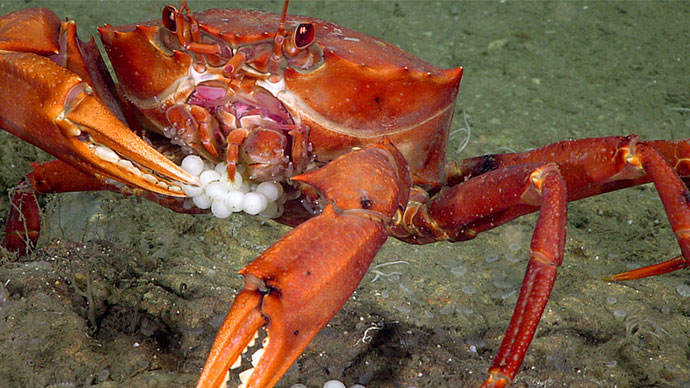
Deep-sea Coral and Sponge Communities: During the expedition, scientists both on the ship and on shore will work to characterize the diversity and extent of coral and sponge communities, which represent some of the most valuable marine ecosystems on the planet, creating structures that provide shelter, food, and nursery habitat to other invertebrates and fish. A better understanding of how populations of coral, sponge, fish, and other deep-sea species are related across geographically separated locales (a concept known as connectivity) can offer insight into the resiliency of those populations. This is important for predicting the impacts of human activities on coral communities and for developing solid plans for their protection.
Geologic Context: The team will map, survey, and sample geologic features in order to better understand the geologic context and potential geohazards along the U.S. East Coast. Understanding geologic history can lend insights into potential causes and consequences of natural hazards such as submarine landslides and resulting tsunamis along the coast as well as the probability of hazard occurrence.
The 2019 Southeastern U.S. Deep-sea Exploration will address science themes and priority areas put forward by scientists and managers from NOAA, management agencies in the region, and the ocean science community. During the expedition, we will work to meet a combination of science, education, outreach, and open-data objectives that will support management decisions at multiple levels. These objectives include:
The expedition involves a number of NOAA partners including the Office of Marine and Aviation Operations; the National Marine Fisheries Service’s Office of Habitat Conservation, Deep Sea Coral and Research and Technology Program, and Southeast Fisheries Science Center; the National Ocean Service’s Office of National Marine Sanctuaries and National Centers for Coastal Ocean Science; the NESDIS National Centers for Environmental Information; and Office of Oceanic and Atmospheric Research's Office of Ocean Exploration and Research. Other partners include the South Atlantic Fisheries Management Council, Bureau of Ocean Energy Management, and the U.S. Geological Survey.
The individuals listed below will be the primary leads for activities during the expedition. They will coordinate input from multiple scientists and managers participating from shore to plan dives, narrate the live video feeds, and participate in outreach events. To learn about the rest of the on-ship team, please visit the Meet the Explorers web page.

Stephanie Farrington is a biological research specialist at Harbor Branch Oceanographic Institute, Florida Atlantic University (HBOI/FAU). She has a bachelor’s degree in marine science and biology from the University of Tampa and a master’s in marine biology from Nova Southeastern University’s Oceanographic Center (NSUOC). While at NSUOC, she studied the biogeography of the Straits of Florida to complete a comprehensive study of the deep-sea animals of the region. At HBOI-FAU, she manages and analyzes deep-sea data using her self-created Microsoft Access database. Stephanie has participated in more than 25 cruises using remotely operated vehicles (ROV) and human occupied vehicles. She has almost 15 years of experience identifying and studying deep-sea and mesophotic invertebrates in the Western Atlantic, Straits of Florida, Gulf of Mexico, and Cuba. Most of her work has been conducted off the Southeastern United States and Eastern Gulf of Mexico, including shelf-edge marine protected areas from Florida to North Carolina, the deepwater Oculina Habitat Area of Particular Concern (HAPC), and the deepwater coral HAPC. In 2017, she participated in an ROV cruise that circumnavigated Cuba with Cuban scientists to explore and document the mesosphotic reefs of Cuba and taught a data management course at the University of Havana Marine Lab. Stephanie sailed with NOAA Ship Okeanos Explorer in 2012, assisting with nighttime multibeam mapping, and in 2014 as the biology science lead during the Exploration of the Gulf of Mexico 2014 expedition. She has co-authored over 75 publications, technical reports, and presentations.

Kimberly Galvez is a marine geology doctoral candidate at the Rosenstiel School for Marine and Atmospheric Science (RSMAS) at the University of Miami. A Miami, Florida, native, Kim’s interests in marine life started from a young age with regular trips to the beach and snorkeling among reefs in the Florida Keys. During her undergraduate studies at the University of Miami, where she studied biology, Kim became involved with the Marine Geosciences Department at RSMAS as a student research assistant. She learned how her love of marine biology is heavily intertwined with geology while working with graduate students on projects involving carbonate sedimentology. After graduating with her bachelor’s degree, Kim began working on her doctorate at RSMAS with a focus on cold-water coral systems within the carbonate province of the Straits of Florida. Her research includes habitat mapping and terrain classification with acoustic maps, carbonate sedimentology, stable isotope geochemistry, and geochronometry. During her spare time, Kim enjoys traveling, hiking, scuba diving, and baking.

A native of Long Island, New York, Mike took a deep interest in ocean science at a young age growing up in and on the water. After graduating from the State University of New York at Geneseo with a degree in geological sciences, Mike continued his education at the School of Marine and Atmospheric Sciences at Stony Brook University. Upon receiving his master's in marine and atmospheric science and completing a graduate certificate in geospatial science, Mike started with NOAA as a hydrographic analyst with NOAA’s Integrated Ocean and Coastal Mapping team at the Center for Coastal and Ocean Mapping at the University of New Hampshire. Mike joined the NOAA Office of Ocean Exploration and Research (OER) mapping team in 2016 and has led deep-sea mapping teams in the Pacific Ocean, Gulf of Mexico, Carribbean, and the Atlantic Ocean. Mike now serves as an expedition coordinator for OER, where he will continue to lead remotely operated vehicle/mapping and technology demonstration expeditions. When not at sea, Mike loves spending time at home in the garden and with his goldendoodle, Wendy.

Shannon Hoy is a mapping lead with the NOAA Office of Ocean Exploration and Research (OER). She has always had a love of the ocean and pursued a degree in marine biology from the College of Charleston, where she was first introduced to seafloor mapping in 2009. During her undergraduate career, she participated with four seafloor mapping expeditions, allowing her to increase her seafloor mapping knowledge and skills, make valuable connections, and travel to exotic places such as Indonesia and Antarctica. Two of these expeditions were actually aboard NOAA Ship Okeanos Explorer in 2010! After completing her undergraduate degree, Shannon spent the next few years gaining as much multidisciplinary ocean experience as possible. She worked for the U.S. Geological Survey’s Submarine Geohazards Group in Woods Hole, Massachusetts, as well as University of Bristol’s paleoceanography group in the United Kingdom. She continued to map throughout these years, and began specializing in habitat mapping using high-resolution techniques (such as remotely operated vehicle mounted multibeam), seamlessly combining her three disciplines: marine biology, geology, and seafloor mapping. In 2015, Shannon began pursuing her master’s degree in ocean mapping at the University of New Hampshire’s Center for Coastal and Ocean Mapping, with the aim to increase her theoretical acoustic and geodetic background. Towards the end of her graduate degree, she jumped at the opportunity to join the OER team as a Mapping Lead, as being an OER Explorer-in-Training nearly a decade earlier had greatly shaped her career and allowed her to pursue her passion for ocean exploration.
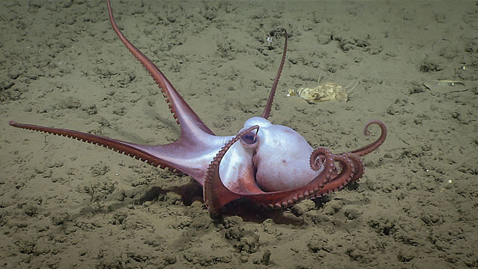
Dive highlight videos, short video clips, and photos will be posted online as they become available.
Please contact Emily Crum for high-resolution footage, B-roll, and other materials at Emily.Crum@noaa.gov.
NOAA Office of Ocean Exploration and Research
Emily Crum
Email Address: emily.crum@noaa.gov
NOAA Office of National Marine Sanctuaries
Vernon Smith
National Media Coordinator
Office: (240) 533-0662
Email Address: vernon.smith@noaa.gov
NOAA National Marine Fisheries Service
John Ewald
Director of Public Affairs
Office: (301) 427 - 8029
Email Address: john.ewald@noaa.gov
NOAA Office of Marine and Aviation Operations
David Hall
Public Affairs Officer
Office: (301) 713 - 7671
Email Address: david.l.hall@noaa.gov