by Clayton Pollock, National Park Service
November 4, 2018
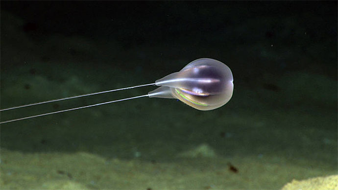
Video courtesy of the NOAA Office of Ocean Exploration and Research, Exploring Deep-sea Habitats off Puerto Rico and the U.S. Virgin Islands. Download larger version (mp4, 61.6 MB).
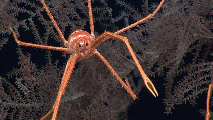
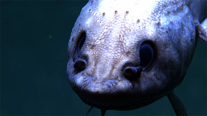
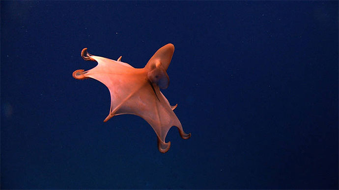
Dive 3 of the Océano Profundo 2018 expedition on November 2, 2018, took place at depths between 1,600-1,800 meters (5,250-5,905 feet), inside Buck Island Reef National Monument. During the dive, scientists recorded a wide variety of deep-sea organisms, including deep-sea fishes, corals, sponges, and other invertebrates. This was a special dive, as it explored the deepest areas ever surveyed inside the Monument and was also the deepest dive ever conducted within a conservation area managed by the U.S. National Park Service (NPS).

Maps showing the track of Dive 3 of the Océano Profundo 2018 expedition, during which we explored the deepest portion of the Buck Island Reef National Monument. Image courtesy of the NOAA Office of Ocean Exploration and Research, Exploring Deep-sea Habitats off Puerto Rico and the U.S. Virgin Islands. Download image (jpg, 1.1 MB).
Buck Island Reef National Monument was the first fully protected marine park established by the NPS. The Monument was established in 1961 to preserve and protect one of the Caribbean’s finest shallow-water coral gardens, as well as the myriad of marine species that are dependent upon these ecosystems. At that time, the Monument was comprised of the 176-acre island and 704 acres of nearshore submerged habitat. In 2001, the Monument was expanded to include an additional 18,135 acres of submerged habitat, including additional varieties of coral reef habitats (patch, spur and groove, deep, and wall), as well as other habitats not included in the original boundary such as seagrass beds, algal plains, shelf edges, deep-sea habitats, and pelagic habitats. The expanded area also contains significant cultural and historical resources; notably the shipwrecks of the slave ships Mary and General Abercrombie.

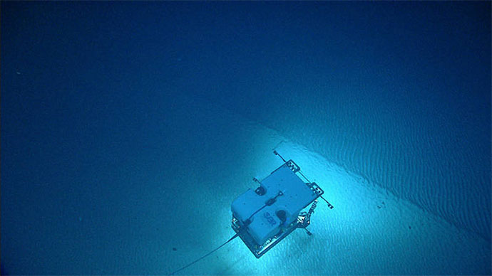
ROV Deep Discoverer about to collect a sample from a rocky outcrop on the seafloor within the Buck Island Reef National Monument. Image courtesy of the NOAA Office of Ocean Exploration and Research, Exploring Deep-sea Habitats off Puerto Rico and the U.S. Virgin Islands. Download image (jpg, 1.2 MB).
The diverse mosaic of habitats contained within the Monument are both singularly and synergistically important to a wide assortment of ecologically important species. Many animals such as sea turtles, sharks, conch, lobster, shore birds, ground lizards, and a myriad of fishes utilize the Monument’s habitats within their life cycles. The protections afforded within the Monument allow threatened and endangered species, as well as other ecologically and economically important species, to grow and reproduce unimpaired.
Marine protected areas have been shown to increase biodiversity, resiliency, and biomass within their boundaries. The successes of this conservation approach often “spill over” into adjacent waters and help sustain nearby fisheries and local economies through eco-tourism. In addition, the preservation of these unique habitats and associated species provides generations of visitors with enjoyment and education.

This sea urchin with big sacs is called Phormosoma. A publication suggested that the sacks serve as hypodermic needles for self defense. Image courtesy of the NOAA Office of Ocean Exploration and Research, Exploring Deep-sea Habitats off Puerto Rico and the U.S. Virgin Islands. Download image (jpg, 1.4 MB).
NOAA has previously partnered with the NPS to conduct deepwater surveys of the Monument. In 2005, NOAA Ship Nancy Foster conducted mapping and remotely operated vehicle (ROV) operations inside the Monument as part of a larger effort to create habitat characterization maps for the greater U.S. Caribbean region. This was a systematic habitat characterization approach that requires collection of seafloor mapping data, as well as short ROV dives. That mission included four ROV dives to maximum depths of 50-180 meters (164-590 feet) with ROV Phantom S2, which can explore depths down to 300 meters (984 feet).
In contrast, the Océano Profundo 2018 expedition is a lot more exploratory, and used ROV Deep Discoverer and Seiros (capable of diving to 6,000 meters (3.7 miles) depth), to explore the deepest portions of the Monument at 1,600-1,800 meters. Additionally, the 2018 expedition uses telepresence technology to engage a wide diversity of scientists, managers, students, and the public in deep-sea exploration.

Local school group following Dive 3 in real time from the National Park Service office in St. Croix. Image courtesy of Jessica Stuczynski. Download image (jpg, 659 KB).
During the recent dive, managers and local school groups were able to watch the Monument dive in real-time from a public display at the NPS office in St. Croix and thereby experience the wonders of exploration and discovery. Bringing the place to the people is a big part of the mission of remote conservation areas like the Buck Island Reef National Monument, and the Océano Profundo 2018 helped address this goal.