by Dr. Jeffrey Obelcz, Marine Geologist, Naval Research Laboratory
Matt Poti, Spatial Ecologist, NOAA National Centers for Coastal Ocean Science

Predictive model of deepwater coral presence in the Gulf of Mexico, produced using MaxEnt ecological habitat mapping software. Hot colors are likely suitable habitats for deepwater corals, while cold colors are unsuitable for corals. Image courtesy of Matt Poti, NOAA. Download image (jpg, 265 KB).
In a perfect world, scientists would learn about the Earth by sampling everything, everywhere. This is obviously an unrealistic expectation, especially in the ocean where remote sensing methods such as satellites and aerial drones aren’t very useful. As a necessary alternative to oceanographic maps with large blank spaces, scientists use a variety of methods to fill in the blanks. One popular method is probabilistic (also known as predictive) modeling. Predictive modeling is essentially making mathematical “educated guesses” of unsampled locations based on observations, or previously sampled locations, and predictors, which are complementary datasets correlated with observations.
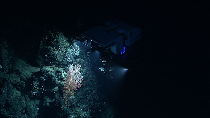
You have probably heard at some point that the vast majority of the ocean, upwards of 80 percent, is unexplored. If this sounds like a lot of work left to do, it gets even worse—only a small fraction of that 20 percent has been physically sampled with video, coring, or grab samples; most of the “explored” area has only been mapped using sonar devices.
This is where predictive modeling can help, offering “placeholder” estimates for uncharted waters based on similar, explored areas. Not only do predictive models offer an estimate of whatever parameter is being modeled (for instance, seafloor porosity , seagrass habitat suitability , or seafloor substrate ), but they also provide uncertainty – that is, how confident the model is it knows the correct answer for a given location. This uncertainty is great for exploration, as it can highlight areas of the ocean where data are needed most, and data collected can be fed right back into the model to improve it. Symbiosis isn’t just for biology!
. Hot colors are likely suitable habitats for deepwater corals, while cold colors are unsuitable for corals. Habitat maps like this one help with selecting ROV dive sites for Okeanos Explorer expeditions.")
Predictive model of deepwater coral presence in U.S.-Canada Atlantic waters, producing using Naval Research Lab Global Predictive Seafloor Model (GPSM). Hot colors are likely suitable habitats for deepwater corals, while cold colors are unsuitable for corals. Habitat maps like this one help with selecting ROV dive sites for Okeanos Explorer expeditions. Image courtesy of the Naval Research Laboratory. Download image (jpg, 794 KB).
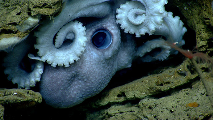
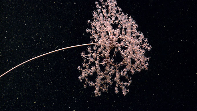
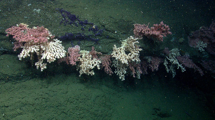
That’s enough explaining how predictive models work – let’s look at some examples. One of the primary biological and ecological goals of the NOAA Office of Ocean Exploration and Research is to map the extents of deepwatercorals. In addition to their aesthetic appeal, these organisms host thriving, diverse ecosystems and slowly grow over hundreds or even thousands of years. They are vulnerable to disturbance such as deep-sea trawling, so successful management requires knowledge of their location and abundance.
The NOAA Deep Sea Coral Database contains thousands of confirmed coral locations (many found through previous Okeanos Explorer expeditions), but this is an extremely small number compared to the size of the ocean. Fortunately, we have a good understanding of the requirements for corals to grow: hard substrate to anchor to, vigorous currents to circulate the marine detritus they feed on, suitable temperatures, and so on.
Confirmed locations of deep-sea corals are entered into the predictive model as observations and maps of their habitat requirements discussed above are used as predictors, and from these a map of likelihood of coral presence is produced. NOAA has used predictive modeling to map deepwater coral presence probability in the U.S. Atlantic and the Gulf of Mexico, and Fisheries and Oceans Canada (DFO), a partner for this U.S.-Canadian transboundary expedition, has also produced predictive maps of coral distributions from the U.S. border on Georges Bank to the eastern Arctic. It is important to remember that these maps show only probability – where corals are likely to be, not where they are or are not. Similar to a weather forecast, a 50 percent chance of rain over two hours doesn’t mean you only need your umbrella for 60 minutes!
 in Northeastern U.S. Atlantic waters displayed over a map of seafloor slope (green is gently sloping, red is steeply sloping). Landslides were mapped by Jason Chaytor, USGS. Landslides generally occur on steep slopes at the shelf edge, sometimes within submarine canyons. Documented landslide locations are used as observations for predictive modeling, and seafloor slope is a highly correlated predictor.")
Submarine landslide locations (blue polygons) in Northeastern U.S. Atlantic waters displayed over a map of seafloor slope (green is gently sloping, red is steeply sloping). Landslides were mapped by Jason Chaytor, U.S. Geological Survey. Landslides generally occur on steep slopes at the shelf edge, sometimes within submarine canyons. Documented landslide locations are used as observations for predictive modeling, and seafloor slope is a highly correlated predictor. Image courtesy of the Naval Research Laboratory. Download image (jpg, 405 KB).
For geological oceanographers, “landslide” is a misleading term – they don’t just occur on land! Submarine landslides are ubiquitous features in all oceans and are more likely to occur in regions with steep slopes, including the submarine canyons and seamounts our expedition will be exploring.
While submarine landslides aren’t as dangerous to humans as their onshore counterparts, they still cause damage to submerged data cables and oil pipelines, and extremely large events can even generate tsunamis . Knowing where submarine landslides have occurred can help predict likely locations of future occurrence.
As you might imagine, observing a submarine landslide while it’s happening is very difficult, so most of what we know about them is through the evidence they leave behind. This includes the scarp where the landslide detached from, the path of destruction as it moves downslope, and the deposit where movement ceased. One or a combination of these are used as observations, and the various factors known to be correlated with submarine landslides are used as predictors. Some examples of submarine landslide predictors are seafloor slope (the steeper, the more likely a landslide will occur); the rate of sediment deposition; and triggering factors, such as large waves, earthquakes, or fast seafloor currents. The prediction of submarine landslide location and size is in early stages, but initial results are promising.
. Submarine landslides are concentrated in mudflow gullies, depressions within the seafloor that resemble mud conveyor belts.")
Predictive model of submarine landslides on the Mississippi River Delta Front, Gulf of Mexico, generated using Naval Research Lab Global Predictive Seafloor Model (GPSM). Submarine landslides are concentrated in mudflow gullies, depressions within the seafloor that resemble mud conveyor belts. Image courtesy of the Naval Research Laboratory. Download image (jpg, 1.0 MB).
Predictive modeling is one way scientists try to estimate in the absence of actual data. It works by making a mathematical “educated guess” for missing values based on the relationship between observations, or known values of the desired phenomenon, and predictors, or datasets known to be correlated with the desired phenomenon.
Predictive modeling is very useful for oceanography, where data points are typically few and far between. Two example applications of predictive modeling are deep-sea coral habitat suitability and submarine landslide location and size. These models help us explore and data from exploration helps the models, so it’s important to keep doing both!