
July 7 – August 2, 2017
Between July 7 and August 2, 2017, NOAA and partners conducted the 2017 Laulima O Ka Moana expedition on NOAA Ship Okeanos Explorer, continuing efforts started in 2015 to collect critical baseline information about unknown and poorly known deepwater areas in the Johnston Atoll Unit of the Pacific Remote Islands Marine National Monument, now known as Pacific Islands Heritage Marine National Monument. Over the course of the expedition, scientists explored previously unexplored seamounts, encountered animals that are likely new species, and documented never-seen-before high-density coral and sponge communities. Along the way, they helped to bring the excitement, wonder, and importance of ocean exploration, and the uniqueness of the Johnston Atoll Unit, to armchair explorers around the world. Video courtesy of the NOAA Office of Ocean Exploration and Research, 2017 Laulima O Ka Moana. Download larger version (mp4, 139.0 MB).

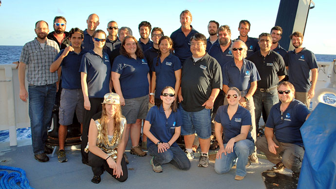
The shipboard mission team of the 2017 Laulima O Ka Moana: Exploring Deep Monument Waters Around Johnston Atoll expedition. Image courtesy of the NOAA Office of Ocean Exploration and Research, 2017 Laulima O Ka Moana. Download larger version (jpg, 1.2 MB).
This expedition is part of the three-year Campaign to Address Pacific monument Science, Technology, and Ocean NEeds (CAPSTONE), an initiative to collect deepwater baseline information to support science and management decisions in and around U.S. marine protected areas in the central and western Pacific.
The 2017 Laulima O Ka Moana: Exploring Deep Monument Waters Around Johnston Atoll expedition was a two-part, 27-day telepresence-enabled expedition. The first part was four days of shakedown operations following the ship’s drydock period and the second part was an expedition to collect critical baseline information about unknown and poorly known deepwater areas in the Johnston Atoll Unit of the Pacific Remote Islands Marine National Monument (PRIMNM). The goal of the expedition was to use remotely operated vehicle (ROV) dives and seafloor mapping operations to increase the understanding of the deep-sea ecosystems in this area to support science and management needs. Major accomplishments from this expedition are summarized below. Download a PDF version of this summary. (1.8 MB)

Infographic summarizing accomplishments from the 2017 Laulima O Ka Moana: Exploring Deep Monument Waters Around Johnston Atoll expedition. Image courtesy of the NOAA Office of Ocean Exploration and Research. Download infographic (pdf, 1.8 MB).

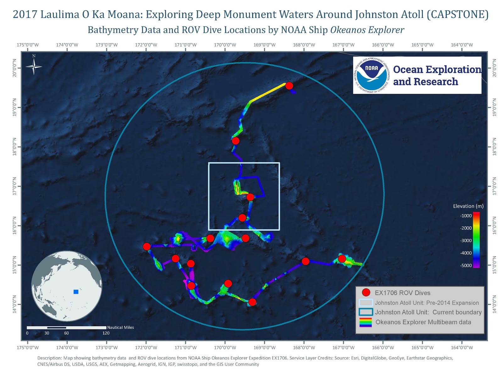
Overview map showing seafloor bathymetry and ROV dives completed during the 2017 Laulima O Ka Moana: Exploring Deep Monument Waters Around Johnston Atoll expedition. Image courtesy of the NOAA Office of Ocean Exploration and Research, 2017 Laulima O Ka Moana. Download map (jpg, 289 KB).
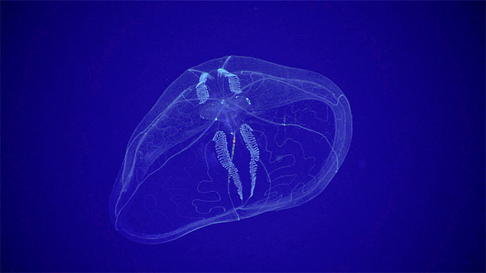
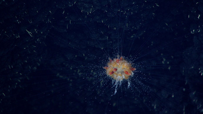
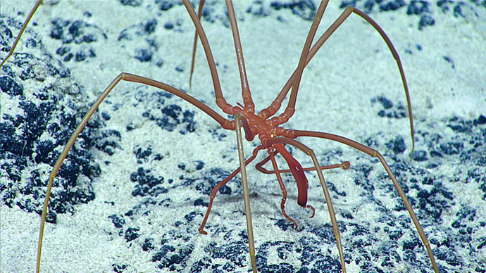
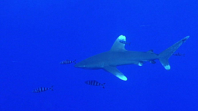
Conducted 15 ROV dives ranging in depth from 250 to ~2,600 meters to survey the biologic and geologic variability of oceanic habitats, including the water column biome, deep-sea coral and sponge habitats, and manganese-encrusted habitats on seamounts.
Chris Mah, researcher at the Smithsonian Institution's National Museum of Natural History in the invertebrate zoology department, decribes the characteristics of different sea star species observed on the final dive of the Laulima O Ka Moana expedition. Video courtesy of the NOAA Office of Ocean Exploration and Research, 2017 Laulima O Ka Moana. Watch larger version.
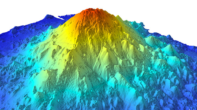
Mapped more than 38,300 square kilometers of seafloor.
Investigated the geologic history of central Pacific seamounts.
The relationship between hosts and associates is discussed while observing multiple examples of organisms living in close association with one another. Several coral and sponge species rarely seen are viewed up close and discussed. Video courtesy of the NOAA Office of Ocean Exploration and Research, 2017 Laulima O Ka Moana. Watch larger version.
Collected more than 12 TB of data, including multibeam, single beam, subbottom, ADCP, CTD, XBT, surface oceanographic and meteorological sensor, video, image, and associated dive and video products. All of the data from this expedition is publicly available through national archives.
Engaged with the local community, as well as audiences around the world.

