Bill Chadwick - Oregon State University and NOAA/Pacific Marine Environmental Laboratory
February 22, 2017

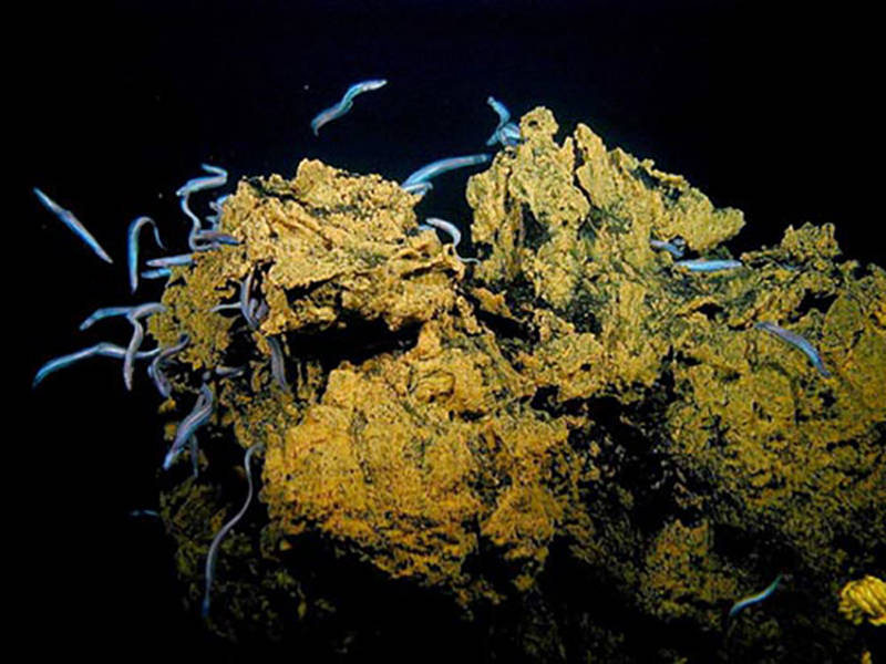
Swarms of cutthroat eels thriving in the crevices on the summit of Nafanua. Scientists dubbed this site “Eel City.” Image courtesy of Vailulu'u 2005 Exploration, NOAA-OE. Download image (jpg, 88 KB).
During the 2017 American Samoa expedition, scientists hope to conduct a remotely operated vehicle dive at Vailulu’u Seamount, weather permitting. In anticipation of the dive, NOAA Ship Okeanos Explorer resurveyed the seamount’s summit several days ago using the ship’s multibeam sonar to look for bathymetric changes since the last time the seamount was mapped. You see, Vailulu’u is an active submarine volcano and is known to be restless.
Using the submersible Pisces during an expedition to Vailulu’u in 2005 that was also supported by the NOAA Office of Ocean Exploration and Research, the volcano was found to have erupted a new cone in its summit caldera. Scientists named the new cone “Nafanua” for the Samoan goddess or war. The crater was found to be hydrothermally active at multiple sites and some areas were teeming with life, like a site named “eel city” at the summit of Nafanua cone.
Other areas, like the deep caldera floor surrounding Nafanua, were named “the moat of death” because the turbid and acidic waters there were apparently toxic to most marine life.

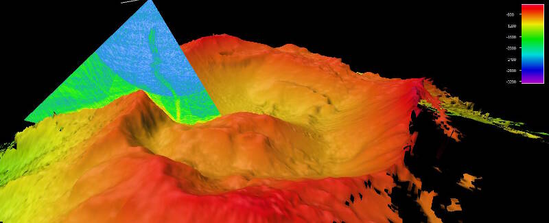
A plume of bubbles is shown rising from the seafloor at Vailulu’u Seamount in the mid-water multibeam sonar data. Image courtesy of the NOAA Office of Ocean Exploration and Research, 2017 American Samoa. Download larger version (jpg, 359 KB).
The 2017 multibeam sonar survey conducted by the Okeanos shows two extraordinary things. First, there is a remarkable plume of bubbles (probably carbon dioxide) rising from the area that was previously called the Northern Moat Hydrothermal Complex. This plume indicates there are gas-rich hydrothermal fluids being emitted on the seafloor in that area. The plume will make a good dive target if we are able to conduct a Deep Discoverer dive at the seamount.
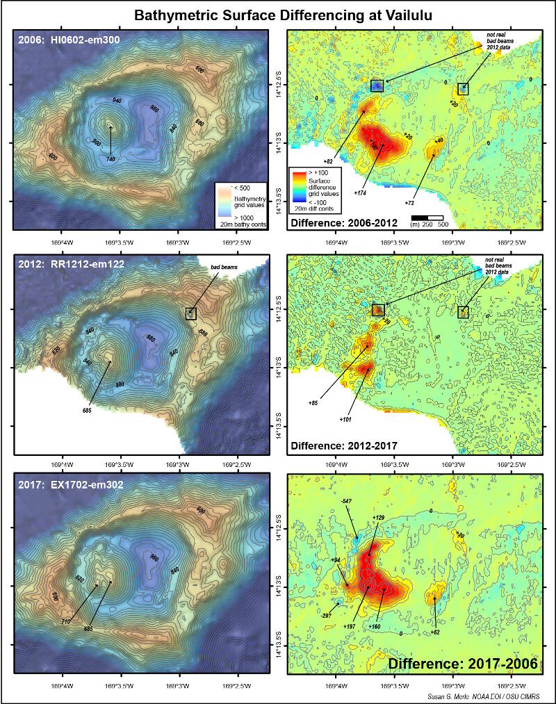
Second, there have been major depth changes in the summit caldera of Vailulu’u since the 2005 expedition. The 2017 bathymetric survey shows that Nafanua cone has grown both in height and especially in width since 2005, no doubt due to continuing volcanic activity.

Maps comparing three bathymetric surveys collected at Vailulu’u in 2006, 2012, and 2017 (left) and depth comparisons between them (right). Red areas show positive depth changes due to eruptions at Nafanua cone between the surveys. Image courtesy of of Susan Merle, Oregon State University and NOAA/PMEL. Download larger version (jpg, 2.9 MB).
By comparing surveys collected in 2006 and 2012, we can also see that Nafanua cone has grown during all of the time intervals – either slowly and continuously or perhaps during multiple discreet events. These episodes of growth are sure to have caused major changes in the hydrothermal systems and their chemosynthetic ecosystems in the summit caldera.
But what will these changes be? We won’t know until we go exploring! All this evidence for recent activity and change at Vailulu’u is creating great anticipation within the science team. We can’t wait to see what other surprises Vailulu’u has in store for us!