Just offshore of Puerto Rico and the U.S. Virgin Islands are a diversity of deep-sea features that include the deepest trench in the North Atlantic Ocean; seamounts; and numerous submarine canyons, valleys, and troughs. Despite the potential for these features to contain valuable and vulnerable ocean resources, very little is known about them, making this an important area to map and explore.
, and the Caribbean and North American oceanic plates. Note that the Puerto Rico Trench, a deep trough where the North American plate slides past and underneath the Antilles, becomes deeper and wider north of Puerto Rico. Image courtesy of USGS.")
Bathymetry of the northeast corner of the Caribbean plate. The main topographic features of this area include: the Lesser Antilles volcanic arc, the old inactive volcanic arc of the Greater Antilles (Virgin Islands to Hispaniola), and the Caribbean and North American oceanic plates. Note that the Puerto Rico Trench, a deep trough where the North American plate slides past and underneath the Antilles, becomes deeper and wider north of Puerto Rico. Image courtesy of USGS. Download image (jpg, 50 KB).
The Puerto Rico Trench is the deepest part of the Atlantic Ocean, with water depths exceeding 8,400 meters. Its depth is comparable to the deep trenches in the Pacific Ocean. Trenches in the Pacific are located in places where one tectonic plate subducts or slides under another one.
The Puerto Rico Trench, in contrast, is located at a boundary between two plates that slide past each other with only a small component of subduction. The trench is less deep where the component of subduction is larger.
The unusually deep sea floor is not limited to the trench, but also extends farther south toward Puerto Rico.
The Puerto Rico Trench is also associated with the most negative gravity anomaly on Earth, -380 milliGal, which indicates the presence of an active downward force.
Finally, a thick limestone platform, which was originally deposited in flat layers near sea level, is now tilted northward at a uniform angle. Its northward edge is at a depth of 4,200 meters, and its southern edge can be found on land in Puerto Rico at an elevation of a few hundred meters.
Many tectonic models have been proposed to explain this geologically fascinating, tectonically active region; however, none have gained acceptance, and the region remains poorly understood, largely because its underwater location makes it difficult to study.
The geologic settings of Puerto Rico and the Virgin Islands have created or contributed to several pressing societal issues related to human safety, environmental health, and economic development. Over four million U.S. citizens live on these islands, mostly along the coast. Because the island lies on an active plate boundary, earthquakes are a constant threat, and the densely populated coastal areas are vulnerable to tsunamis (Uri ten Brink, 2003).
For more information on past exploration of this region by the NOAA Office of Ocean Exploraiton and Research, visit this page.
 and two survey area boxes within the region around Puerto Rico and the U.S. Virgin Islands. Bathymetry collected by Okeanos Explorer and University of New Hampshire Law of the Sea Project is shown in the background and gray boxes show the extent of existing Okeanos Explorer mapping surveys in the Atlantic.")
Transit line down to Puerto Rico (red line) and two survey area boxes within the region around Puerto Rico and the U.S. Virgin Islands. Bathymetry collected by Okeanos Explorer and University of New Hampshire Law of the Sea Project is shown in the background and gray boxes show the extent of existing Okeanos Explorer mapping surveys in the Atlantic. Image courtesy of the NOAA Office of Ocean Exploration and Research. Download image (jpg, 44 KB).
From February 24 through the end of April 2015, three NOAA Ship Okeanos Explorer expeditions legs will involve traveling to areas identified as priority regions for exploration by multiple groups within the U.S. Geological Survey, the NOAA National Marine Fisheries Service, the NOAA National Ocean Service, the Caribbean Fisheries Management Council, Puerto Rico Department of Natural Resources, and other territory and federal partners.
During Leg 1 of this expedition, the ship will transit from her home port in North Kingstown, Rhode Island, to the U.S. Exclusive Economic Zone (EEZ) around Puerto Rico and the U.S. Virgin Islands. Legs 1 and 2 will focus on 24-hour mapping using the ship’s three scientific sonars as the ship travels to Puerto Rico and the U.S. Virgin Islands.
The transit area is in the Western Atlantic Ocean from Rhode Island straight to Puerto Rico. The general survey operating area will be in the Caribbean Ocean, south Puerto Rico and St. Croix islands, in the area of Turner Hole Canyon, Saba Valley, and south of the St. Croix Ridge.
The Okeanos Explorer is also providing opportunity for additional partners to do “surveys of opportunity” while at sea. Leg 1 will include the deployment of a NAVOCEANO ocean glider on loan to the National Ocean Service. This glider will be recovered several months later by NOAA Ship Nancy Foster when she is operating in the area.
In addition to continued mapping of the region, Leg 2 will include deployments of a new type of benthic lander, a data collector moored to the ocean floor for an extended period of time. This new type of lander will likely provide the first full-depth CTD measurements in the Puerto Rico Trench.

Approximate operating area (white polygons) of NOAA Ship Okeanos Explorer during Leg 3. The multi-colored lines denote the approximate locations of the EEZ boundaries. Figure produced in Google Earth Pro. Download image (jpg, 44 KB).
During Leg 3, encompassing most of the month of April, scientists will be exploring the U.S. Exclusive Economic Zone surrounding Puerto Rico and the U.S. Virgin Islands, and the Puerto Rico Trench.
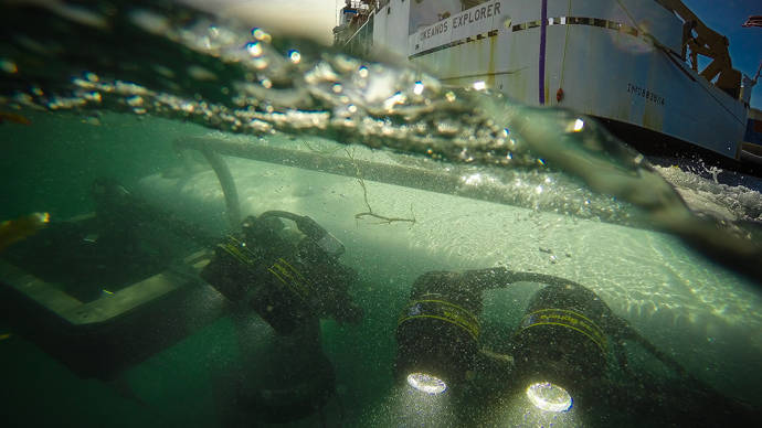
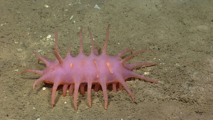
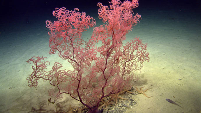
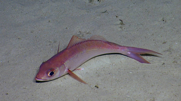
Weather permitting scientists expect to execute 20 dives with NOAA’s remotely operated vehicle (ROV) Deep Discoverer. This expedition will include some of the deepest dives in this region and the deepest dive ever for the Deep Discoverer at 6,000 meters. This leg of the expedition will likely include exploration of deepwater canyons, seamounts, fish habitat, and possibly a mud volcano.
ROV dives will mostly be conducted during the day, while CTD casts, and multibeam, singlebeam, and sub-bottom acoustic mapping will occur at night when the ROV is on deck. This will be the first Okeanos Explorer cruise to plan on conducting ROV operations 12 hours a day.
Leg 3 will include telepresence capability for all ROV dives, permitting the public to watch the expedition live and in action over the Internet. To explore along with the expedition team, visit this page.
The cutting-edge capabilities of the Okeanos Explorer help to increase the scope and efficiency of ocean exploration. The data collected by the Okeanos Explorer during this exploration will improve our understanding of the unique geology and biology of the U.S. Exclusive Economic Zone surrounding Puerto Rico and the U.S. Virgin Islands, and the Puerto Rico Trench, as well as contribute to national ocean floor mapping priorities.