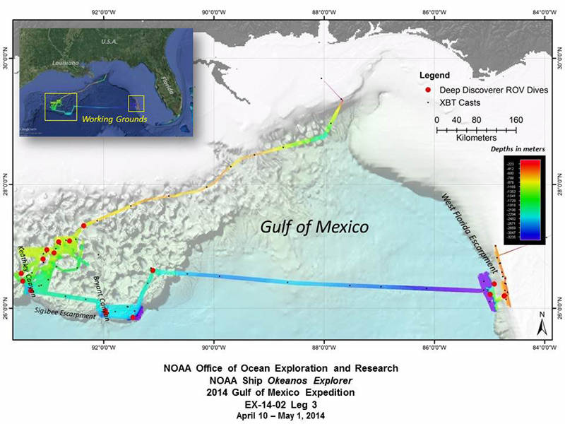

Summary map showing the approximate location of the 16 ROV dives conducted during the cruise, the 17,600 square kilometers of multibeam seafloor bathymetry data, and the location of all XBT deployments (expendable bathythermograph - a device that measures temperature through the water column. XBT software calculates sound velocity, which is applied to calibrate the multibeam data). Image courtesy of the NOAA Office of Ocean Exploration and Research, Exploration of the Gulf of Mexico 2014. Download larger version (jpg, 296 KB).
Okeanos Explorer cruise leg 3 – the final voyage in the series of three ocean exploration cruises as part of the 2014 Gulf of Mexico Expedition – conducted 16 highly successful telepresence-enabled remotely operated vehicle (ROV) dives in two different areas of the Gulf:
Dive 1 was conducted on April 12, and Dive 16 was conducted on April 29.
One dive was sacrificed to inclement weather in the first area, and another in the second area could not be conducted because of strong currents and winds. All of these dives were identified by management groups or support management interests in the region. During the course of these dives, our initial count is that more than 230 different types of animals were documented.

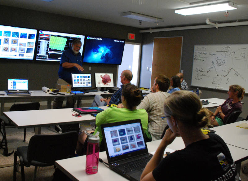
During the 2014 Gulf of Mexico Expedition, only two scientists participated in the cruise onboard NOAA Ship Okeanos Explorer. Via telepresence, the majority of the science team participated from shore - tuning into the live video feeds online and communicating directly with other members of the science team using instant messaging and a teleconference line. Here, Dr. Dennis Hanisak runs through the mission plan with a team of students participating in the expedition from the Harbor Branch Oceanographic Institute Exploration Command Center. Image courtesy of the NOAA Office of Ocean Exploration and Research, Exploration of the Gulf of Mexico 2014. Download larger version (jpg, 4.2 MB).
ROV dives were conducted at a diversity of sites. In the northwestern Gulf of Mexico, dives were conducted at two cold seep sites, two deep-sea coral habitat areas of interest for deep-sea coral modeling, three historic shipwrecks (investigated during two dives), three sites in Keathley Canyon, two sites in Bryant Canyon, and two asphalt volcanos.
Highlights of these dives include discovery of asphalt volcanism (nicknamed “tar lilies”) in an area of the Gulf where it was not previously known to occur; discovery of a chronometer (a rare and significant finding for an early 19th century vessel) at Monterrey wrecksite A; and possible extension of the depth range of a few deep-sea coral types in the Gulf of Mexico.
Several rare observations also occurred, including Paleodictyon “burrows” in Keathley canyon; a rare orange sea star, Dytaster sp., in Bryant Canyon; and a dumbo octopus displaying a body posture that has never before been observed in cirrate octopods.
Four ROV dives were also conducted at priority sites on the central part of the West Florida Escarpment, including two dives investigating seafloor habitats in deep water along the escarpment and two dives documenting deep-sea coral habitat in high-priority areas for fisheries management on the shelf.
Highlights from these dives included incredible deep-sea coral diversity (at least 23 species) during one of the deep escarpment dives; discovery of two potential new species of crinoids; and close-up imagery documenting a sea urchin eating an octocoral – an observation rarely, if ever, captured on camera.

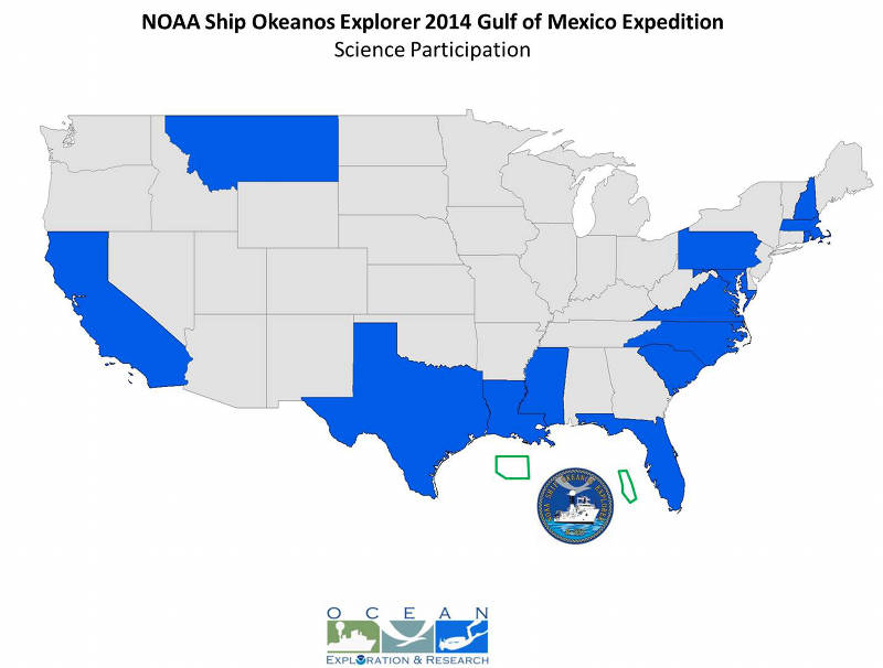
More than 70 scientists and students from 14 states participated in the 2014 Gulf of Mexico Expedition ROV dives from shore, providing their input and expertise to help characterize these areas in real-time and guide exploration activities. Image courtesy of the NOAA Office of Ocean Exploration and Research, Exploration of the Gulf of Mexico 2014. Download larger version (jpg, 235 KB).
More than 70 scientists and students participated in these dives from shore, providing their input and expertise to help characterize these areas and guide the exploration. Online coverage of the expedition including live video feeds, were streamed to shore throughout, allowing hundreds of thousands of the public to join our dives and virtually explore the ocean with us!
The expedition was highlighted and shared on more than 150 different media venues in the U.S. and Europe, and the live video feeds received more than 700,000 visits during leg 3. Through social media venues and our website’s “Ask an Explorer” link, a tremendous number of comments have been shared by the public, expressing excitement about deep ocean observations and thanking the expedition team for allowing them to “dive” with us.

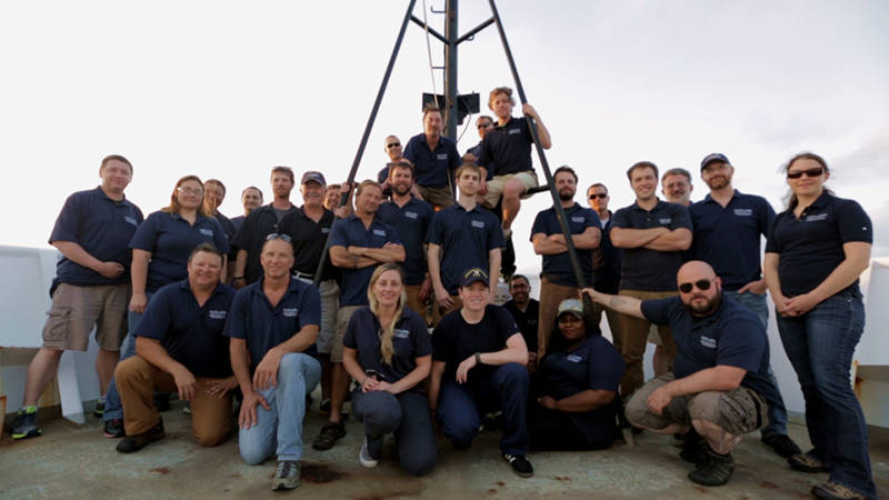
The crew that was on board NOAA Ship Okeanos Explorer during the third leg of the Gulf of Mexico 2014 expedition. Image courtesy of the NOAA Office of Ocean Exploration and Research, Exploration of the Gulf of Mexico 2014. Download larger version (jpg, 697 KB).
Okeanos Explorer also conducted extensive overnight sonar mapping operations in the region, acquiring multibeam, sub-bottom and split beam data in priority areas. During the third cruise leg, 17,600 square kilometers of seafloor were mapped. Combined with cruise leg 1 and leg 2 mapping operations, 66,375 square kilometers were mapped – an area larger than the state of West Virginia!
Though the expedition itself is over, the data and information generated from these cruises is completely and freely publically available and provides new information at priority areas and sites in the Gulf of Mexico and will support follow-on exploration, research and management activities for years to come.
Check out highlight images from Leg 3.