
by LCDR Ben Evans, NOAA, Commanding Officer and Chief of Party, NOAA Ship Ferdinand R. Hassler (S-250)
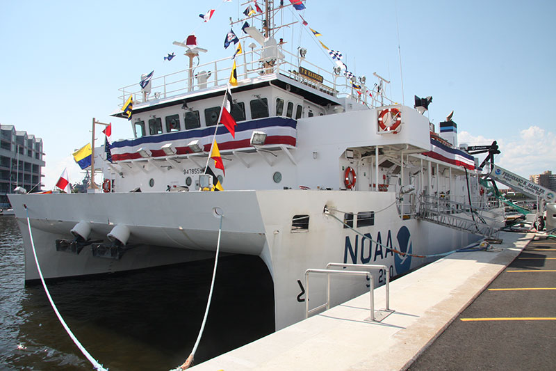
NOAA Ship Ferdinand R. Hassler on commissioning day, June 8, 2012. Hassler is a Small Waterplane Area – Twin Hull (SWATH) vessel optimized for coastal ocean mapping. Image courtesy of NOAA Office of Marine and Aviation Operations Public Affairs. Download larger version (jpg, 5.7 MB).
NOAA Ship Ferdinand R. Hassler is the newest ship in NOAA’s fleet, and is specifically designed for coastal ocean mapping. The ship is equipped with a range of echosounder systems, which allow us to produce high-resolution three-dimensional maps of the seabed in depths up to about 500 meters. Most of our work supports NOAA’s Office of Coast Survey, which is responsible for producing nautical charts of U.S. waters to ensure the safe and efficient flow of vessel traffic in and out of our nation’s ports. This is a critical job, as over 80 percent of U.S. foreign trade travels by water, and the military, commercial ships, fishing vessels, and recreational boats all rely on NOAA’s nautical charts. However, the data we collect can also have important applications to fisheries research and other science.
Hassler’s participation in the ACUMEN project was the result of a mutually-beneficial collaboration between NOAA’s Office of Coast Survey, Office of Ocean Exploration and Research (OER), and Northeast Fisheries Science Center.
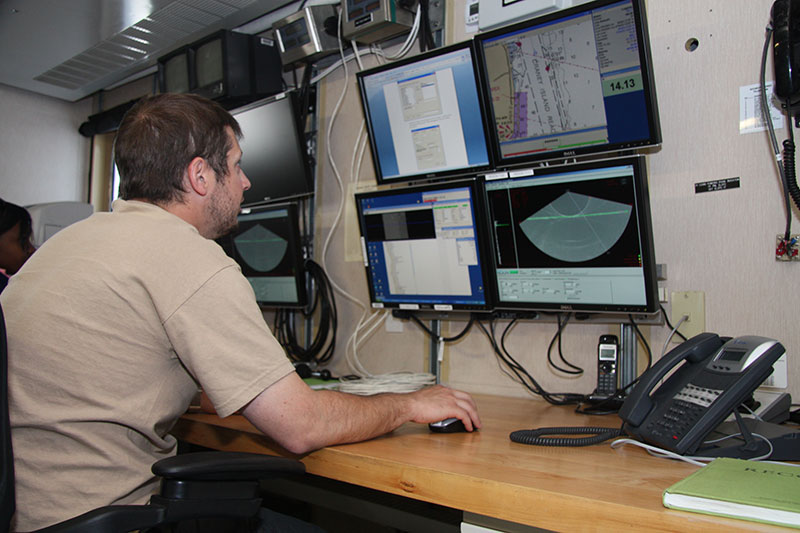
Senior Survey Technician David Moehl at the controls of Hassler’s multibeam echosounders in the ship’s Survey Lab. Hassler is equipped with several different seabed mapping systems, each optimized for a different depth range. Image courtesy of NOAA Office of Marine and Aviation Operations Public Affairs. Download larger version (jpg, 5.4 MB).
The combined Okeanos - Hassler dataset should improve the effectiveness and efficiency of a follow-on cruise led by NOAA Fisheries aboard NOAA Ship Henry B. Bigelow. Scientists aboard Bigelow plan to deploy a towed camera system to visually explore the most promising locations revealed by Okeanos’ and Hassler’s echosounder data.
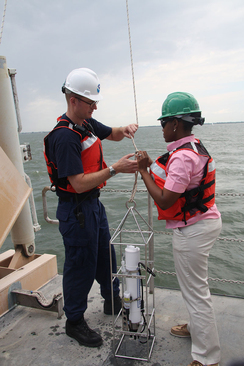
LT Sam Greenaway and Physical Scientist Vanessa Self-Miller prepare to deploy a Conductivity-Temperature-Depth (CTD) instrument. CTDs measure the essential parameters to compute the speed of sound in water, which is a critical correction for Hassler’s echosounder data. Image courtesy of NOAA Office of Marine and Aviation Operations Public Affairs. Download larger version (jpg, 4.8 MB).
Hassler’s role in the ACUMEN project was our first operational mission after the ship’s commissioning ceremony on June 8, 2012. After conducting public outreach and tours at the OpSail Virginia and Baltimore Sailabration events, we departed Baltimore on 20 June bound for Toms Canyon, about 85 nautical miles east of Atlantic City, New Jersey. We arrived on the morning of June 21, and began our work. (June 21 has been designated by the United Nations as World Hydrography Day. Although we didn’t plan it, this seemed a very auspicious time to begin Hassler’s operational career!)
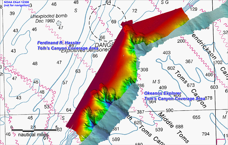
Hassler’s mapping coverage in the Toms Canyon area, overlaid on mapping data from Okeanos Explorer. Image courtesy of NOAA Ship Ferdinand R. Hassler. Download larger version (jpg, 4.9 MB).
We spent about a day and a half working in the Toms Canyon area. Using the Okeanos Explorer’s data as a guide, we extended the mapping coverage up the steep slope of the continental shelf break and searched for the heads of the canyons. Fortunately, the maximum range of our Reson 7111 mid-depth multi-beam echosounder system (approximately 500 meters) overlapped nicely with the shallowest work completed by Okeanos Explorer with their Kongsberg EM302. As we moved up the slope, we switched echosounders and frequency modes to ensure we were achieving the maximum coverage and resolution possible. Ultimately, we identified very well defined canyon heads at Berkeley, South Toms, and Toms Canyons in about 100-150 meters of water.
This exploration work was an interesting change for Hassler. Ordinarily, Coast Survey assigns us a rectangular box of seafloor where modern, full bottom coverage mapping is required to update NOAA’s nautical charts. Our job is to completely map the assigned area, strictly adhering to set data quality standards and fully investigating all features identified therein. However, on the ACUMEN project, our job was to find the heads of the canyons of interest, wherever that might lead us. While we had good general guidance from the fisheries scientists on what types of features to look for and the resolution required to adequately define them, ultimately it was up to us to decide what data would be of most value to the project and which of our tools to use to acquire it. The flexibility and challenge of this project was a fun change from the back and forth “mowing the lawn” surveys which we are typically assigned.
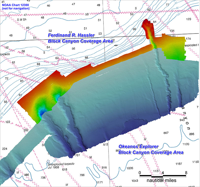
Hassler’s mapping coverage in the Block Canyon area, overlaid on mapping data from Okeanos Explorer. Image courtesy of NOAA Ship Ferdinand R. Hassler. Download larger version (jpg, 4.1 MB).
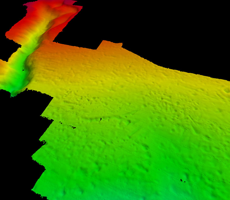
Pock marks mapped by Hassler in the vicinity of Block Canyon. These depressions in the seabed are approximately 10 meters deep and 150-200 meters across. Image courtesy of NOAA Ship Ferdinand R. Hassler. Download larger version (jpg, 343 KB).
From the Toms Canyon area we moved about 80 nautical miles northeast along the shelf break to Block Canyon, roughly 70 nautical miles south of Montauk Point, at the eastern tip of Long Island. Though the canyon head features were less well defined in this area, we did find an interesting field of “pock marks” just southeast of Block Canyon. We don’t know what caused these pock marks, but similar features elsewhere are often formed by complex currents or gas seeping from the seabed. We also collected an important calibration dataset overlapping with Okeanos Explorer, which will improve our ability to make products combining data from both ships in the future.
Unfortunately, a problem with one of our main engines cut our cruise short. We departed the survey area on June 24 and arrived in Norfolk, Virginia, on June 26. However, we were able to complete the highest priority areas of the project before departing. On our way back to Norfolk, we quickly processed the data we had acquired to produce a dataset for Fisheries to utilize on their Henry B. Bigelow cruise. We look forward to the results of their towed camera surveys.
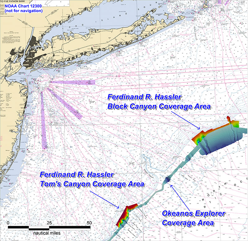
Overview of ACUMEN project area. Image courtesy of NOAA Ship Ferdinand R. Hassler. Download larger version (jpg, 7.9 MB).