The Search for Norlindo – The First World War II Casualty in the Gulf of Mexico
Found in Translation? Deciphering the Historic Record to Find Norlindo
Doug Jones, Bureau of Ocean Energy Management
An old cliché holds that there are three sides to every story: your side, my side, and the truth. This is certainly the case when trying to find historic shipwrecks that sank before GPS, and when vessel logbooks, and the sailors who wrote in them, often went down with the ship. Secondhand accounts and shipwreck maps are notoriously unreliable; “X” rarely marks the spot. Even wrecks from as recently as World War II, which often had radar positioning, rescued survivors, and other eyewitnesses, may be discovered tens of miles from where they were reported in official records. When you are scrambling for a lifeboat or scanning the horizon for another torpedo headed your way, writing down your coordinates is probably not a high priority.
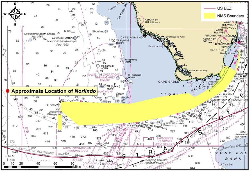
When planning the search for Norlindo, our team’s research design initially targeted an area encompassing its last known location, approximately 55 nautical miles to the northwest of Dry Tortugas National Park and the western extent of NOAA’s Florida Keys National Marine Sanctuary. However, while conducting additional research U.S. Bureau of Ocean Energy Management’s (BOEM) archaeologists identified several online resources that called into question the accuracy of the freighter’s previously reported sinking location. First was http://uboatarchive.net , which contains translations of the German Kriegstagebücher (war diaries), including those of U-507, the submarine responsible for sinking Norlindo. The U-boat captains regularly noted their daily actions in these diaries, including their positions relative to the Germans’ classified mapping system that divided the world’s seas into a series of six-mile by six-mile grids. Second was http://www.navalgrid.com , which uses a complex mathematical model to calculate the modern coordinates of those German map grids. According to U-507’s diary, the attack on Norlindo occurred within grid DM1739. If correct, that would place Norlindo’s remains approximately 32 kilometers (20 miles) southeast of the position noted in American records, and potentially at a much greater depth. This discovery presented the team with the problem of which source to trust and where to focus our search.
Locations of Norlindo as reported in German and American records. Image created by Mike Prymula. Download largest version (jpg, 188 KB).
Luckily, we had several other wrecks with which to test the theory. The locations of 15 of the 56 Allied merchant vessels sunk by U-boats in the Gulf of Mexico have been previously confirmed, and BOEM has strong evidence for the identity of two more. By comparing these known locations against both the reported American and German positions we were able to draw some conclusions. In short, the German war diaries are considerably more accurate for estimating the actual location of any particular shipwreck. In only two cases were the confirmed wreck locations closer to the American position than to the German grid, and most of the American positions were inaccurate by over 10 nautical miles. Given that glaring discrepancy, the choice for where to start our search for Norlindo seems clear.
So now we have the first two sides to this story. Will this expedition successfully discover the third?

