


The Search for Norlindo – The First World War II Casualty in the Gulf of Mexico
The Search for Norlindo – The First World War II Casualty in the Gulf of Mexico: Expedition Plan
August 18 – September 4, 2021
Leonardo Macelloni, Arne Diercks, and Leila Hamdan – University of Southern Mississippi
Late in December of 1941, six German long-range Type IX U-boats were dispatched to the German Kriegsmarine to scout the east coast of the United States in an operation code-named “Paukenschlag” (Drumbeat). Five months later, World War II claimed its first combat casualties in the Gulf of Mexico. The SS Norlindo, a 2,686-ton and 253-foot-long American steam freighter, was sunk on May 4, 1942, off of the Dry Tortugas by the German U-boat U-507 under command of Korvettenkapitän Harro Schacht.
U-507 continued its hunt in the Gulf of Mexico and, over the next two days, sank two more freighters, Munger T. Ball and Joseph M. Cudahay. These latter shipwrecks have since then been discovered by recreational scuba divers in shallower waters off the Florida coast; Norlindo remains undiscovered, 75 years after the end of World War II.
The search for Norlindo is a team effort, comprised of German, Italian, and American scientists and archaeologists embarking on a three-week expedition to locate and investigate this historic shipwreck. In preparation for this expedition aboard the University of Southern Mississippi (USM)-owned Research Vessel Point Sur, an extensive search of historic archaeological and geospatial data was performed using U.S. and international archives.
Archaeological data discovered during planning for this search identified an area of interest of approximately 36 square nautical miles. Archived acoustic echosounder data collected for this area were analyzed line by line to identify potential targets-having dimensions similar to that of Norlindo or that could represent shipwreck-related debris on the seafloor.
Acoustic backscatter information, a byproduct of multibeam echosounder (MBES) data acquisition, were used to corroborate the identified potential targets in the MBES data with dimensions similar to Norlindo (253 feet x 43 feet x 26 feet). Acoustic backscatter data generate roughly 10 times higher per-pixel resolution, providing information about the reflectiveness of the seafloor (or objects resting on it); however, backscatter data fail to provide a vertical scale. Thus, the combination of backscatter and echosounder data prove to be a very promising way to locate objects larger than 5 meters (16.4 feet) on the seafloor.
Single targets measuring close to these dimensions as well as clusters of two or more objects whose combined dimensions measured close to Norlindo’s size were identified. These individual targets will be investigated during the expedition using a deep-sea autonomous underwater vehicle equipped with a MBES, to survey the seafloor. If successful in locating a promising target on the seafloor, a remotely operated vehicle will be deployed to investigate and try to identify the wreckage. We will also collect sediment samples from around the wreck site for analysis of the shipwreck microbiome – to help understand how this, and other shipwrecks shape biodiversity of microscopic life in the deep ocean.

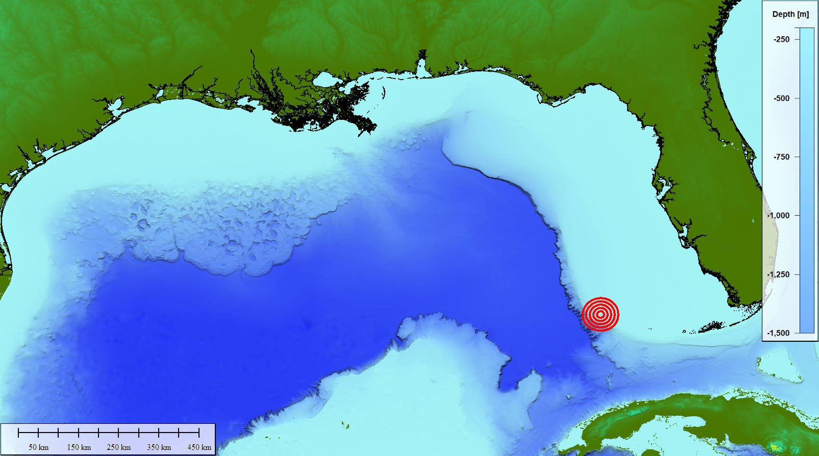
Map of the potential location of SS Norlindo. Image courtesy of The Search for Norlindo Expedition. Download largest version (jpg, 175 KB).
In addition to its intrinsic historical significance in operation Drumbeat, Norlindo also represents a potential environmental hazard. The Screening Level Risk Assessment by NOAA’s Offices of National Marine Sanctuaries and Response and Restoration determined that Norlindo is one of 87 shipwrecks in U.S. waters that poses a potential pollution threat arising from fuel onboard the vessel at the time of sinking. Because it is unknown if the wreckage is intact, it is unclear if an acute hazard is present in the form of an intact, but corroding fuel container. Norlindo’s remains represent an ecological and archaeological resource and a war grave that our multidisciplinary team endeavors to discover.
NOAA Ocean Exploration funded this expedition via its 2019 Federal Funding Opportunity for Ocean Exploration and through the NOAA Ocean Exploration Cooperative Institute .