By Chris German
and Dana Yoerger, Woods Hole Oceanographic Institution

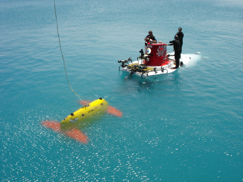
The Sentry autonomous underwater vehicle meets the submersible Alvin during a testing expedition off Bermuda in April 2006. Image courtesy of Chris German, Woods Hole Oceanographic Institution. Download larger version (jpg, 1.8 MB).
Perhaps the single biggest change is that we will start our 2012 exploration by focusing on the seafloor, rather than the overlying ocean, to search for hydrothermal vents. One of the important new devices that Sentry is equipped with is a sidescan sonar system. Both ABE and Sentry (and, indeed, RV Melville) have used multibeam sonar systems that use sound-waves echoing off the seafloor to construct very precise contour maps of the shape of the seabed. But sidescan sonar does something rather different – it uses sound waves to generate the underwater equivalent of aerial photography of the underlying seabed. Donna Blackman, Greg Kurras and Chris German on this cruise have extensive prior experience collecting and interpreting sidescan sonar data from other mid-ocean ridges using deep-towed instruments towed slowly behind research ships to build up a picture of the volcanic, tectonic and sedimented areas on the seabed but this will be our first time using the same kind of data collected by AUV. Our expectation is that, even in regions of the seafloor that are extremely flat because of covering by sediment from the adjacent continental margin, any hydrothermal fluid upflow will change the texture of the seafloor and this will show up in the sidescan data, even in places where the multibeam indicates that everything is boring and flat!
In terms of water column sampling, the one sensor we are confident will still be effective for us (based on the one set of data collected from ABE in 2010) is the Eh sensor provided by our colleague Dr Ko-ichi Nakamura from AIST in Japan who will be joining this cruise. While our 2010 CTD data did not reveal convincing in situ optical sensor anomalies at plume height, our shipboard and shore-based analyses of CH4 and He3 prove that not only are there plume-signals present, close to the Chile Triple Junction, but that they are unambiguously hydrothermal in their origin. What we need now is a good suite of sensors that will be able to guide us all the way to the vent-sources, ideally with real-time feedback aboard ship.

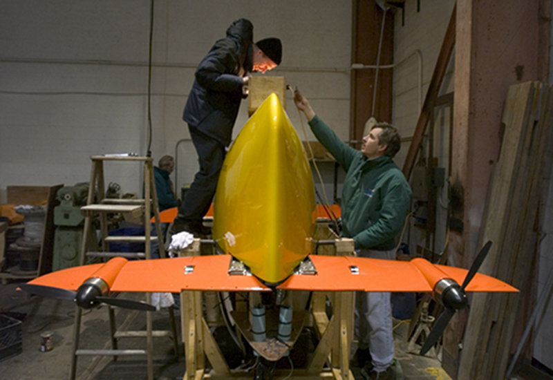
WHOI engineers Bob Brown (left) and Tito Collasius check the fit of the yellow outer skin over the lifting eye of the Sentry autonomous underwater vehicle. Image courtesy of Tom Kleindinst, Woods Hole Oceanographic Institution. Download image (jpg, 95 KB).

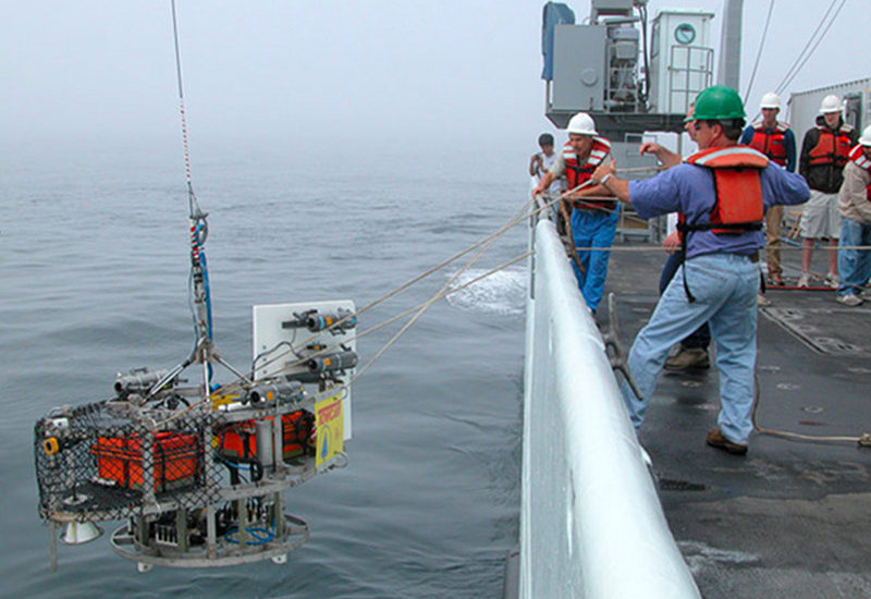
TowCam, a towed underwater camera system will work in tandem with Sentry during the Chile Triple Junction 2012 Expedition. Sentry will map the seafloor; TowCam will collect imagery. Image courtesy of Mitch Elend, University of Washington. Download image (jpg, 101 KB).
We are planning to approach that problem in two ways. First, we have developed some new methods since we last went to sea with ABE which allow us to interrogate the AUV, acoustically, and learn at least some of what it has been measuring while it is still operating at depth and before it returns to the surface where we can down-load the full data-set. Thus, even within a given dive, we can typically learn whether or not any hydrothermal signals have been intercepted and where those signals were most strong. Second, we will be using additional Eh sensors that Ko-ichi is bringing to the cruise, as well as a comparable ORP (oxidation-reduction potential) probe and a next-generation MAPR equipped with the same ORP, both provided by NOAA’s Pacific Marine Environmental Lab. In concert we expect that we will deploy an Eh sensor and/or its equivalent on pretty much every package that goes over the side of the ship – Sentry, the CTD, TowCam, even the multi-corer – until the vents are tracked down.
To start, we will drive Sentry up and down the length of the ridge axis all the way across to the edge of the continental margin for our sidescan (plus Eh sensor) survey while, in parallel, we will use our CTD system to tow/yo or pogo all the way down the same center line that yielded the strongest plume signals (from sample analyses only) in 2010. Ideally, we will see strongest in situ sensor anomalies right where we pass closest to the underlying vents. Later, after a short Sentry survey that will include sidescan sonar, mapping and bottom photography at the known cold seep site along the adjacent continental margin, we will return to the ridge axis for more detailed seafloor mapping and in situ sensing ending with photography at whichever site has yielded the most promising chemical signals at that point.
Exactly what will happen next is hard to predict, because that is the nature of ocean exploration. Just like Forrest Gump’s proverbial box of chocolates, whenever you go looking in places that nobody has ever studied before, you never know what you’re going to get!
Happily, what our 2010 exploration already showed us is that we are well on our way to the next set of discoveries and with the science team assembled and all the diverse technology at our disposal, anything could happen in the next 10 days aboard ship.