


Photo & Video Log
This page contains photos and videos from the Northwestern Hawaiian Islands Exploration cruise conducted between September 18-23, and October 21 - November 15, 2002, 2002. Click on any image to view a larger version and for additional information. If a movie camera icon ![]() is present, a video can be viewed by clicking on the image.
is present, a video can be viewed by clicking on the image.
 Video & Slideshows
Video
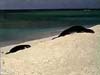
![]() Video taken from a small camera attached to a monk seal swimming
Video taken from a small camera attached to a monk seal swimming
Images
November 15
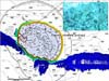
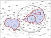
Preliminary soundings near Lisianski Island.
November 15
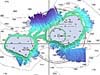
Newly surveyed data around Maro Reef.
November 12
3-D view Lisianski Island data.
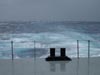
November 12
High seas.
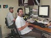
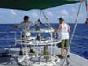
November 12
Taking a break from processing data.
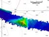
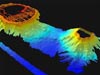
November 5
A digital terrain model of a seamount.
November 5
A backscatter mosaic.
October 28
Multibeam data of Nihoa Island.
October 28
Bathymetry of the French Frigate Shoals.
October 28
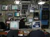
The bathymetry data control center.
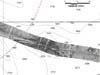
October 24
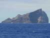
Nihoa Island.
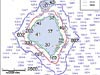
October 24
Nihoa Island nautical chart.
October 24
Preparing the CTD for deployment.
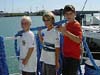
October 24
Students helping out onboard.
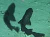
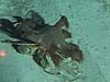
Summary I
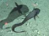
Spongehead catshark.
Summary I
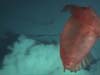
A “flying” sea cucumber.
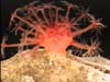
Summary I
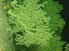
Sponge and coral field.
September 22
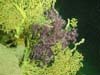
Purple coral growing over gold coral.
September 22
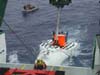
Launching of the Pisces IV.
September 22
A vertical wall of gold coral.
September 21
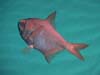
The “alphonsin” Beryx decadactylus.
September 21
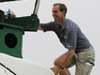
Frank Parrish climbs into the Pisces IV.
September 20
A member of the Bathygadid fish family.
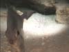
September 20
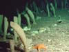
A hermit crab and invertebrate.
September 19
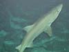
A smalltooth sand tiger shark.
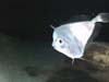
September 19
A tinselfish kiss.
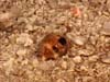
September 19
A checker board cowrie shell.
September 19
A toadstool soft coral.
September 18
A tinselfish encounter.
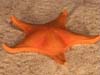
September 17
Bright orange sea star.
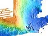
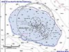
September 17
Seabeam map of the south and east banks of the eastern Northampton Seamount.
Sign up for the Ocean Explorer E-mail Update List.