
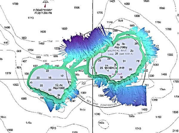
The multibeam data from Nihoa is displayed over the charts in the form of a digital terrain model with 25-m resolution. Light blues are shallow areas, while dark blues are deeper.

The multibeam data from Nihoa is displayed over the charts in the form of a digital terrain model with 25-m resolution. Light blues are shallow areas, while dark blues are deeper.