

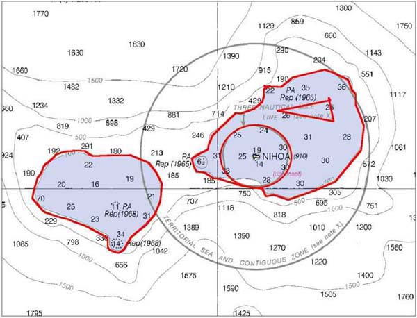
This is the area the R/V Kilo Moana is currently surveying. We've completed the western portion, and are now on the southern side of the eastern portion. The red lines are the areas the ship is following, which corresponds to the predicted 25 and 100 fathom depth contours.