2022 Caribbean Mapping
March 10 - 28, 2022
Expedition Overview
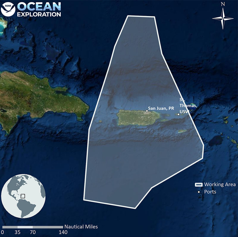
From March 10 - 28, 2022, NOAA Ocean Exploration will conduct an exploratory ocean mapping expedition on NOAA Ship Okeanos Explorer focused on U.S. waters south of Puerto Rico generally deeper than 200 meters (656 feet).

The first several days of the expedition will involve transit mapping as the ship departs Key West, Florida, and heads east towards primary survey grounds. For the remainder of the expedition, focused mapping operations will occur within U.S. waters south of Puerto Rico. Acoustic exploration mapping operations will be conducted 24 hours a day in permitted areas and will result in the collection of high-resolution data needed to fill critical mapping gaps in the region.
This is the first of two mapping expeditions being led by NOAA Ocean Exploration in 2022 that will support the completion of deepwater mapping in the U.S. Exclusive Economic Zone around Puerto Rico. The mapping work conducted during the 2022 Caribbean Mapping expedition will result in high-resolution maps of the seafloor and provide acoustic backscatter data information about the seabed and water column. Acquired data on deepwater habitats, including deep-sea coral and sponge communities and important fish habitats, will support science and management needs. Mapping of geologic features will increase understanding of the geological context of the region and improve knowledge of past and potential geohazards.
In support of NOAA Ocean Exploration’s goal of training the next generation of ocean explorers, three Explorers-in-Training will participate in the expedition, assisting in the collection and processing of sonar data.

Published March 7, 2022