June 28, 2018
Video courtesy of the NOAA Office of Ocean Exploration and Research, Windows to the Deep 2018. Download larger version (mp4, 49.8 MB).
On June 24, 2018, NOAA used the scientific sonars onboard NOAA Ship Okeanos Explorer to search for potential shipwrecks by mapping the seafloor offshore North Carolina near the Monitor National Marine Sanctuary. Our sonars showed a very strong reflection off an object roughly the size and shape of the ship types known to have sunk in the area. This strong reflection can indicate hard surfaces like rocks or metal from shipwrecks. We also noted a deep scour immediately behind this feature.
By working with archaeologists on shore, we confirmed that this type of scour is typically indicative of a shipwreck in this region, as soft sediment is eroded away from the backside of a wreck by the high currents of the Gulf Stream. This information led our team to believe that we might have found a large shipwreck.
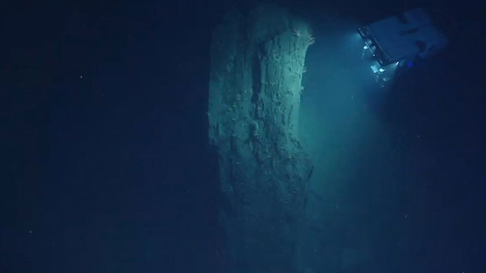
 shown in black and white as draped over the topography of the seafloor. White indicates a strong reflection and hard substrate. The depth of this feature is 330 meters. Though thought to possibly be a shipwreck, the bright mound ended up being a rocky reef habitat.")
A three-dimensional view of the scour mark caused by a hard object on the seafloor as mapped by NOAA Ship Okeanos Explorer. The image shows the sonar reflection intensity ("backscatter") in black and white, as draped over the topography of the seafloor. White indicates a strong reflection and hard substrate. The depth of this feature is 330 meters (1,083 feet). Though thought to possibly be a shipwreck, the bright mound ended up being a rocky reef habitat. Image courtesy of the NOAA Office of Ocean Exploration and Research, Windows to the Deep 2018. Download larger version (jpg, 1.8 MB).
This region is known to be an area with many shipwrecks due to the World War II Battle of the Atlantic and ships lost at sea along the high traffic trade routes along the U.S. East Coast off of Cape Hatteras, North Carolina. Many of the vessels lost in this area have only roughly reported sinking locations, and their final resting location remains unknown.
Our interest was further peaked when overnight mapping (early morning of June 27) revealed the detection of a potential object, or objects, above the seafloor. On June 27, NOAA Ship Okeanos Explorer returned to the area, dubbed “Big Dipper,” to conduct a dive using remotely operated vehicles (ROV) Deep Discoverer and Seirios.
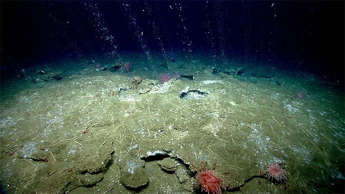
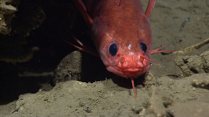
As the ROVs approached the target, the ship and shore-based science team anticipated the opportunity to find an important part of maritime cultural history. Instead of a shipwreck, however, the team found an area of broken rock slabs that was home to a diversity of organisms. Nearly every nook and cranny of habitat surveyed was home to fish and the surfaces of rocks were often covered in anemones or coral.

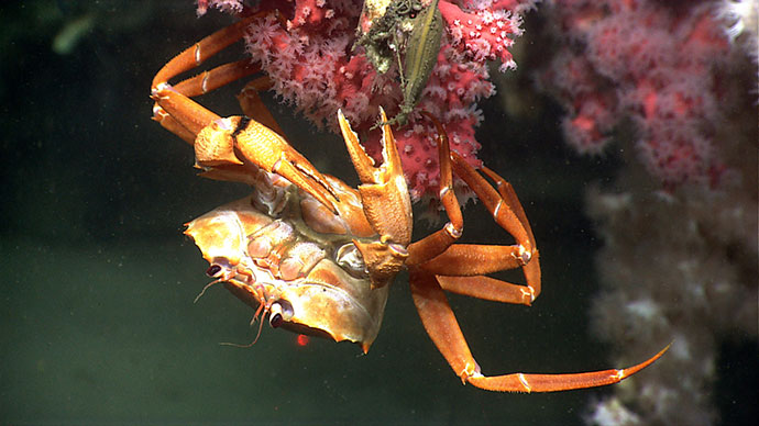
The feature discovered at the “Big Dipper” anomaly was in fact rocky habitat that was home to a number of fish, crabs, anemones, and coral. Image courtesy of the NOAA Office of Ocean Exploration and Research, Windows to the Deep 2018. Download larger version (jpg, 699 KB).
While exploring the ocean, we never know exactly what we will find, which is part of the reason we use telepresence technology to conduct our operations. We use a high-bandwidth satellite connection and Internet-based collaboration tools, so that we can leverage the intellectual capital on shore.
At the start of the dive, the science team was primarily composed of archaeologists, participating from shore; however, as soon as we determined the dive location was not an underwater cultural heritage site, the expertise of the team shifted. Instead, biologists and geologists on shore joined the live chat room to help us characterize the rich marine habitat we had discovered. Over 55 scientists from around the world joined us for the dive, including individuals from 17 U.S. states as well as Germany, Japan, and Russia.

A highly camouflaged monkfish was observed blending into the seafloor during the 13th dive of the Windows to the Deep 2018 expedition. Image courtesy of NOAA Office of Ocean Exploration, Windows to the Deep 2018. Download larger version (jpg, 975 KB).

Two fish, a conger eel, and a scorpion fish inhabit an overhang encrusted with small anemones. Image courtesy of NOAA Office of Ocean Exploration, Windows to the Deep 2018. Download larger version (jpg, 784 KB).
NOAA’s ROV dive on a sonar anomaly dubbed “Big Dipper” highlights the importance of conducting telepresence-enabled ocean exploration and the value of harnessing the power of Internet-based collaboration tools to connect with scientists around the world on shore as we explore the deepest reaches of our largely unknown ocean.