
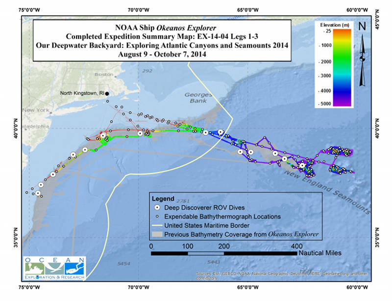
Summary map showing the approximate locations of the 16 ROV dives, the 36,200 km2 of seafloor bathymetry data, and the location of all XBT deployments (expendable bathythermograph - a device that measures temperature through the water column. XBT software calculates sound velocity, which is applied to calibrate the multibeam data). Image courtesy of the NOAA Office of Ocean Exploration and Research, Exploring Atlantic Canyons and Seamounts 2014. Download larger version (jpg, 8.6 MB).
During August, September, and October 2014, NOAA Ship Okeanos Explorer systematically explored diverse habitats and geological settings of the U.S. Atlantic Submarine Canyons and New England Seamount Chain. This three-leg expedition collected critical data for the science and management communities that will expand our understanding of this region. Throughout the expedition, Okeanos Explorer collected high-resolution multibeam sonar data covering 36,200 square kilometers of seafloor and conducted 16 highly successful remotely operated vehicle (ROV) dives, which explored six seamounts and nine canyons.
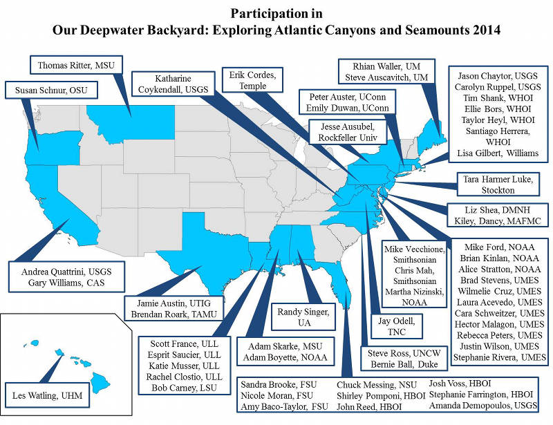
During ROV explorations, our extended shore-based science team included over 55 scientists from 23 different states. Image courtesy of the NOAA Office of Ocean Exploration and Research, Exploring Atlantic Canyons and Seamounts 2014. Download larger version (jpg, 663 KB).
More than 50 scientists and students on shore participated in the ROV dives, providing their expertise to help characterize these areas and guide the exploration. Online coverage of the expedition included constant live video feeds, allowing thousands of people to join our dives and virtually explore the ocean with us!
Though the expedition itself is over, the data and information generated from these cruises are publicly available and provide new insights into previously unexplored sites that will support follow-on exploration, research, and management activities for years to come.
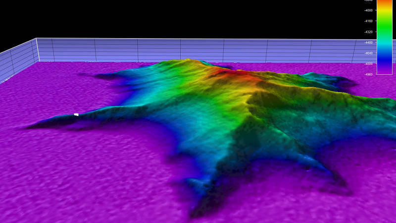
This image shows a side view, two-times vertical exaggeration, of the unnamed seamount we explored during Dive 10. The white dot represents the point where remotely operated vehicle Deep Discoverer was deployed. Image courtesy of the NOAA Office of Ocean Exploration and Research, Exploring Atlantic Canyons and Seamounts 2014. Download larger version (jpg, 437 KB).
The first leg of this expedition was conducted from August 9-30 and involved the completion of high-resolution multibeam sonar mapping of six seamount features within the New England Seamount Chain. The first several days of the expedition were dedicated to testing and calibrating mission-critical mapping and communication systems that were upgraded during a summer in-port maintenance period.
The rest of the expedition focused on completing high-resolution mapping of Panulirus, Gosnold, Sheldrake, Gregg, and San Pablo Seamounts. Mapping of approximately half of the Manning Seamount complex was also completed. Water column and seafloor backscatter data, and sub-bottom sonar data were also collected 24 hours a day during mapping operations. Mapping work had to be suspended two days earlier than planned due to the arrival of Hurricane Cristobal.
During Legs 2 and 3, we experienced a number of weather days that prevented us from conducting ROV dives. Fortunately, our team was quickly able to adapt to changing conditions and shift to mapping operations. Okeanos collected over 14,900 km2 during these two legs.
All mapping data collected during these expeditions will be available in NOAA’s public data archives within 60-90 days of the conclusion of the cruise and can be accessed via the NOAA Ocean Exploration Data Atlas.
During the expedition, our team conducted 16 dives with ROV Deep Discoverer (D2) that explored six seamounts and nine canyons, of which four seamounts and five canyons had never been explored before. We investigated several different habitats at depths ranging from 660 meters to 4,689 meters and documented deep-sea corals and their associated invertebrates, a variety of fish and other benthic animals, a diversity of mid-water fauna, and a number of species we have yet to identify.
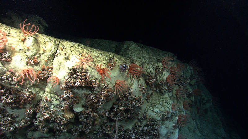
During the first-ever exploration of Nantucket Canyon, we transited up a steep wall and discovered areas of dense populations of cup corals and brisingid sea stars. Image courtesy of the NOAA Office of Ocean Exploration and Research, Exploring Atlantic Canyons and Seamounts 2014. Download larger version (jpg, 1.4 MB).
As was documented in 2013, the submarine canyons investigated during this expedition proved to be biodiversity hotspots, hosting many different species of coral, numerous fish species, several cephalopods (squids and octopus), and a variety of echinoderm species (e.g., sea stars, sea urchins, sea cucumbers).
These canyons were generally characterized by downslope areas of soft sediment leading up to steep walls with abundant biological communities under overhangs. Evidence of human influence was occasional, with the exception of Ryan and McMaster Canyons where D2 encountered several instances of trash and derelict fishing gear, potentially due to its proximity to shipping channels into large cities on the U.S. East Coast.
Highlights from these dives include observations of deep-sea predation, a series of caves inhabited by octopuses (dubbed the "octopus grottoes"), dragonfish, and several areas of high coral density.
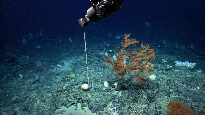
During Leg 3, our ROV team built and tested D2’s new probe to determine sediment accumulation, which we affectionately dubbed the “Sepoke.” Here, the Sepoke is deployed on Gosnold Seamount. Image courtesy of the NOAA Office of Ocean Exploration and Research, Exploring Atlantic Canyons and Seamounts 2014. Download larger version (jpg, 1.4 MB).
During our six dives on the New England Seamount Chain, D2 documented extensive deep-sea coral and sponge habitat, patchy and often sparse fish distribution, and a variety of exciting geologic features. Seamount dives contained the highest diversity of corals of the expedition, with particularly high densities observed during our dives at Gosnold and Atlantis II. We observed several different types of lava flow, lower sediment cover with a coarser grain size compared to in the canyons, and manganese encrusting over rocks.
D2 documented potential range extensions for two species of deep-sea coral, previously unknown phenomena in the water column, and potential new species and collected rare imagery of deep-sea predation and behaviors.
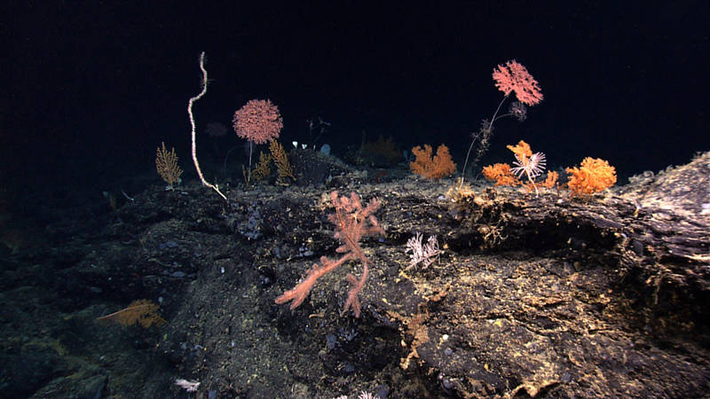
A spectacular hard rock area with a very high coral diversity, seen during our dive on the Atlantis II Seamount Complex. This one image has black corals, bamboo corals, and several additional octocorals, all living together to form a community. Image courtesy of the NOAA Office of Ocean Exploration and Research, Exploring Atlantic Canyons and Seamounts 2014. Download larger version (jpg, 1.6 MB).
We also conducted the deepest dive to date on the New England Seamount Chain on an unnamed and previously unexplored seamount that was first mapped in high-resolution using Okeanos's EM302 multibeam system in 2013.
Highlights from these dives include D2’s deepest dive to date, large colonies of precious corals, a dumbo octopus and vampire squid, several rare or unknown species, and areas of active coral recruitment.
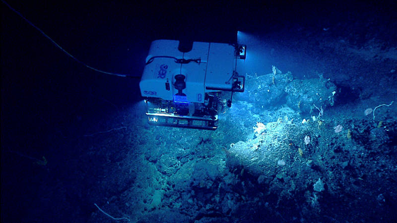
ROV Deep Discoverer investigates a diverse deep-sea coral habitat on Retriever Seamount. Image courtesy of the NOAA Office of Ocean Exploration and Research, Exploring Atlantic Canyons and Seamounts 2014. Download larger version (jpg, 1.6 MB).
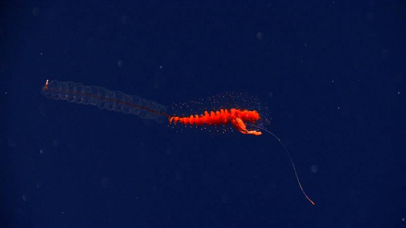
Siphonophores are regular visitors in the midwater. These animals form colonies where groups of individuals carry out specific functions. Image courtesy of the NOAA Office of Ocean Exploration and Research, Exploring Atlantic Canyons and Seamounts 2014. Download larger version (jpg, 1.5 MB).
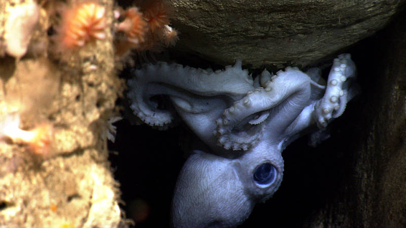
Here, an octopus mother protects her eggs in Hendrickson Canyon. If you look closely, you can see the eyes of a baby octopus through the egg. Image courtesy of the NOAA Office of Ocean Exploration and Research, Exploring Atlantic Canyons and Seamounts 2014. Download larger version (jpg, 1.4 MB).
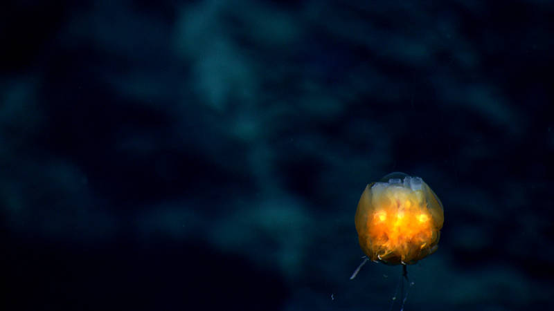
Even though they are rare, we were lucky enough to see dandelion siphonophores on three dives during this expedition. Image courtesy of the NOAA Office of Ocean Exploration and Research, Exploring Atlantic Canyons and Seamounts 2014. Download larger version (jpg, 942 KB).
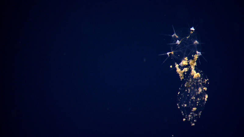
We saw this mysterious organism at 2,035 meters depth on Retriever Seamount, floating 50 meters above bottom. We could offer no other label than strange gelatinous spiked plankton. Steven Haddock, a deep-sea biologist at the Monterey Bay Aquarium Research Institute, sent an email that evening telling us it was a phaeodarian radiolarian, a type of single-celled protistan that feeds on marine snow. Image courtesy of the NOAA Office of Ocean Exploration and Research, Exploring Atlantic Canyons and Seamounts 2014. Download larger version (jpg, 1.4 MB).
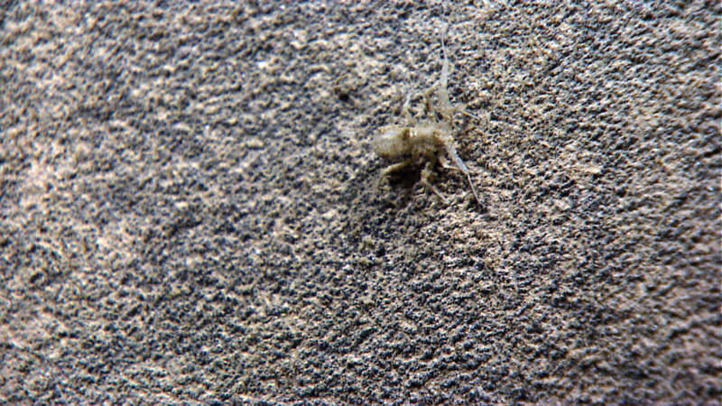
Although the expedition ends for many of our viewers when Okeanos returns to the dock, the work is just beginning for our science team. This munnopsid isopod was unidentified when we concluded the dive, but was identified by an isopod expert who was unable to participate in the dive live. Image courtesy of the NOAA Office of Ocean Exploration and Research, Exploring Atlantic Canyons and Seamounts 2014. Download larger version (jpg, 2.2 MB).
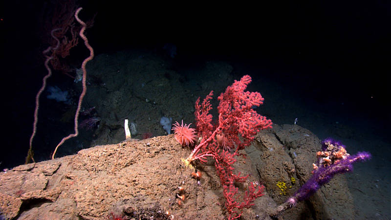
Benthic cnidarians are common in the deep-sea canyons and seamounts we are exploring. Here, octocorals, cup corals, and anemones share a rock at 1,459 meters depth in Hendrickson Canyon. Image courtesy of the NOAA Office of Ocean Exploration and Research, Exploring Atlantic Canyons and Seamounts 2014. Download larger version (jpg, 1.3 MB).
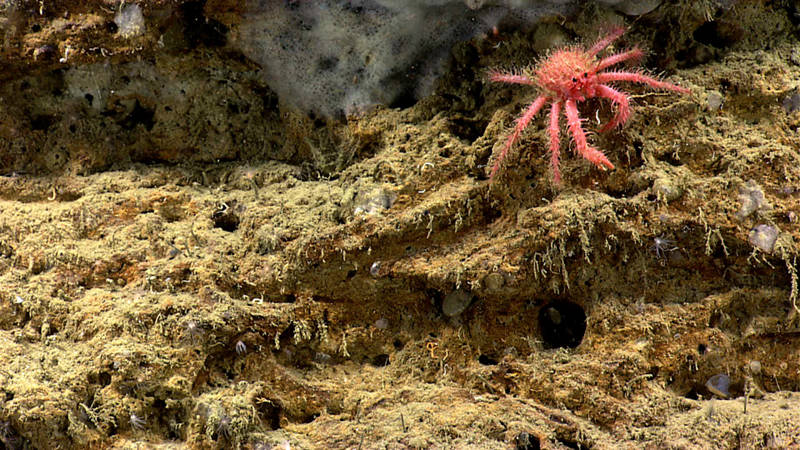
A juvenile King Crab in Phoenix Canyon. Image courtesy of the NOAA Office of Ocean Exploration and Research, Exploring Atlantic Canyons and Seamounts 2014. Download larger version (jpg, 2.0 MB).
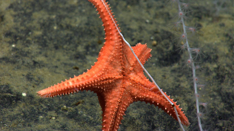
A rarely documented instance of sea star predation on bamboo coral. Image courtesy of the NOAA Office of Ocean Exploration and Research, Exploring Atlantic Canyons and Seamounts 2014. Download larger version (jpg, 1.6 MB).
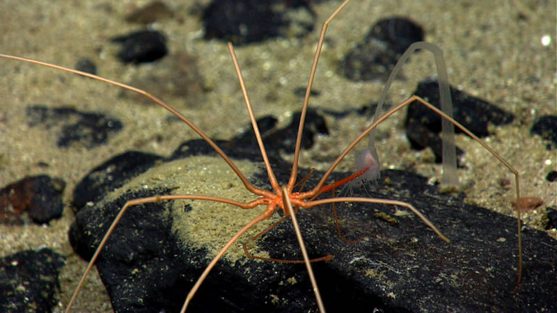
Although we saw several sea spiders during the expedition, this one feeding on a solitary hydroid was particularly exciting! Image courtesy of the NOAA Office of Ocean Exploration and Research, Exploring Atlantic Canyons and Seamounts 2014. Download larger version (jpg, 1.3 MB).
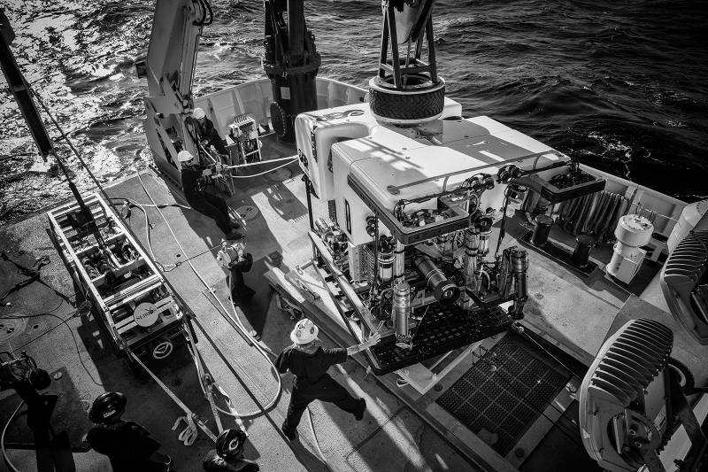
Recovery of ROV Deep Discover onboard NOAA Ship Okeanos Explorer. Image courtesy of the NOAA Office of Ocean Exploration and Research, Exploring Atlantic Canyons and Seamounts 2014. Download larger version (jpg, 4.2 MB).
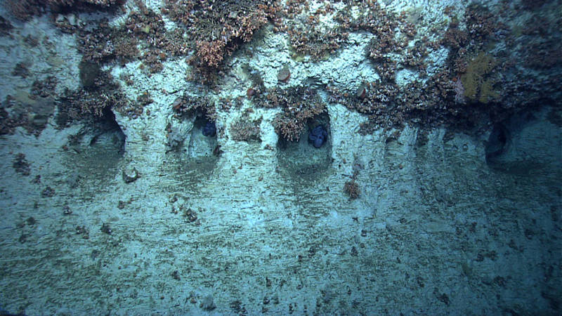
Towards the end of Dive 4, ROV Deep Discoverer came upon a series of caves inhabited by octopuses, which our team dubbed the "Octopus Grottoes." Image courtesy of the NOAA Office of Ocean Exploration and Research, Exploring Atlantic Canyons and Seamounts 2014. Download larger version (jpg, 1.8 MB).
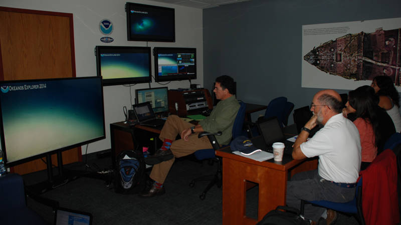
Scientists from NOAA and University of Maryland Eastern Shore participate from NOAA’s Silver Spring Exploration Command Center during our dive at Phoenix Canyon. Image courtesy of the NOAA Office of Ocean Exploration and Research, Exploring Atlantic Canyons and Seamounts 2014. Download larger version (jpg, 3.8 MB).

ROV Deep Discoverer as seen in the camera lens of Camera Sled Seirios, as the vehicles leave the seafloor from our last dive of the 2014 field season. Image courtesy of the NOAA Office of Ocean Exploration and Research, Exploring Atlantic Canyons and Seamounts 2014. Download image (jpg, 37 KB).