A key purpose of NOAA’s Ocean Exploration Initiative is to investigate the more than 95 percent of Earth’s underwater world that until now has remained virtually unknown and unseen. Such exploration may reveal clues to the origin of life on Earth, cures for human diseases, answers on how to achieve sustainable use of resources, links to our maritime history, and information to protect endangered species.
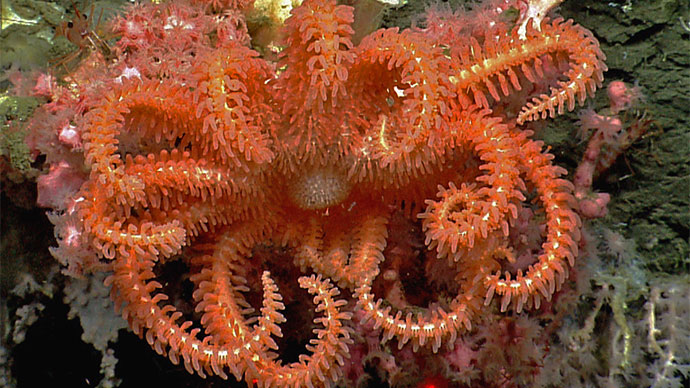
Deepwater canyons are among the most striking features of the continental slope off the east coast of the United States. There are more than 70 of these canyons in depths ranging from about 100 meters to about 3,500 meters, with steep, narrow walls that make exploration difficult. Research during the 1970s and 1980s (Hecker et al., 1980; Hecker and Blechschmidt, 1979) showed that submarine canyons along the mid-Atlantic continental slope could contain unique hard-bottom communities, many of which include high densities of deepwater corals. There also are numerous shipwrecks in the same area that are not well documented and whose historical and ecological significance are presently unknown. Similar sites in other areas are known to support important fisheries and other biological resources, but also to be vulnerable to severe damage from human activity and natural events.
In addition, cold seep communities have been found at two locations on the east coast continental slope. These communities may signal the presence of other unusual ecosystems, potentially important energy resources and areas that may be susceptible to submarine landslides that can trigger tsunamis. A recent assessment of tsunami hazard along the U.S. east coast (ten Brink, 2009) by the U.S. Geological Survey with funding from the U.S. Nuclear Regulatory Commission has identified submarine landslides along the submerged continental margin as the primary potential source of dangerous tsunamis to this coast. An historic example of this hazard was the 1929 Grand Banks submarine landslide, which produced a tsunami three to eight meters high. That tsunami killed 28 people along the Newfoundland coast, even though this area was sparsely populated at the time. A similar tsunami along the present-day Atlantic coast might be much more devastating.
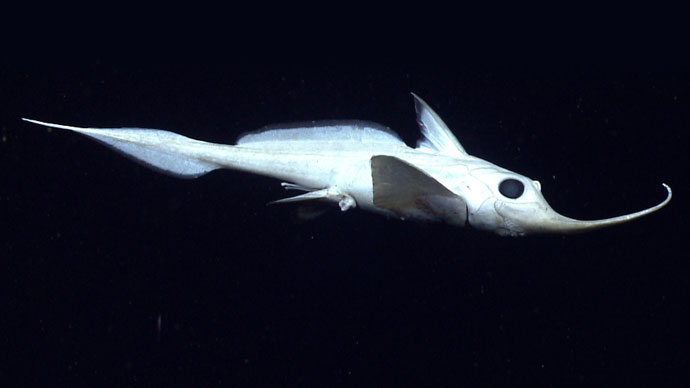
At least 660 submarine canyons are known throughout Earth’s ocean, and recent studies (De Leo, et al., 2010) suggest that at least some of these may be among the most productive habitats that have been found in the deep sea. Canyons can enhance biological productivity by providing varied and complex habitats, and by concentrating organic material and nutrient-rich sediments that provide food resources in areas that are normally food-poor. These resources can support large biomasses of benthic (bottom-dwelling) invertebrates that in turn provide food for a wide variety of bottom-feeding fishes, crustaceans, and other megafauna (the prefixes mega-, macro-, and so forth do not have precise meanings, and researchers often provide their own definitions; typically, megafauna are larger than about 20 millimeters; macrofauna are in the range 0.5 – 20 millimeters; meiofauna are 0.05 – 0.5 millimeters; and microfauna are less than 0.05 millimeters).
Habitat complexity in submarine canyons results from a combination of geological and biological features. Steep canyon walls, rocky outcrops, hard clay formations, boulders, rock rubble, and soft sediments all provide surfaces upon and within which various benthic organisms may grow. Sessile (non-moving) species such as sponges and cnidarians increase the surface complexity and provide additional habitat for other species. Soft sediment is the major substrate type, and most canyons on the Atlantic continental slope have extensive holes and tunnels produced by crabs, fishes, burrowing anemones, and other animals that further extend the range of available habitats.
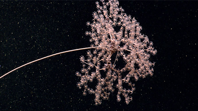
Canyons on the U.S. continental slope may also include chemosynthetic communities whose food webs are based on the energy of chemical compounds, in contrast to photosynthetic communities whose food webs are based on photosynthesis that uses energy from the sun. The first chemosynthetic communities were discovered in 1977 near the Galapagos Islands in the vicinity of underwater volcanic hot springs called hydrothermal vents, which usually occur along ridges separating the Earth’s tectonic plates. Hydrogen sulfide is abundant in the water erupting from hydrothermal vents, and is used by chemosynthetic bacteria that are the base of the vent community food web. Another type of chemosynthetic community is found in areas where gases (such as methane) and liquid hydrocarbons seep out of sediments. These areas, known as cold seeps, are commonly found along continental margins, and (like hydrothermal vents) are home to many species of organisms that have not been found anywhere else on Earth.
Methane is produced in many environments by a group of Archaea that obtain energy by anaerobic metabolism through which they break down the organic material contained in once-living plants and animals. When this process takes place in deep ocean sediments, water molecules surround methane molecules, and conditions of low temperature and high pressure allow stable ice-like methane hydrates to form. Methane hydrate is a type of clathrate, a chemical substance in which the molecules of one material (water, in this case) form an open lattice that encloses molecules of another material (methane) without actually forming chemical bonds between the two materials. Scientists are interested in methane hydrates for a variety of reasons, including their potential as an energy source, their association with unusual biological communities, and their possible role in tsunamis and climate change.
In 1995, Ocean Drilling Program Leg 164 documented extensive deposits of methane hydrates and methane gas on the Blake Ridge, on the continental slope off the coast of South Carolina and Georgia. The Ocean Explorer 2001 Deep East Expedition found methane gas in water samples collected in the Hudson Canyon region, as well as extensive cold seep communities on the Blake Ridge that contained some of the largest seep organisms ever discovered. To date, only one cold seep has been discovered in the target area for the Northeast U.S. Canyons Expedition 2013, and its continued existence was confirmed during the Deepwater Canyons 2012 expedition; but considering that very little of this area has been explored at all, the discovery of even one cold seep suggests that there may be others.
The purpose of the Northeast U.S. Canyons Expedition 2013 is to extend exploration and investigations begun in 2011 of deepwater coral and hard bottom communities to canyons and inter-canyon areas on the continental slope off the New England coast. These studies are expected to discover new coral areas and other significant canyon habitats and provide information about processes that control their distribution, abundance, and ecological functions.
The target areas for this study include Block, Alvin, Atlantis, Nantucket, Hydrographer, Oceanographer, Lydonia, Nygren, and Heezen submarine canyons and their associated inter-canyon areas as well as Mytilus Seamount, submarine landslide features, and possible gas seep sites.
The Northeast U.S. Canyons Expedition 2013 will be divided into two separate legs; the first leg will explore western portion of this region, looking at several canyons, landslide features and unconfirmed New England seep sites; and the second leg will explore the northeastern portion of this region, looking at canyons and the Mytilus Seamount. This leg will also continue work done in June 2013 by the NOAA Ship Bigelow exploring for deep-sea corals in a few of the canyons. This expedition complements and continues the 2012 Atlantic Canyons Undersea Mapping Expeditions. These expeditions, together with two additional Okeanos Explorer expeditions, gathered baseline information on deepwater canyons off the northeastern U.S. seaboard, mapping along the continental shelf and slope from Virginia to the northeastern boundary of the U.S. Exclusive Economic Zone (EEZ). These expeditions provide the basis for preliminary target selection, and allow the Northeast U.S. Canyons Expedition 2013 to take the next steps in systematic ocean exploration: investigating deepwater areas in and along the northeast canyons off the U.S. East Coast.
Expedition objectives include:
To achieve these objectives, the Northeast U.S. Canyons Expedition 2013 will:
On August 13, 2008, NOAA Ship Okeanos Explorer was commissioned as “America’s Ship for Ocean Exploration,” the only U.S. ship whose sole assignment is to systematically explore our largely unknown ocean for the purposes of discovery and the advancement of knowledge. To fulfill this mission, an exploration strategy is used that involves:
For more on the exploration strategy of the NOAA Ship Okeanos Explorer, visit the introduction pages to the Okeanos Explorer Education Materials Collection: Volume 2, How Do We Explore?
Multibeam sonar is used to make accurate bathymetric maps. A multibeam system uses multiple transducers pointing at different angles on either side of a ship to create a swath of sonar signals. The time interval between signal transmission and return echo arrival is used to estimate depth over the area of the swath. In some systems, the intensity of the return echo is also used to infer bottom characteristics that can be used for habitat mapping. The Northeast U.S. Canyons Expedition 2013 will use the Okeanos Explorer’s Simrad EM302 multibeam system for mapping operations.
Visit https://oceanexplorer.noaa.gov/technology/tools/sonar/sonar.html for more information about sonar systems.
Measurements of conductivity, temperature, and depth are a key component of the exploration strategy used aboard the NOAA Ship Okeanos Explorer. This is because underwater volcanoes, hydrothermal vents, cold seeps, chemosynthetic communities, and other features of the deep ocean are often associated with changes in the chemical properties of seawater.
A CTD is a package of electronic instruments that measure these properties. Conductivity is a measure of how well a solution conducts electricity and is directly related to salinity. Temperature measurements from CTD sensors can be used to detect changes in water temperature that may indicate the presence of volcanoes, seeps or hydrothermal vents. Often, CTDs are attached to a much larger metal frame called a rosette, which may hold water sampling bottles that are used to collect water at different depths, as well as other sensors that can measure additional physical or chemical properties.
For more information on CTDs visit: https://oceanexplorer.noaa.gov/technology/tools/sondectd/sondectd.html and
https://www.pmel.noaa.gov/eoi/PlumeStudies/WhatIsACTD/CTDMethods.html.
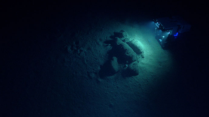
A key technology for the Northeast U.S. Canyons Expedition 2013 is remotely operated vehicle (ROV) underwater robot system. Previously, the Okeanos Explorer program used the Ocean Exploration Center’s ROV, Little Hercules, which was on loan to the program for the past few years. Little Hercules is now on display at the University of Rhode Island Graduate School of Oceanography in their Ocean Science and Exploration Center. Little Hercules is a 4,000-meter-depth-rated ROV, with an impressive past.
Little Hercules was removed from the NOAA Ship Okeanos Explorer after three years of service that took the vehicle to Indonesia, the Galapagos Islands, Panama, and the Gulf of Mexico. Along the way this "little robot that could" captured some of the best underwater video of some of the planet's most spectacular natural landscapes from some of the most remote and hostile places in the world.
NOAA’s new 6,000-meter ROV, Deep Discoverer, has more sophisticated capabilities than Little Hercules, and the increased capabilities will enable innovation through research and development of new sensors and systems. The Deep Discoverer currently includes hydraulic manipulator arms for deploying oceanographic sensors, an inertial navigation system, a Doppler velocity navigation system, and a system for dynamic lighting control.
For more information about ROVs, visit: https://oceanexplorer.noaa.gov/technology/subs/subs.html.
For more specific information on the ROV Deep Discoverer aboard the Okeanos Explorer, visit this page.