

image
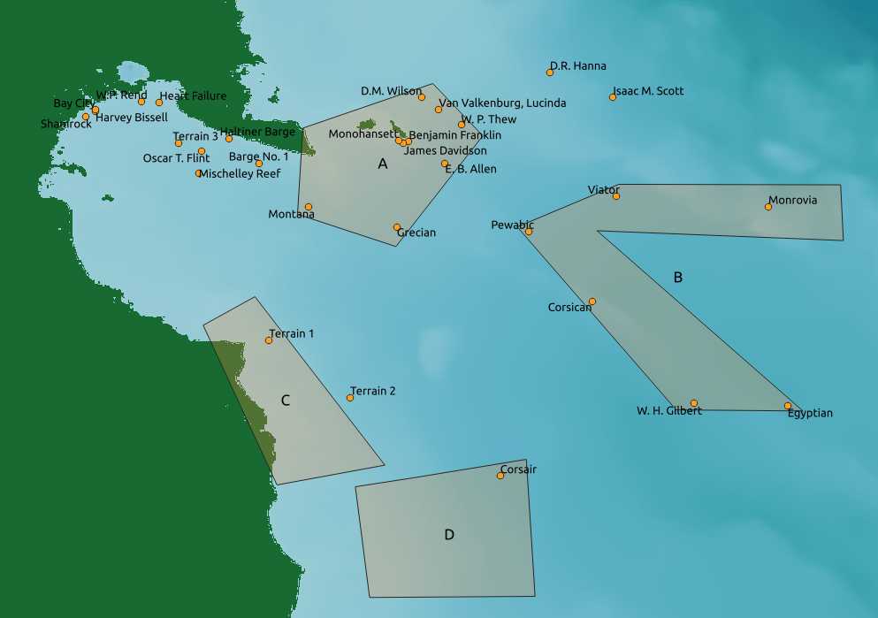
Shipwreck Sites and Exploratory Sites
Figure 1: Map of survey regions A, B, C, and D, where C and D are exploratory areas. Shipwreck sites and exploratory sites from year 1 and year 2 are displayed.