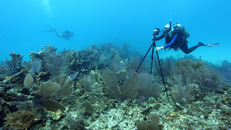
July 18, 2021: 360-degree Panoramic Camera

Image courtesy of the Office of National Marine Sanctuaries. Download larger version (jpg, 5.1 MB).
The Quicksands Archaeological Survey team used two distinct photographic techniques to document archaeological sites in the project area: multi-image photogrammetry and 360֯-degree panoramic imaging. Each technique results in high-resolution imagery suitable for archaeological analysis, while at the same time capturing the archaeological sites within the context of their surrounding natural environment. Additionally, the two distinct viewpoints created by these approaches provide immersive experiences for viewers, allowing them to virtually experience these remote locations.
In this image, NOAA Office of National Marine Sanctuaries maritime heritage coordinator and research team member Brenda Altmeier levels the 360-degree panoramic camera before photographing the Tonawanda shipwreck off Key Largo.
From: Archaeological Documentation Through Photography.