January 9, 2021: Bathymetric Data
 of water and conducting efficient mapping operations in up to 8,000 meters (5 miles) of water.")
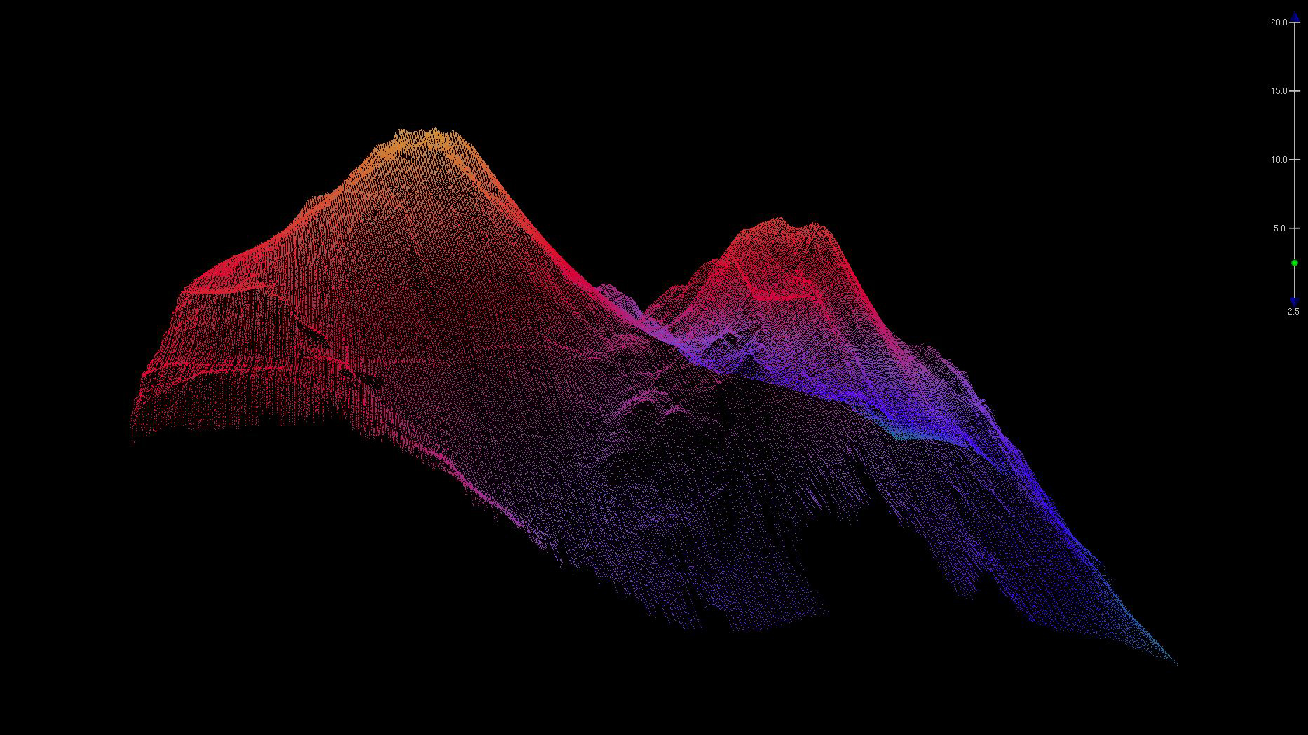
Image courtesy of the NOAA Office of Ocean Exploration and Research, Deepwater Wonders of Wake. Download larger version (jpg, 1.0 MB).
This image was collected in 2016 using the EM302 sonar that was on NOAA Ship Okeanos Explorer; in March 2020, this topside unit was upgraded to an EM304 multibeam sonar capable of detecting the seafloor in up to 10,000 meters (6.2 miles) of water and conducting efficient mapping operations in up to 8,000 meters (5 miles) of water.
This kind of multibeam sonar is used to collect seafloor bathymetry, seafloor backscatter, and water column backscatter. Collected data are converted into three-dimensional point clouds of individual bathymetric soundings of the seafloor, such as the one shown here. Watch-standers use sophisticated software to grid the point clouds, providing high-resolution visualizations of the seafloor.
From: Mapping on NOAA Ship Okeanos Explorer.