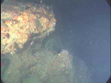
Limestone outcrops often form complex structures on the sea floor. (Photo courtesy of the National Geographic Society.)

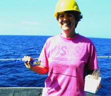
Although much of the gear used in scientific research is highly technical, some of it is decidedly low-tech. Here, marine geologist Kathryn Scanlon collects sediments from the Van Veen grab with a shovel from a child’s beach set. The matching bucket did not survive the cruise. (Photo courtesy of K. Scanlon, USGS.)

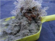
A closeup of the sample taken from the Van Veen grab. (Photo courtesy of K. Scanlon, USGS.)
Madison Swanson Marine Fishery Reserve
June 16-20, 200
Felicia Coleman, Program Director
Institute for Fishery Resource Ecology
Florida State University
NOAA's National Marine Fisheries Service (NMFS) established the Madison Swanson Fishery Reserve in June 2000. This 115-sq-nm area will serve as an experimental site until June 2003, allowing scientists to evaluate the efficacy of "no-take zones" in the management of reef fish, particularly groupers of the family Serranidae. One study focuses on whether the closed area protects male gag (Mycteroperca microlepis), thus allowing them to recover from their current low population levels. According to the American Fisheries Society, gag are at risk of being overfished, and, perhaps, even at risk of extinction, should current fishing practices persist. (Read more on the plight of gag groupers.)
During the Sustainable Seas Expeditions, we concentrated efforts in this reserve because of existing knowledge about the location of spawning aggregation sites. These sites were identified during the peak spawning season for gag and scamp (Mycteroperca phenax) through the efforts of scientists from Florida State University and the NMFS laboratories in Panama City and Pascagoula, and commercial fishermen from North Florida.
Fishermen often participate in our scientific missions. Indeed, their wealth of knowledge about the natural history of the species they catch is woefully underappreciated. We have found a number of individuals to be extremely effective collaborators, and sometimes even strong proponents of marine protected areas. Unfortunately, not all fishermen feel the same way. While the NOAA Ship Gordon Gunter cruised the reserve, so, too, did commercial vessels actively engaged in fishing quite near the spawning sites. The U.S. Coast Guard intercepted two of these vessels and found reef fish onboard.
We selected study sites for this mission from acoustic side-scan images produced by Kathryn Scanlon, a marine geologist with the U.S. Geological Survey in Woods Hole, MA. These maps proved essential for locating different geomorphological features attractive to reef fish. We pinpointed habitats that ranged from low-relief, drowned patch reefs to pinnacles (“The Mad Swan Cones”) and relatively high- relief ridges (“Stu’s Ridge”), making a total of eight dives. G.P. Schmahl, manager of the Flower Gardens National Marine Sanctuary, dove in an area capriciously dubbed “The Alien Spaceship Landing Strip” because of its oddly rectangular array of isolated rocky outcrops on the sea floor. The purpose of the dive was to locate freshwater seeps in the area. On a previous NMFS cruise, a low-salinity anomaly appeared in the records, apparently associated with this strip. We were unable to find the seeps, but came upon an equally interesting array of tilefish burrows. Tilefish excavate burrows in silty substrate in deep water. The burrows attract a number of different organisms as co-habitants, including galatheid and goneplacid crabs. In addition, the burrows provide structure in habitat that is more typically devoid of any features.
Visibility on these dives tended to be rather poor. The expedition traveled in the wake of Tropical Storm Allison, which had been sufficiently strong during the Flower Gardens sanctuary leg to make launching the DeepWorker submersible impossible. This didn’t make the Flower Gardens’ scientific team particularly happy, but it certainly benefited our leg, because it allowed G.P. Schmahl and Emma Hickerson, the science director, to participate on the West Florida shelf.
When the sub was not operating, Kathryn Scanlon conducted systematic sediment sampling to ground-truth her acoustic maps. Knowing the surficial geology of the sea floor provides information about the kinds of organisms inhabiting it and the strength of currents that typically sweep through the area. For instance, fish tend to burrow in silty clay, which will hold a higher angle when excavated than will pure sand, which collapses.
Site Characterizations
June 16-18, Drowned Patch Reef Aggregation Sites
(Depths around 260 ft.) The habitat in this area consists primarily of scattered, low (2-3 ft in height) and somewhat higher-relief (6-8 ft) rocky outcrops embedded in sand with a veneer of silty material. Much of the silt in the area is, perhaps, a result of the tropical storm. The area appears to have been actively fished, as evidenced by the presence of lost longline gear. Longlines can be miles long, set with multiple hooks along the length, and, in this case, fished on the bottom to catch bottom-associated reef fish. Lost gear continues to "fish" until the line itself decays, which may take years, given that the line is made out of plastic. Fish on the reefs include amberjack, scamp, snowy grouper, red snapper, and many small reef fish, known as rough-tongued bass, that serve as forage species for the larger predators. Sessile invertebrates on the rocks include encrusting sponges, sea fans, corkscrew sea whips, and scattered clusters of Oculina coral. Much of the rock had a crustose coralline algae cover. Those able to move around include arrow crabs, crinoids, hermit crabs, and basket stars. When the sub transited sand in a fairly featureless area, the reef fish disappeared and batfish came into view.
June 18, Stu’s Ridge
(Depths ~200 ft.) Stu’s Ridge is a relatively high-relief (~50 ft) ridge that runs through the northeastern part of the Madison Swanson Reserve, continuing to the northwest outside of the reserve.
June 19, Mad Swan Cones
(Depths ~230-250 ft.) The Mad Swan Cones consist of a series of pinnacles, each roughly 30 ft in height off the bottom. The most abundant fish in the area were small basses, including red barbier and rough-tongued bass. Reef butterflyfish and bank butterflyfish were less abundant, but consistently present, in the area. All of the reef fish of any economic importance, such as red snapper, gag, and scamp, were very small, as determined using laser metrics. It would be extremely worthwhile to return to this area in three yrs to note any changes in the average size of the fish. The assumption is that within the reserve, fish should increase both in number and in individual biomass. That is, the protection afforded by the reserve (if, in fact, fishers comply with regulations) should effect these sorts of changes.
June 20, Alien Spaceship Landing Strip
(Depth ~315 ft.) This area, so named because of the paired series of parallel, evenly spaced features over an area of several hundred yards, is primarily sand with an overlay of silt. The “lights” of the “landing strip” are, in fact, very small, low-profile rocky outcrops. Associated with the outcrops were small basses, such as rough-tongued bass and tattler, and short bigeyes. Over the sandy areas were squid, large hermit crabs, and batfish.
Sign up for the Ocean Explorer E-mail Update List.


