By Eric Terrill, Scripps Institution of Oceanography
The Aleutian campaign was the sole World War II (WWII) campaign fought on North American soil, and Kiska Island, along with Attu Island to the west, are the only United States (US) territories occupied by foreign forces in the last 200 years. Kiska remains one of the best preserved historic battlefields from WWII, being one of only two in the world where neither previous nor later settlement obscure military developments. While the terrestrial component is well documented, the maritime component remains largely unexplored. The exception is a short eight-day survey of Kiska Harbor in 1989. Our team will build on existing archaeological and historical data to explore one of the least studied, yet most significant sites of WWII.
Significant benefits to NOAA and the nation are gained through six objectives:
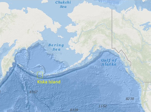
The waters surrounding Kiska Island, one of the Rat Islands in the Aleutians, are the final resting place of potentially hundreds of cultural resources from WWII (Figure 1).

Figure 1: Kiska Island, Alaska is one of the Rat Islands in the Aleutian chain. Image courtesy of CORDC, Scripps Institution of Oceanography. Download larger version (jpg, 211 KB).
Beyond the intrinsic cultural and historical significance, many of these sites are associated with the remains of service members, both American and Japanese, still classified as missing in action.
Our proposed survey focuses on four distinct search areas, each relevant to a unique aspect of the battlefield’s maritime cultural landscape (Figure 2).

Figure 2: Google Earth image of Kiska Island with historical overlay of the USS Abner Read action report (Commanding Officer USS Abner Read 1943), NOAA nautical chart 16442, and four proposed survey areas in red. Image courtesy of CORDC, Scripps Institution of Oceanography. Download larger version (jpg, 2 MB).
Area 1 is Kiska Harbor. Home to the Japanese naval installation, this area was the most frequent target of the US bombing campaign and historical records indicate a large number of Japanese ships and aircraft, and US aircraft lost within. Area 2, east of Twin Rocks, encompasses the final resting place of the Japanese submarine I-7 lost while assisting in the Japanese planned evacuation. Area 3 is Gertrude Cove located on the island’s south shore. The Imperial Army garrisoned over 3,500 men here and it is the site of a number of US bomber losses and Japanese ships. Area 4 lies off the island’s west coast and is associated with the US effort to retake Kiska. On August 18, 1943 the USS Abner Read struck a Japanese mine while patrolling off the northwest landing beach causing the stern to break off and sink with 71 men trapped inside. The total area of all four surveys is ~54 square kilometers.
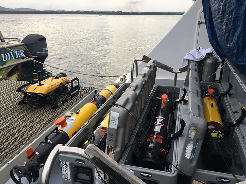
A geophysical remote sensing survey will be conducted in all survey areas. The primary tool employed will be compact autonomous unmanned underwater vehicles (UUVs), underwater robots programmed to survey a specified region, collecting data from many sensors (Figure 3).

Figure 3: An ROV (left side, on deck) and several UUVs ready for deployment on a previous project. Image courtesy of Project Recover . Download larger version (jpg, 6 MB).
Side scan sonar or multibeam sonar data will be collected first, allowing the team to identify potential cultural resources on the seafloor. Magnetometer data will also be collected to help identify magnetic (metal) objects which may be covered in sediment or otherwise be difficult to detect using side scan sonar. A low-light camera can also be deployed, giving the team a visual record of the underwater area surveyed.
The project has the capacity to operate up to four systems simultaneously, allowing for large areas to be investigated in a short span of time (optimally 4 square kilometers per day per vehicle). Once potential locations are identified using the UUVs and remotely operated vehicle (ROV) (a tethered mobile instrument attached to the ship, equipped with a video camera) data can be collected for more detailed exploration. Specially trained SCUBA divers can then be deployed to further document the cultural resources using advanced diver deployed sonars, camera systems, and more traditional archaeological methods.
Our team, using innovative technology and building on existing archaeological/historical data will explore and document cultural resources at one of the least studied, yet most significant sites of WWII. Survey data will provide an inventory of submerged cultural resources associated with the Kiska Island National Historic Landmark as well as baseline environmental/benthic conditions—currents, depth, bottom type, existing ecosystems, visibility, salinity, dissolved O2, and pH—necessary for site management and preservation. We hope to not only locate and document the wreckage of aircraft, ships, and submarines, but also to honor the final resting place of US and Japanese service members who lost their lives in the waters surrounding Kiska Island.