
April 10-21, 2017
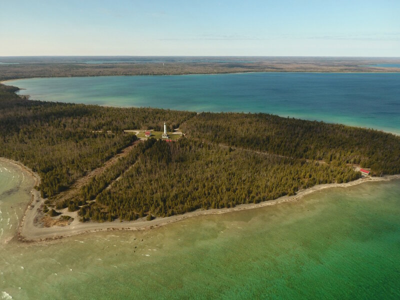
During an afternoon too windy to survey, Oceans Unmanned pilot Brian Taggart collected imagery of the Presque Isle lighthouse. Image courtesy of Thunder Bay National Marine Sanctuary, NOAA, Brian Taggart - Oceans Unmanned. Download larger version (jpg, 2.9 MB).
Matt Pickett, NOAA Remote Sensing Division
Brian Taggart, Oceans Unmanned
J.R. Gibbens, Trumble Unmanned
John Bright and Stephanie Gandulla, Thunder Bay National Marine Sanctuary
Wayne Lusardi, State of Michigan
Shallow water ‘ship traps’ adjacent to historical shipping lanes around Thunder Bay. Field operations focused on the North Point Reef area, but also collected data in Presque Isle Harbor, North Bay, Isaacson Bay, and Black River.
All technology were Unmanned Aerial Systems (UAS), sometimes referred to as Unmanned Aerial Vehicles (UAVs). They included fixed-wing and quad-copter systems.
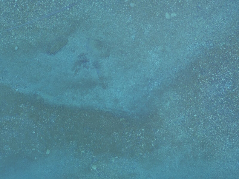
Sample image taken during a survey mission over North Point Reef. The remains of a wooden vessel can be seen and belong to archaeological site Galena, which is buoyed by the sanctuary every summer. The mooring buoy tackle, a large train wheel, is also visible in the image. Image courtesy of Thunder Bay National Marine Sanctuary/NOAA, J.R. Gibbens/Trumball Unmanned. Download larger version (jpg, 3.4 MB).
The Great Lakes provide a natural, waterborne highway that extends over 1,000 miles into the interior of North America. For centuries, people have utilized these waterways for exploration, transportation, and commerce. Even today, freighters still ply these waters, moving goods and commodities along all five lakes and beyond. The Great Lakes, however, present mariners with an array of navigation hazards, including unpredictable weather, prolific fog, sudden gales, and rocky shoals.
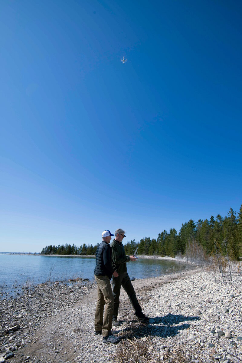
Pilot Brian Taggart controls a Phantom 4 quadcopter (hovering above) as pilot Matt Pickett observes. Image courtesy of Thunder Bay National Marine Sanctuary/NOAA. Download larger version (jpg, 3.8 MB).
Where shallow rocky shoals lie near heavily travelled shipping lanes, such as the waters throughout Thunder Bay, they present an increased hazard to vessel traffic since straying off course even slightly can mean stranding or wrecking upon the shallow shoals. During the late nineteenth century, hundreds of schooners met this fate upon Lake Huron. Archaeologists use the term ‘ship trap’ to describe this type of navigational hazard.
North Point reef, Middle Island, and Black River are three locations within Thunder Bay National Marine Sanctuary where ship traps claimed numerous vessels. Just as these areas were dangerous to historical vessel traffic, they remain un-navigable to modern vessels. Unlike open lake waters, ship traps are difficult to survey with research vessels because it is too dangerous to operate in shallow, rocky areas. As a result, many of these locations within the sanctuary remain unexplored.
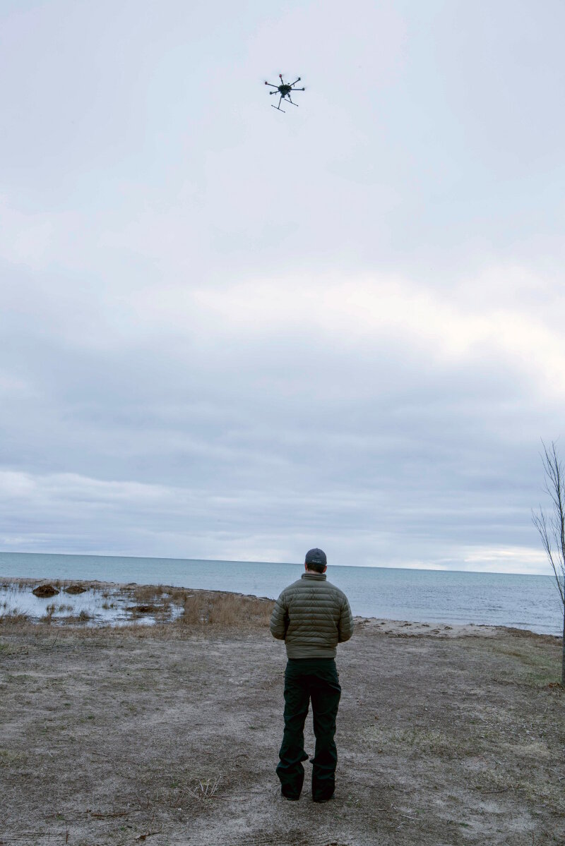
Pilot J.R. Gibbens pilots Trumball Unamnned’s DJI Matrice 600 Pro over Thunder Bay National Marine Sanctuary in the vicinity of Black River. Image courtesy of Thunder Bay National Marine Sanctuary/NOAA. Download larger version (jpg, 2.4 MB).
To solve this limitation, researchers proposed a unique approach: if it is hazardous for a vessel to survey in shallow water, why not remove the vessel from the equation? Lake Huron’s water is often so clear that it is possible to see the lake floor as deep as 30 feet down. Pilots flying low over the lakes have continuously made this observation. The emergence of portable, commercially available UAS products offered an opportunity to put ‘eyes in the sky’ without the prohibitive expense and complexity of operating an airplane.
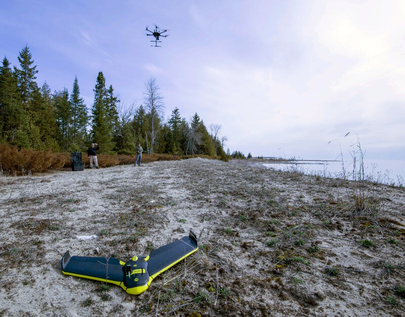
A fixed-wing senseFLY eBee RTK aircraft rests on the ground as a DJI Matrice 600 takes off in the background. NOAA, operating the eBee system, works with partners Oceans Unamanned and Trumball Unmanned to survey shallow-water portions of the Thunder Bay National Marine Sanctuary. Image courtesy of Thunder Bay National Marine Sanctuary/NOAA. Download larger version (jpg, 7.8 MB).
Thus, the plan was born to task UAS with systematic, geo-referenced survey missions over water for the purposes of archaeological exploration and documentation. Testing this procedure brought together partners from Thunder Bay National Marine Sanctuary, NOAA’s Remote Sensing Division, Oceans Unmanned, and Trumball Unmanned to bring an array of aircraft, pilots, and experts together for a two-week survey mission.
Researchers from around the world have often referred to Thunder Bay National Marine Sanctuary as a ‘living laboratory’ for marine technology and archaeological research, and that was no exception for testing UAS applications. Numerous known archaeological sites offered ideal testing locations to calibrate cameras and flight parameters such as altitude, front/side lap, speed, mission duration, etc. Once dialed in, the UAS were then deployed on exploratory survey missions.
The sanctuary’s diverse geography allowed access to areas via land and boat, and exploratory flights were planned from broad to narrow scale. First, the entire area of interest around a ship trap was defined. Then, within the larger area, priority areas were selected, based on the expected amount of archaeological materials. Inside these areas, a series of missions were planned such that, in the course of multiple flights, the entire area was surveyed within hours.
Working in this way, four separate UAS platforms were deployed and all performed exceptionally well. In fact, the constraining factor during the missions was not any UAS system, but the weather. Since the methodology relied on seeing through the water’s surface to the lake floor below, any condition that disrupted the surface visibility would ultimately affect data quality. As a result, glare from the sun or ripples produced by wind over the water would necessitate cancelling planned missions.
Under optimal environmental conditions, however, the data quality was exceptional. In a single flight, one UAS would collect hundreds of overlapping images. In the course of a single day, multiple flight missions yielded thousands of captured images. These images, all tagged with a GPS position recorded during flight, were loaded into a software interface where they were stitched into single, high-resolution mosaics. Archaeologists reviewed these mosaics, each of sufficient quality to observe features as small as individual rocks on the bottom or single timbers from shipwrecks.
As an exploratory approach to surveying shallow water, the UAS operations were highly successful. Low-altitude, camera-equipped UAS offered archaeologists a perspective of these archaeological sites only possible by aerial survey. Unlike using an airplane or helicopter, UAS were portable, efficient, and cost-effective. Having proven the concept of UAS-based archaeological survey within the sanctuary, the future is full of possibilities for how these systems can become an indispensable part of the marine archaeologist’s toolbox.
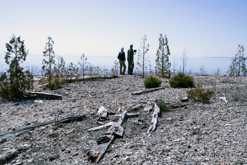
Pilots Matt Pickett and Brian Taggart observe a UAS during a survey mission over Thunder Bay’s North Point Reef; beached shipwreck remains are scattered throughout the foreground. Image courtesy of Thunder Bay National Marine Sanctuary/NOAA. Download larger version (jpg, 7.3 MB).
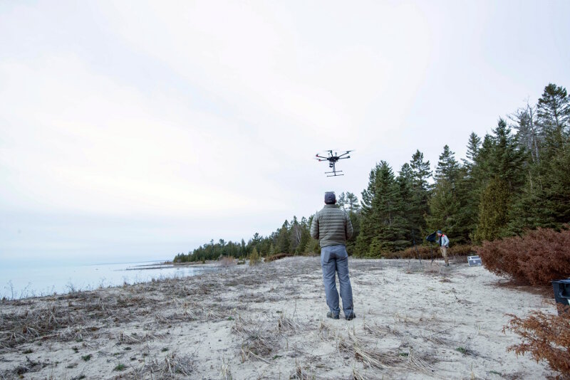
Pilot J.R. Gibbens controls a Matrice 600 during take-off for a survey mission at Thunder Bay’s North Point Reef. Image courtesy of Thunder Bay National Marine Sanctuary/NOAA. Download larger version (jpg, 3.9 MB).
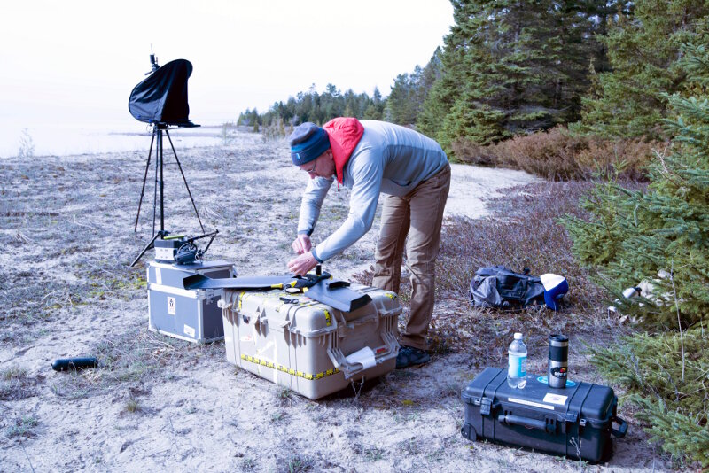
Pilot Matt Pickett readies a senseFLY eBee RTK. Image courtesy of Thunder Bay National Marine Sanctuary/NOAA. Download larger version (jpg, 5.9 MB).
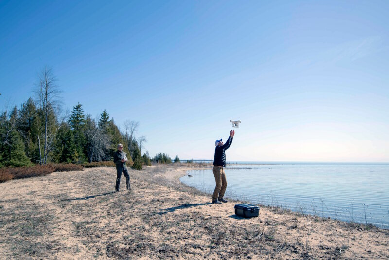
Oceans Unmanned pilot Brian Taggart brings a Phatom4 quadcopter down for a landing as pilot Matt Pickett gets ready to catch. Image courtesy of Thunder Bay National Marine Sanctuary/NOAA. Download larger version (jpg, 4.0 MB).
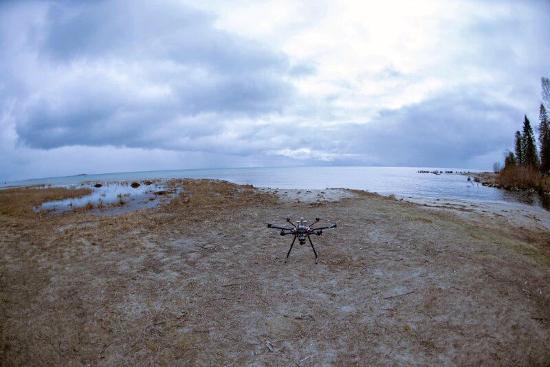
Trumball Unmanned DJI Matrice 600 Pro sits ready for a survey mission next to the back of Black River. Image courtesy of Thunder Bay National Marine Sanctuary/NOAA. Download larger version (jpg, 3.8 MB).
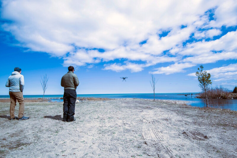
Pilot Matt Pickett looks on as pilot J.R. Gibbens takes off during a sunny break in an otherwise cloudy day. Image courtesy of Thunder Bay National Marine Sanctuary/NOAA. Download larger version (jpg, 4.5 MB).