By Dr. Amanda Demopoulos, Research Benthic Ecologist, U.S. Geological Survey & Dr. Jason Chaytor, Research Geologist, U.S. Geological Survey
August 30, 2016
As we headed to shallow waters off Cape Fear, North Carolina, to wait out some rough weather, we tried to think of ways to make the best use of our time. What better way to pass the time on a research vessel than to collect some data!
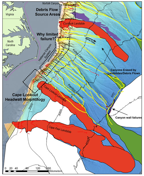
This ship’s Commanding Officer said that we could conduct CTD (conductivity, temperature, depth) operations and it was serendipitous that our colleague, Jason Chaytor at the U.S. Geological Survey, had some target sites in the area. Approximately 100 miles off the coast of Cape Fear is the head of the largest landslide mapped off the U.S. east coast, yet specific age estimates for this landslide and how it formed are still unclear.
Landslides can occur on land or in the sea, where large amounts of material, like rock or sediment, fall downhill, off a mountain, cliff, or slope. While multiple landslides have occurred along the U.S. Atlantic margin, the processes responsible for triggering the landslides may differ. These triggers can include earthquakes, the accumulation of heavy sediment forcing the seafloor to fail, erosion due to currents, and salt diapirism (large salt domes that impinge and disturb the seafloor from below). These factors influence how stable the slope is and its vulnerability to fail or create a landslide.
The Cape Fear Landslide (Figure 1) is currently estimated to have occurred between 10,000 and 27,000 years ago. It may also be the location of older landslide events, potentially triggered by different processes than those that generated the landslides further north. Better age estimates of landslides can help reveal the complex processes and triggers that cause these events. Understanding the size, age, and distribution of submarine landslides allows us to evaluate landslide and landslide-generated tsunami hazard potential, both important for establishing their risk to coastal communities and human infrastructure.

Figure 1: Map displaying location of the Cape Fear Landslide and other landslides to the north. Image courtesy of U.S. Geological Survey. Download larger version (jpg, 2.5 MB).
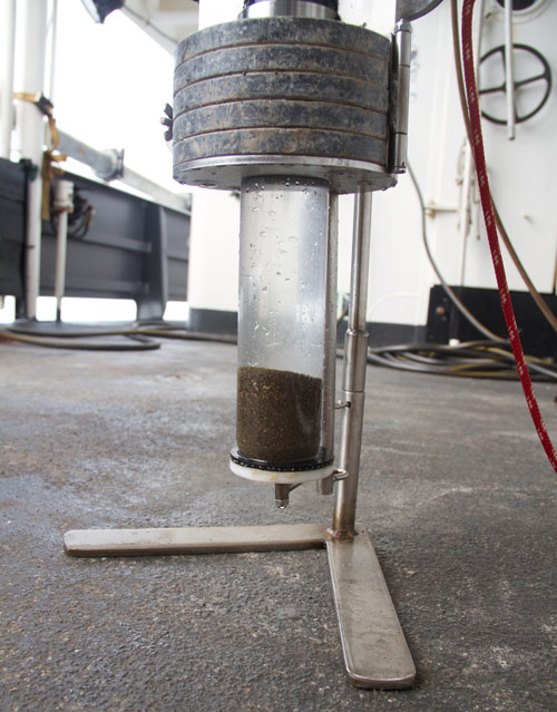
In order to help us understand the Cape Fear Landslide, we deployed the CTD with a monocore attached to the bottom (Figure 2). The monocore allowed us to collect a sediment sample at specific locations along the upper part of the slide.

Figure 2: A monocore is an instrument used to collect a discrete sample of the bottom sediments. Image courtesy of Exploring Carolina Canyons expedition. Download larger version (jpg, 4.5 MB).
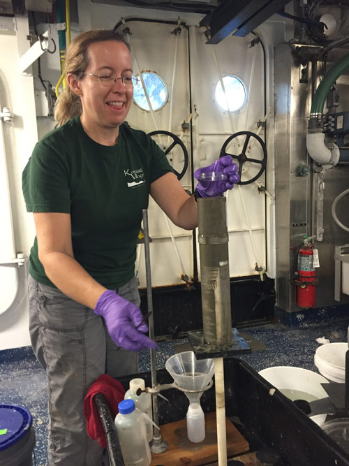
The cores were processed immediately on the ship. First, we took photographs and notes about sediment color, depth, animals present, and any signs that the core was disturbed during collection. We then sliced the core at one-centimeter intervals (Figure 3) all the way to the bottom of the sediment (~20 centimeters total). These slices of mud were placed into pre-labeled bags and then stored in the refrigerator. However, the real work will begin when we return to land and hand over the sediments to Jason.

Figure 3: Amanda Demopoulos prepares to slice another centimeter section from the sediment core. Image courtesy of Exploring Carolina Canyons expedition. Download larger version (jpg, 3 MB).
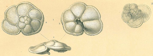
The sediments will be examined for foraminifera, tiny organisms that require a microscope to see and identify (Figure 4). Chemical analysis of these organisms will provide an age estimate of the sediment layers.

Figure 4: Chemical analysis of foraminifera, tiny organisms that require a microscope to see and identify, will provide an age estimate of the sediment layers. Image courtesy of Globorotalia menardii; Brady, H.B. (1884) Report on the Foraminifera dredged by H.M.S. Challenger during the Years 1873-1876. Pl. 103 Download larger version (jpg, 123 KB).
Sediment will also be examined for grain size, texture, and carbonate content, all providing some clue into how that material was deposited on the seafloor and the sedimentation rate (i.e., how fast it settles). Also, examining the mineralogy of the sediment, including a variety of sediment characteristics like crystal structure, as well as physical and chemical properties, can help identify the source of the sediments.
One important piece of data collected with CTD operations is depth. While it seems unusual that we wouldn’t have reliable depth data for these areas off our coast, it turns out the preexisting data were off by about 30 meters for each station. By targeting sites outside and inside the landslide scar, Jason will be able to compare parts of the seafloor that failed with those that have not failed. Ultimately, we hope that these unplanned, yet fortuitous, sediment collections will provide interesting insights into one of the largest and most prominent seafloor features in the deep sea off the U.S. east coast.