By M. Dennis Hanisak, Chief Scientist for the Coral Ecosystem Connectivity 2015 Cruise, and Research Professor - Florida Atlantic University - Harbor Branch
August 29, 2015
Video showing the recovery of the Mohawk remotely operated vehicle as weather conditions began to deteriorate as a result of Tropical Storm Erika. Video credit: Brian Cousin, FAU Harbor Branch. Download (mp4, 7.3 MB).
Earlier in this cruise, we retraced a remotely operated vehicle (ROV) transect at a site we dove on our first Connectivity cruise in 2012 (see John Reed’s mission log of August 23). That was challenging, but we used the same technology and the same team of scientists to duplicate that effort.

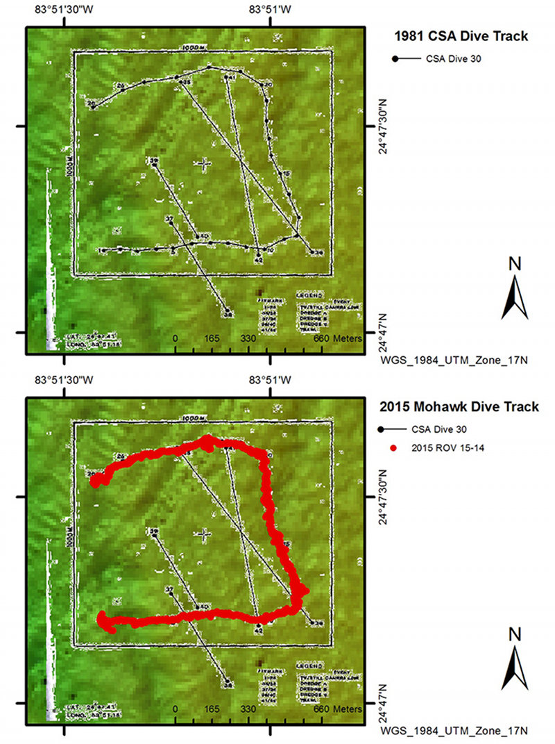
The planned track for today’s remotely operated vehicle (ROV) dive was to repeat as closely as possible a transect made by Continental Shelf Associates in 1981. Due to great teamwork by our ROV pilot Lance Horne and Ship Captain Shawn Lake, we were successful. Today’s track shown at the bottom closely matches the previous track at top. Image courtesy of Stephanie Farrington, FAU Harbor Branch. Download larger version (jpg, 685 KB).
Today, we did a similar comparison, but with a higher degree of difficulty. We retraced a transect from 34 years ago. The earlier effort was done not with an ROV because that technology was still in its infancy back then, but with a “photo sled” — basically a drop camera towed behind a ship.
The previous survey was done by Continental Shelves Associates (CSA) on April 25, 1981. Both John and I are familiar with CSA’s surveys of this area. Indeed, my first cruise to Pulley Ridge in 1984 was preceded by a visit to CSA to see if rumors of a large, leafy green alga (we now know to be Anadyomene menziesii) being pulled up by fishermen might be true. I remember holding up film strips to a light in a dark room at CSA to catch my first glimpses of Anadyomene menziesii, a species that has intrigued me ever since...and thus, beginning my personal Pulley Ridge quest.

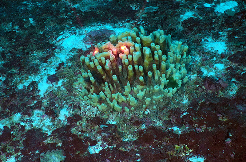
Our first sighting of Oceanapia, a spectacular sponge, on Pulley Ridge. Image courtesy of Coral Ecosystem Connectivity 2015 Expedition. Download larger version (jpg, 785 KB).
One task of our Pulley Ridge Community Structure team is to locate other existing data that we might use to better understand changes in the community. Earlier in the year, John and I discussed the old CSA work, and he tracked down those same images that I had held in my hands long ago. Those photos were made before the age of good underwater cameras, long before digital. John discovered that those images still existed in storage boxes at CSA. He received permission to get the original film strips, cut them into individual frames, digitize, and analyze them. John and Stephanie Farrington did just that, so we now can compare the 1981 images with the high-quality digital stills we now take.
In addition to the still images, we also had the CSA cruise track, which we carefully duplicated today. The CSA transect was a challenge for us to do on a single ROV dive, being 2.4 kilometers long and shaped like a large C, with three segments each 800 meters long. Its orientation relative to the prevailing current and wind challenged our ROV pilot Lance Horne and Ship Captain Shawn Lake. Several times we had to stop and reposition before continuing along the transect. It was our longest dive of the cruise at four hours. But we were successful because of the teamwork of the ROV team and ship’s crew. Once we analyze these data, we will be able to evaluate how this site has changed, if at all, over more than 30 years; there are very few such comparisons in mesophotic reefs that can be made.
Our challenges did not end when our survey ended, as the seas were starting to deteriorate, making the ROV recovery the most challenging one of the cruise. But again, solid teamwork prevailed, and we safely recovered the ROV.

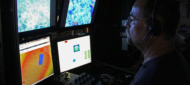
Lance Horn, University of North Carolina at Wilmington’s Undersea Vehicle Program, was in the pilot seat for today’s four-hour remotely operated vehicle dive and his experience was a key part of its success. Lance has conducted 140 ROV missions (1,670 dives). Image courtesy of Brian Cousin, FAU Harbor Branch. Download larger version (jpg, 389 KB).
At that point the Captain advised us that we had pushed our abilities as far as we could for now. We had been watching Tropical Storm Erika for several days, and its latest projection was centered on our location. Although the storm had weakened and was being called “remnants of Erika”, for the Research Vessel Walton Smith, the weather was something we still must contend with. So, we moved to a safer location – Rebecca Shoal in the Dry Tortugas.
As I write these lines, we are still transiting, with wind speeds up to 36 miles per hour. We should be there before midnight. How long we stay depends on Erika and her remnants! Stay tuned!
We thank Keith Spring, Continental Shelf Associates, for access and use of the historical images from 1982 and for information on their sampling design and procedures.