By
Steve W. Ross - UNC-W, Center for Marine Science
Sandra Brooke - Marine Conservation Institute/OIMB
September 5, 2012

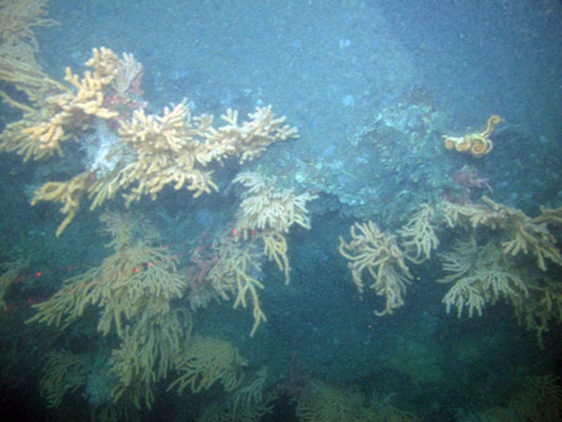
A wall of mixed corals in Norfolk Canyon. Image courtesy of Deepwater Canyons 2012 Expedition, NOAA-OER/BOEM. Download image (jpg, 96 KB).
Actually, in terms of sea conditions, our second leg of this Deepwater Canyons expedition started with calm seas and light winds. We left the dock a little later than scheduled on 3 Sep, but because the ship’s generators needed some calibration work, we spent our first day and night nearshore doing maintenance. We experienced some additional delays in getting offshore, and we did not reach our first ROV dive station in Norfolk Canyon until about 5pm (1700 hrs) on 4 Sep.

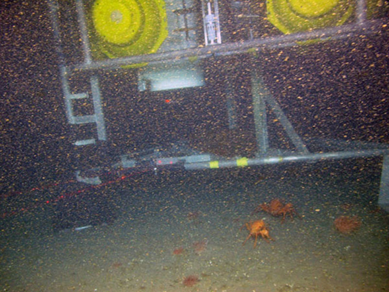
The Dutch benthic lander safely on the bottom in about 600 meters in Norfolk Canyon. Note the high density of particles in the water. Image courtesy of Deepwater Canyons 2012 Expedition, NOAA-OER/BOEM. Download image (jpg, 134 KB).
We were beginning to experience some swells from Hurricane Leslie and winds were building. Nevertheless, we launched the ROV for as long a dive as possible on the north wall at the head of Norfolk Canyon. We begin the dive in the canyon axis to find and film one of the Dutch (NIOZ) landers deployed on the first leg of the project. The ROV sonar picked up the lander quickly but we experienced very strong bottom currents (perhaps nearly 3 kts) and terrible visibility. Eventually we made our way to the lander, documented its condition and the bottom surroundings, and then moved to the north-east into rugged bottom in search of corals. It was a relief to find the lander resting on the bottom as it should be and starting the collection of a year of data.
As we climbed the canyon wall we soon encountered rocky bottom and eventually vertical walls covered with several species of corals, including the Paragorgia and Primnoa corals also seen in the first leg. We observed the first solitary cup coral yet seen on this expedition. The strong currents and poor visibility persisted during this dive. One very disappointing aspect was that we encountered a large amount of trash and discarded fishing gear entangled in the rocks and corals. The ROV even became entangled in an old trap line at one point and it took a very long time to free it. This was a hazardous area to dive, but we successfully documented a variety of habitats and returned to the surface with a number of coral samples. The normally “day“ shift ROV personnel did not turn into their bunks until about 4am.

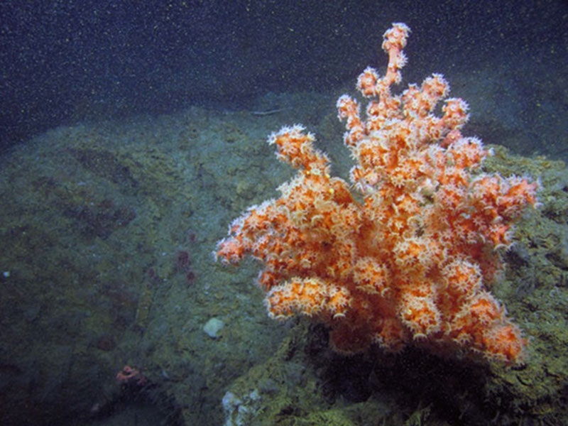
A small bubblegum coral in Norfolk Canyon compared with a very large bubblegum tree (at right) found further up the canyon. Image courtesy of Deepwater Canyons 2012 Expedition, NOAA-OER/BOEM. Download image (jpg, 119 KB).

A very large bubblegum tree found further up the Norfolk canyon than where the small bubblegum coral (at left) was found. Image courtesy of Deepwater Canyons 2012 Expedition, NOAA-OER/BOEM. Download image (jpg, 126 KB).
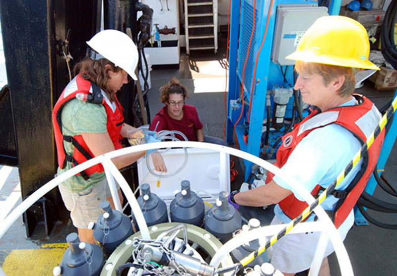
We started again this morning (5 Sep) and were prepared for another ROV dive, this time back in Baltimore Canyon, but seas had increased to 4-5 ft and wind speeds were up to about 25 kts. The ROV dive was cancelled and we switched gears to CTD and water sampling. We are preparing a lander this afternoon for deployment later today in the mouth of Baltimore Canyon. Weather conditions in the next few days do not look promising, but we will stay out as long as we can and continue to get as much work done as possible.

Nancy Prouty (left, USGS), Jennie McClain-Counts (center, USGS) and Liz Baird (right, NC Museum of Natural Sciences) make the best use of rough weather by CTD casts and filtering water for nutrients and trace metals. Image courtesy of Deepwater Canyons 2012 Expedition, NOAA-OER/BOEM. Download image (jpg, 125 KB).