
By Jeffrey B. Glover, PhD, Assistant Professor - Department of Anthropology, Georgia State University
December 20, 2011
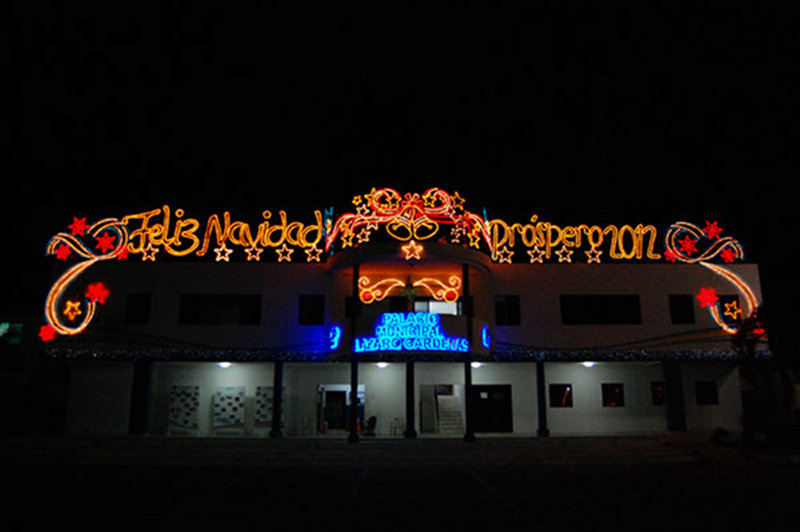
The main municipal building in Kantunilkin displays festive and bright holiday lights. Image courtesy of Proyecto Costa Escondida Maritime Maya 2011 Expedition, NOAA-OER. Download larger version (jpg, 602 KB).
I love Christmas time in Mexico. Not that the holidays aren’t festive in Atlanta, there is just something about all of the lights and decorations in a tropical setting that I find pleasing. Sightseeing, however, was not what brought us back to Kantunilkin and Vista Alegre. We reassembled the team for two main purposes: 1) to gather seasonal data at Vista Alegre on the hydrogeology and ecology and 2) to continue analysis of the mollusks and artifacts recovered during our excavations conducted earlier this year. During our initial field season, we were in the field at the peak of the dry season and coming back before Christmas allowed us to visit the site at the end of the rainy season.
Time-lapse video that provides a quick glimpse of the sorting and documentation process of the ancient Mayan artifacts. Video courtesy of Proyecto Costa Escondida Maritime Maya 2011 Expedition, NOAA-OER. Download (mp4, 13.6 MB).
The changes in the region’s hydrology were noticeable before we even get off the plane. The day of our arrival was clear, and as we angled across the northeast tip of the Yucatan peninsula toward Cancun, the wetlands, flush with freshwater, shimmered in the sunlight. A marked change from the sparse pockets of water we observed in these wetlands in May. This had me really excited about the possible changes to the hypersaline waters around Vista Alegre. Maybe the ancient Maya could have at least had potable water during the rainy season. That would still leave us with a good chunk of the year to explain how they got freshwater, but at least it was a start.
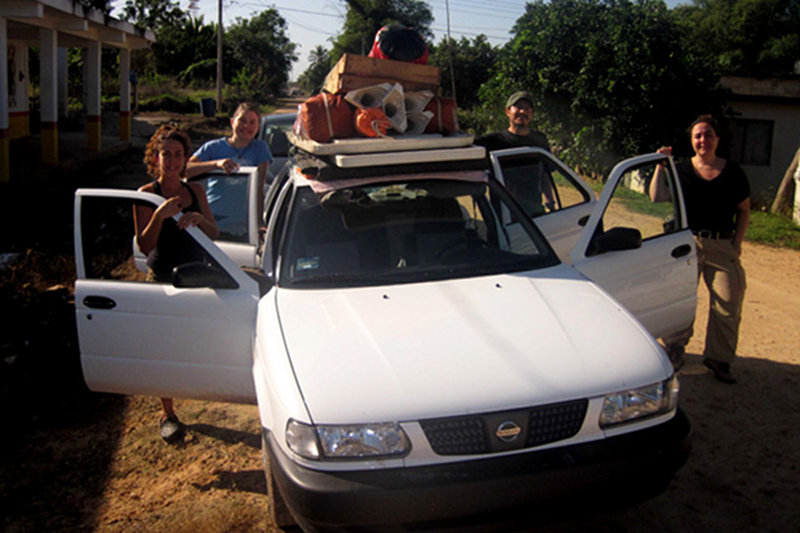
Trish Beddows and her team from Northwestern University packed and ready to roll out for the return trip to Vista Alegre. Image courtesy of Proyecto Costa Escondida Maritime Maya 2011 Expedition, NOAA-OER. Download larger version (jpg, 659 KB).
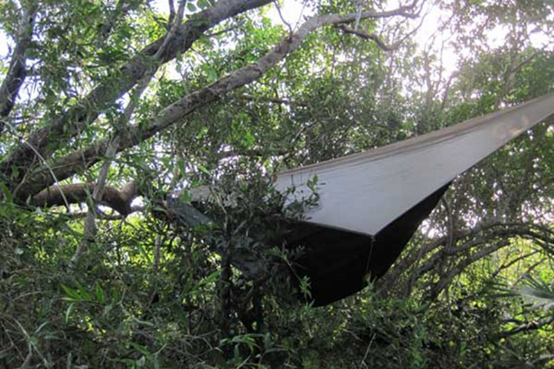
With one of the largest teams to date working at Visa Alegre – finding sleeping accommodations for 12 proved to be an interesting task. Here, Ed Mallon, chose a spot adjacent to one of the archaeological structures at the site to string his hammock. Image courtesy of Proyecto Costa Escondida Maritime Maya 2011 Expedition, NOAA-OER. Download larger version (jpg, 1.2 MB).
I arrived with Derek Smith, Wes Patterson, Halle Stoutzenberger, Hazel Sanchez, and Tyler Hill. We then met Rohi Jaijel, Beverly Goodman’s MA student, at the Cancun airport. We did some provisioning in Cancun and then headed out to Kantunilkin to meet Trish Beddows and her team, which consisted of her husband, Ed Mallon, her graduate student, Emiliano Monroy Rios, and his wife, Karen, and Alice Carter, a Northwestern undergraduate student who is analyzing the Vista Alegre cores as part of her Honor’s Thesis. They had already been on the Peninsula for a week conducting other investigations. Unfortunately Dominique Rissolo, Beverly Goodman, and Emily McDonald could not join us on this trip. With the team assembled in Kantunilkin, we made rapid preparations for a short overnight trip to Vista Alegre the next day. We contacted Roberto Echevaria, our boat captain, and arranged for two boats to take us to the island in the morning. It is amazing the amount of gear that 12 people “need” for a one night trip to the island and even more amazing how much can be stuffed in 3 rental cars.
Upon arrival to the island, it was rapidly apparent that the rainy season had been good to the vegetation, especially the thorny, vine-like variety. The once clear paths were now choked with new growth, which made for slow going and a sore forearm, from all of the machete work. It is always a shock to the system to go from an existence that very much revolves around my office and keyboard to one out in the field. We quickly set to work on unloading gear and getting tents and hammocks put-up. I think Ed got the prime spot atop Structure 16 in his jungle hammock.
With camp set-up, we got to work. We re-opened an excavation unit in the eastern plaza area; Trish setout to retrieve the SENSUS data logger from the “dead zone” that had been collecting tidal data; and Derek conducted more ecological surveys on land. In the late afternoon, Roberto brought us two semi-derelict dinghies, like those used for the coring platform in May, for trips further afield. After a tasty spaghetti dinner, we turned-in early in anticipation of another full day in the field.
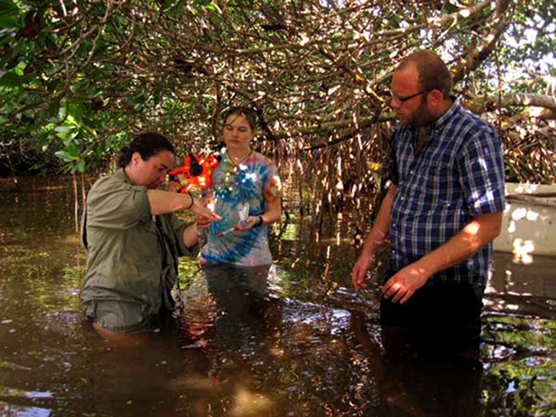
Dr. Trish Beddows collects water samples from Rio Xuxub with the assistance of Alice Carter and Rohi Jaijel. Image courtesy of Proyecto Costa Escondida Maritime Maya 2011 Expedition, NOAA-OER. Download larger version (jpg, 969 KB).
The next day was quite hectic. Trish and crew took one dinghy and made it Rio Xuxub to take some water samples. While the data are still be analyzed, the initial results showed a dramatic change in the salinity Rio Xuxub. It was no longer hypersaline. Clearly the freshwater from the interior wetlands was making its way into these rios (rivers). In fact, Raymundo Joya (our other boat captain) told us that the outflow of freshwater in some of these rios was so strong that you could not get a boat up them. A dramatic change from the stagnant, hypersaline body of water we saw in May. Derek and Emiliano spent the morning in the other dinghy conducting a number of underwater ecological transects. These transects allowed Derek to characterize the area between Vista Alegre and Holbox Lagoon. One surprise (albeit a pleasant one) was the lack of stingrays, which were a constant threat in May. Looks like they had moved away for the holidays, something Derek is working on explaining. The excavation team returned to the unit, and Wes and I began to do some mapping of the wall/sacbe feature that defines the southern boundary of the site. The mapping went well, and we were able to document a good portion of the feature. In the past we just had GPS points to determine its location, so it felt good to get this feature more tightly tied into the rest of the site map. In the excavation unit, there was one major issue - the sediments were very saturated and would not pass through the screen. What we decided to do was carry the buckets loaded with the wet dirt from the unit back to the dock to water-screen them. While this was not a quick process, it was really the only option that we had. About 60 cm into the excavation, the team made an interesting discovery – freshwater. Trish informed us that this was a perched freshwater lens that was most likely seasonal, which explains why we had not run into this phenomena in May. Interestingly, the creation of this freshwater lens can create gleysols (clay-rich sediments), which are what we did find in the lower levels of the excavation units in May. We are still trying to wrap our heads around what this might mean for the earliest deposits at the site.
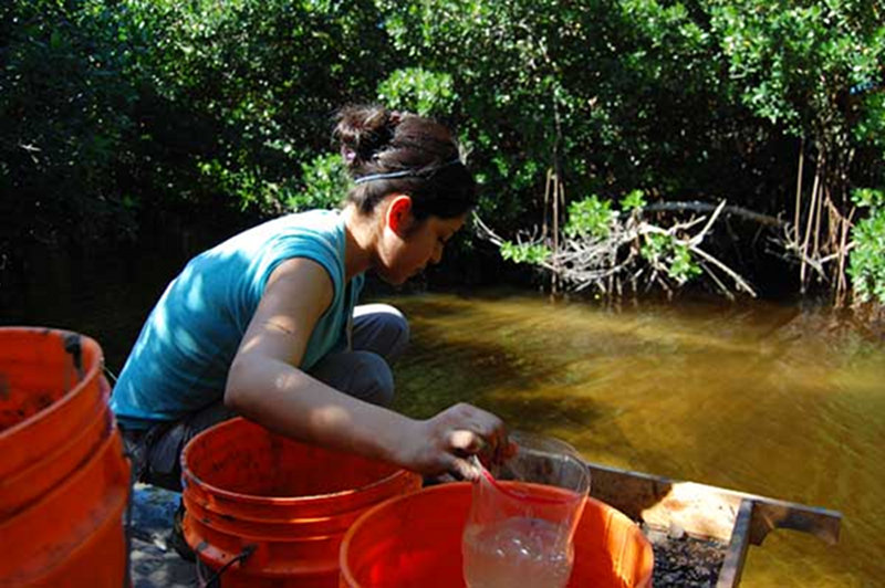
Georgia State University student, Hazel Sanchez, water-screens buckets of sediment from the excavation unit looking for artifacts. Image courtesy of Proyecto Costa Escondida Maritime Maya 2011 Expedition, NOAA-OER. Download larger version (jpg, 2.9 MB).
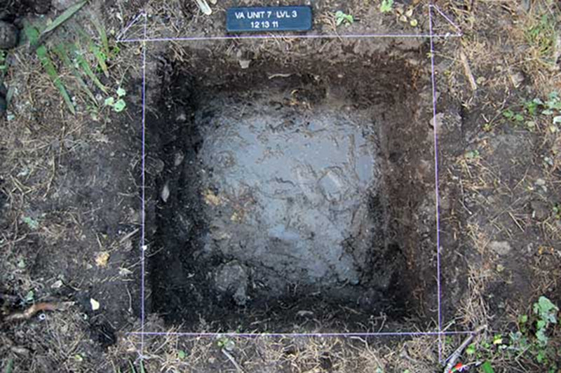
Freshwater is discovered about 60-cm down into an excavation unit. Image courtesy of Proyecto Costa Escondida Maritime Maya 2011 Expedition, NOAA-OER. Download larger version (jpg, 938 KB).
Roberto and Raymundo arrived in the late afternoon, and we quickly broke-down camp. We loaded Raymundo’s boat with the gear and all hopped in Roberto’s boat for a lovely sunset trip back to Chiquila. We ate dinner in Chiquila to celebrate a job well done and Derek’s birthday. We got back to Kantunilkin late and turned-in after getting the gear unloaded. Trish and her crew returned to the coast for more cave diving and rock collection. Our remaining days were spent processing the remaining artifacts and shells. Derek and Rohi measured and cataloged all of the shell from Unit 9. This involved species identification, measuring the size of intact specimens, and weighing all of the shell from each excavation level.
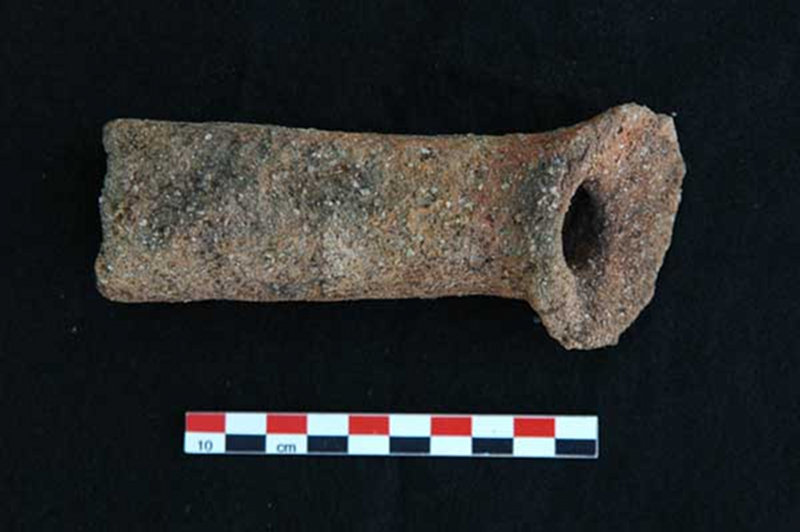
Located on the surface in the eastern part of the site, this artifact represents the handle of a censer. Image courtesy of Proyecto Costa Escondida Maritime Maya 2011 Expedition, NOAA-OER. Download image (jpg, 69 KB).
In regards to the artifacts, most of our time was spent counting, weighing, and labeling the thousands of sherds that we had not gotten to earlier. We also finished describing and photographing specific artifacts (beads, spindle whorl, etc…). The other task that we had was to create a photographic catalogue of the obsidian (volcanic glass) artifacts that we had recovered to date. Tyler took this on. We had permission to take a sample of these obsidian artifacts back to the states for X-ray Florescence (XRF) testing. XRF is a non-destructive way to determine the source of the obsidian raw material. We are collaborating with Dr. Zachary Hruby, a colleague of mine that I have known since graduate school, and Dr. Steve Shackely. Zac is a Mesoamerican lithics expert and Steve runs the XRF lab in Albuquerque. I eagerly await the results, as this will shed light on the various trade routes that were moving these materials around Mesoamerica during the Terminal Classic period.
All in all we had a very productive week in the field and lab. It is amazing how quickly a week can go and how much activity you can jam into it. It was great to touch base with the team again and even better to be able to do it in the field. With the holiday season coming to an end, I finally had a few moments to reflect on this most recent trip and the project overall, and I have to say I am extremely excited about what our explorations are going to reveal about the lives of Vista Alegre’s past inhabitants and their dynamic environment.