


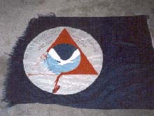
The tattered flag that flew from the mast of the NOAA Ship Ron Brown through wind and storm on the 2002 Hudson Canyon Exploration Cruise. Click image for larger view.
Hudson Canyon Cruise 2002: Mission Summary
August 27 - September 15, 2002
Peter A. Rona, Ph.D., Professor of Marine Geology and Geophysics
Institute of Marine and Coastal Sciences
Rutgers University
Our exploration of Hudson Canyon exceeded our expectations. Through the efforts and good relations between the complement of the great NOAA Ship Ron Brown and our excellent scientific team we were able to attain our goals in spite of being rocked by storms at the beginning and Hurricane Gustav near the end of our cruise. We feel privileged to have captured the grandeur of Hudson Canyon using the ship's state-of-the-art echo-sounding system. Moving seaward over 100 miles we see walls towering a half-mile high where the canyon traverses the continental slope, transforming to meandering channels across the upper continental rise and then to a deep gorge that continues into the deep ocean basin. We also imaged huge blocks of sedimentary rocks, some as high as the Empire State Building, lying at the base of the continental slope where they had apparently come to rest after landsliding down the slope. We are in process of preparing maps for publication using the data that we collected, which will available when completed. We are analyzing our water samples and other data for evidence of venting of the natural gas methane from the seafloor around Hudson Canyon.
The maps and results from the water sampling will give us the big picture and provide targets for the next stage of exploration. The next stage of exploration is to zoom in on details The details will lead us to zones where methane may be venting, where clams and other types of bottom dwelling creatures may be living off microbes that grow in the methane, and where we can learn more about the landslides that have occurred in this area. We need to sample the rocks and to take pictures of the landslide blocks on the seafloor. This information will help us to find out where and when the landslides occurred and to predict the places most prone to future landslides that could potentially create tsunamis and cut trans-Atlantic fiberoptic communications cables that cross the region. This next stage of work will require going down to sample and image the seafloor either with a Remotely Operated Vehicle (ROV) lowered from the ship on a cable or in a Human Occupied Vehicle (HOV).
Our exploration so far has shown that the Hudson Canyon traverses a region of great natural beauty, of potential resources, and of environmental hazards. Our ongoing exploration is building a base of knowledge and understanding of this region that will help to ensure a future for this region that will benefit of our nation. We are grateful to the NOAA Office of Ocean Exploration for the opportunity to explore the Hudson Canyon region and to the complement of the NOAA Ship Ron Brown for a successful cruise.
Sign up for the Ocean Explorer E-mail Update List.