


Software Tools to Enable Automated Detection of Submerged Archaeological Sites From Multibeam Sonar
Completed
Project Summary
Using artificial intelligence, roboticists have developed a new way to virtually detect and discover submerged archaeological sites — like shipwrecks. Their approach relies on a machine learning model to automate the search for such sites in multibeam sonar data collected by surface vessels. It limits the need for human involvement, reducing the time, effort, and cost required to detect submerged archaeological sites and enables discoveries to be made and shared with the maritime heritage community and the public.
The model is specifically designed to detect and segment shipwreck sites in multibeam sonar images:
- Detect: Draw a bounding box label around a region of interest (e.g., a shipwreck site) in a sonar image.
- Segment: Label each pixel in the sonar image as “shipwreck” or “not shipwreck” to output pixelwise segmentation masks.
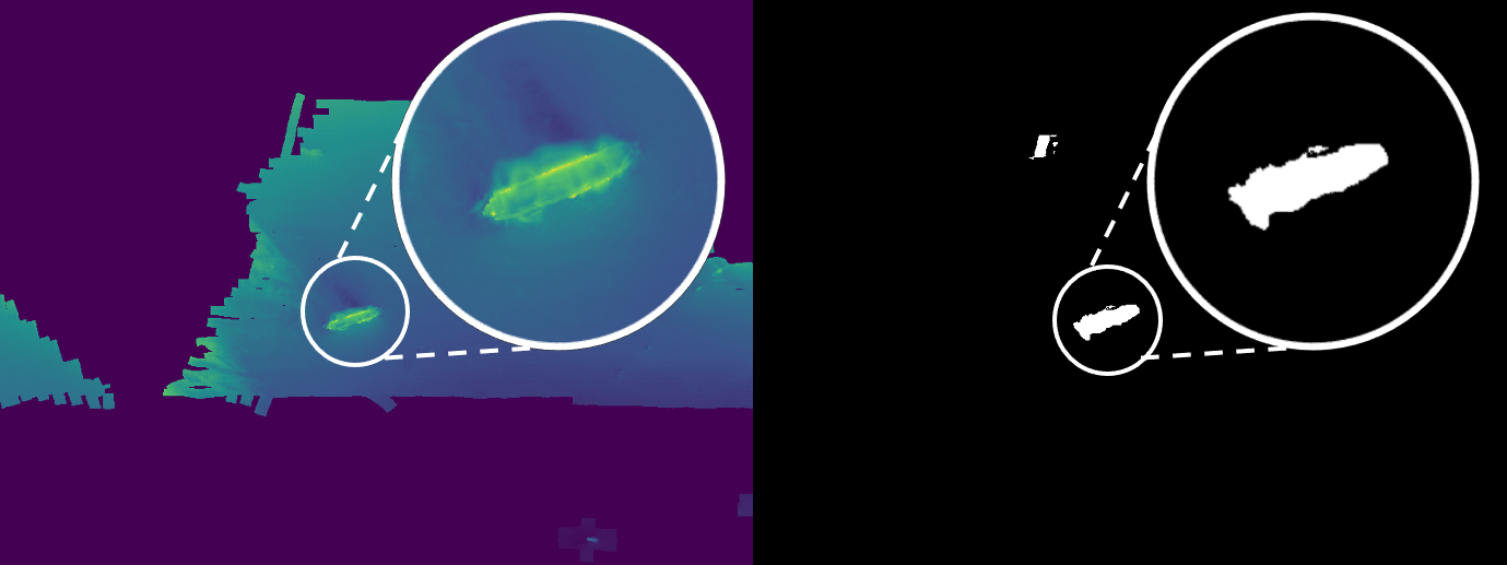
Download largest version (png, 201 KB).
The model is the core of a QGIS toolkit (QGIS is an open-source library) designed to increase the efficiency of processing ocean exploration data. The toolkit will be easily accessible for practical use by marine archaeologists and other users interested in shipwreck detection.
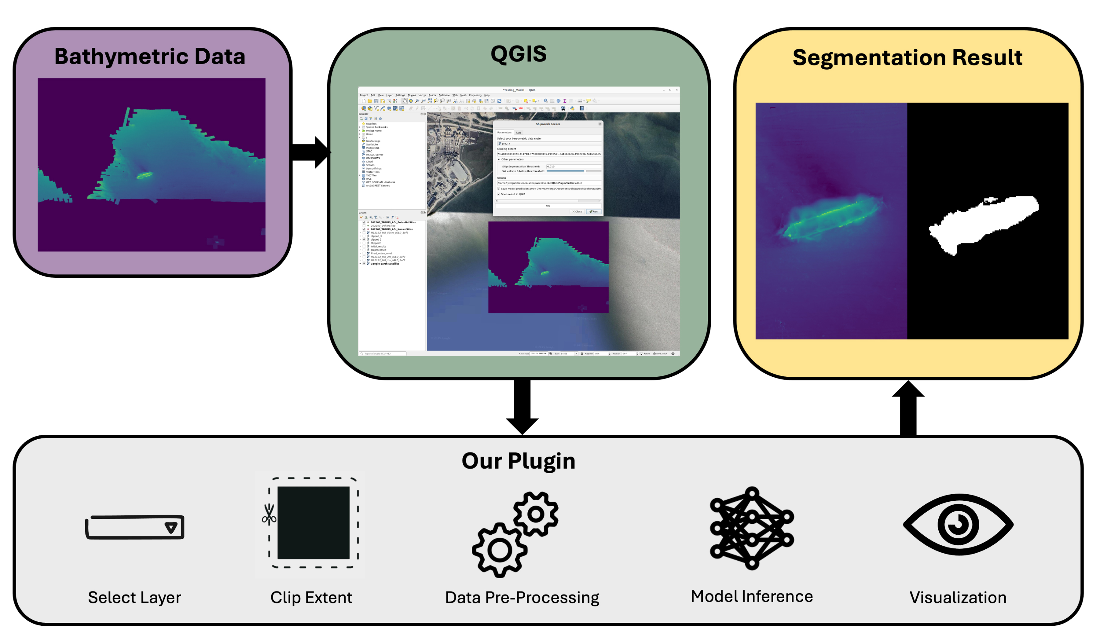
Download largest version (jpg, 1.13 MB).

Education
Ocean Science for Educators provides the best of what the NOAA Ocean Exploration website has to offer to support educators in the classroom. Each theme page includes lessons, fact sheets, ocean facts, exploration notes, multimedia, and related past expeditions and projects. Below are the top education themes related to this project.
Resources & Contacts
- University of Michigan Field Robotics Group (FROG) (Principal Investigator: Katie Skinner)
- University of Michigan Robotics
- University of Michigan Naval Architecture & Marine Engineering
-
- Emily Crum
Communication Specialist
NOAA Ocean Exploration
ocean-explore-comms@noaa.gov
- Emily Crum