Ten Years of Collecting Ocean Exploration Data from NOAA Ship Okeanos Explorer

In 2000, a Presidential panel issued Discovering Earth’s Final Frontier: A US Strategy for Ocean Exploration (President’s Panel for Ocean Exploration, 2000), a timely, compelling and moving call for an “innovative and bold” US ocean exploration program in which “discovery and spirit of challenge are the cornerstones.” As part of this national exploration program, the Panel envisioned a “flagship” dedicated to voyages of discovery that centralized “data collection and outreach technologies on a dedicated platform.”

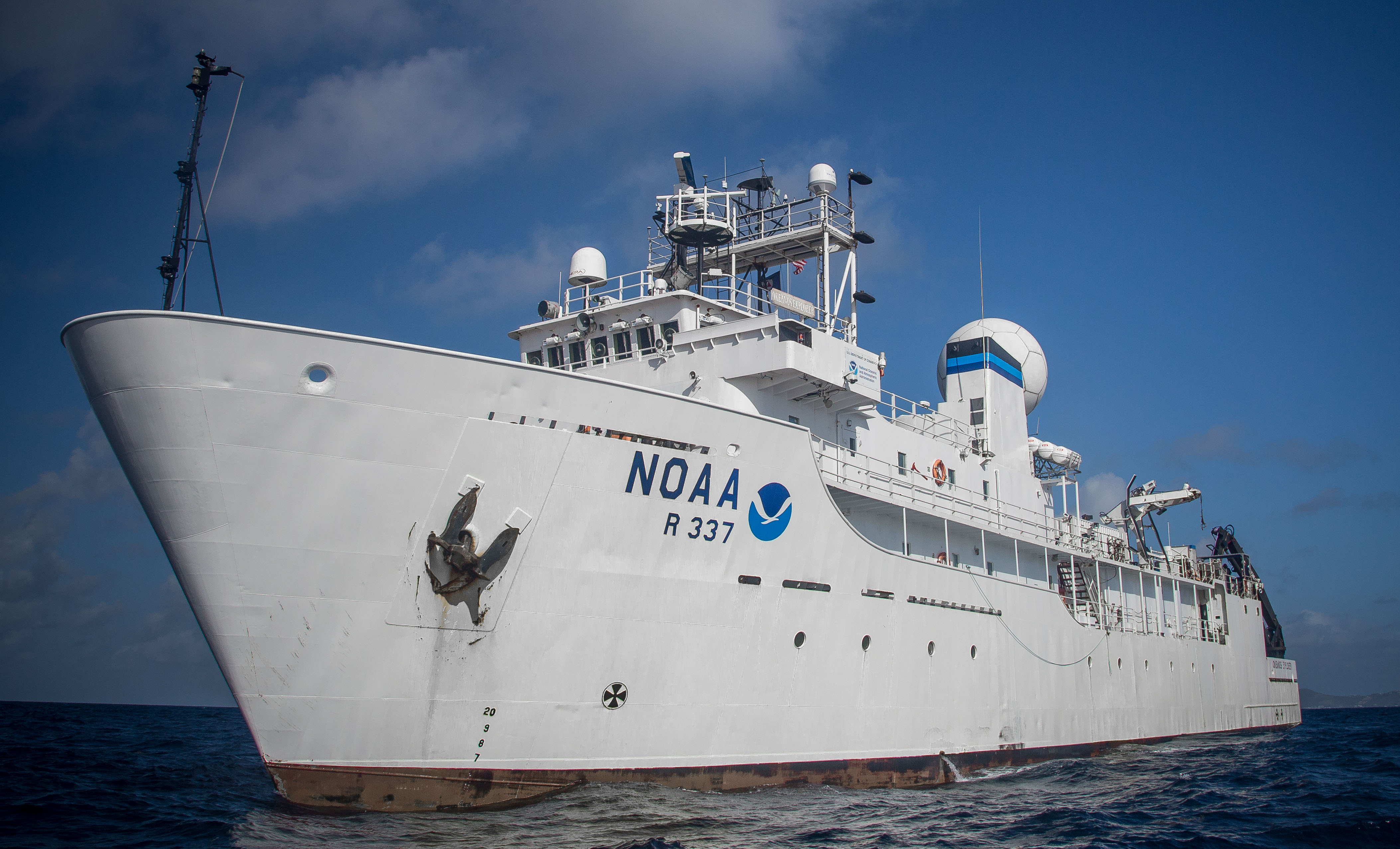
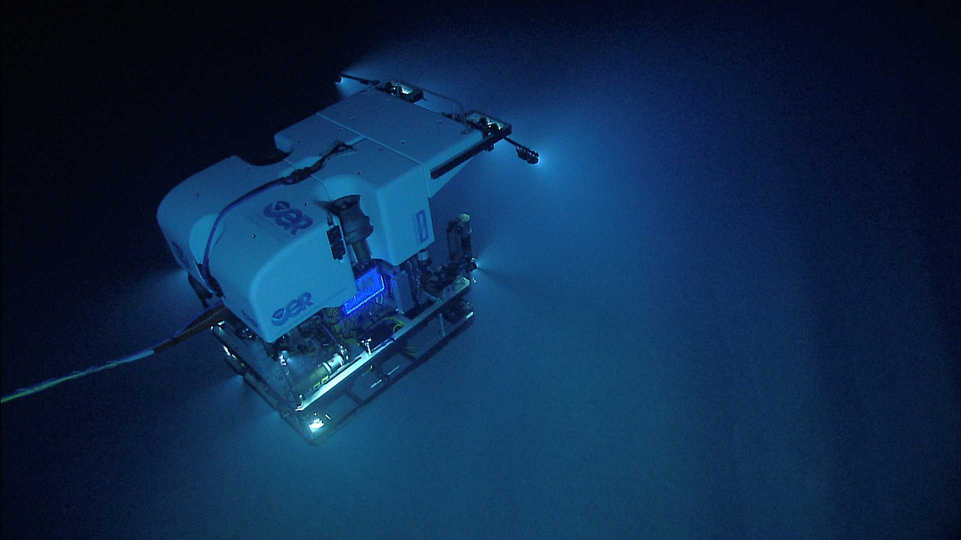
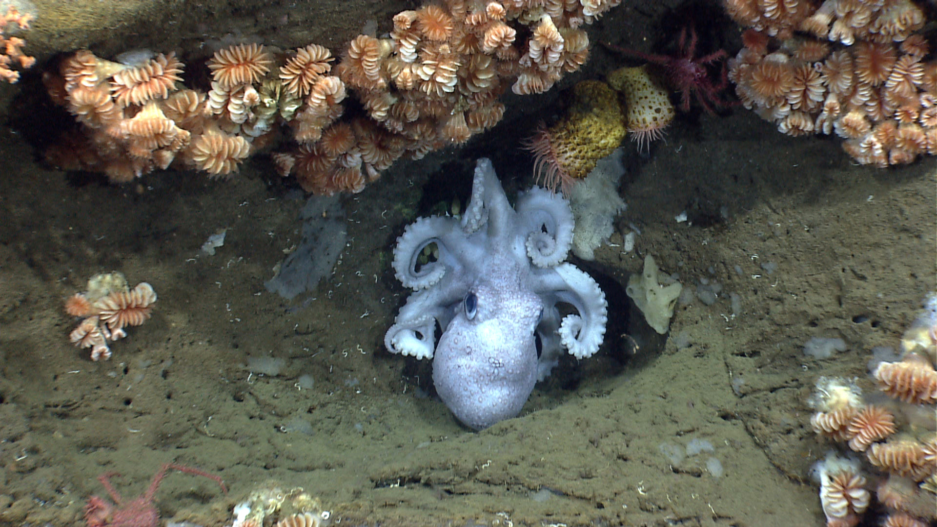
In keeping with the Panel’s vision, the National Oceanic and Atmospheric Administration (NOAA) commissioned NOAA Ship Okeanos Explorer in 2008 as America’s first civilian agency ship dedicated to ocean exploration. Since its first voyage in 2009, Okeanos Explorer has served as the “new technological eyes” that allow NOAA’s Office of Ocean Exploration and Research (OER) to pursue the Exploration Objectives described in the Panel’s report:

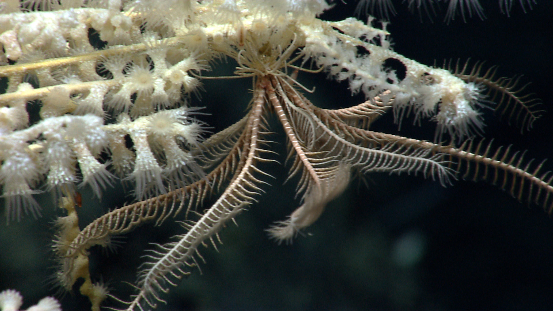
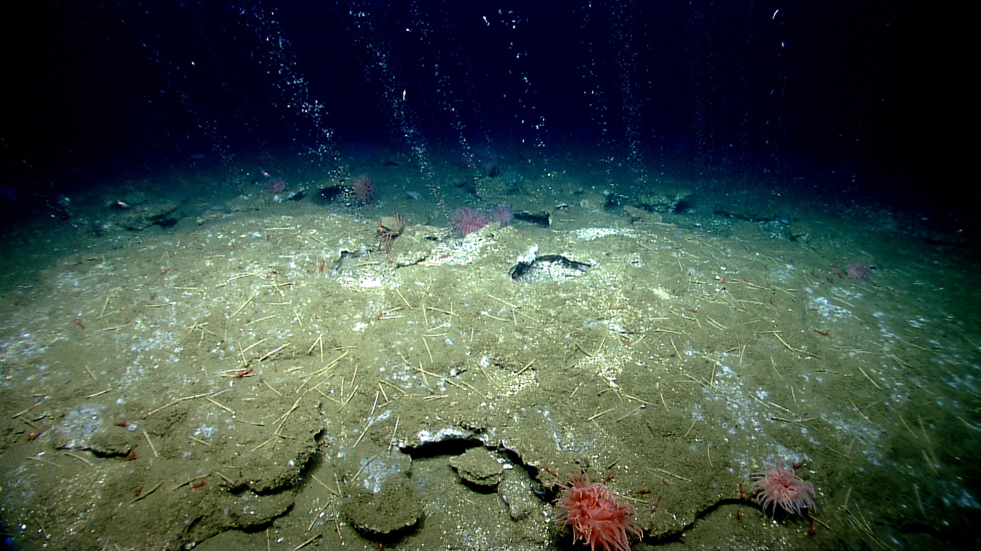
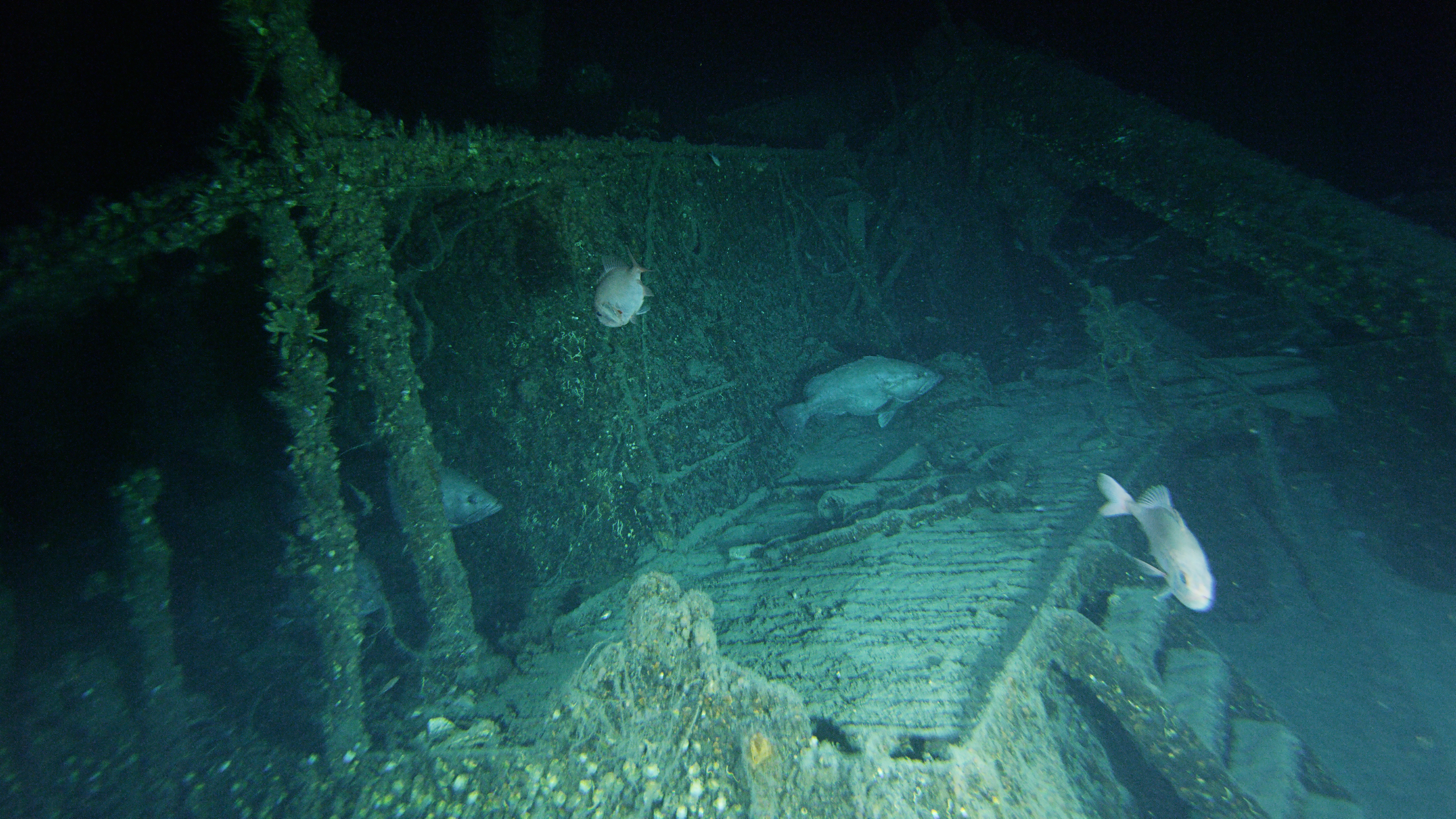
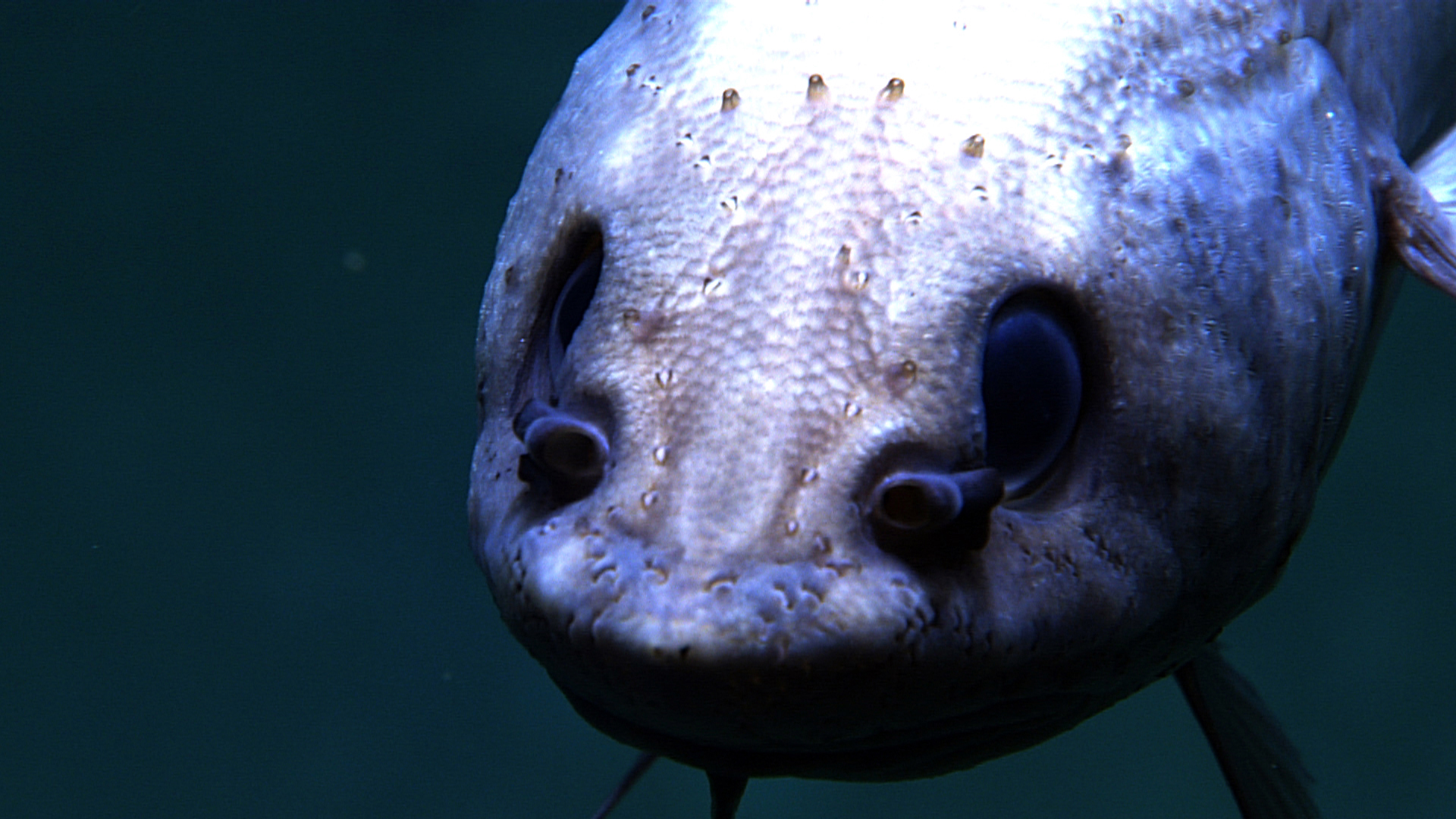
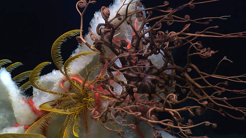
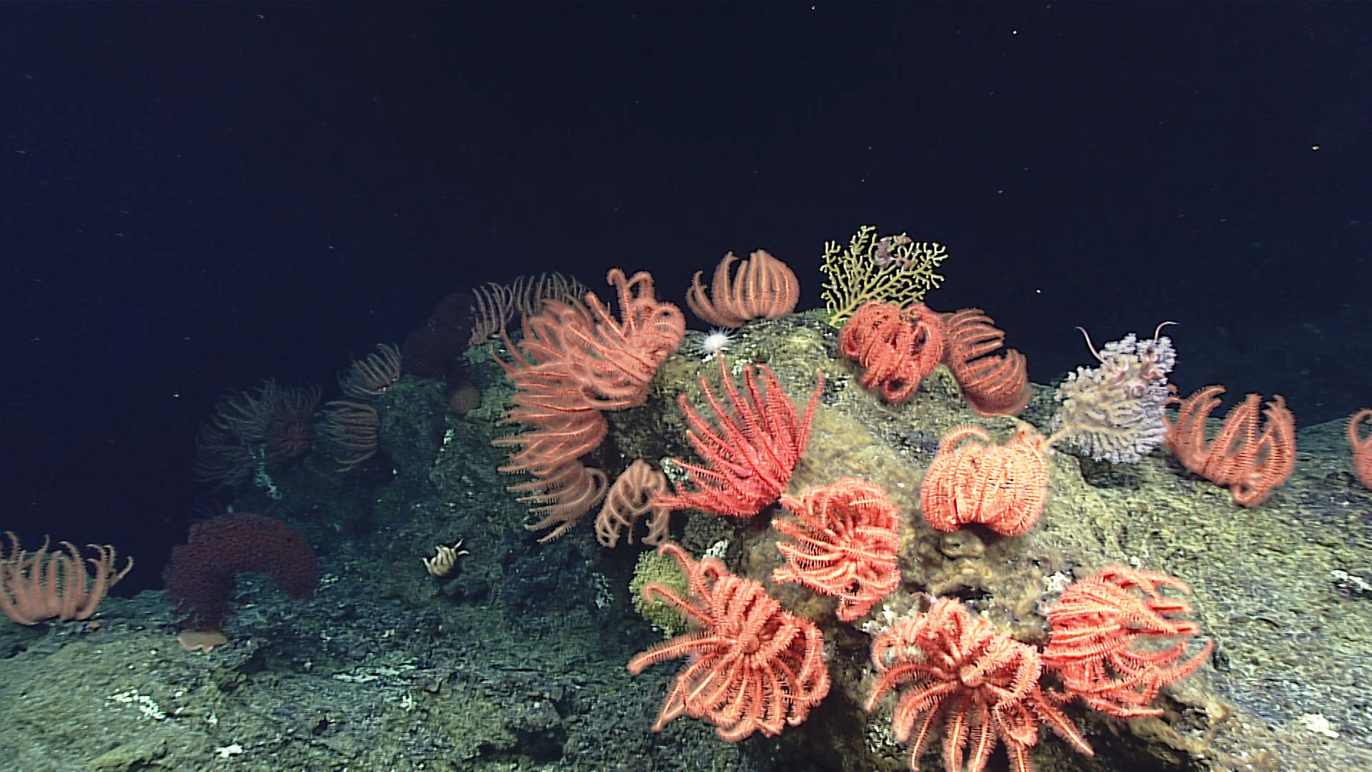
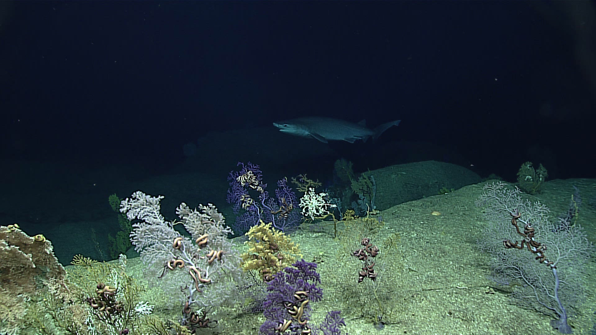
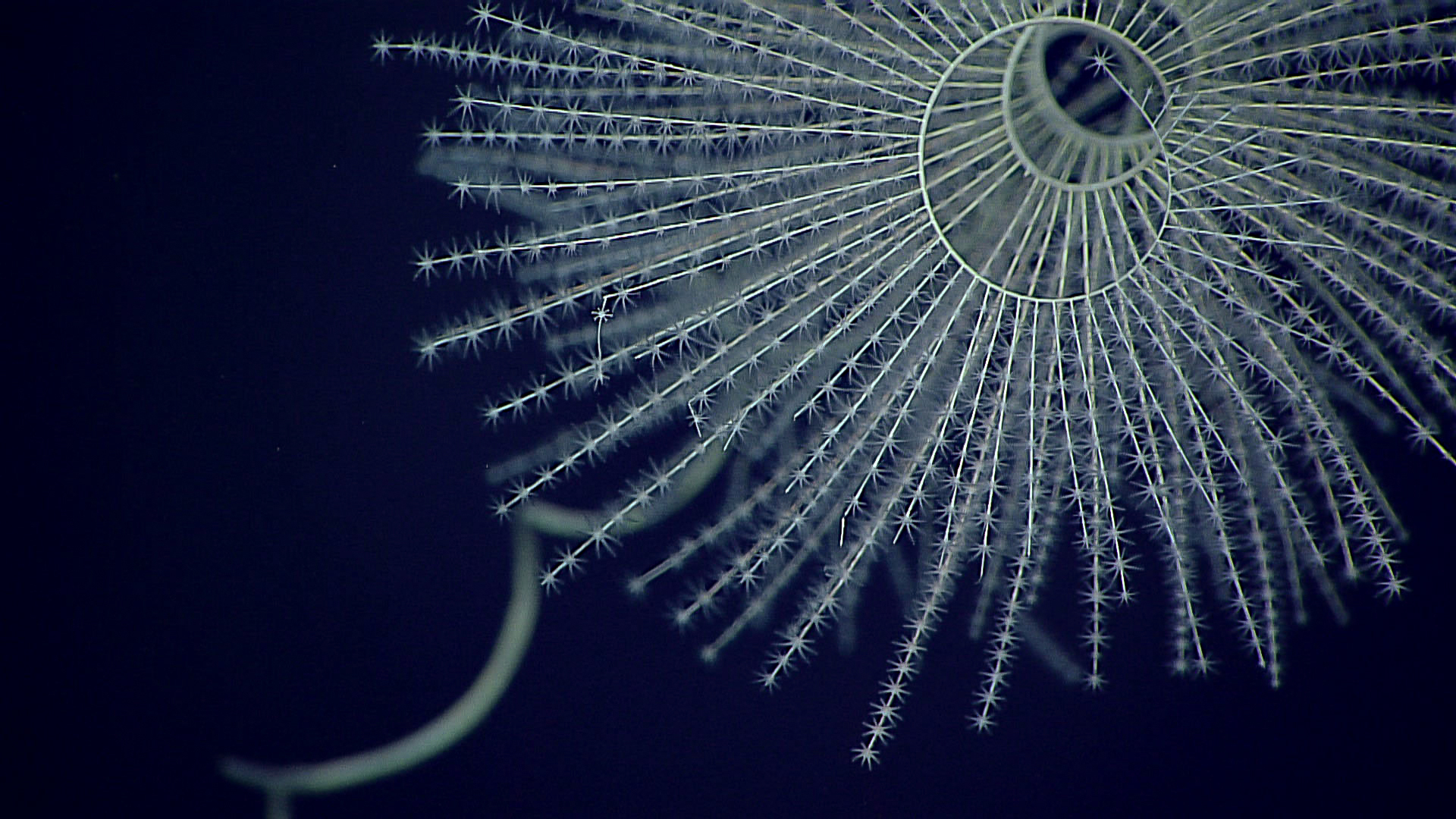
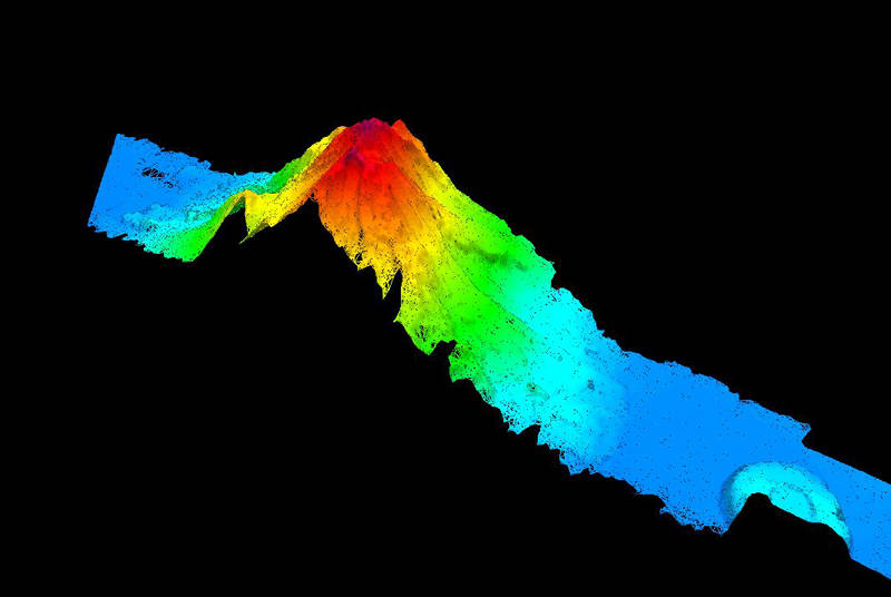
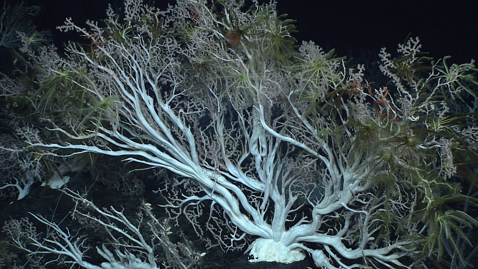
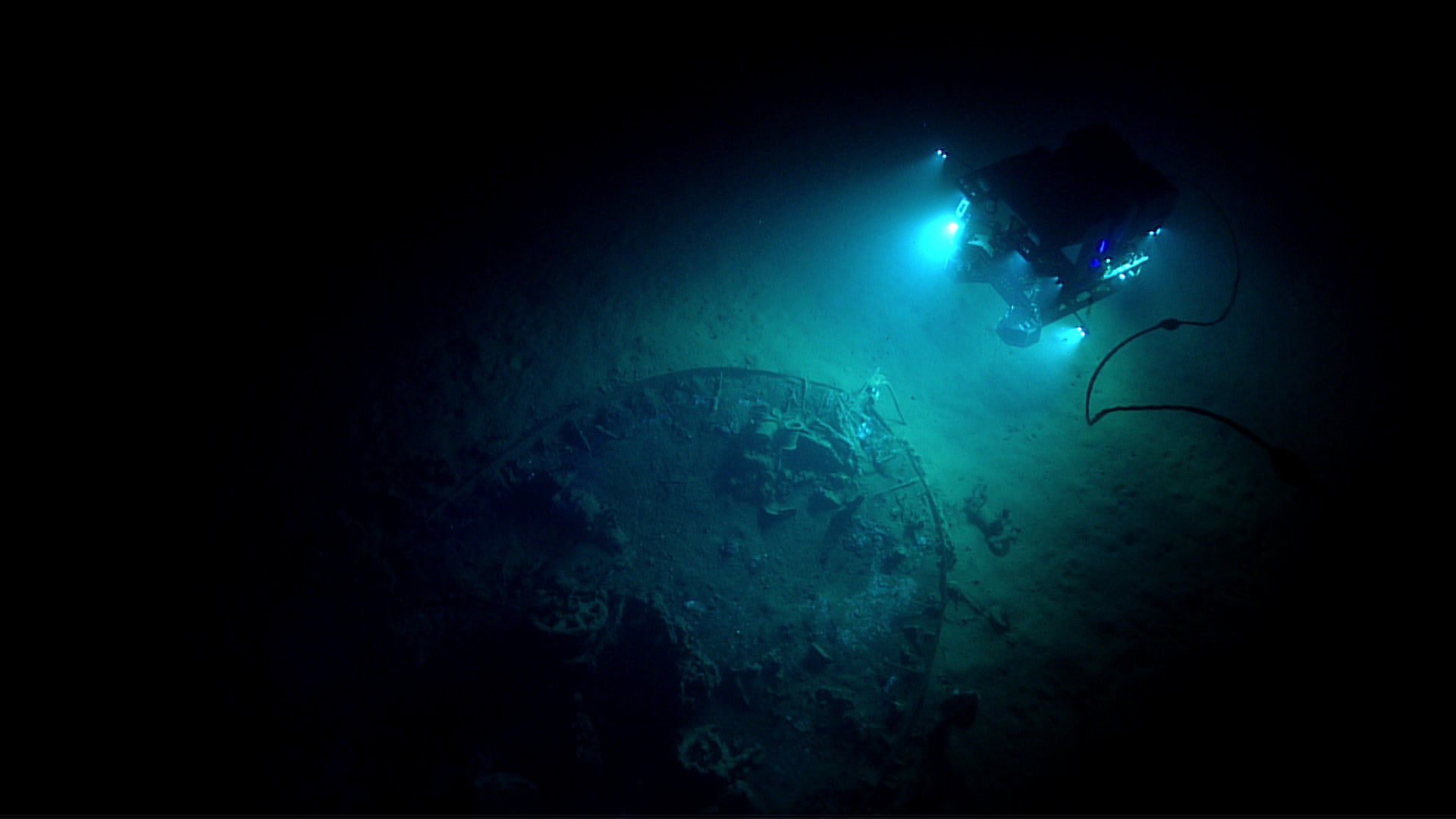
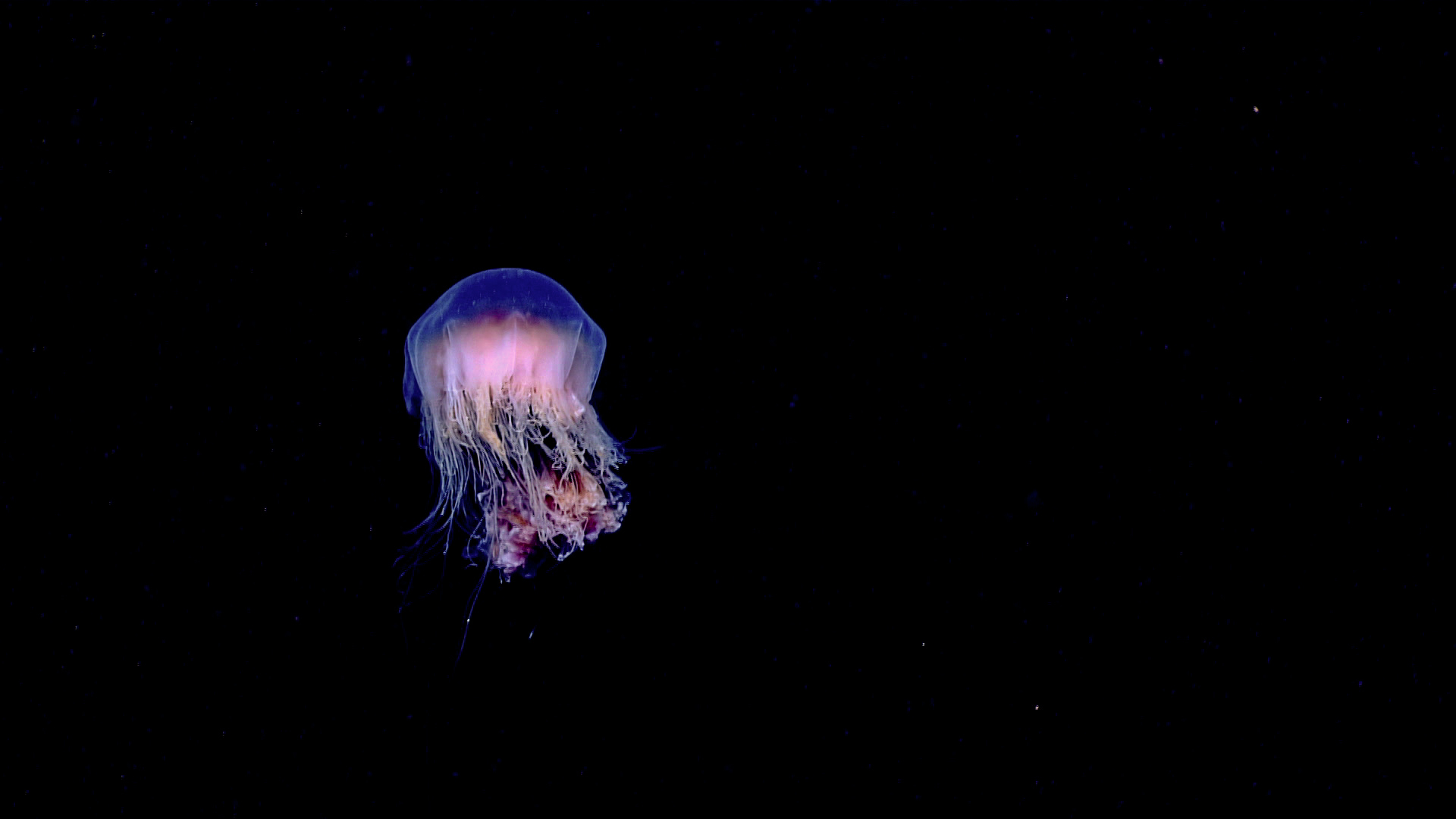
  • Mapping at New Scales. Find and explore archaeological sites, expand understanding of marine resources, characterize ocean ecosystems, discover new species, and map the seafloor—all to show others what lies beyond our current understanding.
  • Exploring Ocean Dynamics and Interactions at New Scales. Discover new oceanographic features, reveal oceanographic and atmospheric changes, and unravel the processes that connect living and non-living systems in the ocean.
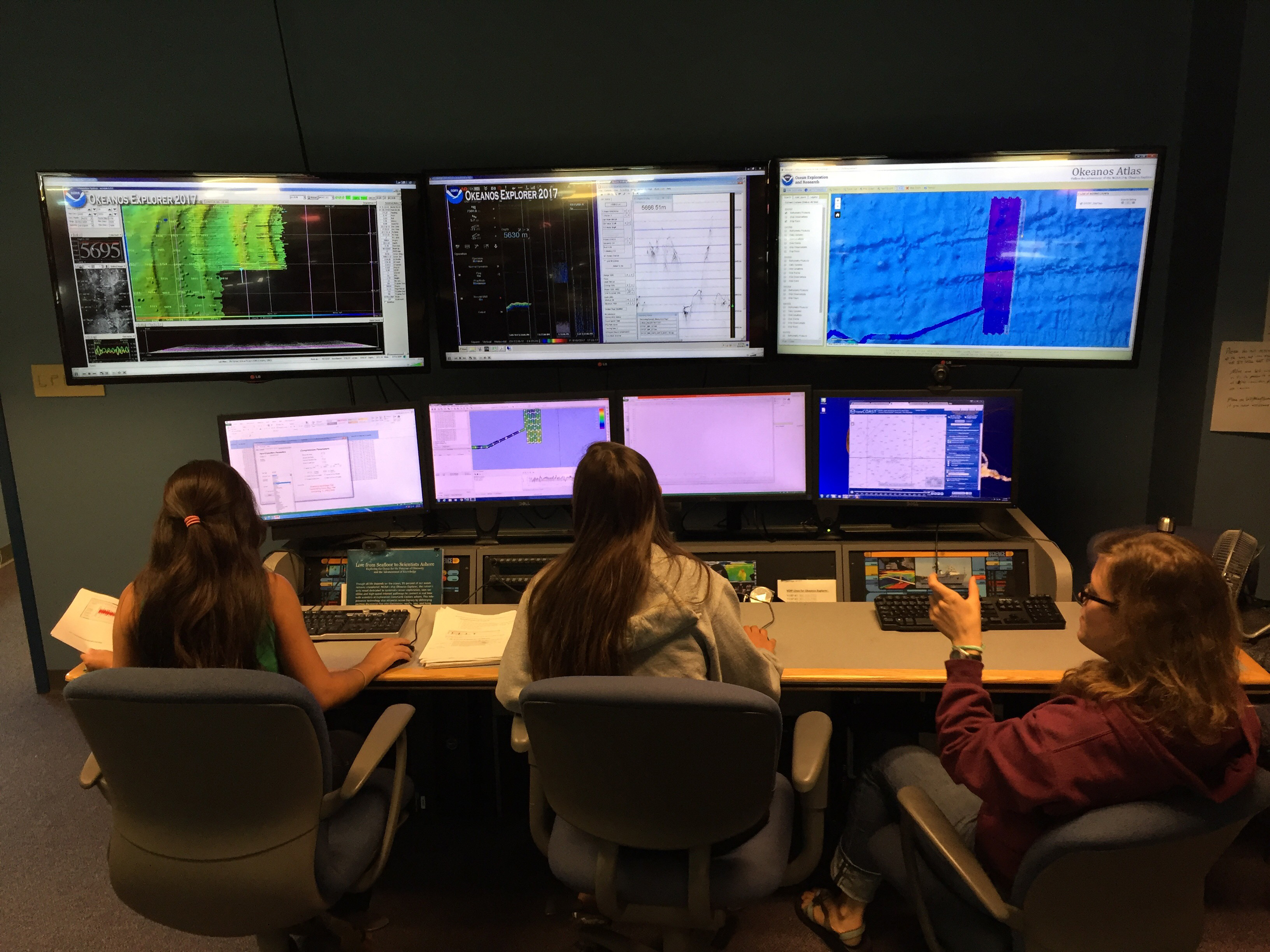
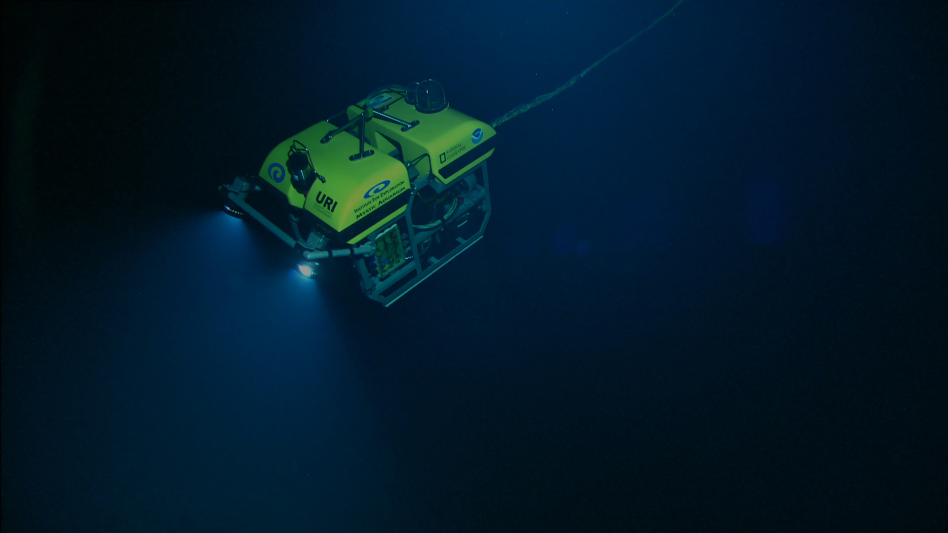
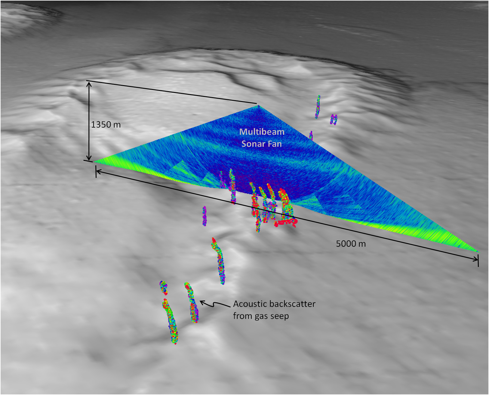
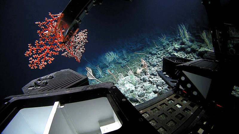
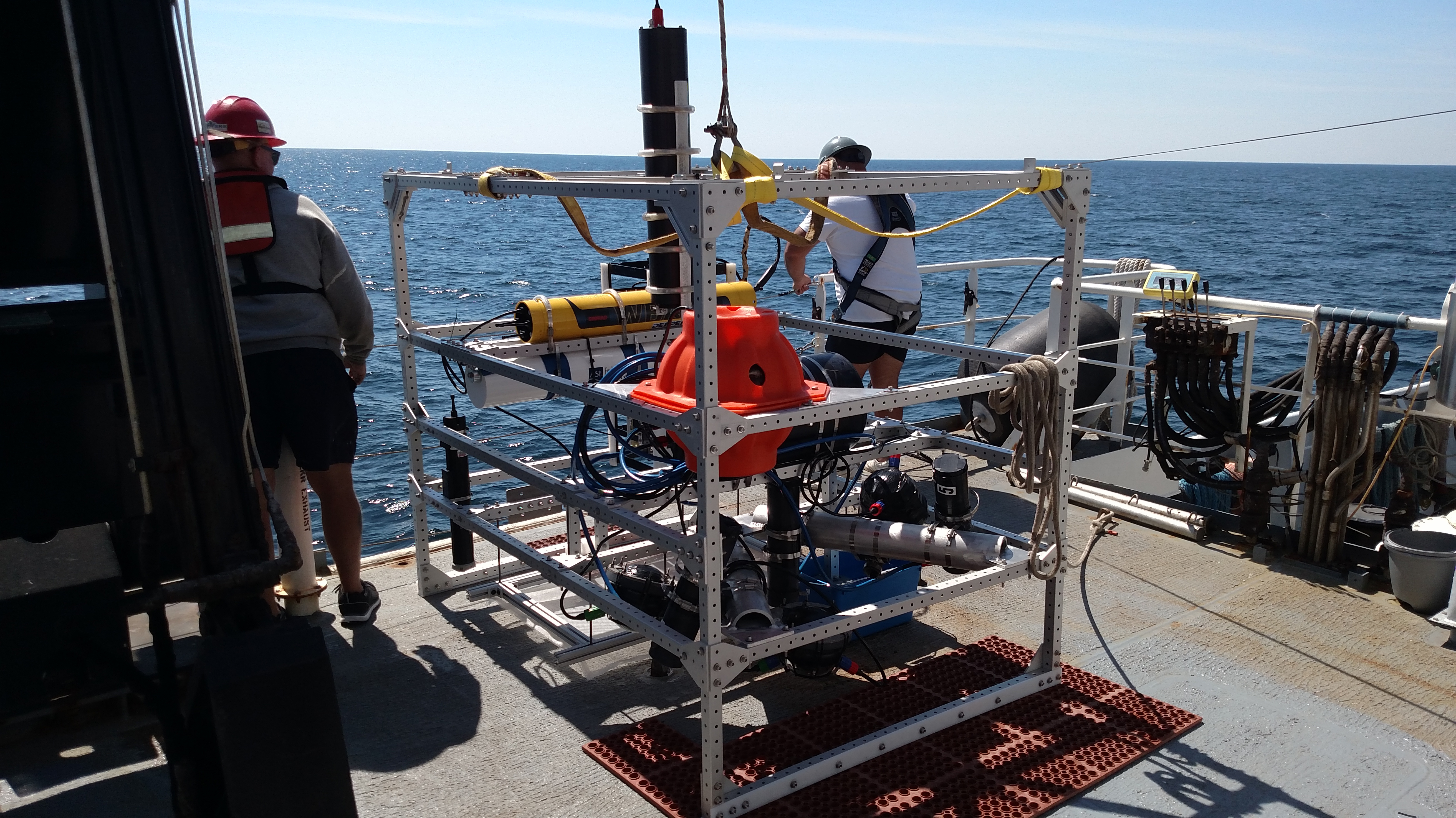
  • Developing New Technologies. Invent, build, and adapt remote and in situ tools for measuring, mapping, and exploring all aspects of the ocean, and create new ways to visualize ocean data.
  • Reaching Out in New Ways. Deliver ocean expeditions to schools and informal science centers around the nation; develop new technologies to connect scientists and explorers with students, educators, and the public; and expand the reach of ocean exploration data to include business and industry partners.

These Exploration Objectives set the stage for 10 years of innovative, exciting, and far-reaching ocean exploration aboard Okeanos Explorer.


Thanks to telepresence technology, scientists are able to add their expertise to missions on NOAA Ship Okeanos Explorer no matter where in the world the ship, or the scientists, are located. This means that, over the course of the 10 years that the NOAA Office of Ocean Exploration and Research has led expeditions on the ship, a lot of scientists have been able to participate! In this video, some of these scientists share their views on how the model of exploration on the Okeanos has impacted them, expanding basic understanding of the deep ocean and opening opportunities to explorers around the world. Video courtesy of the NOAA Office of Ocean Exploration and Research. Download larger version (460 MB).


Stories

These stories, recounted by the people who were there, highlight the science and technology, trials, discoveries, and excitement that are all part of the first 10 years of collecting ocean exploration data from NOAA Ship Okeanos Explorer.

Read more

Ten Years of Collecting Ocean Exploration Data from NOAA Ship Okeanos Explorer

Since the first ocean exploration data was collected from NOAA Ship Okeanos Explorer in 2009, the NOAA Office of Ocean Exploration and Research has led expeditions on the ship around the globe. The baseline data collected during these missions is helping to close significant gaps in our basic understanding of U.S. deep waters and seafloor and the resources they hold, providing information that is critical to sustaining the economy, health, and security of our nation. The timeline below captures expeditions, major events, discoveries, technological advancements, mapping achievements, and educational activities over the course of the 10-year period, with links to learn more about each item.

Jump to year:

2008 2009 2010 2011 2012 2013 2014 2015 2016 2017 2018 2019

2008

NOAA Ship Okeanos Explorer Commissioned

August 13, 2008

Okeanos Explorer at Sea

Since being commissioned in 2008, NOAA Ship Okeanos Explorer has traveled the globe, exploring everywhere from the Indonesian “Coral Triangle Region” and benthic environments in the Galápagos, to areas in the Gulf of Mexico, canyons and seamounts off the Northeast U.S. Atlantic coast, and marine protected areas within the Pacific. By collecting baseline information in never-before-explored areas, Okeanos expeditions further our knowledge while setting the stage for future in-depth exploration activities.

Learn more

Event

First Multibeam Mapping

2008

Initial NOAA Ship Okeanos Explorer field trials result in the first publicly accessible modern NOAA multibeam data off the Washington State coast, an area previously restricted by the U.S. Navy.

EventMapping
2009

Mendocino Gas Plume Discovered

May 2009

During a shakedown mission, gas plumes are detected rising from the seafloor, including one rising 1,400 meters (4,590 feet) off the seafloor at Mendocino Ridge, off the coast of California. Mashkoor Malik recalls the shock of this discovery.

DiscoveryMapping

Explorer-in-Training Program Launched

2009

Standing Watch: Explorers-in-Training Laura Almodovar, Victoria Dickey, and Kelsey Lane standing mapping watch at the University of New Hampshire Center for Coastal and Ocean Mapping/Joint Hydrographic Center. Image courtesy of CCOM.

The NOAA Office of Ocean Exploration and Research launches the Explorer-in-Training program as part of its mission to train the next generation of ocean explorers, hosting undergraduate and graduate students who gain valuable experience in deepwater mapping and exploration. Since 2009, over 120 students have participated in the program.

Learn more

EducationMapping
2010

Little Hercules Remotely Operated Vehicle Integrated

2010

Little Hercules during one of his first dives in Indonesia. A number of organizations and people were critical to bringing him back.

The Little Hercules remotely operated vehicle receives a major overhaul before coming aboard for the Okeanos Explorer’s maiden voyage into Indonesian waters.

Learn more

Technology

INDEX-SATAL 2010

June - August 2010

The NOAA Office of Ocean Exploration leads the INDEX-SATAL 2010: Indonesia-USA Deep-Sea Exploration of the Sangihe Talaud Region expedition on NOAA Ship Okeanos Explorer, marking the ship's first telepresence expedition and the first-ever civilian agency expedition in Indonesian waters. During the expedition, scientists reveal that the deepwater biodiversity in the Coral Triangle is comparable to that of its shallower waters. Up to to 50 new species are discovered during the mission. Commanding Officer Joseph Pica recalls how persistence, scientific curiosity, and international cooperation led to a successful maiden voyage.

Learn more

DiscoveryExpedition

Longest Plankton Tow Across the Pacific Ocean

October 2010

The Continuous Plankton Recorder is returned to the deck of the Okeanos Explorer after collecting plankton for over 300 miles. Image courtesy of NOAA Okeanos Explorer Program and NMFS.

While transiting from Hawaii to California, a Continuous Plankton Recorder is towed behind NOAA Ship Okeanos Explorer, capturing plankton from seawater for later analyses in the laboratory. Final data will help provide a picture of plankton diversity across more than 5,100 miles of the Pacific Ocean. NOAA oceanographer Michael Ford talks about this unique opportunity.

Learn more

Event

NOAA Ship Okeanos Explorer Education Materials Collection Implemented Nationwide

November 2010

Ocean Education Materials Collection

The NOAA Office of Ocean Exploration and Research releases the Okeanos Explorer Education Materials Collection to encourage educators and students to become personally involved with the voyages of and discoveries made via the ship.

Learn more

Education
2011

California Shakedown Cruise 2011: Exploring California's National Marine Sanctuaries

March 2011

California Shakedown Cruise 2011 Map

During this shakedown mission, the ship gets underway and all systems and equipment are tested to ensure they are fully operational prior to integration of the remotely operated vehicle on board.

Learn more

Expedition

Galápagos Rift Expedition 2011

July 2011

From June to July 2011, OER leads the Galápagos Rift Expedition 2011 to to explore the water column and unexplored benthic environments in the Galápagos region.

During the expedition, the team completes the first multibeam bathymetric map of the Galapagos Rift axis from 101.3°W to 98.0°W and a continuous CTD tow-yo and multibeam transect between 89.33°W and 85.75°W to locate active hydrothermal areas on two adjacent tectonic ridge segments, spanning more than 200 kilometers (125 miles) of spreading axis. At least 20 distinct water column anomalies are revealed along the eastern arm of the rift.

Also ROV dives result in the discovery of "Tempus Fugit"—one of the largest vent fields known on the rift, characterized by diffuse venting in a once massive clam bed thought to be more than 20 years old.

Learn more

DiscoveryExpeditionMapping

Mid-Cayman Rise Expedition 2011

August 2011

Image of an active hydrothermal vent (left) located SE of the central Von Damm hydrothermal field seen at the very end of our last dive at the MCR. Note the filaments of bacteria and hydrothermal shrimp in the immediate vicinity of the active fluid flow. Image courtesy of NOAA Okeanos Explorer Program, MCR Expedition 2011.

NOAA Ship Okeanos Explorer travels to the deepest part of the Caribbean Sea, where a team of international scientists both at-sea and on shore conduct interdisciplinary investigations of the Mid-Cayman Rise.

During the Mid-Cayman Rise Expedition 2011, the team discovers chemosynthetic shrimp and tubeworms inhabiting the same hydrothermal site and makes the first discovery of a live tube worm at a hydrothermal vent site in the Atlantic.

Learn more

DiscoveryExpedition

First Field Trials of Multibeam to Detect Gas Seeps in Gulf of Mexico

August-September 2011

A view of the multibeam sonar water-column backscatter data used to detect gas seeps. Gas seeps derived from the sonar are shown in the foreground. Image courtesy of the University of New Hampshire Center for Coastal and Ocean Mapping / Joint Hydrographic Center using IVS Fledermaus software.

During the Gulf of Mexico 2011 expedition, OER successfully tests, for the first time, use of the ship's EM 302 sonar to map gases in the water column, with the idea that collected can be used to determine the origin of natural seafloor seeps or hydrocarbon leaks from human-made structures.

Learn more

ExpeditionMapping
2012

Atlantic Canyons Undersea Mapping 2012 Expeditions

February - August 2012

Scientists and managers identified this five-canyon area, the Tom's Canyons complex, as a high-geographic priority. The map displays bathymetry collected by NOAA Ships Okeanos Explorer and Hassler. Yellow dots show the locations of towed camera operations from NOAA Ship Bigelow. Images courtesy of ACUMEN 2012, NOAA.

Between February and August 2012, a team of NOAA and external partners conducts a mapping ‘blitz’ focused on deepwater canyons off the northeastern seaboard. During this this series of five Atlantic Canyons Undersea Mapping Expeditions (ACUMEN), scientists on three NOAA ships gather baseline information, mapping priority frontier areas along the continental shelf and slope along the mid-Atlantic coast of the United States, from Virginia to Rhode Island.

ACUMEN marks the first full exploration "campaign led by OER.

Learn more

ExpeditionMapping

Gulf of Mexico 2012

March - April 2012

A view of the escape swimmer Benthothuria, flexing so strongly that the mouth has been brought into view. Image courtesy of the NOAA Office of Ocean Exploration and Research, Gulf of Mexico Expedition 2012.

OER coordinates a team of scientists and technicians both at-sea on NOAA Ship Okeanos Explorer and on shore in exploratory investigations on the diversity and distribution of deep-sea habitats and marine life in the northern Gulf of Mexico. The OER team and Okeanos crew also filled gaps in scientific knowledge, documenting the extent of damage from the Deepwater Horizon spill on the fragile deep coral ecosystem.

Learn more

Expedition

Public Live Streaming Begins

March 2012

Children watching live stream.

OER launches the first live stream of ROV dives from NOAA Ship Okeanos Explorer, inviting anyone with an Internet connection to join scientists in the expedition.

Learn more

EducationTechnology

Discovery of a Pristine, 19th Century Copper-Sheathed Wreck

April 2012

During the Gulf of Mexico 2012 expedition, the team investigates "Site 359," a large, stoutly built and remarkably intact mid to late 19th century wooden-hulled sailing ship covered with marine life. Although deteriorating, the wooden hull is thought to be the best-preserved wooden shipwreck yet discovered in the Gulf of Mexico.

Learn more

Discovery

Northeast and Mid-Atlantic Canyons Expedition

November 2012

Northeast and Mid-Atlantic Canyons Expedition map.

OER leads an expedition on NOAA Ship Okeanos Explorer in the North Atlantic Ocean focused on systematically mapping the continental slope off of the U.S. East Coast. During this expedition, Okeanos Explorer travels 5,231 kilometers (3,250 miles) and bathymetrically maps 15,467 square kilometers (5,972 square miles) of the seafloor. In addition to bathymetric data, water column acoustic backscatter data and sub-bottom profiles are collected with onboard sonar systems.

Learn more

ExpeditionMapping

Gas Seeps Detected Along the Atlantic East Coast

November 2012

Perspective image of gaseous seeps at location 1derived from water column acoustic reflectivity observations. Also shown is associated bathymetry and seafloor backscatter. Image courtesy of NOAA Office of Ocean Exploration and Research.

Mapping cruise along the U.S. East Coast in November 2012 detected deep gas seeps at four new locations with the EM302 multibeam sonar. Geologist Adam Skarke talks about the significance of this discovery.

Learn more 

DiscoveryMapping
2013

2013 ROV Shakedown and Field Trials in the U.S. Atlantic Canyons

May - June 2013

OER reaches an exciting milestone during this shakedown mission with the unveiling of ROV Deep Discoverer, capable of diving to depths of 6,000 meters. With this new vehicle, OER is now able to access the vast majority of the seafloor, joining an elite group that can reach all but the deepest of the world’s ocean trenches. Designed, built, and operated in partnership with the Global Foundation for Ocean Exploration, the new ROV has been years in the making and is truly a high-quality ‘made in America’ product.

Learn more

ExpeditionTechnology

New England Seamount Chain Exploration

June 2013

New England Seamount Chain Exploration map.

OER leads seafloor and water column mapping operations on NOAA Ship Okeanos Explorer in the Western North Atlantic Ocean over a portion of the New England Seamount Chain.

Learn more

ExpeditionMapping

Northeast U.S. Canyons Expedition 2013

July - August 2013

A crinoid or feather star hangs out on a deepwater coral on the south side of Mytilus Seamount. Image courtesy of the NOAA Office of Ocean Exploration and Research, Northeast U.S. Canyons Expedition 2013.

A team of scientists and technicians both at-sea and on shore conducts exploratory investigations on the diversity and distribution of deep-sea habitats and marine life along the Northeast U.S. Canyons and at Mytilus Seamount, located within the U.S. Exclusive Economic Zone.

Learn more

Expedition

Discovery and Mapping of Extensive Methane Seep Province Along Atlantic Margin

August 2013

Methane bubbles flow in small streams out of the sediment on an area of seafloor offshore Virginia north of Washington Canyon. Quill worms, anemones, and patches of microbial mat can be seen in and along the periphery of the seepage area. Image courtesy of the NOAA Office of Ocean Exploration and Research, 2013 ROV Shakedown and Field Trials in the U.S. Atlantic Canyons.

While conducting mapping operations along the U.S. Atlantic Coast, the ship's EM 302 sonar reveals hundreds of previously unknown methane seeps.

DiscoveryMapping
2014

Exploration of the Gulf of Mexico 2014

February - May 2014

OER leads a 59-day expedition on NOAA Ship Okeanos Explorer to explore the diversity and distribution of deep-sea habitats and marine life in the Gulf of Mexico, acquiring data on priority exploration areas identified by the ocean management and science communities.

During the expedition, the team documents cold seeps, investigates shipwrecks, finds several sites with incredible deep-sea coral diversity, and makes several rare observations of animals doing things we'd never observed them doing. Additionally, approximately 66,375 square kilometers (25,627 square miles) of seafloor are mapped.

Learn more

Expedition

Discovery of Asphalt Volcano Scientists Named “Tar Lily”

April 2014

In the Gulf of Mexico, what is suspected to be a shipwreck based on sonar data is revealed by cameras on the ROV to be an asphalt volcano supporting marine life. Prior to this expedition, asphalt volcanism had not been known to occur in this area of the Gulf.

Learn more

Discovery

Exploration, East Coast Mapping

May 2014

A video frame grab of the stern cabin of the SS Bluefields. Image courtesy of John McCord, UNC Coastal Studies Institute - Battle of the Atlantic expedition.

During a 16-day mapping expedition on the Okeanos, OER conducts exploratory mapping from Florida to Rhode Island. While mapping in a large region offshore of northeastern Florida and southern Georgia on the western portion of the Blake Plateau, revealing a region dubbed "Million Mounds" due to a seemingly endless expanse of mound-like structures. ROV exploration in 2018 will confirm that these mounds are biogenic and host a high density of corals, revealing one of the largest areas of deep-sea coral reef habitat discovered in U.S. waters.

Mapping is also conducted in select areas in the vicinity of the Monitor National Marine Sanctuary, offshore of Cape Hatteras, North Carolina, in order to help archaeologists search for additional Underwater Cultural Heritage sites, such as shipwrecks. During this mapping, the wrecks off the German U-boat U-576 and the merchant ship Bluefields, lost during the World War II Battle of the Atlantic, are discovered.

Learn more

ExpeditionDiscoveryMapping

Our Deepwater Backyard: Exploring Atlantic Canyons and Seamounts 2014

August - October 2014

A three-leg expedition on NOAA Ship Okeanos Explorer to explore the diverse habitats and geological settings of the U.S. Atlantic Submarine Canyons and New England Seamount Chain yields critical data for the science and management communities. During the expedition, the team collects high-resolution multibeam sonar data covering 36,200 square kilometers (13,975 square miles) of seafloor and conducts 16 highly successful ROV dives, exploring six seamounts and nine submarine canyons.

Learn more

Expedition
2015

Océano Profundo 2015: Exploring Puerto Rico’s Seamounts, Trenches, and Troughs

February - April 2015

A close up of a grenadier investigating ROV Deep Discoverer. Image courtesy of the NOAA Office of Ocean Exploration and Research, Exploring Puerto Rico’s Seamounts, Trenches, and Troughs.

During a three-leg expedition on the Okeanos in the vicinity of Puerto Rico and the U.S. Virgin Islands , scientists on the ship and on shore explore seafloor habitats for fisheries managers, collect valuable data for assessing and predicting geohazards, conduct some of the deepest ROV work ever in the Puerto Rico Trench, document several range extensions and potential new species, and make many rare observations. Additionally, bathymetry and acoustic backscatter data are collected in areas where primarily only low-resolution satellite or topographic data existed.

Learn more

Expedition

Campaign to Address Pacific monument Science, Technology, and Ocean NEeds (CAPSTONE) Initiated

July 2015

A squat lobster at home in its octocoral.  Image courtesy of the NOAA Office of Ocean Exploration and Research, Deepwater Wonders of Wake.

In July 2015, NOAA and partners initiate the ‘Campaign to Address Pacific monument Science, Technology, and Ocean NEeds (CAPSTONE),' a multi-year effort focused on deepwater areas of U.S. marine protected areas in the Pacific. Using OER's dual-body ROV capable of collecting biological and geological samples and diving to 6,000-meter depths, as well as four different types of mapping sonars on the Okeanos Explorer, over the course of three years, NOAA conducts 23 cruises and more than 185 ROV dives and maps over 600,000 square kilometers (231,660 square miles) of seafloor. Valuable data are collected in the unknown and little known deepwater areas in and around the Pacific Remote Islands Marine National Monument, the Papahānaumokuākea Marine National Monument, the Marianas Trench Marine National Monument, National Marine Sanctuary of American Samoa, the Rose Atoll Marine National Monument, and the high seas.

Learn more

Expedition

2015 Hohonu Moana: Exploring the Deep Waters Off Hawai’i

July - September 2015

ADeep-sea corals and sponges provide habitat and refuge for many other animals living on or near the seafloor. Here, a sponge covered with hundreds to thousands of tiny anemones also provides a home to several brittlestars (pink), crinoids or “sea lilies” (yellow), and a basket star (brown). Image courtesy of the NOAA Office of Ocean Exploration and Research, 2015 Hohonu Moana.

During the first expedition of CAPSTONE, a team of NOAA and external partners both at-sea and on shore conduct mapping and ROV operations in the deep waters of the Hawaiian Archipelago, including the Papahānaumokuākea Marine National Monument and Johnston Atoll.

Learn more

Expedition

Sampling Operations Began

August 2015

ROV Deep Discoverer (D2) places a piece of an uknown Corallium species collected at 2,078 meters depth in one of the bio boxes on the ROV. Following collection, the boxes are sealed to keep specimens insulated for their return to the surface. Image courtesy of the NOAA Office of Ocean Exploration and Research, 2015 Hohonu Moana.

The 2015 Hohonu Moana expedition marks the first time that samples are collected during an Okeanos mission, thanks to modifications made to the Deep Discoverer ROV by the Global Foundation for Ocean Exploration, based on feedback from the science community.

Since the first samples were collected, the sampling philosophy on the Okeanos has remained to take just enough for scientists to be able to characterize a dive site. Samples are only collected if they can provide a general representation of the biological and geological settings for a given dive or an area of interest. This means that fewer samples taken taken during any given Okeanos ROV dive than during conventional research expeditions. With a few exceptions, all collected samples are made freely available after an expedition.

Learn more

Technology

Largest Sponge Known to Date Discovered

August 2015

A giant glass sponge, close to 3.7 meters (12 feet) long and 2.1 meters (7 feet) wide, comparable in size to a minivan, is recorded during the 2015 Hohonu Moana expedition, at a depth of 2,134 meters within Papahānaumokuākea Marine National Monument. At the time of its discovery, this is the largest sponge known in the world.

Learn more

Discovery
2016

Mission System Shakedown 2016

February 2016

ROV Deep Discoverer as seen from the second part of the two-bodied system, camera sled Seirios. Image courtesy of the NOAA Office of Ocean Exploration and Research, Exploring Atlantic Canyons and Seamounts 2014.

The team conducts a shakedown of newly installed systems, tests data work flow and integration, and prepares for the rest of the field season. A primary objective of this cruise is to test the ROVs in a controlled environment and to train new ROV engineers.

Learn more

Expedition

2016 Hohonu Moana: Exploring Deep Waters off Hawaiʻi

February - March 2016

D2 discovered one of the largest aggregations of brisingid sea stars anyone on the ship had ever seen. Image courtesy of NOAA Office of Ocean Exploration and Research, Hohonu Moana 2016.

Scientists continue 2015 Hohonu Moana expedition efforts to explore deepwater habitats in and around Papahānaumokuākea Marine National Monument with this mission. The expedition includes work on seamounts in the Mid-Pacific Mountains while en route to port in Kwajalein.

Despite some uncooperative weather, the mission is a success eight ROV dives, including the deepest ever conducted in the area, and the first-ever exploration of three unnamed seamounts. The data the team brings back will keep researchers busy for years.

Learn more

Expedition

Ghost-like "Casper" Octopus

February 2016

During the first operational dive of Okeanos Explorer’s 2016 season, on February 27, explored depths of over 4,000 meters northeast of Necker Island (Mokumanamana) in the Hawaiian Archipelago, the Deep Discoverer ROV encountered a ghostlike octopod that has since been determined to be an undescribed species.

Learn more

Discovery

Mapping in the Pacific Remote Islands Marine National Monument

March - April 2016

Mapping in the Pacific Remote Islands Marine National Monument map.

OER leads 24-hour mapping operations to explore the largely unknown region surrounding the Wake Island Unit of the Pacific Remote Islands Marine National Monument (PRIMNM). This is the first of three cruises in the 2016 field season focused on deepwater exploration of the PRIMNM.

Learn more

ExpeditionMapping

2016 Deepwater Exploration of the Marianas

April - July 2016

A sixgill shark paid us a visit, and even stuck around for a minute. Note the high diversity of coral species in the foreground. Image courtesy of the NOAA Office of Ocean Exploration and Research, 2016 Deepwater Exploration of the Marianas.

NOAA and partners conduct a three-cruise expedition on NOAA Ship Okeanos Explorer to collect critical baseline information of unknown and poorly known areas in and around the Marianas Trench Marine National Monument and the Commonwealth of the Northern Mariana Islands.

Over the course of the expedition, the team maps more than 73,800 square kilometers (29,495 square miles) of seafloor, conducts 41 ROV dives, investigates a variety of of different geological features, collects more than 48 TB of data, and engages the local communities in Guam and Saipan, as well as audiences around the world.

Learn more

Expedition

New Hydrothermal Vent Sites Discovered in Mariana Region

May - June 2016

During the 2016 Deepwater Exploration fo the Marianas expedition, the team discovers and documents three new hydrothermal vent sites at Eifuku and Chamorro Seamounts, and a new active high-temperature “black smoker” vent field composed of multiple chimneys (one over 30 meters/98 feet tall!) on the Mariana Back-Arc spreading center.

Learn more

Discovery

First Living Member of Fish Family Observed

July 2016

While exploring at ~2,500 meters (8,200 feet) depth in Marianas Trench Marine National Monument, the team encounters an eel-like fish from the family Aphyonidae. What makes the sighting so remarkable is the fact that a fish in this family has never been seen live – until now.

Learn more

Discovery

World War II B-29 Bomber Wreckage Found

July 2016

The team on the Okeanos conducts a mapping survey to look for B-29 bombers that may have been lost offshore of Tinian Island while flying missions during World War II. Using the collected mapping data, a dive target is selected and is revealed to be the first B-29 crash site of over a dozen American B-29s lost in the area. This discovery gives further insight into the history of U.S. involvement in the war and serves as a marker for biological growth in the area.

Learn more

Discovery

Deepwater Wonders of Wake: Exploring the Pacific Remote Islands Marine National Monument

July - August 2016

This is a great look at the spiral shape of an Iridogorgia. Image courtesy of the NOAA Office of Ocean Exploration and Research, Deepwater Wonders of Wake.

NOAA and partners conduct a telepresence-enabled ocean exploration cruise on NOAA Ship Okeanos Explorer to collect critical baseline information in and around the Wake Island Unit of the Pacific Remote Islands Marine National Monument.

During the 24-day expedition, 14 ROV dives are conducted to survey the diversity and distribution of bottom fish habitats and deep-sea and precious coral communities; characterize manganese-encrusted habitats on seamounts; and collect rock samples that could potentially change our understanding of the geologic history of the region as well as the tectonics of the Pacific Plate around 100 million years ago. Additionally, the team expands mapping coverage by more than 36,000 square kilometers (13,900 square miles) along the ship’s transit line and within the Pacific Remote Islands Marine National Monument.

Learn more

Expedition

Telepresence Seafloor Mapping in the Pacific Remote Islands Marine National Monument - Wake Island Unit

August - September 2016

An unnamed seamount was mapped during our transit mapping operations today. The 2,865-meter high seamount's peak is 562 meters below the surface of the water, with surrounding water depths of 4,709 meters. Image courtesy of the NOAA Office of Ocean Exploration and Research, 2015 Hohonu Moana.

Mapping efforts during this expedition focus on using NOAA Ship Okeanos Explorer deepwater sonar systems to explore several unnamed, previously unexplored seamounts near Wake Island during a transit from Kwajalein Atoll to the operational working grounds near Wake Island, followed by final transit to Honolulu, Hawaii.

Learn more

ExpeditionMapping

OER Video Portal Launched

November 2016

OER Video Portal screenshot

OER launches the new OER Video Portal – a self-service web portal allowing anyone to access ROV dive video segments and highlights recorded during NOAA Ship Okeanos Explorer expeditions. Portal users can search for, discover, preview, and/or directly download low-resolution video files and place orders for full-resolution video files, opening access to OER's video assets.

Learn more

Event

Establishment of Frank R. Lautenberg Deep-Sea Coral Protection Area

December 2016

A deep-sea red crab hangs out on a bubblegum coral. Image courtesy of the NOAA Office of Ocean Exploration and Research, Exploring Atlantic Canyons and Seamounts 2014.

NOAA announces the designation of the Frank R. Lautenberg Deep-Sea Coral Protection Area off the Mid-Atlantic coast. The area extends from the continental shelf/slope break off the Mid-Atlantic states (New York to North Carolina) to the border of the Exclusive Economic Zone. The deep-sea coral zone consists of a broad zone, starting at a depth contour of approximately 450 meters, and encompasses 15 discrete zones. The use of bottom-tending commercial fishing gear in the designated deep-sea coral zone is prohibited in this area. Data collected during expeditions on the Okeanos were used in the designation process.

Learn more

Event
2017

CAPSTONE Telepresence Mapping in Pacific Marine Protected Areas

January - February 2017

NOAA Ship Okeanos Explorer at sea.

This seafloor mapping expedition commences on January 20, 2017, in Honolulu, Hawaii, and concludes on February 11 in Pago Pago, American Samoa. In addition to the operation of the ship’s sonar suite, this expedition is the fifth cruise to test telepresence-enabled mapping operations on the Okeanos Explorer. Continuous telepresence-based remote participation for mapping operations is performed using the ship’s high-bandwidth satellite connections for real-time ship to shore communications.

Learn more

ExpeditionMapping

2017 American Samoa Expedition: Suesuega o le Moana o Amerika Samoa

February - April 2017

This Bolosoma stalked glass sponge may represent a new species. This Bolosoma stalked glass sponge may represent a new species. Image courtesy of the NOAA Office of Ocean Exploration and Research, 2017 American Samoa.

NOAA and partners conduct two telepresence-enabled ocean exploration cruises on NOAA Ship Okeanos Explorer to collect critical baseline information of unknown and poorly known deepwater areas in American Samoa and Samoa, with an emphasis on Rose Atoll Marine National Monument, National Marine Sanctuary of American Samoa, and National Park of American Samoa.

Learn more

Expedition

Vailulu'u Seamount Mapped Again

February 2017

A mapping survey conducted from the Okeanos of Vailulu’u seamount, an active volcano lying in the eastern region of the Samoan hotspot, reveals that the volcanic cone in the crater of Vailulu'u – called Nafanua – had grown extensively since it was last mapped in 2012. Multibeam and single beam data reveal a plume in the water column that appears to rise from the northern portion of Vailulu’u crater. The plume is likely composed of gas bubbles emanating from the volcano. Following the mapping survey, the team conducts the first ROV dive here since 2005 and observes a high degree of turbidity - more severe than observed during prior dives, which is consistent with possible increase in hydrothermal  activity at Vailulu'u.

Learn more

DiscoveryMapping

Discovering the Deep: Exploring Remote Pacific Marine Protected Areas

March 2017

NOAA and partners conduct a telepresence-enabled ocean exploration expedition on NOAA Ship Okeanos Explorer to explore unknown and poorly known deepwater areas in the Howland and Baker Unit of the Pacific Remote Islands Marine National Monument and the Phoenix Islands Protected Area. All all 19 dives are conducted in areas that had never been explored before, allowing us to increase our understanding of precious coral habitats, bottomfish fishery habitats, and manganese-encrusted habitats at seamounts in the region.

Learn more

Expedition

Telepresence Mapping in American Samoa and the Cook Islands

April 2017

A plume of bubbles is shown rising from the seafloor at Vailulu’u Seamount in the mid-water multibeam sonar data. Image courtesy of the NOAA Office of Ocean Exploration and Research, 2017 American Samoa.

OER conducts a mapping expedition on NOAA Ship Okeanos Explorer using the ship's state-of-the-art suite of sonars to map the seafloor, the water column, and the sub-seafloor. This is the second of two Okeanos cruises focused on exploring the waters of American Samoa and Samoa, and is the first of two cruises focused on exploring the waters of the Cook Islands.

Learn more

ExpeditionMapping

Mountains in the Deep: Exploring the Central Pacific Basin

April - May 2017

Prior to returning to Honolulu, information about deepwater areas is collected as the ship transits across the northern portion of the Cook Islands, with work focusing in the vicinity of both the Jarvis Island and Kingman/Palmyra units of the Pacific Remote Islands Marine National Monument.

Learn more

Expedition

2017 Laulima O Ka Moana: Exploring Deep Monument Waters Around Johnston Atoll

July - August 2017

NOAA and partners conduct an expedition on NOAA Ship Okeanos Explorer to continue collecting critical baseline information about unknown and poorly known deepwater areas in the Johnston Atoll Unit of the Pacific Remote Islands Marine National Monument. During the expedition, the team conducts 15 ROV dives to survey the biologic and geologic variability of oceanic habitats, including the water column biome, deep-sea coral and sponge habitats, and manganese-encrusted habitats on seamounts. Also, more than 38,300 square kilometers of seafloor are mapped.

Learn more

Expedition

Musicians Seamounts Telepresence Mapping

August 2017

Musicians Seamounts Telepresence Mapping map

Focused mapping operations and strategic mapping transits by NOAA Ship Okeanos Explorer within the waters of Hawaii and in international waters at the Musician Seamounts chain results in the mapping of more than 88,600 square kilometers of seafloor, including full or partial coverage of 50 seamounts and ridges.

Learn more

ExpeditionMapping

Deep-Sea Symphony: Exploring the Musicians Seamounts

September 2017

A pink coral observed at ~1,654 meters had a base approximately 18 centimeters wide, indicating a particularly old colony. Image courtesy of the NOAA Office of Ocean Exploration and Research, Deep-Sea Symphony: Exploring the Musicians Seamounts.

NOAA and partners conduct an expedition on NOAA Ship Okeanos Explorer to explore unknown and poorly understood deepwater areas around the Musicians Seamounts and the Hawaiian Islands. More than 88,600 square kilometers of seafloor are mapped during the two-part expedition and 22 ROV dives are conducted to characterize the morphology and geologic history of seafloor features and survey midwater and benthic habitats including ridges, bottomfish and precious coral habitats, and the site of the USS Baltimore. This expedition marks the end of the three-year Campaign to Address Pacific monument Science, Technology, and Ocean NEeds (CAPSTONE) initiative.

Learn more

Expedition

Canal Transit and Gulf of Mexico Mapping

November 2017

Canal Transit and Gulf of Mexico Mapping map

An exploratory mapping expedition is conducted as the Okeanos Explorer transists from Panama City, Panama, to Key West, Florida.

Learn more

ExpeditionMapping

Gulf of Mexico 2017

November - December 2017

During Dive 07, Deep Discoverer explored an unknown shipwreck identified by the Bureau of Ocean Energy Management simply as “ID Number 15377.” The ROV conducted a full survey of the wreck, collected imagery to generate a 3D mosaic survey, and documented biology living on the wreck. Based on initial observations, archaeologists believe the shipwreck likely post-dates 1830 and may have been a merchant ship built for distance over speed. Image courtesy of the NOAA Office of Ocean Exploration and Research, Gulf of Mexico 2017.

A team of scientists and technicians, both at-sea and shore-based, conduct exploratory investigations into the diversity and distribution of deep-sea habitats and associated marine communities in the Gulf of Mexico basin.

Learn more

Expedition
2018

Gulf of Mexico Technology Demonstration

March 2018

This suite of sensors includes high-frequency acoustic sensors from collaborators Drs. Brad Penta (Naval Research Laboratory) and Kevin Boswell (Florida International University) that allow us to map distributions of individual returns from organisms at finer scales while at depth. Image courtesy of Florida Atlantic University and the Gulf of Mexico Technology Demonstration.

The Gulf of Mexico Technology Demonstration is the first operational cruise on board NOAA Ship Okeanos Explorer in 2018, during which the team conducts the first emerging technology demonstration projects from the ship. They work with three new technologies, including a new midwater profiler system, a cable to measure temperature along the entire 1,300 meters (4,265 feet) of cable simultaneously, and a new Simrad EK80 split beam sonar.

Learn more

ExpeditionTechnology

Gulf of Mexico 2018

April - May 2018

NOAA and partners conduct a telepresence-enabled ocean exploration expedition on NOAA Ship Okeanos Explorer to collect critical baseline information about unknown and poorly understood deepwater areas in the Gulf of Mexico. Over 15 ROV dives, the team explores deep-sea coral and sponge communities, bottomfish habitats, submarine canyons, shipwrecks, and chemosynthetic habitats such as brine pools, gas seeps, and mud volcanoes. More than 21,000 square kilometers of seafloor in the Gulf of Mexico U.S. Exclusive Economic Zone are mapped, including several areas that had never been mapped with high-resolution multibeam sonars, such as portions of Perdido Canyon, Pourtales Terrace, and the West Florida Escarpment.

Learn more

Expedition

Atlantic Seafloor Partnership for Integrated Research and Exploration: ASPIRE

May 2018

ASPIRE logo

NOAA launches the Atlantic Seafloor Partnership for Integrated Research and Exploration, or ASPIRE. This collaborative ocean exploration field program is focused on raising collective knowledge and understanding of the North Atlantic Ocean. Running through 2020, the campaign will provide data to inform and support research planning and management decisions in the region.

Learn more

Event

Windows to the Deep 2018: Exploration of the Southeast U.S. Continental Margin

May - July 2018

This species of jelly was seen throughout the dive and during the 500-meter water column transect of Dive 15 of the Windows to the Deep 2018 expedition. Image courtesy of the NOAA Office of Ocean Exploration and Research, Windows to the Deep 2018.

NOAA and partners conduct an expedition on NOAA Ship Okeanos Explorer to collect critical baseline information about unknown and poorly understood deepwater areas of the southeastern United States. During the expedition, scientists explore a diversity of features with mapping and remotely operated vehicle operations targeting deep-sea coral and sponge communities, maritime heritage sites, a landslide feature, and water column sonar anomalies of possible cold seeps.

Learn more

Expedition

Blake Escarpment Steppe Features Discovered

June 2018

Prior to the Windows to the Deep 2018 expedition, this section of the Blake Escarpment appeared to be an area of low slope with no distinct features based on satellite altimetry. Image A shows satellite altimetry (Smith and Sandwell, 2014) at the Dive 04 site on “Blake Escarpment South.” During the expedition, multibeam mapping revealed a series of terraced features (Image B) and ROV exploration (at the site of the red mark) documented a highly diverse and dense community of deep-sea corals and sponges that were observed throughout the dive (Image C). Image courtesy of the NOAA Office of Ocean Exploration and Research, Windows to the Deep 2018.

During the Windows to the Deep 2018 expedition, mapping operations reveal previously unknown bathyal steppe features that host a diversity of deep-sea corals along the Blake Escarpment. Due to their size, these features cannot be picked up by satellites and can only be seen in multibeam bathymetry. The steppe features are observed to create good habitat for corals and sponges, which further supports the importance of high-resolution bathymetry data.

Learn more

DiscoveryMapping

Mapping Deepwater Areas Southeast of Bermuda in Support of the Galway Statement on Atlantic Ocean Cooperation

July - August 2018

This ridge feature, extending over 30 kilometers (18.6 miles), is topped with distinct cones around depths of 4,396 meters (2.7 miles) that rise over 910 meters (2,985 feet) above the seafloor. Prior to this expedition, these features were completely unexplored. The colors and units in the corresponding profile are in meters; white contour lines are 100-meter (328-foot) intervals. Image courtesy of the NOAA Office of Ocean Exploration and Research.

OER conducts a 24-day exploratory mapping expedition on NOAA Ship Okeanos Explorer to collect critical baseline information about an unknown and poorly understood deepwater priority area southeast of Bermuda. All together, a total of over 52,000 square kilometers (20,400 square miles) are mapped as the ship travels over 7,200 linear kilometers (4,500 miles), collecting mapping data at all times. These mapping efforts support the ASPIRE goal to extend seafloor mapping coverage in the U.S. Exclusive Economic Zone and international waters in support of Seabead 2030 and collected mapping data will directly contribute to the Galway Statement on Atlantic Ocean Cooperation and the Atlantic Ocean Research Alliance’s deep-sea mapping and exploration efforts.

Learn more

ExpeditionMapping

Mapping Deepwater Areas off the Southeast U.S. in Support of the Extended Continental Shelf Project

October 2018

Perspective view of the bathymetry of Blake Spur. Blake-Bahama Outer Ridge (BBOR) in upper right background. Bedforms occur on a plateau built to the southwest of BBOR. Image courtesy of Center for Coastal and Ocean Mapping, Joint Hydrographic Center.

A team on NOAA Ship Okeanos Explorer conducts a 24-day exploratory mapping expedition to collect critical data for the U.S. Extended Continental Shelf Project. Operations target three adjacent priority areas east of the Blake Plateau, northeast of the Bahamas.

Learn more

ExpeditionMapping

Océano Profundo 2018: Exploring Deep-sea Habitats off Puerto Rico and the U.S. Virgin Islands

October - November 2018

NOAA and partners conduct an expedition on NOAA Ship Okeanos Explorer to collect critical baseline information on unknown and poorly understood deepwater areas surrounding Puerto Rico and the U.S. Virgin Islands. During the expedition, scientists explore a diversity of features with mapping and remotely operated vehicle operations, including deep-sea fish habitats, deep-sea coral and sponge communities, midwater habitats, submarine canyons, submarine landslides, and other unique geological features.

Learn more

Expedition

Rare Sea Stars Observed

October - November 2018

Mysterious six-rayed starfish seen during Dive 11 of the Océano Profoundo 2018 expedition. Image courtesy of the NOAA Office of Ocean Exploration and Research, Exploring Deep-sea Habitats off Puerto Rico and the U.S. Virgin Islands.

As many as five rarely seen or in some cases undescribed (i.e., new) species of sea stars are seen during the 2015 and 2018 Océano Profundo expeditions to explore deep-sea habitats off Puerto Rico and the U.S. Virgin Islands.

Learn more

Discovery
2019

Shakedown and Sea Trials 2019: An Unexpected Shipwreck Discovery

May 2019

In early May, NOAA Ship Okeanos Explorer sets sail for a 13-day shakedown and sea-trial expedition in the Gulf of Mexico. On May 16, while conducting an "engineering dive" to test new remotely operated vehicle equipment, the team makes an unexpected – and exciting – discovery: the wreck of what is likely a mid-19th century wooden sailing vessel.

Learn more

DiscoveryExpedition

Windows to the Deep 2019: Exploration of the Deep-sea Habitats of the Southeastern United States

May - July 2019

An octopus guards her eggs under an overhang in Hydrographer Canyon. Image courtesy of the NOAA Office of Ocean Exploration and Research, 2013 Northeast U.S. Canyons Expedition.

NOAA and partners will conduct a two-part, telepresence-enabled ocean exploration expedition on NOAA Ship Okeanos Explorer to collect critical baseline information about unknown and poorly understood deepwater areas of the southeastern United States. The second leg of the expedition marks the 100th mission from which ocean exploration data has been collected from the ship.

Learn more

Expedition