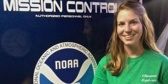
Meet Melissa Price
Melissa Price is an Explorer-in-Training who served as a mapping intern onboard NOAA Ship Okeanos Explorer. Read the full text of Melissa’s interview below to learn more about her experience while onboard the ship.
About Melissa's Role
What were your duties as an Explorer-in-Training?
My duties as a mapping intern included monitoring multibeam bathymetry software, conducting sound velocity profile casts, and monitoring subbottom profiling software. I also processed multiple data sets (bathymetry, bottom backscatter, water column backscatter) for quality control and to explore features of interest.
Which school are you attending?
I graduated from East Carolina University in December 2015, receiving a master’s degree in Maritime Archaeology.
Where was your work experience located? If you were working at sea, what were your impressions of living and working on a ship?
My team worked in the area of the Pacific Ocean between Kwajalein, Wake Island, and Guam—with an emphasis on exploration within the Wake Atoll Unit of the Pacific Remote Islands Marine National Monument, now known as Pacific Islands Heritage Marine National Monument.
This was my second journey on the Okeanos Explorer and I loved it as much as my first experience. I enjoy the structure of living on a ship and did not mind the close quarters. The constant rocking motion, to me, is soothing. People have asked me if I am afraid to not see land or to be so remote, but I embrace feeling far away and seeing nothing but vast ocean for miles. Spending time at sea is an inspiring and unforgettable experience!
What sparked your initial interest in ocean sciences?
While studying archaeology during my undergraduate career, my professor showed my class a video about the RMS Titanic. What struck me was the advanced technology required to travel more than two miles below the ocean’s surface to record video of the wreck and to recover artifacts. To my “undergraduate eyes,” this depth was a new world. Afterwards, I immediately began researching underwater archaeology; the deep, dark, and scary fascinated me. I wanted to study shipwrecks and be able to use the technology required to access wrecks: SCUBA, sonar, and, maybe one day, remotely operated vehicles. I cannot help but be intrigued by our ocean; there is much to explore geologically, biologically, archaeologically, and otherwise.
What was the most personally rewarding part of your experience?
Being exposed to the other interns’ and mapping leads’ interests and knowledge was rewarding. I enjoyed hearing about others’ passions and appreciated spending time with the scientists. There is much to learn about the world around us; meeting others and sharing information is a wonderful way to build relationships and grow individually. Of course, the other rewarding part of my experience was that moment when the mapping technology ‘clicked’ in my brain. After asking so many questions and working slowly for the first few days, it felt great to finally know what I was doing behind all those computer screens.
What is the most unexpected thing you have learned?
Even though I was not trained in ocean sciences and never mapped with this technology before, I learned that, with the right guidance, I was capable of accomplishing much in a month at sea. As an archaeologist, I worried I would be unable to keep up with the others. The mapping leads, however, were amazing and answered all of my questions with patience and willingness, leading to a wonderful experience.
Please describe your final project.
For my final project, I created a poster that discussed sub-bottom profiling and the technology we use to capture profiles. I focused on a particularly fascinating transect profile acquired during our mapping session, which illustrated a number of seamounts and abyssal hills covered with over 100 meters of sediment. I also highlighted various profiles of selected seamounts and guyots mapped during the trip.
How do you see this experience fitting in with your future career plans?
As an archaeologist, exposure to any mapping technology is imperative to my career. Much of underwater archaeology is becoming reliant upon multibeam and sub-bottom profiling technology to locate and study wrecks in deep water where SCUBA diving may not be feasible. To remain competitive in my field, knowledge of and experience with mapping technology is a must. I am thankful to NOAA, the NOAA Office of Ocean Exploration and Research, and University Corporation for Atmospheric Research for providing me with the chance to take part in this expedition!