by Toni Parras, Papahānaumokuākea Marine National Monument
.")
A map of the Hawaiian Archipelago showing the location of Papahānaumokuākea Marine National Monument in the Northwestern Hawaiian Islands (blue outlined area). Image courtesy of the NOAA-ONMS-PMNM. Download pdf version (1.2 MB).
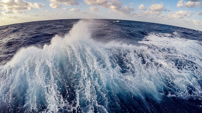
Located in the Northwestern Hawaiian Islands, PMNM encompasses a series of islands, atolls, submerged banks, seamounts, and open-water ecosystems that span 362,061 square kilometers. With a spectrum of elevations ranging from abyssal depths greater than 5,000 meters below sea level to rugged island hillslopes up to 275 meters above sea level, PMNM harbors diverse habitats including pelagic basins, abyssal plains, submarine escarpments, coral reefs, shallow lagoons, littoral shores, dunes, and dry coastal grasslands.
Due to their vast geographic isolation, PMNM’s ecosystems have remained largely protected from many of the human stressors that impact more populated areas and these ecosystems are among the most pristine in the world.
The marine habitats of PMNM are home to more than 7,000 species, 25 percent of which are endemic to the region, meaning they are found nowhere else on the planet. Some fish populations on coral reefs at the northernmost atolls of the Monument contain 90-100 percent endemic species, signifying that PMNM represents one of the major reservoirs of marine biodiversity on the planet.
The Monument is home to 19 threatened or endangered species, including the endangered Hawaiian monk seal. It also provides nesting grounds for over 90 percent of Hawaii’s threatened green sea turtles and 14 million seabirds. More than 99 percent of the world’s Laysan albatrosses and 98 percent of black-footed albatrosses return to PMNM to reproduce each year.
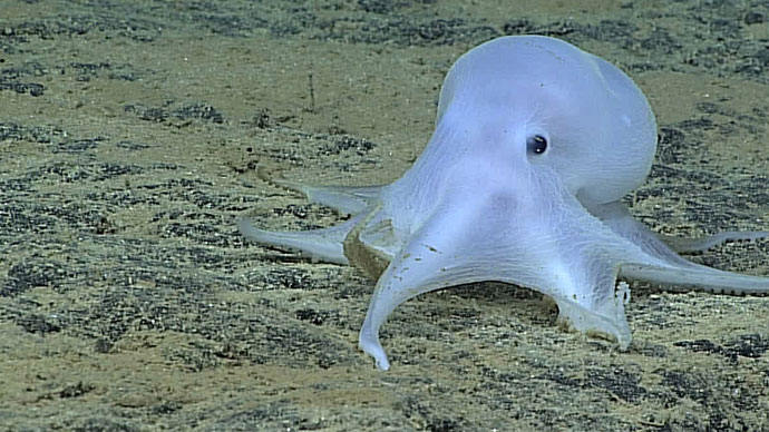
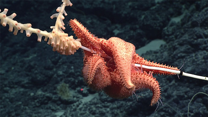
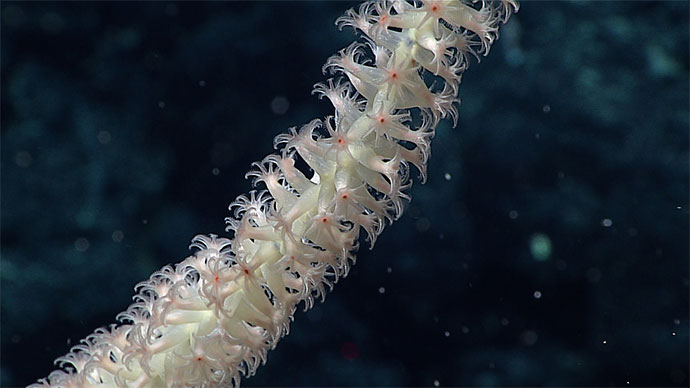
These are just a few of PMNM’s land-based and shallow-water natural features. However, as more than 98 percent of PMNM’s seafloor lies below 100 meters, its deep-water resources are far less known than its shallow-water counterparts. These deep areas likely include many secrets yet to be discovered.
A single deep-water expedition to the Monument in 2003 discovered more than 20 new species of corals and sponges, while an expedition aboard the Okeanos Explorer in 2015 collected 35 species that are either new to science or were not previously known from the region. This extraordinarily high rate of new species discoveries indicates that the Monument’s deep-sea fauna still contains many undiscovered species and represents an enormous opportunity for scientific exploration.
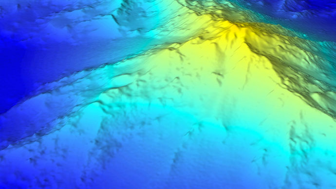
The geology of PMNM is equally fascinating. Formed by the Hawaiian hotspot millions of years ago, the islands traveled northwestward along the Pacific tectonic plate, slowly subsiding to become what they are today. This geological progression continues beyond the last emergent island, Kure Atoll, as a chain of submerged platforms that makes a sudden northward bend to become the Emperor Seamounts, which extend across the entire North Pacific to Russia. These volcanic platforms terraced with drowned fossil reefs provide a detailed record of the formation of the Hawaiian Archipelago.
Papahānaumokuākea has great cultural significance. Early Polynesian voyagers arrived in the Northwestern Hawaiian Islands as early as 1000 A.D., with periodic settlements occurring for over 700 years on the islands of Nihoa and Mokumanamana. These two islands have more than 140 identified archaeological sites, the highest density of prehistoric structural remains in the entire Hawaiian Archipelago. As a result, both Nihoa and Mokumanamana are listed on the National and State Registers of Historic Places. Native Hawaiians maintain a cultural connection to the place through traditional navigation, natural observations and cultural practices.
The Monument is also home to a variety of post-Western-contact historic resources, including several legendary 19th-century commercial whaling ships, as well as aircraft and vessels from World War II, many associated with the historic Battle of Midway.
Due to its extensive and unique resources, the region has undergone a long history of protection, beginning in 1903 when President Theodore Roosevelt sent in the U.S. Marines to stop the slaughter of seabirds for feathers and eggs at Midway Atoll. Over the next 100 years, six U.S. Presidents and one Hawai'i Governor afforded the region increasing protection, including the establishment of the Hawaiian Islands Reservation in 1909, the Hawaiian Islands National Wildlife Refuge in 1940, the Midway Atoll National Wildlife Refuge in 1988, the Northwestern Hawaiian Islands Coral Reef Ecosystem Reserve in 2000, the Northwestern Hawaiian Islands State Marine Refuge in 2005, and PMNM in 2006.
Culminating this long history of designations, Papahānaumokuākea was globally distinguished through World Heritage inscription in 2010 as the first (and still only) mixed World Heritage Site (for both natural and cultural value) in the United States, sharing this special status with only 31 other sites in the world.
For more information, visit www.papahanaumokuakea.gov.
The name Papahānaumokuākea commemorates the union of two Hawaiian ancestors – Papahānaumoku and Wākea – who gave rise to the Hawaiian Archipelago, the taro plant, and the Hawaiian people.